Improve water access and maximize social benefits

The design and implementation of the flood canal take into consideration different levels of water.


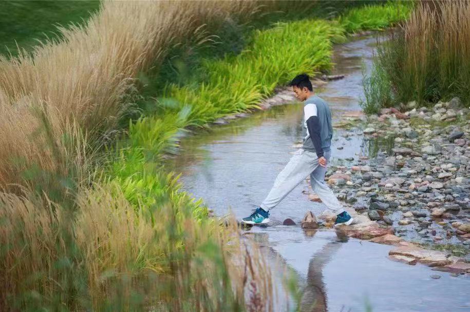
During periods of relatively low water levels (below the 5-yr level), the canal resembles a natural stream. A small flow of water runs through gravel and stones, passes over a weir, scatters in shallow areas, and eventually disappears among wetland plants. This scenic stream continues even on non-rainy days through the use of stored rainwater.


At the 30-year level, the canal serves as a boundary for different types of plants. Above this level, groups of trees and shrubs are planted, while below it, various species of Miscanthus are cultivated. These plants are well-suited to fluctuating water levels and protect against the force of large flood flows.


At the 50-year level, all pathways in the park are elevated above the flood level, ensuring that they remain accessible and cannot be submerged. Along the canal, various amenities are strategically placed to cater to the well-being, comfort, and enjoyment of the citizens. This includes gym facilities, a basketball court, a playground, and shaded seating areas.


Overall, the flood canal area is designed to provide a pleasurable experience for visitors, offering a sense of tranquility, recreational opportunities, and a connection with nature.

Flood engineers and landscape architects understand that design encompasses much more than mere decoration. They collaborate to create functional and aesthetically pleasing spaces that consider both the practical aspects of flood control and the overall visual and experiential qualities of the environment.

Studying nature is indeed a valuable approach when creating landscapes. Drawing inspiration from natural ecosystems can help landscape architects design spaces that are harmonious with the surrounding environment and promote ecological balance.  We found Nature-based Solutions and Sponge City are both very useful in the design.
Preserve wetland and reduce the impact of urban development

Wetlands (willow ponds) have is a unique and poetic riverside landscape in the semi-arid Loess Plateau. Recognizing the importance of preserving this distinctive habitat and native flora and fauna along the Qingshui River, the willow ponds were kept with water supported from the Qingshui River.


This conservation effort becomes increasingly important as the existing landscape along the River continues to disappear. By using the existing drainage route as the main line for the flood canal, the impact of development is minimized. This approach reduces the need for soil displacement and lowers the risk of soil collapse, striking a balance between flood control and environmental preservation.


Furthermore, the design incorporates a soft grass area in the side slope of the canal as much as possible. This choice aims to enhance the aesthetic appeal and livability of the canal area. Additionally, the bottom of the canal is kept permeable,  to improve the overall quality of the canal as a living space.


By carefully considering these design elements, the project seeks to create a harmonious and sustainable flood canal system that not only manages water flow but also preserves and enhances the unique landscape of the semi-arid Loess Plateau.

1- With the increasing emphasis on the environment and growing awareness of ecological principles, the ecological design of flood canals is gaining greater acceptance among clients and the general public.

2- The open space available at the site allows for the design of various dimensions for different sections of the flood canal. Additionally, as the building or urban facility is situated at a considerable distance from the canal, it becomes easier for the government client to implement initial experimental details.

The characteristics of the site play a critical role in determining the approach to mitigate the environmental impacts of man-made facilities. The unique attributes of a site are the primary factors considered when deciding how best to minimize the negative effects on the environment.

Increase the flood mitigation capacity and resiliency

The design approach for the flood canal seems well-thought-out. Diverting water through a weir into two pathways based on rainfall intensity allows for adaptability during different flood conditions.


Below the 5-year flooding level, the water is directed along a branch line to a wetland area, serving as a means for natural purification and infiltration of the water.


For higher flood levels, the canal incorporates an overtopping mechanism at the diversion weir, diverting excess water to the river via a flood channel, for up to a 50-year return period.


Consideration of various flood levels (5-year, 30-year, and 50-year) is important for erosion control measures. Different design strategies, such as impervious concretion base for the 5-year flood, retaining walls along the slope for the 30-year flood, and pervious surface measures above that level due to low erosion risk, help meet the requirements of each flood level and velocity.


Overall, the design of the flood canal appears to account for ecological concerns, varying flood conditions, and the management of sedimentation and erosion.

1- The completion of flood modeling during the early stages has proven advantageous for the flood canal design.


2- The design of the flood canal received support from a diverse team of experts, including hydrology and hydraulics (H&H) engineers, geotechnical specialists, and landscape architects. The successful implementation of integrated solutions would not have been possible without effective teamwork and collaboration.

Coordinating different departments and designers are very important through this comprehensive design, to make sure the design meets the demands. 

Conduct good site investigation and flood modeling

During the initial phase of the project, a comprehensive urban flood risk map was created using GIS and HEC-RAS. This map encompasses both the river and the expansive Guyuan metropolitan area, spanning over 150 square kilometers. The model effectively captures crucial data points like flood velocity, inundation areas, duration, and other vital information, laying a strong foundation for informed decision-making and effective flood mitigation strategies.

Thanks to the valuable support from the local government and survey department, we were able to obtain high-definition raster data to accurately depict the site’s topography. With a resolution of 0.5m, which surpasses the standards of typical projects, this detailed topographic information greatly benefits all phases of the project, including design and implementation.


The visualization of modeling results plays a crucial role in enhancing the understanding of flooding issues, particularly for clients. This clear visualization becomes a pivotal factor in obtaining approval for necessary mitigation measures.

COMMUNITY ACTION PLAN

A participatory planning tool based on the following steps:

  • Preparation: identification of actors (community leaders and managers of the territory), of previous agreements, and logistical preparation for the workshops.
  • Plan constructionworkshop.
  • Socialization of the Plan among the communities and managers.

During the Plan Construction Workshop, the participation of the communities involved (as a whole or through their elected representatives) and the managers of the territory is encouraged, with the accompaniment of the Project's technical team.

Thus, during this workshop (of approximately 8 hours), a Collective Dream of a 12-month scope is identified, linked to tourism within their territorial spaces, and that at the same time is consistent with the conservation efforts of their protected area.

Once the Collective Dream is identified, the participants determine:

  • Objectives.
  • Goals that allow them to measure the achievement of their objectives.
  • Activities (and their respective responsible parties) that will make it possible to achieve their goals.
  • Follow-upindicators to measure progress in the fulfillment of their activities.
  • Responsible parties, both for goals and activities.
  • Estimateddeadlines and dates.
  • Resources, of the project, of the destination's agents and of the territory's own managers.
  • Tourism Use Plans being updated: this allowed the Community Action Plan to become a reference document for the sustainability of the tourist destination.
  • Full Life Plans (in the case of the Amarakaeri CR) in the process of being updated: this allows the PACs to be a precedent in the identification of the vision and needs of the native communities.
  • Involvement of the communities and managers: this allowed for active collaboration as the main characteristic of the governance of a territory with a vocation for sustainable tourism.

In the process of designing the Community Action Plan, a methodology was developed that required validation by those involved in the project and transfer with the team in charge of field work. To this end, the developing versions of the methodology were socialized and perspectives were aligned among all those involved in this stage, giving priority to the conservation approach and community tourism as a high-impact tool that promotes capitalizable economic income from the knowledge of the participating communities.

The implementation process required a convening stage, the challenge of which was representativeness; it also faced geographical distances and the time of the community representatives and managers.

For this, two formats were used (one for each PA): in the case of Río Abiseo, one in which 2 community representatives met in an 8-hour workshop; the other (Amarakaeri), in which the workshop format was carried out at the rate of one workshop per community. Both allowed for representation and assertive management of each workshop.

Mitigation of human pressures on the park’s natural resources

Before 1990, the area around Bau Sau was under severe pressures from local communities in Dak Lua Commune. Local people often entered the park for harvesting timber, fishing, and hunting animals. Conflicts between locals and forest rangers occurred frequently and seriously (with death, and a ranger station was burnt in 1990).

After establishment, the park managers focused on law enforcement. Number of donor projects in this period helped improving local livelihoods through productive and effective farming, e.g. irrigation, increasing rice crops cultivation from twice to three times/year, high yielding maize. With consensus from local people, households living in the core zone were supported to relocate to the buffer zones. Forest protection contracts were signed with local households, forest protection teams were established in villages around the park. Illegal activities were sharply reduced. Relationship with local communities has been improved, pressures on natural resources has reduced, and the habitat quality has been enhanced.

Along with proactive habitat restoration measures, wild fauna populations recovered rapidly. In addition to the Siamese Crocodile population that was re-established in Bau Sau area, other populations of animals of conservation concerns such as Gaur, and Green Peafowl etc. are well maintained.

  • New protected area policies have helped solving many limitations in the previous period.
  • Appropriate conservation plans and strategies are in place.
  • There are sufficient resources (human, financial) provided through nationally and internationally funded projects.
  • Active participation of local communities in conservation work.
  • New awareness on biodiversity conservation regarding restoration of  wild native and threatened species.

The conservation achievements of Cat Tien National Park could have only be achieved when the participation of the community was mobilised. Good strategic plans and sufficient financial investment have helped local communities redirect livelihood activities to reduce pressures on natural resources, thereby creating conditions for the restoration and improvement of the park’s biodiversity values.

Commitment of producers to try non-lethal alternatives to coexist with wild carnivores

Producers must also have to commit not to kill predators and to be part of a more environmentally friendly production. A final key aspect is that the conservationist using this technique will have to invest a considerable amount of time between training the dog, selecting puppy candidates, constant monitoring and much more. If the social factors mentioned before are not taken into account and these commitments are not met, the success of the project would not be possible.

Commitment by participating herders not to kill wildcats.

Recording of depredation events before and after the LGD to provide evidence-based results.

Selected herders should not use poison or traps in the livestock grazing area. It's important that they have a good relationship with their neighbours, otherwise the protection dogs will be at risk. Producers must be accompanied by technicians and be trained to successfully complete the protection dog training. On rare occasions when the puppy starts work it may bite or kill livestock, this behaviour must be corrected immediately using non-aggressive techniques. Producers must sign a pledge not to kill wildcats, mainly those at risk. It’s advisable to work with NGOs, producer associations, government and others to cover costs and ensure sustainability in time.


Raising, training and care of future protector puppies and breeding females

Social factors are important in conflicts between humans and predators. Predation has direct economic costs related to loss of income and food, and indirect economic costs such as time spent avoiding predation. There are also underestimated non-economic costs, related to the sense of uncertainty, insecurity and general disruption to livelihoods caused by the unexpected loss of livestock, which strongly influence human-carnivore interactions. Livestock keepers who choose to join this programme must be prepared to make cultural and behavioural changes, including changing their cultural relationship with predators and dogs.  They must be committed to caring for and managing LGDs in a different way to how they normally interact with dogs. The herder must spend time with the dog in the first few months to ensure that it does not get lost, and must provide food and water on a daily basis.

Commitment of the producers to work with, care for and complete the training of the LGD.

Logistical and technical capacity to visit and train the herders during the first months after receiving the puppy. This should be done until the puppy is at least one year old. This is essential to ensure that the puppy does not develop undesirable behaviours.

Producers must be fully committed and convinced that they want to keep, train and care for a puppy and know what is required from them. LGD puppies must be accessible to low-income producers, who are most vulnerable to predation events.


PaRx Program: Outreach and engagement with the public and with health-care professionals

The BC Parks Foundation and PaRx program conducted outreach and media events to raise awareness of the program and the link between health and nature. The launch of the collaboration with Parks Canada generated substantial media coverage, including from international outlets, thus raising awareness of the connections between nature and well-being, and the PaRx program. Parks Canada has also developed informational materials to help health-care providers connect patients with Parks Canada administered places, in so doing creating connections with the health-care community, increasing interest in health and wellness activities across Parks Canada destinations, strengthening engagement between health care sector and protected and conserved areas, and raising awareness of protected heritage areas in Canada.

  • Both the BC Parks Foundation and Parks Canada have a track record of educating the public about the health benefits of time spent in nature and the importance of protecting nature to maximise these heath benefits for current and future generations.
  • Health care professional spokespeople as trusted messengers
  • Regular communication between PaRx and endorsing health organizations ensures consistent and widespread promotion of the program to help build public and health-care professional trust in and awareness of the program.
  • Uptake of the program increased with targeted media campaigns and launches across provinces in Canada. Continued targeted marketing, new resources, and improved usability of the platforms is important for maintaining and growing interest in the program.
PaRx Program: Collaboration with Parks Canada

PaRx and Parks Canada worked together to identify shared objectives around increasing access to nature and the connection between health, well-being and spending time in nature. This collaboration was formalized in a three-year partnering agreement, establishing that Adult Discovery Passes (valued at $72.25 a year) would be provided free of charge to PaRx to be prescribed by health-care professionals during the course of regular visits. The Parks Canada Adult Discovery Pass provides admission for one adult to over 80 Parks Canada administered places across Canada that typically charge a daily entrance fee for an entire year, including national parks, national historic sites, and national marine conservation areas. When prescribing Adult Discovery Passes to patients, health care providers are asked to prioritize those who live close to national parks, national historic sites, or national marine conservation areas, and who could benefit from it the most, such as those for whom cost of accessing nature may be a barrier.

  • Parks Canada’s willingness to present and protect natural and cultural spaces for overall ecosystem health benefits and benefits to human health.
  • Knowledge and capacity within the BC Parks Foundation to design and run a national health-care-provider-driven program.
  • Parks Canada’s management of a well-established and trusted network of nationally managed cultural and natural spaces across Canada.
  • Initial administrative challenges in issuing Parks Canada passes to prescribers are being overcome and streamlined through new practices and Customer Management Systems (CRM) to improve ease of access for prescribers and patients.
  • Requirement for flexibility in issuing passes based on demand from prescribers. Originally 100 Adult Discovery Passes were offered as part of the program. When interest in the program ballooned after the launch of the collaboration, Parks Canada substantially increased its support in the form of additional Adult Discovery Passes,  to approximately 1500 passes in the first year of the collaboration.