Skip to main content
Main navigation
Explore solutions
Network
Resources
News & Events
Contribute solution
Secondary navigation
About PANORAMA
Partners and Collaborators
Communities
Utilities navigation
Newsletter
Manual
FAQ
English
English
Français
Español
Deutsch
Italiano
中文
العربية
Bahasa Indonesia
한국어
Русский
Português
日本語
Nederlands
Türkçe
User account menu
Log in
Register
Oceania
Promoting culture to preserve nature
Léon
RAZAFINDRAKOTO
4 Building blocks
Creation of a booklet on culture and nature
Organizing awareness campaigns
Creation of communication tools
Reforestation operation
East Asia
Embracing Forest Therapy as a New Approach to Ecology, Livelihoods and Production
Li-Chuan
Weng
West and Central Africa
East and South Africa
Central America
South America
North and Central Asia
Southeast Asia
South Asia
East Asia
International Alliance against Health Risks in Wildlife Trade
Secretariat of
International Alliance against Health Risks in Wildlife Trade
6 Building blocks
Project Map
Funded Projects
Country packages
Members Area
Working Groups
Governmental Consultation Facility
West and Central Africa
Biodiversity conservation by indigenous peoples in APAC Bembiteli
Héritier
MILENGE KAMALEBO
2 Building blocks
Traditional resource management by aboriginal communities
Use of traditional and customary rules in resource management
Southeast Asia
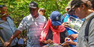
Strengthening Forested Area Planning and Management in Non-State Forest areas in Kalimantan
Andrea
Egan
3 Building blocks
Strategic Stakeholder Engagement in APL Forest Management
Quality Data for APL Forest Protection
Sustainable Alternative Revenue from APL Forests
East and South Africa
Roots of Change: Community-Based Ecological Mangrove Restoration in Kenya
Susanna
Tol
3 Building blocks
Capacity building, Knowledge sharing and awareness raising on CBEMR with Stakeholders
Establishment of CBEMR demonstration site for learning and research
Monitoring and evaluation for evidence-based practice and sustainability
West and Central Africa
East and South Africa
Southeast Asia
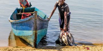
Combating illegal, unreported, and unregulated fishing practices
Global Programme
Sustainable Fisheries and Aquaculture
6 Building blocks
Relevance
Planning and first steps
Training to encourage legal fishing practices
Community-based management structures and sensitization of stakeholders
Registration and licensing, controls, and inspection
Case Study
West Asia, Middle East
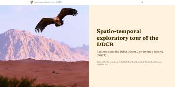
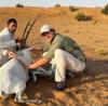
Dubai Desert Conservation Reserve (DDCR) GIS StoryMap
Basil
Roy
East and South Africa
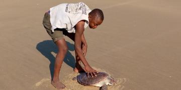
Scaling-Up Sea turtle conservation through the establishment of a Local Marine Managed Area (LMMA) in Marereni
Edward
Mwamuye
South Asia
Integrated Mangrove Fishery Farming System (IMFFS)
Dr. V.
Selvam
4 Building blocks
Situation Analysis and Vulnerability Assessment
Village Level Institutions
Construction of Integrated mangrove fish ponds
Participatory Monitoring
Pagination
Previous page
‹‹
Page 53
Next page
››
Subscribe to Local


")