Skip to main content
Main navigation
Explore solutions
Network
Resources
News & Events
Contribute solution
Secondary navigation
About PANORAMA
Partners and Collaborators
Communities
Utilities navigation
Newsletter
Manual
FAQ
English
English
Français
Español
Deutsch
Italiano
中文
العربية
Bahasa Indonesia
한국어
Русский
Português
日本語
Nederlands
Türkçe
User account menu
Log in
Register
East and South Africa
Adaptive management to strengthen coral reef resilience in the Ankarea Marine Protected Area
Hajannie
Razafimandimby
Southeast Asia
Urban Ecosystem-based Adaptation to Enhance Urban Flood Management and Resilience of Dong Hoi City in Central Viet Nam
Ngoc Anh
Nguyen Thi
3 Building blocks
Scoping Mission and Preliminary Study to Identify and Select Potential Urban EbA Measures in Dong Hoi City
Implementation of Urban EbA Measures in Dong Hoi City
Capacity Building on Urban EbA and Climate Risk Management for Provincial Partners and Local Communities
West and South Europe
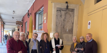
La restauration de la Madone de via Belle Arti aux Portiques de Bologne
Maria-Beatrice
Bettazzi
East and South Africa
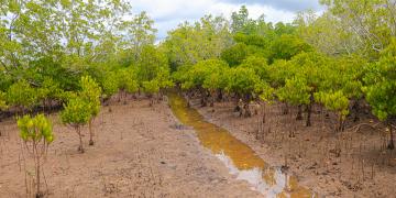
Hydrological restoration of mangroves in saltpans of Jimbo
Nathaniel
Mwangeka
5 Building blocks
Participatory and Inclusive Baseline Survey
Field-Based Training
Collaboration with Partners
Research-Led and Ecological Mangrove Restoration
Continuous Community Engagement Throughout the Project Period
West and Central Africa
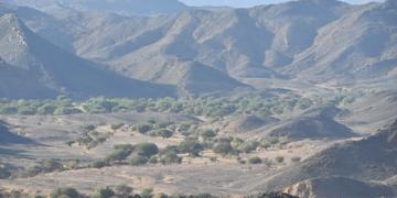
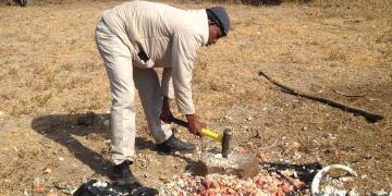
Reversing the decline of threatened Saharan wildlife in the Aïr & Ténéré National Nature Reserve of Niger
Moussa Zabeirou
Abdoul Razack
1 Building block
Approch
East and South Africa
Helping Endangered Cape vultures at Tswapong Hills, Eastern Botswana
Moses
Selebatso
Southeast Asia
Co-management (shared governance) of natural resources in the coastal area
Klaus
Schmitt
4 Building blocks
A negotiation process
Co-management agreement
Pluralistic governance board
Ensuring Justice-based Ecosystem-based Adaptation
Southeast Asia
Adaptive, community-driven and resilient co-management plan
Raphaël
Glémet
5 Building blocks
Understanding local impacts and threats
Creating ownership
Testing of conservation and rehabilitation techniques
Developing a management plan of shared solutions
National upscaling and transboundary exchanges
Southeast Asia
Creating direct incentives through ecotourism for protecting wildlife
Paul
Eshoo
4 Building blocks
Creating a Theory of Change Model with Your Team
Creating Simple Conservation Contracts with Communities
Developing and promoting the tourism product
Revise Contracts with Community Input (Adaptive Management)
Central America
Private sector investment in conservation of dry forests and mangrove restoration
Michael
Schloenvoigt
4 Building blocks
The Global Conservation Standard
Feasibility study and benefit validation
Conservation credit unit (CCU) marketing
Implementation and monitoring
Pagination
Previous page
‹‹
Page 52
Next page
››
Subscribe to Local