Landscape Assessment for Species Success

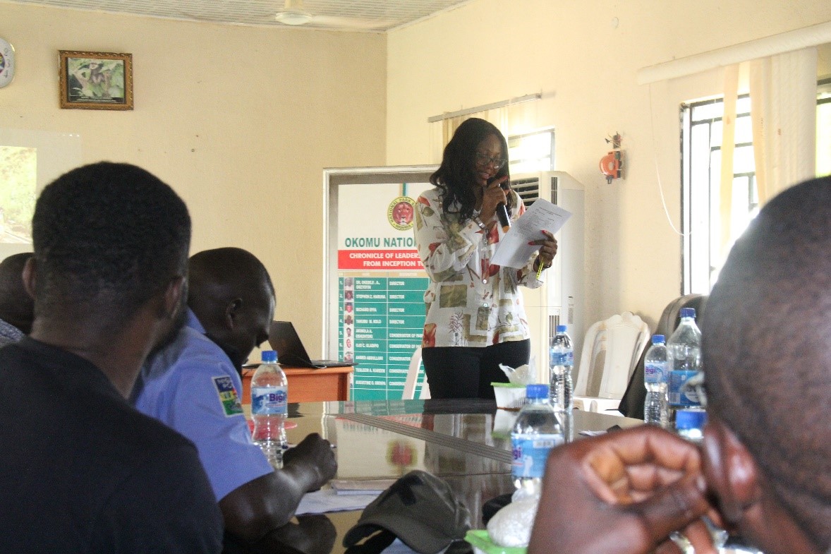
The purpose of this building block is to conduct thorough landscape assessments on the land owned by colleges and universities. By evaluating the environmental conditions, we can determine which species are best suited to thrive in these areas. This careful selection process ensures higher success rates for planting and contributes to more sustainable conservation efforts. The landscape assessment serves as the foundation for effective planting strategies, aligning species selection with the specific ecological characteristics of the land, ultimately leading to more resilient ecosystems.

Key factors for success include having strong environmental technical expertise within the team and leveraging our partnerships with universities to access the land for assessment. These partnerships provide the necessary support and resources to conduct comprehensive evaluations, ensuring that the species selected are well-suited to the specific conditions of each site, which is critical for the long-term success of the planting efforts.

One of the primary lessons learned is that not all tree species can thrive in the same region. Conducting land assessments is essential for understanding the unique environmental conditions of each area. This knowledge allows us to select species that are more likely to succeed, improving the overall effectiveness of our planting efforts. By aligning species with their ideal habitats, we enhance the sustainability and impact of our conservation initiatives.

Community sensitization on environmental issues

This building block focuses on engaging directly with local communities through face-to-face interactions and site visits to every forest block. We worked closely with the community to discuss the impact of forest degradation on agriculture, livelihoods, and the natural environment. On-the-ground visits ensured a deep understanding of the issues and secured community buy-in for the program. These efforts were carried out in partnership with the Kenya Forest Service (KFS), which played a key role in validating and supporting the initiative.

  • The presence of KFS added significant value to the efforts, especially with the introduction of new forestry laws. It reassured the community that they could co-manage their lands, improving their livelihoods. KFS’s involvement provided a sense of ownership and legitimacy, motivating community participation.
  • Communicating in the local native language facilitated quicker access to information, better understanding, and more effective implementation of initiatives by the community.
  • Tailoring direct communication to meet the specific needs of the local community was vital for successful community sensitization and engagement.
  • Sensitization is an ongoing process. Regular meetings and continuous communication are essential to maintaining open dialogue with local actors. Since policies and legislation are constantly evolving, it’s important to engage and update the community frequently.
  • Linking partners such as government entities, communities, and CSOs to address local issues increases the success of the programs.
  • The transition from national to county-level management of land and restoration efforts can present challenges, particularly in resource management. The complexity of working across different levels of government can impact resource management and program implementation.
  • This building block provides an opportunity to empower communities to take ownership of their land and address environmental issues directly, fostering a sense of responsibility and stewardship.
Inclusive and Participatory Research

The community was directly engaged during this research to gain a clear understanding of the impacts affecting them.

NACOFA and WWF-Kenya recognized the concerns raised by the community, county government, and horticulture industry regarding reduced river flow and water supply to the lake, which threatened their investments and livelihoods. A study was conducted in collaboration with Water Resource User Associations (WRUAs) in the region, revealing that the root cause of the problem was forest and landscape degradation, along with poor farm management practices in riparian areas.

  • Our strong relationship with WWF Kenya allowed us to integrate their deep understanding of local issues into our research, building on existing knowledge rather than starting from scratch.
  • Strong relationships and networking with local government and CFAs helped us gain a better understanding of the issues and facilitated greater access to local communities, enabling a more participatory approach in our research.
  • By improving livelihoods through restoration programs, we found it easier to engage more youth in our research, as they had already benefited directly from these projects.
  • Securing buy-in from the government and Kenya Forestry Service was simpler because they had previously witnessed the benefits of our initiatives.
  • We gained an enhanced understanding of the native tree species that are more resilient and grow faster in this specific ecosystem.
Stakeholder Mapping & Engagement

To effectively address the degradation of Lake Naivasha, it's essential to understand the activities of other local actors in the area. This building block focuses on stakeholder mapping and engagement, aiming to harmonize efforts, avoid duplication, and identify the key priorities and concerns of different stakeholders. By coordinating actions and aligning objectives, the initiative can more effectively tackle the environmental challenges facing Lake Naivasha.

  • The mapping exercise must be inclusive, involving all key actors such as development partners, community networks, county governments, and national government bodies.
  • It is vital for the county government to lead stakeholder efforts, ensuring alignment and understanding across the county. Their leadership is also critical due to the heightened governmental scrutiny on conservation and restoration activities.
  • Pre-existing strong relationships with key stakeholders make it easier to map, communicate, and address key issues and priorities effectively.
  • Multi-stakeholder meetings led by the county government are preferred to harmonize restoration issues and efforts across the county.
  • It may be beneficial to map more NGOs working at the local level, as their integration could provide a better understanding of restoration efforts across Lake Naivasha.
  • Engaging the broader private sector can be challenging unless there is direct funding support for the program. For example, horticultural institutions involved in flower farming share concerns about lake pollution, which could serve as a potential entry point for future discussions.
Capacity building to enhance TREEO App utilization

TREEO SaaS product enhances the skills, knowledge, and abilities of our users, enabling them to effectively utilize the app’s features for tree monitoring and carbon sequestration. We aim to ensure that users can maximize the app’s potential, leading to more accurate data collection, better project management, and ultimately, more successful reforestation projects. 

It also enables user empowerment, increases project transparency, and supports the scalability and sustainability of reforestation efforts. We do this through training, tutorials, and guides that provide hands-on experience and detailed documentation. Ongoing support via a dedicated customer service team,  and FAQs.

  • In house specialists: help to solve the daily challenges from a distance and also on-site immediately 
  • Offline technology that supports access in remote regions: most of the planting sites are remotely located and therefore the wifi signal can be weak in those areas. Our app ensures to collect all the data even offline
  • Ongoing support and customer service: we provide trainings on tool implementation; how to use the technology for all the use cases (land survey, project management, reporting, exporting data, etc.); we do a detailed training and onboarding process
  • User-friendly interface (TREEO App) - plus in-app training: Understanding that some of our app users might be illiterate, we have designed the app to be self-explanatory and supported by training manuals and visual aids.
  • Offering TREEO App as a SaaS product has helped us gather user feedback which has enabled us to identify areas of improvement. Therefore, with every update we consider the user feedback to make the app more user-friendly.
     
  • We maintain clear and transparent communication with our different customers about updates, new features, and best practices. This allows them to be fully equipped on how to use the TREEO app leading to better utilization of our product offering.
     
  • Our capacity building fosters environmental stewardship and motivate local people to actively participate in climate action - a “co-benefit” of such projects
     
  • Setting up the Customer Success team to conduct both remote and on-site training on-demand.
     
  • To ensure complete understanding, our training team uses the local languages of the area in their sessions with farmers.
Reforestation Project Due Diligence

The TREEO SaaS product provides project implementers with tools to carry out their due diligence process for their tree planting projects and provides data insights into the viability of the project or if the project meets with target standards and goals. This will be enabled through the following instruments:

  • Land survey: designates the geographical boundaries of tree planting project areas (or plots)
  • App is configured for remote locations without signal
  • Built-in questionnaires should help to find out whether the projects are suitable for using the app 
  • Personalized onboarding helps project implementers to use the entire TREEO technology correctly
  • Go & No-go zone: shows the plantable and non-plantable areas
  • Data validation: validation of monitoring data to ensure project compliance
  • Satellite verification: an additional layer of data validation as well as historical checks on land cover and land use

This provides a replicable solution to collect land survey data and proper site selection. The TREEO App is designed as an offline-first app that works in remote regions even without internet connection (the data would be uploaded at the next possible connection). 

  • Established Technology: The TREEO Technology is fully operational, having been tested and continuously used in monitoring by our tree-planting partners over the past two years
     
  • Open Access EO Data: Eligibility and boundary setting for planting sites are determined using open access Earth Observation (EO) data
     
  • Market Demand for Trustworthy Data: The current market demand for reliable data on tree planting activities empowers partners with better control over planting quantities, mortality rates, and offers a tool to publicly verify their planting efforts
  • Go/No-Go Zones: we encountered land included in the project that were not suitable for planting, hence it was important to have the go-zone feature implementation 
     
  • Technology: simplify the UX design to facilitate the tech optics in rural populations 
     
  • Land survey: provide trainings for farmers to improve the land survey measurement quality 
Planning and first steps

Establishment of multi-stakeholder platforms (MSP)

Addressing IUU practices in artisanal fishing requires a coordinated approach between different stakeholders involved in the fishing sector and includes a variety of strategies and actions. The foundation of this approach is the establishment of multi-stakeholder platforms (MSP) that bring together government institutions, the private sector and civil society to collaborate and develop a legal framework for sustainable fisheries management. This also includes fisherfolk and community members, particularly women. Regarding marine fisheries, the importance of trans-regional dialogue and agreements must be taken into account, due to the interconnected nature of the marine environment. MSPs encourage an integrated approach to governance, as they ensure all kinds of perspectives are considered and that the management strategies are effective and beneficial to all involved. Regular meetings of the MSPs reinforce the exchange among the various actors.

Baseline data

The next step is the collection and management of accurate baseline data, which is crucial for understanding the extent of the issue and for monitoring progress. As local research institutes may already assess data on catch and stock estimations, their role is vital for sustainable management of fish resources. However, they are often underequipped, understaffed and need initial capacity building and investments. Supporting these institutions with technical equipment and methodological training will also provide better and more transparent catch assessments during and after the project implementations. During this first phase, recognizing traditional knowledge is crucial for understanding the history of local fisheries. 


Benefits of small-scale aquaculture comparing to industrial production

In addition to its economic viability, small-scale aquaculture is usually more environmentally friendly compared to industrial production systems based on industrialized feeds. Fish feed usually includes a certain ratio of fishmeal and fish oil and these ingredients are produced mainly from small pelagic fish from capture fisheries, which put an additional burden on the marine environment. It also affects the food insecure population because small pelagic fish are highly nutritious and help to combat food and nutrition insecurity directly. Fish feed also includes agricultural products like corn and soya, thus competing with food production for human consumption. Despite the negative externalities on ocean biodiversity, research has also shown that intensive aquaculture systems contribute more to global warming through automated processes and high demand for production inputs. Additionally, these systems cause habitat destruction and introduce alien species, which further affect the indigenous biodiversity. In contrast, extensive and semi-intensive small-scale aquacultures requires little external inputs and have less environmental impact. For this reason, GP Fish supports small-scale aquaculture farming of omnivorous fish species such as Carp and Tilapia. The aim is to empower producers technically and economically by optimizing pond productivity and integrating fish production into agriculture activities. This approach uses the natural environment sustainably to promote fish production.

How to make more fish available in the local market

What strategies need to be pursued to make more fish available to consumers in local markets? Because wild fish stocks are generally overfished, and the oceans’ ecosystems experience severe degradation the logical strategy is to increase fish supply through aquaculture. When increasing fish availability, especially for the food insecure population, the approach chosen must be environmentally sustainable, provide fish at an affordable price for this group (e.g., by avoiding additional costs such as for transportation) and should still offer the opportunity for producers to earn a living income.

The approach should therefore be centered around sustainable, decentralized aquaculture adapted to the limited financial and technical capacities of smallholders. Small-scale aquaculture in low-income countries plays already a crucial role in food and nutrition security as well as poverty reduction but still has significant potential to grow. On the one hand, vertically integrated aquaculture farms (companies that expand production to up- or downstream supply-chain activities) make important contributions to a country’s economic growth by increasing export earnings, but they usually have only little impact on the local fish supply and food security. On the other hand, small-scale aquaculture directly contributes to a higher fish consumption by the producers, depending on cultural preference for fish as a source of animal protein and to higher incomes that allow producers to purchase other foods.

When evaluating aquaculture as a source of income, it is important to consider that most small-scale farmers have little technical knowledge and financial capacities. These constraints prevent them from making larger investments for infrastructure and inputs, which are required when operating an intensive aquaculture production system. Formulated feeds, veterinarian products and machinery can significantly increase aquaculture production but are in most cases financially prohibitive for smallholders in remote rural areas. The required investments exceed their financial capacities by far and credits would put the household economies at risk. For this reason, technical and financial capacity development is so important. Optimizing the productivity of earthen ponds with low investments for fertilizer and supplementary feeds generating high profits per kg fish produced seems a workable way forward.

As an example, for a technique increasing production and being adapted to smallholders’ capacities, the GP Fish has introduced intermittent harvesting of Tilapia in Malawi. This practice is applied in mixed sex cultures of Tilapia, based on natural feed supplemented with agricultural by-products. Excess Tilapias, that hatched during the production cycle, are harvested by size-selective traps before reaching reproductive age. These frequently harvested fish are an easy-accessible protein source and nutrient-rich food component for a diversified diet and surplus production is generating additional income. Intermittent harvesting also reduces the economic risk of losing the entire production due to predators, theft, diseases, or natural disasters.

Mapping, Needs Assessment, and Data Collection

Thorough assessments were conducted to identify human-wildlife conflict (HWC) hotspots and ensure the project addressed the most critical areas. This involved gathering quantitative and qualitative data to make informed decisions about fence placement and other interventions. GIS mapping, surveys, and interviews were utilized to understand current land use patterns, wildlife corridors, and areas experiencing frequent HWC. Surveys were also conducted with households to establish threats, crop and property destruction, and the amount of harvest farmers were getting. The results of the needs assessment were submitted to the Kamungi Board, who used this information to select three final beneficiaries of the 10% Fence Plan. Their decision was then passed through a public participation community meeting, where members present endorsed the identified beneficiaries.

  • GIS Mapping: Geographic Information Systems (GIS) were employed to map current land use patterns, wildlife corridors, and areas experiencing frequent HWC. This technology provided detailed spatial data that was crucial for planning and implementing the 10% Fence Plan effectively.
  • Surveys and Interviews: Structured surveys and interviews with community members were conducted to gather data on HWC incidents, economic losses, community needs, and the amount of harvest farmers were getting. This approach ensured that the project was grounded in the actual experiences and requirements of the affected communities.
  • Historical Data Analysis: Historical data on HWC incidents were reviewed to identify trends and predict future conflict zones. This analysis helped in understanding long-term patterns and preparing proactive measures.
  • Community Involvement: Local community members were involved in data collection processes, which helped in building trust and ensuring that the data gathered was comprehensive and accurate.
  • Technology Integration: Advanced data collection tools and software (kobotool box) were utilized to streamline the data gathering and analysis processes, improving efficiency and accuracy.
  • Board Engagement: The Kamungi Board reviewed the needs assessment results and selected three final beneficiaries of the 10% Fence Plan. This ensured that decisions were made by trusted local authorities.
  • Public Participation: The selection of beneficiaries was endorsed through a community meeting, ensuring transparency and community buy-in.
  • Accurate data collection and mapping were crucial for targeting interventions effectively.
  • Community input provided valuable insights into local challenges and needs, ensuring that the project was responsive and relevant.
  • Involving local community members in data collection fostered ownership and increased the accuracy of the information gathered.
  • Utilizing technology improved the efficiency and accuracy of data collection and analysis processes.
  • Regular updates to mapping and data collection ensured that interventions could adapt to changing conditions, maintaining their relevance and impact.
  • Historical data analysis provided important context and helped in predicting future conflict zones, enabling proactive planning.
  • Effective communication of data and findings to the community and stakeholders built trust and facilitated better decision-making.
  • Continuous learning and adaptation based on data analysis allowed for ongoing improvement of intervention strategies.
  • Engagement of the Kamungi Board in the beneficiary selection process ensured that decisions were made by trusted local authorities.
  • Public participation in endorsing the beneficiaries built community trust and support for the project.