Technological aids to assist marine management
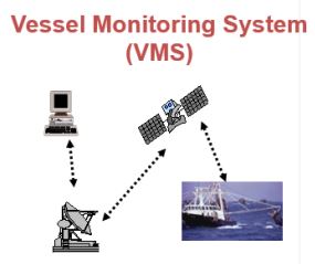
VMS are used to track and monitor commercial fishing vessels. VMS requires a GPS on the vessel and communications, usually via satellite. The GPS location of a vessel at specific times can be shown and is an important monitoring and compliance tool.
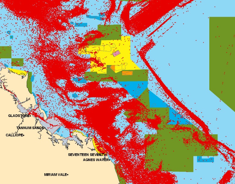
The revised Queensland Trawl Plan requires trawlers to carry a VMS on board while operating in the East Coast Trawl Fishery. VMS data was not available when the Draft Plan was released; this map shows VMS data overlain on the Draft Zoning Plan.
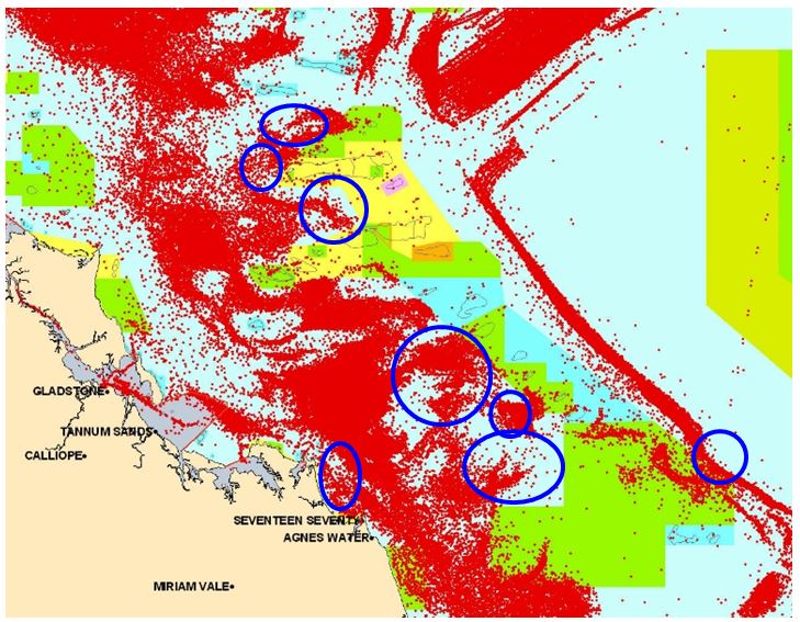
This map shows how subsequent access to VMS data enabled planners to make changes to the final zone boundaries to minimise impacts of the new zoning on key trawling areas (e.g. compare areas within blue circles with Draft Plan shown in previous map).
Effective management in the marine realm can be greatly assisted by various technological aids; examples include:
• Global Positioning System (GPS) - a satellite navigation system accessible to anyone with a GPS receiver (including most cell phones). Provided there is unobstructed access to four or more GPS satellites, a GPS will provide three-dimensional position, velocity and time anywhere on Earth.
• Vessel Monitoring System (VMS) - an electronic tracking system used by regulatory agencies to monitor the activities of commercial fishing vessels. VMS can play important roles in fisheries management, including the prevention of illegal fishing and protecting the marine environment. VMS requires a GPS on the vessel and communication between the vessel and shore, usually via satellite. It has wider applications (e.g. collision avoidance) and may be used to monitor vessels up to 200 nm from the coast of most countries.
• Automatic Identification System (AIS) - a radio broadcasting system enabling AIS equipped ships and shore stations to identify and locate ship’s positions, course and speed. Vessel traffic services (VTS) uses AIS to monitor vessels in ports, busy waterways and inshore waters, primarily for safety and efficiency.
• A GPS may be portable, relatively low cost, generally reliable, rarely influenced by weather and fairly accurate. Differential GPS facilities, however, do provide greater accuracy for the marine enforcement.
• GPS satellites are regularly updated by the various operating governments.
• The cost to access VMS data varies according to the functionality of the system; the greater the functionality, the more expensive the equipment and data links.
1. MPA managers should seek to augment their field capacity by utilising such technological aids as GPS and/or VMS, particularly as such aids can help to capture and accurately locate observations, heighten intelligence gathering and compliance, and assist in the efficient deployment of vessels based patrols.
2. While a GPS unit may be useful for enforcement in an MPA, a GPS being used in the offshore marine environment needs to be routinely ground-truthed against a known calibrated fixture to ensure accuracy.
3. Sometimes GPS signals are not accurate (interference in the marine realm includes extreme atmospheric conditions and geomagnetic storms). However if differential GPS facilities are available using a network of radio beacons, they provide greater accuracy.
4. A GPS can fail (e.g. if battery powered), or users can, at any given time, be denied access to the system (i.e. satellites shut down), so always carry a backup map and compass.


