Gestión participativa de jornadas de cuidado comunitaria de humedales urbanos costeros
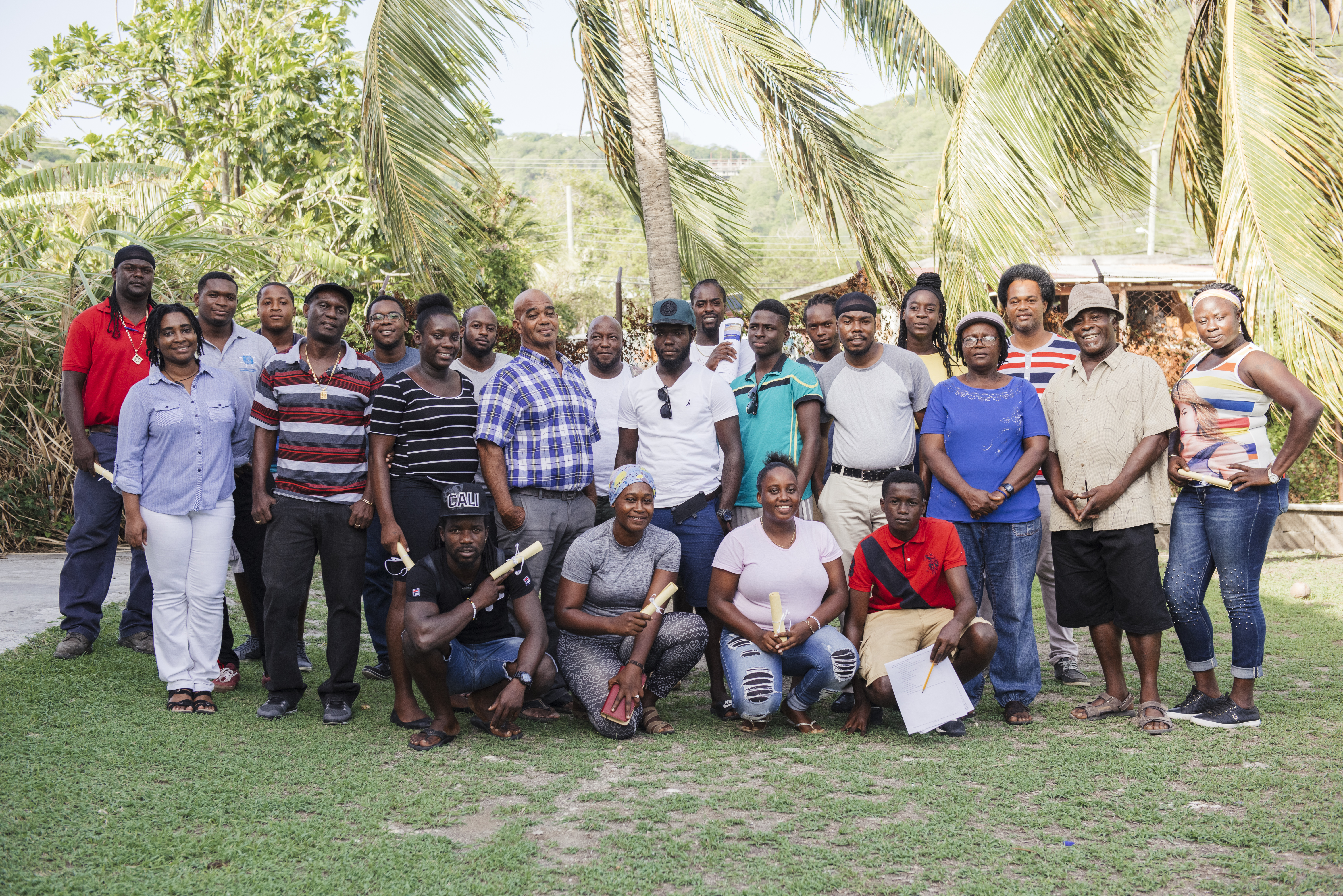
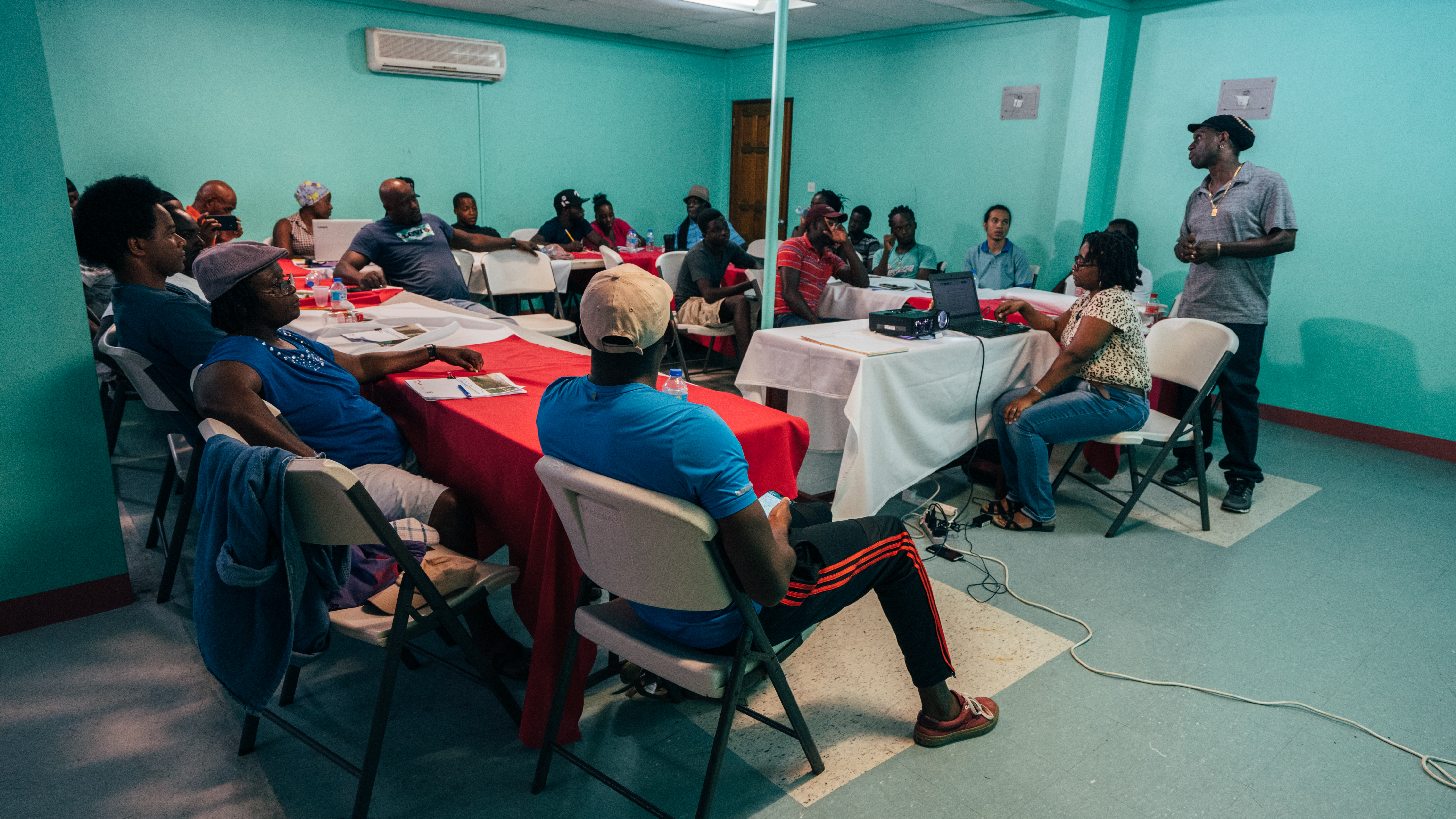
En la fase 3 del proyecto se han implementado acciones de protección y restauración de humedales urbanos costeros. Se partió de la información obtenida en los espacios de concertación con los actores clave (talleres, reuniones, entrevistas) durante la fase inicial complementado con propuestas trabajado en el curso GECOPE y se inició el proceso de priorización participativa de las acciones más viables.
En primera instancia fueron priorizadas las siguientes acciones:
- En los Cabos: Fomentar el intercambio de información mediante el establecimiento de espacios de diálogo (mesa de trabajo, foro participativo) y contribuir al establecimiento de un banco de datos.
- En Veracruz (Arroyo Moreno y Sistema de Lagunas Interdunarias de Veracruz) se priorizó realizar la acción piloto en el sistema de lagunas interdunarias de Veracruz, buscando definir y aplicar lineamientos para la elaboración participativa de planes de acción (planeación estratégica) para la conservación de los humedales urbanos.
- En Quintana Roo (La Sabana y Bacalar), se ha priorizado realizar la acción piloto en la laguna Bacalar, que consiste en establecer un programa de restauración y conservación de los manglares de la Laguna Bacalar y diseñar mecanismos de financiamiento que permitan su implementación.
Durante el proceso fue necesario hacer cambios por cambios en la voluntad política, recortes o ajustes presupuestarios, dificultades con la viabilidad legal (permisos), por lo que se llegó a tener los resultados como los que se presentan abajo:
Delimitación comunitaria de áreas temporales de conservación en la laguna Bacalar La laguna Bacalar es el principal atractivo turístico del municipio de Bacalar, que recibe cada año más turistas, con 234.000 turistas en el 2022 (SEDETUR, 2022). La oferta de actividades recreativas es amplia y va desde paseos en embarcación, hasta recorridos en velero, kayak, paddling board, etc. Los turistas de Bacalar dejaron en el 2022 una derrama económica de 45 Millones de USD (SEDETUR, 2022). Los actores, conscientes de la importancia de la laguna para el sector turístico, se unieron para fomentar buenas prácticas ambientales. Con el apoyo del proyecto se fortaleció el tejido social multi-actor y se apoyó a los actores a proteger y conservar los paisajes y la biodiversidad presentes en las zonas de mayor uso turístico del humedal mediante la delimitación comunitaria de 3 km. La medida tuvo incidencia en 24.2 hectáreas.
Los actores de la iniciativa son: Hoteles, restaurantes y otros negocios: Laguna Kristal (tours), Sailing Colibrí (tours), Amir Adventures (tours), Sailing Tours Aleana (tours), Cocalitos Bacalar (Balneario), Hotel Makaaba (Hotel), El Manatí (restaurante), Enamora (restaurante), El Paste (restaurante), Da Bruno (restaurante), Raíz Audiovisual (productora)
Organismos de Gobierno: El Ayuntamiento de Bacalar, Policía Municipal de Bacalar, Secretaría de Marina (Chetumal), Capitanía de Puerto (Chetumal), Comité Municipal de Derecho de Saneamiento Ambiental de Bacalar.
Organizaciones civiles: Prestadores de Servicios Náuticos y Turísticos Laguneros de Bacalar A.C., Fundación Emerge Bak´halal I.A.P., Agua Clara Ciudadanos por Bacalar A.C., Amor por Bacalar, Mensajeros del manglar GIZ México y Eco-Consult (BIOCITIS) , Voluntarios Turistas Miembros de la comunidad.
Limpieza de Lirio acuático y basura en el Estero San José del Cabo: El Estero San José del Cabo (44ha), sitio RAMSAR (124 ha) y Reserva Ecológico Estatal (REEESJC) (472 ha), está ubicado en el municipio de Los Cabos. El estero sufre del crecimiento excesivo de lirio acuático, planta ornamental que está desplazando las plantas nativas por la eutrofización del agua y, al tapar la superficie del Estero, afecta a toda la fauna nativa. Vecinos del Estero, preocupados por su conservación, se unieron en SOS Estero San José y realizan esfuerzos de concientización, generación de fondos para acciones de cuidado ambiental, y campañas de limpieza de lirio acuático y basura con voluntarios de la comunidad de San José del Cabo. El actor principal de la iniciativa es SOS Estero San José y, de manera indirecta, sus aliados, como los vecinos del Estero y otros voluntarios que realizan limpieza, los Hoteles y operadores turísticos vinculados a la iniciativa, el Municipio de Los Cabos, IMPLAN, Universidades, etc. Con el apoyo del proyecto se fortaleció a SOS Estero San José en sus campañas de limpieza del Estero y sus esfuerzos de concientización sobre el lirio acuático y la importancia del Estero. La iniciativa tuvo incidencia directa en 2 hectáreas e incidencia indirecta en toda el Estero (44 ha)
Facilitar el intercambio y acceso a la información sobre el Estero San José del Cabo: Los actores (públicos, privados y sociedad civil) vinculado al estero San José del Cabo consideraron prioritaria como medidas de asistencia técnica del proyecto BIOCITIS al intercambio de información sobre el Estero y la gobernanza interinstitucional. Consideran como limitación para la conservación del Estero que poco se comparten los documentos técnicos y publicaciones, y el estar muy dispersa la información. Como medida para promover el intercambio de información, se recolectaron entre los actores participantes 30 publicaciones (Científicas/técnicas) sobre el Estero, que fueron depositados en la página web de IMPLAN para facilitar su acceso. https://implanloscabos.mx/estero-san-jose-del-cabo/
Otra acción para facilitar el intercambio y la colaboración entre actores fue el proceso participativo de elaboración de una cartera de proyectos para la gestión del Estero, recogiendo los proyectos actuales y planificados, de los actores que trabajen en este humedal. La tercera línea de acción fue realizar un foro para intercambiar información, promover la colaboración entre los actores y generar mayor visibilidad sobre la importancia del Estero.