Assessing the views of those who don’t want to get involved

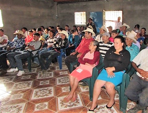
It should not be assumed that all those who have an interest in an area or the planning process will necessarily provide a written submission. Around 1 million people live adjacent to the GBR and many millions of people elsewhere in Australia and internationally are concerned for the future of the GBR. However the 31,600 written public submissions represented only a small proportion of all those concerned citizens (noting many individual submissions were prepared on behalf of groups representing many hundreds of members). At many public events during the planning or in the media, it was a small ‘noisy minority’ who dominated the discussions. Different techniques were therefore applied to determine the views of the ‘silent majority’, many of whom were interested or concerned but did not bother to write a public submission. This included commissioning telephone polling of major population centres elsewhere in Australia to determine the ‘real’ level of the wider public understanding and support. In addition, community attitudes and awareness were monitored through public surveys. These showed that many stakeholders were misinformed about the key issues/pressures and what could, or should, be done to address their concerns.

Telephone polling in major population centres around Australia is an approach used by political parties for political purposes. The same polling companies who undertake these surveys were used in the rezoning, with the planners working closely with them to determine the most useful questions. The results helped politicians to understand the wider public perspective, not just the noisy minority or the media reports. Community attitudes were also monitored through public surveys.

  1. Don’t ignore those stakeholders who choose to remain silent.
  2. Remember that politicians are usually more interested in what the wider community thinks than just those who send submissions.
  3. Recognise the ‘noisy minority’ usually does not represent the silent majority comprising all those with an interest in the future of the MPA.
  4. Public meetings are often dominated by a few – ways are needed to allow wider concerns to also be heard.
  5. Some stakeholders ‘leave it to others’ to send a submission – either because they think everything is fine, or else they believe changes are unlikely and so are not motivated to act.
  6. Telephone polling of the wider public or internet surveys can determine the real level of understanding and support.
  7. Tailor your key messages for different target audiences (take a strategic approach).
  8. Monitor wider community attitudes and awareness through media analysis, via the internet (e.g. Survey Monkey) or face-to-face interviews or surveys.
Written public submissions during the planning

Given that GBRMPA had previously never received so many public submissions (> 10,190 in the 1st phase and 21,500 in the 2nd phase commenting on the draft zoning plan), the following multi-stage process was used to analyse all the submissions:

  1. Contact details from each submission were recorded in a database, a unique identification number was assigned, and an acknowledgment card was sent to whoever made the submission.
  2. All submissions were individually scanned and the electronic files were saved into an Oracle submissions database.
  3. Trained GBRMPA staff analysed each submission using a coding framework consisting of keywords for a range of themes and attributes. The framework was developed from a stratified random sample of submissions based on place of origin and sector. The database linked the scanned PDF with the relevant contact details and analytical information (i.e. keywords)
  4. A search and retrieve ability based on the keywords enabled planners to search and retrieve PDFs of specific submissions or to run various queries of all the information in the submissions.
  5. Many submissions involved spatial information, including some 5,800 maps in the formal submission phases; these maps were digitized or scanned.

The legislation outlines a comprehensive process for community participation in the planning process. The fact that the locals were ‘familiar’ with two phases of public participation and written submissions from previous experiences with GBR planning processes did assist this most recent planning process. Many groups assisted by submitting joint submissions. Consistency of analysis across the analytical team was ensured by the team leader checking a sample of the analysed submissions.

  1. The analysis method must consider the substance of submissions rather than the number of times a comment is made. The submission process is not a numbers game but more about the quality of any argument that is made.
  2. In the first public phase, many open questions on the submission form led to long rambling answers; these proved hard to code, as were the large maps that were also distributed.
  3. The 2nd phase was more effective as a simple two page A3 size submission form asked more specific questions. Not everyone used the submission form, but it did make scanning and coding easier.
  4. Many pro-forma submissions were received; easy to code but not helpful.
  5. Linking spatial information with a qualitative coding system in the GIS was important.
  6. Coding was based on seven key themes and a range of sub-themes, allowing a detailed analysis of each submission and all information provided.
  7. Public feedback is important to demonstrate that all comments were considered.
Post training monitoring of progress and feedback
The monitoring of the interpretive efforts over time is essential as it provides continued reinforcement that the interpretation is working. Furthermore, it also acts as an opportunity for the operators to come together and discuss openly challenges faced, challenges overcome and success stories they have enjoyed. Learning from each other is the best possible feedback and having a facilitated opportunity to do this makes it realistic and beneficial to the overall effort of protecting the marine resources. The Kenya Wildlife Service (KWS) took on the responsibility of monitoring the interpretive efforts. The KWS was able to oversee a few meetings with various operators to discuss progress but sadly the monitoring momentum slowed down after the initial meetings.
Having regular meetings is essential. Do not assume that since the interpretive efforts are working well 2 weeks after the workshop that they will continue to do so for many more weeks thereafter. Continual reinforcement is a necessity.
In this particular solution the feedback sessions were appointed to a third party. Sadly this third party did not uphold their commitment to host these feedback sessions and as a result the interpretive efforts gradually reduced over time. When the same workshop was conducted in another Kenyan marine park efforts were made to maintain these feedback sessions and as a result interpretive efforts worked better over the long run.
Community data collection and participatory analysis

This building block relates to the ownership and in situ analysis of collected monitoring data. At the pilot site, four village school-leavers were recruited and trained to record data on octopus catches at each of two landing sites. Training was given in weighing and measuring the catch of 30 fishers/day over the 16 main fishing days of the lunar month (spring tides). Data books were then submitted monthly to the data logger; a local school teacher who was trained in excel using a laptop computer. Project leaders kept in regular contact with data recorders and the results were checked to identify problems at an early stage. After 8 months of recording, two parameters were chosen by which to examine the results of the exercise with the recording team: total catch per fishing period for both landing sites, and average size of octopus per fishing period. Recorders were shown how to make bar-charts to display the results. A detailed discussion with project leaders explored what the data and trends might suggest. The data recorders then visited the headquarters of the Department for Fisheries Development and presented their results. An ensuing discussion explored the implications for management and any changes suggested.

  • Members of the community that can read and write in order to be able to make written records of catch data
  • Buyers who are amenable to their catch being weighed and recorded at the landing site
  • A community member who can be trained to log data on a laptop
  • Regular support and interest in the work of the data recorders by project leaders
  • A supporting partner/project leader who can facilitate simple analysis of data collected in a participatory manner
  • Data recorders need a thorough understanding of the data to be collected and of the importance of correct recordings. (People’s exact names and ages, as well as the time spent fishing are important so that fishing effort can be calculated for instance).
  • Regular logging and checking of data is crucial so that mistakes or misunderstandings can be picked up early and corrected accordingly (use of a restricted entry form (macro) helps minimize errors).
  • Participatory analysis of data needs to be given adequate time and kept at a level that is easily assimilated and presented.
  • Participatory analysis of data gives the data recorders and the Village Fisheries Committee pride and confidence in their work and raises their standing with Fisheries Department officers. It also gives them evidence/references for discussion of future management options with the community.
Critical reflection and review
Reflection and review gives room to an evaluation of the learning and change that has occurred and the contributing factors. It is an essential part of the process to ensure that learning continues. Engaging in a critical reflection and review of the changes that have happened enables dissonance borders to be stretched and for participants to acknowledge mistakes and successes and to be able to determine the reasons why. Through engaging in a reflexive practice, new influences and pressures were also considered as benefits and or constraints. These then informed subsequent actions.
Synthesizing information, creating space for knowledge learning and sharing of experiences to understand and change outcomes from local people’s perspectives. Understanding the different roles and responsibilities has proven to strengthen relationships necessary for sustainable prosperity of interactions locally and globally.
Lesson learning has been a priority from the outset and the project adopted a participatory action framework for its evaluation. A range of data collection methods was used, ranging from informal discussions and focus groups to photo-voice exercises. As the data and lessons learned were through a collaborative process, so the shift toward sustainable change outcomes was also collaborative, highlighting the importance of shared learning and importance of creating space for a deliberative dialogue between different participants. This reflexive approach ensures those lessons are continually learned collaboratively and that sustainable change and adaptation become synonymous.
Data request form

Scientific results and data are often published in formats that managers cannot access or find challenging to process and extract directly useful information (e.g. scientific publications). Once managers know what data they need to inform management (have thought through objectives and indicators), they can create a data request form asking researchers for the specific data most relevant to MPA management and in the format managers are using to allow rapid understanding and integration into existing databases.

Training in understanding marine and coastal ecosystems. Managers know what data they need for management. Scientists are willing to share data (may require memorandum of understanding – as part of data request form – specifying how data will be used).

Managers are frequently frustrated by lack of access to data collected in their MPAs. Scientists often do provide data, but in formats not preferred by managers. We surveyed MPA managers from 8 nations to determine how they would like to receive data from managers, then helped them develop data request forms reflecting their needs, and in the units that they understand. Researchers have expressed willingness to complete these forms, especially when they contain an memorandum of understanding indicating that data will be used for management and not in publications or presentations without prior consent and acknowledgements. This has increased access of data by managers.

Capacity building for leaders and fishing organizations

We have three capacity building programs to pursue legal, sustainable and competitive fishing practices:

1. Capacity building for leaders: It focuses on human development at the individual level. We identify community leaders and provide the tools and knowledge to strengthen their leadership for the common good. The leaders develop sustainable fishing and marine conservation projects, to which COBI provides follow-up. We have had 38 fellows from 18 communities.

2. Capacity building for fishing cooperatives: It provides legal guidance and

training to fishing cooperatives to improve their operations, be more competitive, and ensure financial sustainability in the mid and long-term. 26 cooperatives have participated in the program.

3. Capacity building for fishery committees and alliances: Designed to increase collective action in working groups that represent different stakeholders

and interests within a given area or resource. The program provides guidance to define common goals, rules for decision-making and operations, working plans, and a follow-up strategy. Four committees and an alliance have participated in the program.

1. Leaders in fishing communities.

2. Cooperatives willing to make improvements in their organizaiton and fisheries.

3. Multi-stakeholder groups that want to work together towards a common goal.


Sustainable fisheries and marine conservation efforts will only be successful if there is fishing organizations are strong. We need to pay enough attention being paid to the individuals and organizations we work with. Only strong organizations can invest and transition towards sustainability.

Implementation and Monitoring Plan

Besides setting conservation goals, the Implementation and Monitoring Plan also details strategic objectives and activities to be implemented over a set period of time in order to achieve these goals. Furthermore, the plan identifies potential risks and difficulties and provides indicators for monitoring and evaluation.

  • Defined targets according to CBD
  • Annual activities of the Monitoring Plan included in the Operating Working Plan of SINAC, the annual acquisition plan of the trusteeship and in the working plans of bilaterally cooperating projects that contributed in the first four years
  • Budgeted activities according to the existence of a trusteeship
  • Application for regulated goods and services from SINAC to ACRXS for a cooperation agreement and a manual of operations

Using clearly defined targets, a detailed plan to meet them and a budget allowing this:

  • divided revenues from the trusts,
  • an efficient and organized implementation,
  • a guarantee to meet the targets mentioned.
Informed Decision Making
Access to pertinent and best-available information is important for informed decision-making, yet coordination between government agencies and other data collection and management organizations can be stymied by lack of resources and inconsistent mandates. To address this gap, The Nature Conservancy (TNC) has invested in connecting agency departments with other local, regional and international organizations that contribute to data production and/or management relevant to risk reduction and adaptation planning. Working closely with the Grenada Statistics Department, TNC developed a coding system that allows census survey data to be linked with spatial representations of survey districts and made unrestricted information freely available through an online platform. To support data access, co-management, and use, the AWE project in partnership with the World Bank contributed to the development of holistic databases and critical training of government technical staff. This partnership makes non-confidential information available via a centralized system and helps decision-makers access integrated spatial information on ecological, social, and economic systems.
• Involvement of and participation of Government Ministries and Departments in the project processes. • Effective partnerships with other organizations (e.g. World Bank) and government agencies.
• The importance of understanding dynamics of organizations and agencies as it relates to information sharing. • The importance of prioritizing clear communication about the project with partner agencies to ensure that project aims, objectives potential benefits are fully understood. • The importance of strong partnerships.
Testing of conservation and rehabilitation techniques
The testing of the techniques enabled the team and working group to obtain lessons learned from management activities directly influencing the design of the management plan and also to answer immediate concerns and threats faced by local stakeholders. Techniques included the rehabilitation of a waterway inside the mangrove forest to protect villagers from storms on the coast (canal dredging), re-planting zones affected by coastal erosion, implementation of a zoning system regulating uses in the site. Feedback and lessons learned for a better management plan are compiled.
- Preliminary participatory approach to identify priorities and activities most needed by local stakeholders - Sufficient scientific information to ensure the activities tested are “no regrets” activities and won’t impact the site - Capacities for close monitoring with local stakeholder to draw lessons learned in common
The technical activities, in particular the secured access brought by the rehabilitated canal, enabled a shared and mutual trust in the process and also informed the management plan drafting process. The beach stabilization was rather difficult to achieve through re-plantation only, therefore the management planning committee is now studying other green techniques.