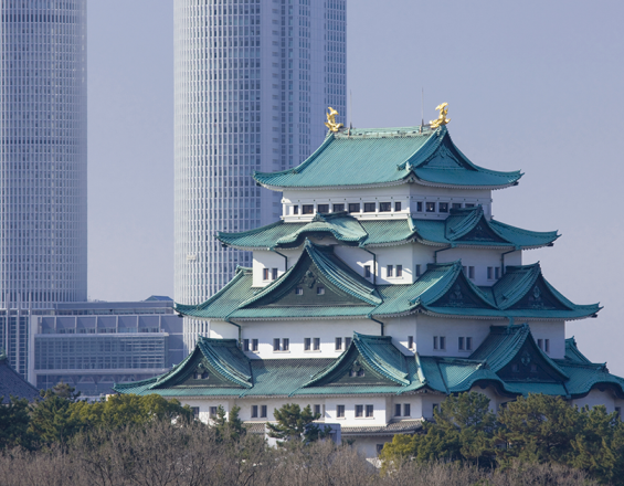
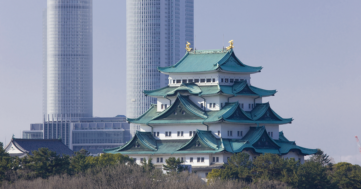
Nagoya City
NIPPON TRAVEL AGENCY Co.,LTD.
Home to 2.30 million people, the city of Nagoya is the third largest in Japan excluding Tokyo. The city is unique in that it has developed a variety of urban settings for global competitiveness, such as transportation networks, high-rise business districts, and hubs of value added industries. These urban elements are well-organized with vast green spaces and arterial roads that enable smooth traffic circulation in the central business district. During the World War II, however, the city was devastated. Immediately after the war ended, the City of Nagoya started its fast-track restoration programs that subsequently established the city as it is today under the strong initiative of the city government.
Last update: 21 Oct 2020
2342 Views
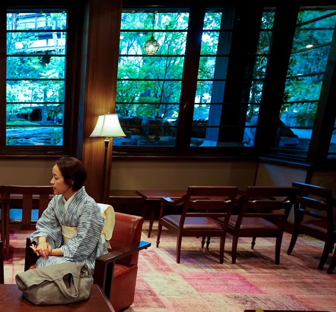
Photo and video gallery
Context
Challenges addressed
Prior to World War II, Nagoya grew as a leading industrial city where many heavy-industry giants placed their main factories. Since the city was also a major production hub for fighter aircrafts and other war-related machinery, it became one of the major targets under the US military’s “scorched earth” policy. The successive air raids devastated one fourth of the city area and the population dropped to half of its peak in the 1930s.
Location
Nagoya, Aichi Prefecture, Japan
East Asia
Process
Summary of the process
To guide rapid urbanization properly during a post-disaster or post-conflict restoration period, local governments need to immediately take development initiatives and implement the restoration plans in a timely manner. Their quick and strong responses enable to control unsystematic urbanization and accelerate successive large-scale urban and economic growth in the long run. Among various restoration policies the city of Nagoya adopted, proactive land readjustment programs contributed re-definition of the border of land plots, increased the ratio of the city’s public assets, and supported quick reconstruction of the city.
Building Blocks
Immediate Execution of the Post-war Restoration Plan by a Strong City Government Initiative
Remarkably, the city’s postwar restoration efforts began only one month after the war ended in August 1945. To begin with, the city regulated new housing developments since many temporary dwellings were arbitrarily constructed in burned-down areas. In June 1946, the city drew up a postwar reconstruction plan covering 4,400 ha of urbanized area, and moved forward with it immediately. The prompt implementation of the plan led to different results from other cities. Although retrenchment in 1949 by the national government resulted in reconstruction plans being cut in many other cities, Nagoya’s plan was not significantly influenced because the city had already executed 90% of the process to replot temporary land. Notably, 16 “One-hundred-meter roads” (roads with a 100 meter width) were planned across the country, but only three roads – two in Nagoya and one in Hiroshima - were actually built. Nagoya achieved remarkable recovery and growth; the total area of the city doubled and the population exceeded 1 million, merely five years after the war.
Enabling factors
- Localized rules for implementing the land readjustment scheme, widely used for post-war regeneration activities
- Regulating new housing development in burned-down area immediately after the war
- Promptly implementing the restoration plan led by the municipal government.
Lesson learned
To keep city development on the right track during a post-disaster or post-conflict restoration period, local governments need to immediately take development initiatives, control unsystematic urbanization, and accelerate successive large-scale urban and economic growth. Also, a city’s positive attitudes to attain fast-track urban restoration could strongly motivate citizens to make cooperative efforts on revitalizing their city.
Guiding Urbanization by Proactive Land Readjustments
The city established a large-scale land readjustment program under the reconstruction plan. The city designated almost all replotting area by the end of 1949. The readjustment contributed re-definition of the border of land plots that became blur in the war-devastated areas and supported quick reconstruction of the city. As the result of readjustment, the ratio of the city’s public assets were significantly increased: road areas by 2.12 times (2.36 times in the urban center); public parks by 3.07 times; total areas for cemeteries by 1.30 times; and station squares by 5.25 times. The readjustment project continued until 1998 and during the rapid industrialization around 1960, land adjustment became an effective way to prevent uncontrolled sprawl into the suburbs. The city extended its urban boundaries by merging the surrounding towns and villages and conducted replotting to accommodate the increasing population.
Enabling factors
- Localized rules for implementing the land readjustment scheme, widely used for post-war regeneration activities
- Growth boundaries which separated the city into Urbanization Promotion Areas (UPA) and Urbanization Control Areas (UCA)
Lesson learned
An ideal and future-looking vision for the city was drawn up in the reconstruction plan and this helps to readjust land use and create a certain amount of public spaces for future economic development and environmental sustainability. However, at the same time, it could be a risk for cities to arbitrarily extend the urban boundary during the restoration period as land readjustments become time-consuming and costly. Thus, to guide rapid urbanization properly, it is essential to proactively regulate new property developments especially in the expanding suburban areas and expedite consensus-building among a range of stakeholders with strong economic incentives and/or social interactions.
Impacts
Economic Impact: The challenging urban programs (i.e., large-scale land readjustment programs, developing extremely wide roads, and controversial relocation of cemeteries) contributed to establishing the city’s foundation that subsequently boosted high economic growth from the 1950s to the 1970s. For example, the one-hundred-meter roads together with other arterials constructed in the postwar period constitute a city-wide transportation system that has been able to accommodate rapid motorization and support industrial development over the past decades.
Social Impact: Rapid implementation of reconstruction contributed to quick post-war recovery, which also contributed to better lives for the people. Increased urban parks and road facilities developed under the reconstruction plans provide evacuation spaces in case of disaster and prevent fire from spreading. These public spaces also enhance citizens’ safety and help to create livable environments.
Environmental Impact: By re-adjusting a number of land parcels, the city generated a variety of green spaces including recreation spaces in the center of one-hundred-meter roads, a large park as a location of the unified cemetery, and other new urban parks. These areas of greenery contributed to increasing amenity and to reducing the heat-island effect, and also expected to absorb greenhouse gas emissions in the urbanized area.
Beneficiaries
- Residents of Nagoya city
- Private entities in Nagoya city
Sustainable Development Goals
SDG 11 – Sustainable cities and communities
Story
Among a range of projects implemented during the postwar period, three prominently contributed to such recovery: readjusting large-scale land lots, relocating many cemeteries, and developing one-hundred-meter roads. Apart from land readjustment programs shed light on in the first building block, details of the two endeavors are below.
Relocation of All Cemeteries
In Japan, cemeteries are commonly part of Buddhist temples. Cemeteries were considered as large obstructions to urban development since they were located in limited urban spaces and thus affecting city landscapes. To promote the reconstruction plan, Nagoya decided to remove all the cemeteries that were scattered over the urbanized area and consolidate them into one new park to the east of the city. While many people showed strong reluctance to disturb the burial grounds at that time, temples faced severe difficulties in reconstructing their devastated facilities and there was a shortage of new tomb spaces for people who died during the war. The city established a committee for cemetery removal with temples, and made great efforts to build consensus among temples and related families. Finally, 279 temples and more than 180,000 tombs were relocated to one park in a hilly area in the east of Nagoya.
One-hundred-meter Roads
“One-hundred-meter roads” (roads with a 100 meter width) were considered a symbol of postwar recovery not only in Nagoya also across the whole of Japan. The idea of extremely wide roads was proposed in the nation’s postwar restoration plan, aiming to provide evacuation spaces in case of disaster, to prevent fire from spreading, and to prepare for massive motorization. A total of 16 one-hundred-meter roads were planned in the restoration plans across the country, but only three roads – two in Nagoya and one in Hiroshima - were actually built, due in large part to the national government’s fiscal contraction policy. As described, the immediate implementation of construction plans made this success. In Nagoya, the two roads were built; one from East to West and one from North to South across the city. In the middle of the roads, there are large green spaces that accommodate a range of economic, social, and cultural facilities, such as parks, elevated expressways, station exits, car parking, and a television tower.