Establecimiento de las bases para la ordenación del espacio marino en las Azores mediante un proceso participativo
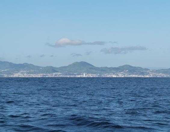
En medio del Atlántico Norte se encuentran las Azores, un archipiélago de nueve islas. A pesar de su pequeño tamaño, el espacio marítimo circundante de las islas representa casi un millón de kilómetros cuadrados. En virtud de los marcos jurídicos de la Unión Europea (UE) y Portugal para la Ordenación del Espacio Marítimo (OEM), la región autónoma de las Azores, dirigida por la Dirección Regional de Asuntos del Mar (DRAM), debe elaborar su Plan de Situación. Este es el principal instrumento de la política de ordenación del espacio marítimo en Portugal. El proyecto de Ordenación del Espacio Marítimo de la Macaronesia (MarSP) nació para apoyar el desarrollo de los planes de ordenación del espacio marítimo en los archipiélagos de la región de la Macaronesia (Azores, Canarias y Madeira). Este proyecto piloto creó capacidades y herramientas para aplicar la ordenación del espacio marítimo en estas regiones ultraperiféricas de la UE entre 2018 y 2019. El equipo de las Azores desarrolló metodologías innovadoras para abordar los pasos iniciales del proceso de planificación, donde la participación de las partes interesadas y los ciudadanos tuvo un papel central.
Contexto
Défis à relever
- Las 9 islas del archipiélago están diseminadas a lo largo de una superficie aproximada de 600 kilómetros. Esto significa que existe un vasto espacio marítimo de casi 1 millón de kilómetros cuadrados que hay que planificar, gestionar y cartografiar.
- La remota ubicación del archipiélago de las Azores, en pleno Atlántico Norte, determina su aislamiento geográfico. Esto, unido al pequeño tamaño de las islas, aumenta su dependencia del mar y de las actividades marítimas, lo que provoca conflictos entre los sectores, especialmente en las zonas costeras.
- Recursos humanos y financieros limitados para desarrollar un proceso inclusivo de participación de las partes interesadas en las nueve islas.
- Garantizar la participación y representatividad de las partes interesadas dentro de cada sector marítimo.
- Encontrar el equilibrio entre las necesidades del marco político de la ordenación del espacio marítimo y los requisitos del proyecto de la UE (por ejemplo, presentar los informes en portugués o en inglés).
Ubicación
Procesar
Resumen del proceso
El building block 1 (BB1) interactúa con todos los demás bloques. El proceso de participación de las partes interesadas fue crucial para validar los diferentes pasos y resultados del proyecto, pero también para recopilar nuevos datos e información. Tras la validación de la visión y los objetivos (building block 2 - BB2), los resultados se utilizaron para construir los Escenarios de desarrollo para las Azores (building block 3 - BB3). El building block 4 (BB4), que incluye el análisis de los sectores marítimos, se nutrió de los resultados del proceso participativo y de la revisión bibliográfica. El bloque de construcción 5 (BB5) integra los datos geoespacializados recogidos y validados a lo largo del proceso participativo (tanto talleres con las partes interesadas como entrevistas individuales).
Bloques de construcción
BB1. Organizar el compromiso de las partes interesadas y la participación pública
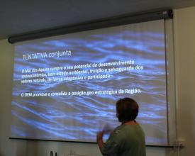
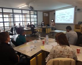
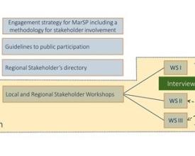
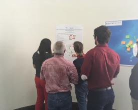
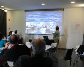
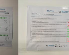
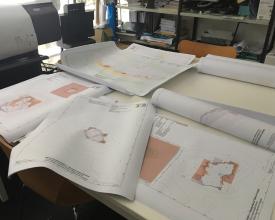
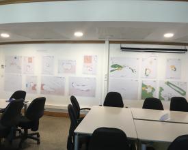
El Plan Espacial Marítimo de las Azores fue diseñado en un proceso transparente e inclusivo, con la participación activa de un amplio abanico de partes interesadas. Para ello, se elaboraron una estrategia para la participación de las partes interesadas y directrices para la participación pública. El compromiso se diseñó en una serie de tres talleres de partes interesadas celebrados simultáneamente en las tres islas más pobladas del archipiélago (São Miguel, Terceira y Faial). Los talleres tenían la misma estructura, que combinaba la comunicación sobre los avances del MSP con actividades para debatir, complementar y validar los resultados del proyecto. Antes de los talleres, se realizó un mapeo de las partes interesadas mediante la técnica de bola de nieve. Todas las partes interesadas identificadas se reunieron en el directorio regional de partes interesadas y se les invitó a participar en los eventos a lo largo de los dos años del proyecto. Se realizaron actividades complementarias, como entrevistas, para colmar importantes lagunas de conocimiento relacionadas con sectores marítimos específicos.
Factores facilitadores
- Planificación y realización de un proceso participativo transparente e integrador.
- Amplia cobertura de todo el archipiélago, permitiendo la participación de las partes interesadas de las nueve islas.
- Organización y coordinación oportunas entre los miembros del equipo, permitiendo la comunicación y el intercambio entre los talleres simultáneos en las tres islas.
- Colaboración de colegas y voluntarios para apoyar y moderar los talleres.
- Comunicación a las partes interesadas de los resultados de los talleres.
Lección aprendida
- Es necesario ponerse en contacto con las partes interesadas con suficiente antelación para obtener una buena respuesta.
- Una buena coordinación y organización entre los miembros del equipo y en la preparación de los materiales es esencial para la realización puntual de las actividades del taller.
- El desarrollo de herramientas de visualización podría ayudar a disminuir la huella ecológica de este tipo de talleres (la mayoría de los materiales eran de papel) y a reducir el tiempo empleado en la organización de los materiales.
- La falta de datos; la multiplicidad de sistemas de referencia o su inexistencia; la información dispersa tanto en términos de entidades responsables como de tipos de datos (digitales, analógicos, etc.), afectaron al desarrollo de los materiales.
- Gran carga de trabajo al intentar normalizar toda la información para poder utilizarla en un sistema SIG.
- Las entidades tardan demasiado en recopilar y poner a disposición la información, lo que dificulta el trabajo del equipo.
Recursos
BB2. Crear una visión y unos objetivos para la PSM
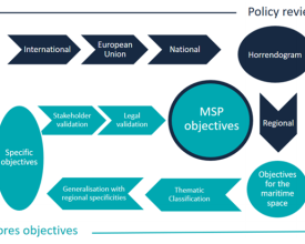
Establecer una visión y unos objetivos es un paso inicial fundamental en todos los planes de ordenación del espacio marítimo. En el marco del proyecto MarSP, se creó una metodología para desarrollar los objetivos de la ordenación del espacio marítimo. Esta metodología vinculaba los objetivos de la ordenación del espacio marítimo a los compromisos políticos establecidos por estos archipiélagos a escala internacional, comunitaria, nacional y regional. Se adoptó en las Azores siguiendo estas fases:
- Revisión de la política: revisión de la política marina para determinar los objetivos dirigidos al espacio marítimo. El horrendograma político portugués ayudó en la selección de políticas.
- Clasificación temática de los objetivos por temas y subtemas.
- Generalización de los objetivos por subtemas para obtener objetivos específicos.
- Debate, priorización y validación de los objetivos específicos por las partes interesadas.
- Validación jurídica y cotejo con los documentos de la política de ordenación del territorio para finalizar los objetivos de la ordenación del territorio.
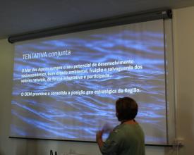
Durante el primer taller de partes interesadas en la ordenación del espacio marítimo celebrado en las Azores, se pidió a las partes interesadas que debatieran y validaran los objetivos específicos. Este fue también el caso de la propuesta de una visión regional de la ordenación del espacio marítimo, también debatida y validada en el taller de partes interesadas.
Factores facilitadores
- La validación de los objetivos por las partes interesadas se incluyó en la metodología desde su inicio para garantizar el enfoque participativo y la aceptación social.
- Las metodologías deben comunicarse adecuadamente para garantizar la comprensión de los métodos científicos por parte de los interesados. Se realizó una breve comunicación sobre la metodología antes de la participación de las partes interesadas.
- El debate sobre los objetivos permitió incluir las aportaciones de las partes interesadas.
- Las actividades con las partes interesadas necesitan orientación para facilitar un debate fluido y unos resultados aceptables.
Lección aprendida
- La revisión de diversas políticas marinas a distintos niveles geográficos da lugar a múltiples objetivos para el espacio marítimo. Esto puede dificultar la tarea de alcanzar los objetivos de la ordenación del espacio marítimo.
- La revisión de todos los compromisos políticos es muy exhaustiva y requiere priorizar las políticas más significativas. Se seleccionaron las políticas más significativas a cada escala geográfica.
- Tras las aportaciones y la validación de las partes interesadas, hubo una fase final para cotejar los objetivos resultantes con la política de ordenación del territorio. Esto permitió tanto la validación legal de las aportaciones de las partes interesadas como garantizar su conformidad con las obligaciones legales impuestas por la política de ordenación del territorio.
- Algunos objetivos van más allá del ámbito legal de la ordenación del espacio marítimo (por ejemplo, algunos objetivos sectoriales). A pesar de no estar incluidos en la lista de objetivos de la DEP, se tuvieron en cuenta en el marco de esta política.
- La obtención de objetivos SMART (Specific, Measurable, Achievable, Realistic, Time-bound) requiere un compromiso firme a la hora de fijar el marco temporal de los objetivos.
BB3. Construir escenarios para la MSP
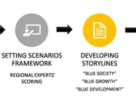
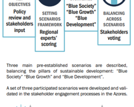
El proceso de ordenación del espacio marítimo planifica hacia un futuro deseado y una visión común. La visión suele ser una integración de varias aspiraciones de diferentes partes interesadas y sectores que dependen del marco de gobernanza que los rige. Una herramienta como el desarrollo de escenarios es de gran importancia, ya que ayuda a los responsables de la toma de decisiones a visualizar tanto el futuro que podría desarrollarse debido a acciones/políticas específicas como las acciones/políticas necesarias para hacer que un determinado futuro suceda. Para la región de las Azores, MarSP adoptó un proceso de construcción de escenarios basado en una combinación de dos enfoques: uno exploratorio ("¿qué se puede hacer?") y otro normativo ("¿cómo se alcanzará un objetivo específico?").
La metodología se estructura en cuatro pasos principales (Figura 1):
(i) establecimiento de los objetivos de la ordenación del espacio marítimo sobre la base de la revisión de las políticas y siguiendo las aportaciones de las partes interesadas (BB2);
(ii) identificación de objetivos clave tras consultar con expertos regionales;
(iii) desarrollo de argumentos para los escenarios; y
(iv) equilibrar los escenarios basándose en las opiniones de las partes interesadas recogidas a través de acciones de participación (incluyendo, en primer lugar, (i) una votación sobre el escenario y, en segundo lugar, (ii) una votación sobre las frases que construyeron el argumento de los escenarios).
Factores facilitadores
- Una metodología de participación de las partes interesadas definida al principio del proceso, que conecta las distintas etapas a lo largo del mismo.
- La existencia de una visión y unos objetivos de la ordenación del espacio marítimo basados en un proceso participativo permitió elaborar escenarios más adaptados a la región.
- Los talleres previos para la participación de los expertos y las partes interesadas y la puesta en común de los resultados marcaron el camino para su creciente disposición a participar y colaborar.
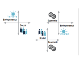
- La clasificación de los objetivos en temas medioambientales, sociales y económicos por parte de los expertos sirvió de base para crear argumentos sólidos.
Lección aprendida
De los tres escenarios propuestos (uno de orientación económica, otro medioambiental y otro social), los participantes votaron por el escenario medioambiental. Sin embargo, seleccionaron más frases del escenario económico, lo que sugiere que los participantes están ideológicamente dispuestos a proteger el medio ambiente, pero menos dispuestos a tomar las medidas necesarias para que ese escenario se haga realidad.
BB4. Análisis sectorial y sesiones informativas
Para comprender la situación actual y potencial de los usos y actividades marítimas en las Azores, se elaboró un amplio análisis sectorial que incluía nueve sectores. Para cada sector marítimo identificado en la región, se realizó un briefing sectorial. Cada informe sectorial incluye información relativa a su caracterización, el marco jurídico pertinente, la distribución espacial actual y potencial, un análisis DAFO, un análisis de las interacciones (con otros sectores, con el medio ambiente y las interacciones tierra-mar), así como un análisis de las presiones resultantes de los diferentes motores del cambio (por ejemplo, el cambio climático, los cambios demográficos y las políticas de crecimiento azul). Este trabajo supuso una amplia recopilación de información, tanto a través de la revisión bibliográfica como de la recogida de datos de las partes interesadas durante el proceso de participación.
Factores facilitadores
- Los análisis sectoriales son esenciales para comprender el panorama actual.
- Una cantidad significativa de información estaba disponible en línea.
- Voluntad de algunas instituciones de facilitar datos actualizados.
Lección aprendida
- Lleva tiempo desarrollar esta metodología de forma sólida y coherente.
- A veces es extremadamente difícil obtener información del sector.
- Algunas instituciones no estaban disponibles para apoyar el proceso de recopilación de datos.
BB5. Base de datos espaciales y colmación de lagunas
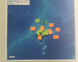
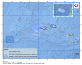
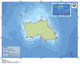
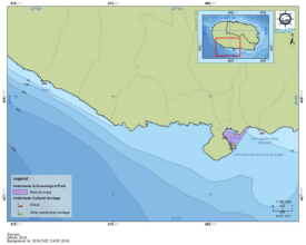
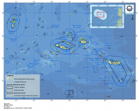
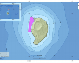
La base de datos espacial elaborada para el archipiélago de las Azores se basó esencialmente en la compilación de información cartográfica ya existente y disponible. Esto se debió al limitado plazo de ejecución del proyecto MarSP y a la necesidad de validación de la información por parte de las entidades/autoridades competentes, en el caso de la elaboración de nueva cartografía. Así, la nueva información recogida se compuso de información producida durante el proceso participativo. El proceso participativo, con la consiguiente producción de información cartográfica, se basó en dos etapas diferenciadas: (i) desarrollo de entrevistas individuales, con los principales actores representativos de cada uno de los sectores de actividades marítimas identificados para las Azores y (ii) talleres de discusión y/o validación de los resultados preliminares obtenidos durante la investigación y las entrevistas sectoriales realizadas, y para añadir más información (durante el 3er taller de actores). Para recoger los datos en las entrevistas realizadas, se utilizó una solución basada en la web (SeaSketch). Esta solución reúne potentes herramientas para potenciar y mejorar el proceso de la ordenación del espacio marítimo.
Factores facilitadores
- Las entrevistas cara a cara permiten una mejor participación y recogida de datos.
- Los talleres permiten aclarar dudas, enmendar datos y recoger otros nuevos.
- El uso de una herramienta web (SeaSketch) facilita la recogida de información espacial durante las entrevistas.
Lección aprendida
- Las entrevistas llevan mucho tiempo.
- Rellenar las lagunas de conocimiento requiere un gran esfuerzo.
- Necesidad de tiempo para validar la información/datos por parte de las entidades competentes, en el caso de la elaboración de una nueva cartografía.
Impactos
- Mayor conocimiento y concienciación sobre la ordenación del espacio marítimo entre las partes interesadas, lo que reforzó sus capacidades en este ámbito.
- Aumento de la confianza entre las partes interesadas, lo que contribuye a una mayor disposición de éstas a participar y apoyar la futura aplicación del plan de ordenación del espacio marítimo.
- Se colmaron las lagunas de conocimiento sobre varios aspectos relevantes para el proceso de planificación, incluida la distribución espacial de determinados sectores marítimos.
- Las partes interesadas pudieron influir en el plan gracias a su participación en el proceso.
- Proporcionó el marco inicial para que la autoridad competente finalizara y aplicara el plan regional de ordenación marítima de las Azores.
Se espera que los conflictos existentes entre los sectores marítimos disminuyan una vez aplicado el plan.
Beneficiarios
El Gobierno Regional de las Azores, que es la autoridad competente para coordinar el desarrollo del plan MSP. Las partes interesadas y los sectores marítimos que tuvieron la oportunidad de contribuir al plan con sus opiniones, valores e información.
Objetivos de Desarrollo Sostenible
Historia
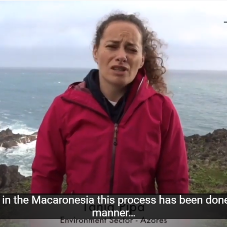
Desde Corvo, la isla más occidental de las Azores, con la menor población (~400 habitantes) y extensión (~17 km2), Tânia Pipa, cuenta su perspectiva e impresiones sobre el proceso participativo. Para ella, el proceso de participación en la región fue muy participativo. Disfrutó mucho formando parte de él y se sintió orgullosa de haber tenido la oportunidad, junto con otras partes interesadas de diferentes orígenes y puntos de vista, de contribuir a la MSP regional y al debate promovido por el proyecto.
Como bióloga que trabaja en la conservación de aves marinas, Tânia afirmó que el proceso le brindó la oportunidad de aprender, compartir experiencias y comprender mejor las perspectivas de otros sectores (por ejemplo, turismo, transporte marítimo, etc.). También destacó que los resultados de las discusiones, construidas por varios usuarios marítimos, apoyan el desarrollo de medidas dirigidas al crecimiento económico teniendo en cuenta la conservación del océano. Terminó diciendo que cree sinceramente que el enfoque participativo llevado a cabo a través del proyecto MarSP debería estar siempre presente en las futuras MSP como forma de validar el proceso.

