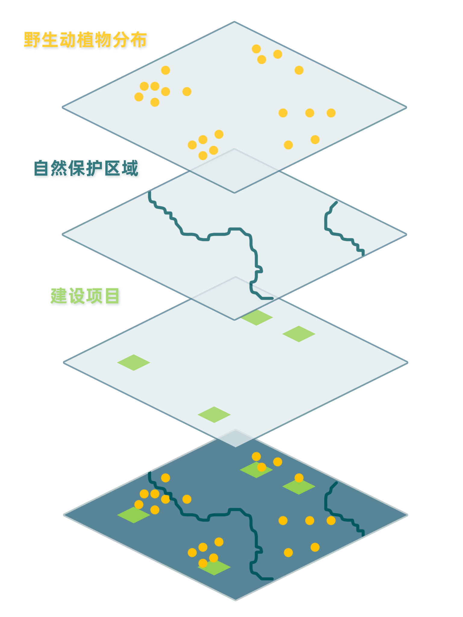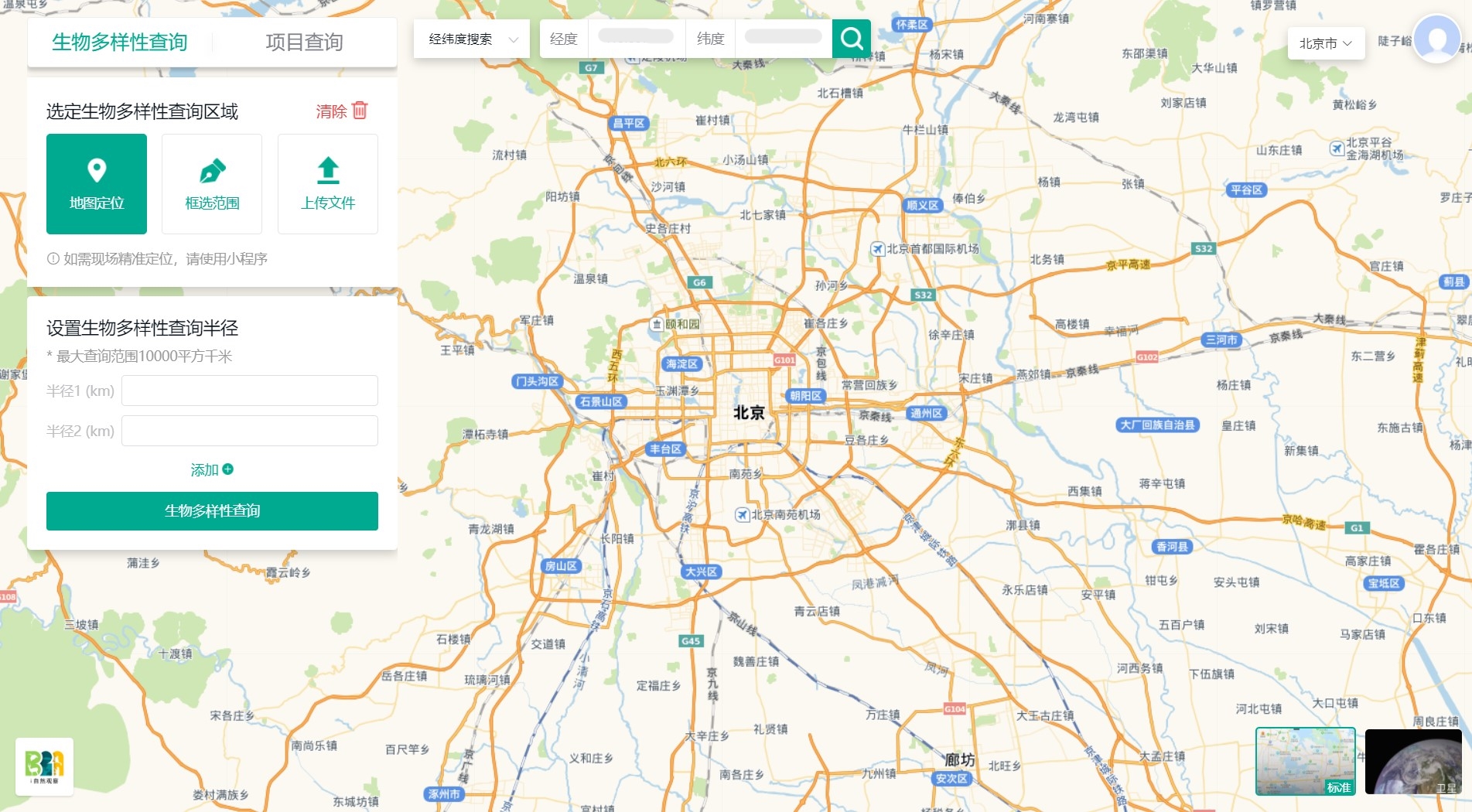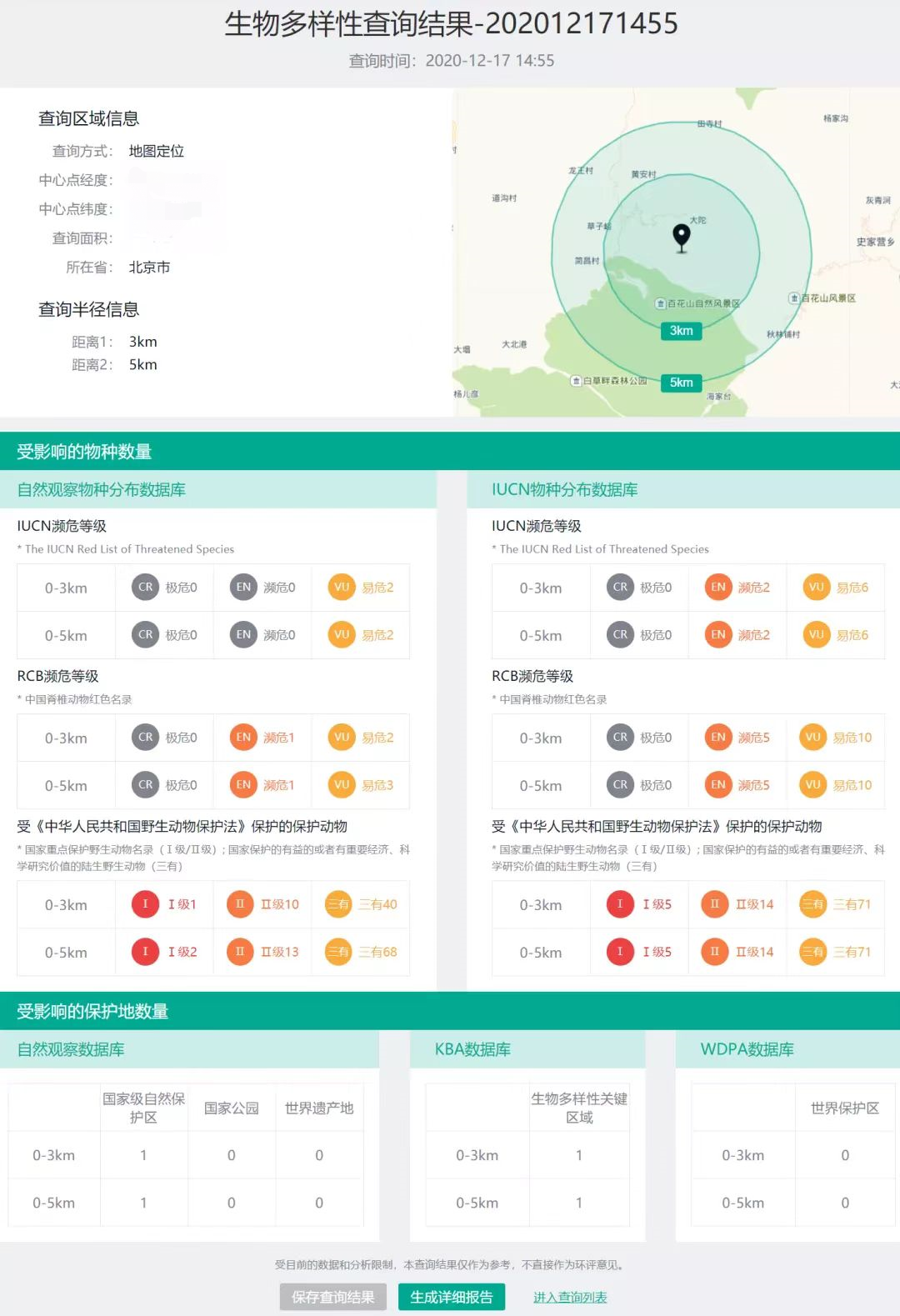


To enable automatic and instant biodiversity impact assessment enquiry, the BiA tool has been developed to facilitate enquiry services for land planners and other interested parties via Azure platform. The BiA tool works by overlaying the enquiry site or region (or existing construction projects) with multiple geographic layers including species distribution and protected area range to investigate if the site or region is within certain distance (e.g., 3 km, 5 km) from and may cause impact on endangered species habitat and/or protected areas. The assessment reports illustrate ecological and environmental risks of construction projects for decision-makers and could hopefully promotes them to take biodiversity into consideration.
A brief timeline of the BiA tool:
- Apr-Jun 2020: team formation, requirement communication, system development plan
- Jul-Sept 2020: tool development
- Oct 2020: trial test, application and dissemination
- (in preparation) Apr-Sept 2022: system upgrade
- Years of data collection accumulation and constant thinking of data application approaches.
- Theoretical & technical basis accumulated from long-term research and conservation practice.
- Promotion of the BiA tool to its potential users, like governments, investors, and enterprise.
- Keeping track of tool operation and user feedback to devise further upgrade of the tool.
- Data application is the foremost step in the whole data workflow, where the data turns into valuable information for stakeholders. Effective data application reports should bear the audience in mind (e.g., being concise and focused).
- The complete of development and releasing is not the last step for a tool. Finding potential users and persuading them to use the tool is also very important. A tool has to be used to provide the most value.