Developing high-quality digital learning resources
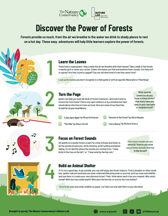
Nature Lab "Power of Forests" Activity Guide
TNC
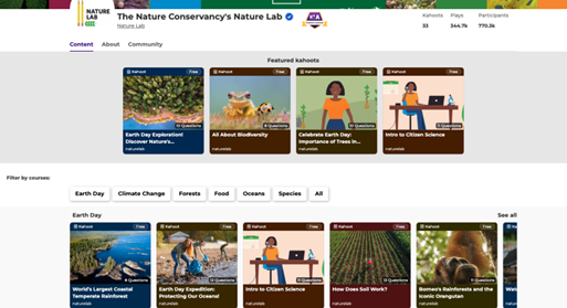
Nature Lab’s curriculum includes a collection of virtual field trips, teaching guides for educators, and seasonal activity guides for families with children ages 5 to 11. Virtual field trips allow students to explore diverse ecosystems—such as forests, wetlands, oceans, and urban environments—through high quality videos and structured learning experiences. Each virtual field trip is accompanied by a teaching guide with activities that encourage observation, inquiry, and provide connections to real-world environmental issues.
Nature Lab’s teaching guides provide ready-to-use lesson plans and student resources that bring nature-based learning into classrooms, supporting a wide range of environmental science topics. These materials are designed to help students build critical thinking skills, deepen their understanding of environmental science topics, and recognize their role in protecting the planet.
In addition, seasonal activity guides empower families to connect with nature through simple, locally relevant experiences that foster curiosity, creativity, and environmental awareness in everyday life. Together, these resources aim to make nature education accessible to all learners and support the development of the next generation of environmental stewards.
Successful collaborations with our internal video team are essential for producing high-quality virtual field trips. Through their network, we engage animation and video production experts to create impactful visual resources. By aligning lesson plans with NGSS standards, we ensure that Nature Lab materials are relevant across diverse educational settings. Additionally, outreach, promotional campaigns, and partnerships are key drivers in expanding the platform's reach and increasing awareness of the resources.
Through our video production process, we've learned that successful projects require early planning and collaboration with both production and subject matter experts. By involving the right teams from the start, we ensure smoother development and a stronger final product. Flexibility is key, as content and scripts can evolve over time. Additionally, nature-focused videos benefit from careful consideration of outdoor conditions, including weather and seasonal timing.
We also learned the importance of selecting the right video-sharing platform. While YouTube is widely used, it may be blocked in schools, so alternative platforms like Vimeo or hosting videos directly on a landing page offer better accessibility for educators.
When creating digital teaching resources, we recognized the need for ongoing maintenance. PDFs are convenient but can present challenges when updates are necessary, as changes require reloading the resource. Regular checks for broken links and ensuring easy access for teachers are essential for keeping resources up to date.