Financing the community gardens

The implementation of a community garden of about 6000 square metres costs around 33 000 USD. This includes working devices (e. g. spades and hoes), irrigation system and sun protection, measures of soil improvement such as organic fertilizer and humus, construction timber for the compost heap and planting beds, plants, seeds, petrol for the delivery of materials and machines, and personnel costs for two agricultural engineers who help residents create the garden. Costs vary depending on the size of the garden. 


The implementation of the community gardens is financed through donations from private and public persons and foundations. In 2015, a German branch was founded in Berlin (Städte Ohne Hunger Deutschland e. V.) with the objective to support Cities Without Hunger's work in Brazil financially and public relations work abroad, especially in Germany, but increasingly at an international level. 


After one year, community gardens are self-supporting. Gardeners earn their income selling their produce. Cities Without Hunger still provides technical support and lends bigger machines like tractors when needed. The NGO also supports network-building actions to integrate the gardens in São Paulo's wider economy, e. g. through delivery partnerships with restaurants.

  • Cities Without Hunger depends on donations to finance the implementation of community gardens.
  • After one year, the gardens are self-supporting and gardeners earn their livelihoods by selling their produce. 
  • The NGO keeps providing technical support and fostering socioeconomic integration of the garden projects after the one-year implementation phase.
  • Financing the implementation of the garden projects through donations does not guarantee planning security. If this building block is to be replicated, attention must be given to finding reliable sources of funding.
  • Even though community gardeners manage their gardens autonomously after a year, technical support and machines are shared amongst them via Cities Without Hunger. In that resepct, the NGO plays an important role as project coordinator. 
Vacant urban land and landuse contracts

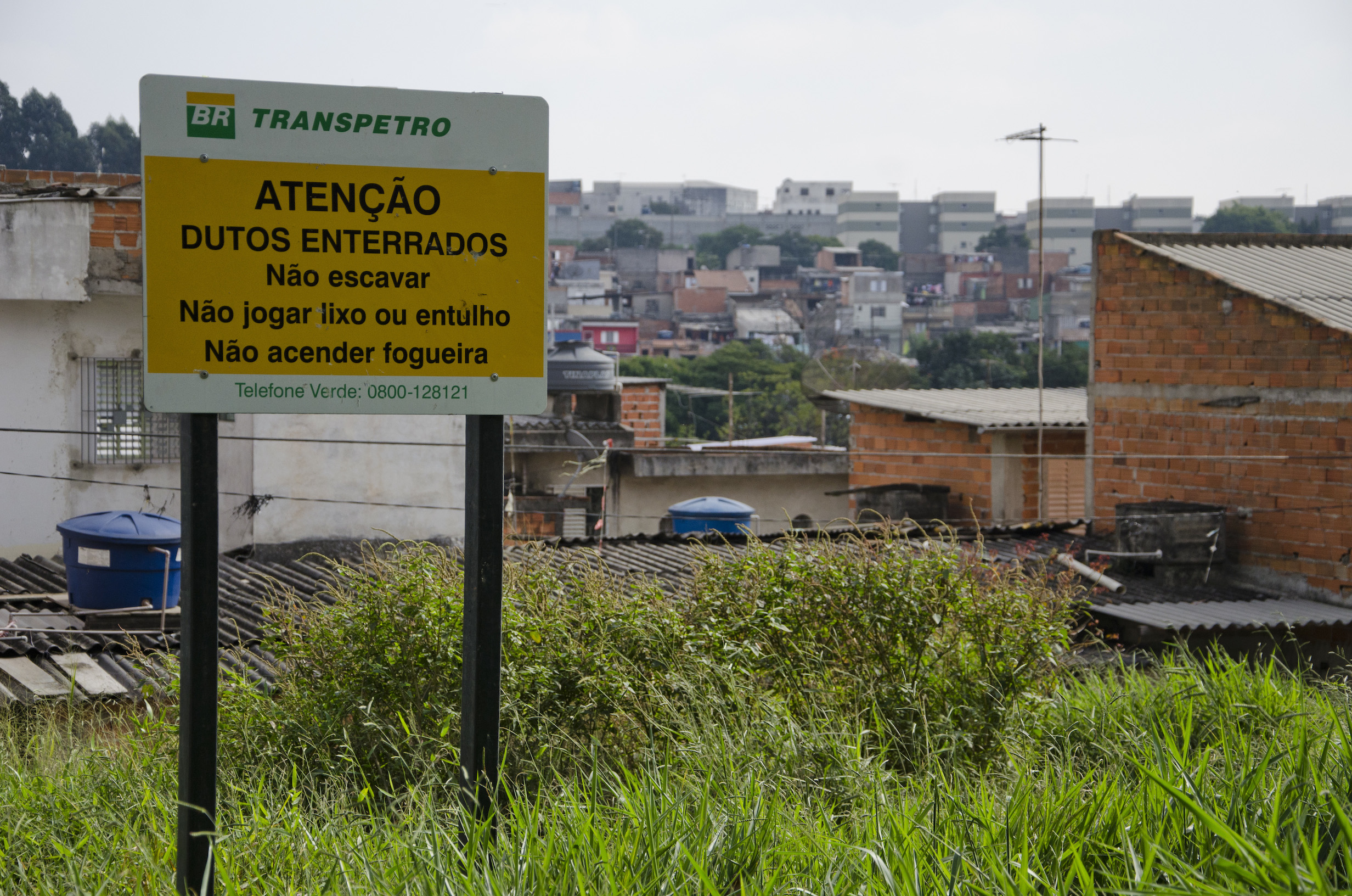
Vacant urban land is the essential building block required for the implementation of a community garden. The urban sprawl offers spaces where such gardens can be created. Areas include land below electricity lines, near oil pipelines, city-owned land, or private properties. 


Cities Without Hunger makes contracts with land owners on the use of the respective area. The land is given to the NGO for free. In turn, land owners can be certain that their land is going to be used as a community garden, avoiding the misuse of areas as dumping sites, and helping prevent wilful damage of infrastructures such as electricity lines or oil pipelines. On such areas, other landuses such as housing are prohibited. That way, landuse conflicts do not occur. 


Land use contractors include e. g. the energy supplier Petrobras, Transpetro, or Eletropaulo. 


With a growing number of community gardens and strong media presence within São Paulo and beyond, Cities Without Hunger earned a reputation as an NGO with who private and public land proprietors want to collaborate. Hence, getting access to new areas is usually unproblematic. 

  • vacant urban land
  • land proprietors willing to sign a landuse contract with Cities Without Hunger 
  • trust in Cities Without Hunger: a good reputation as reliable partner through strong media presence and word-of-mouth both within citizens' circles and the corporate and public realm
  • Due to soil contamination, not all areas within the city can be used for plant cultivation. Hence, it is necessary to take soil samples and have them tested in a laboratory before starting a garden. Gardens will not be built on soil which does not meet the requirements.
  • Public relations work with the media, primarily television and newspapers, matters: It helped and still supports the NGO's good reputation. 
Visibility, communication, and guidance lead to replication

The first community garden was built by Mr. Temp and his brother on their own initiative on a plot of vacant urban land in front of Temp's house in São Paulo's East Zone.


Both have experience in organic agriculture: His brother runs their great-grandfather's farm in Agudo in the South of Brazil, and Temp, after having studied business management in Rio de Janeiro (1985-88), completed a two-years course in organic agriculture on a farm in Tübingen, Germany (1993-95). 


The garden area had been abused as a dumping site. When neighbours saw the garden being built there instead, they became aware of and interested in this alternative kind of landuse. A group of people got together to help and to replicate the implementation of gardens. Temp guided them.


Today, having implemented 25 community gardens, he considers guidance crucial for the success of the gardens. Furthermore, this guidance needs to be continuous and intensive especially in the first year of a garden's implementation. Afterwards, community gardeners are able to manage their garden autonomously, but it is important for Cities Without Hunger to be present as contact persons and to lend bigger machines when needed. 


  • guidance for the implementation of gardens: practical knowledge and experience in organic agriculture
  • visibility of garden in the neighbourhood
  • word-of-mouth communication between neighbours spread the word of the possibility to build community gardens
  • interested neighbours need continuous guidance on the ground for the implementation of gardens  
  • visibility of gardens is crucial for people to understand that alternative landuses are possible, and evoke the desire to replicate these
  • gardens are successfully implemented on residents' own initiative rather than using top-down approaches
Closing the gap between city administration and local residents

Before he founded Cities Without Hunger, Hans Dieter Temp had worked as project coordinator in the city of São Paulo's public administration, supporting the creation of the Secretaria de Relações Internacionais da Prefeitura de São Paulo, the mairy's secretary for international relations. He found that the effort put into administrative tasks could do little to tackle the actual problems of local people in 

the city districts, because the city administration was lacking staff responsible for such tasks, and because residents were lacking basic prerequisites to improve their situation. He wanted to close this gap and to be present on-site as coordinator to support the local network. In December 2003 he quit his job at the city administration and began the foundation process of Cities Without Hunger.

  • on-site experience in the socioeconomic deprived East Zone of the city
  • personal contact to residents of the East Zone
  • experience in city government and administration allowing for identification of a gap between administrative level and the local level of residents' daily life
  • In order to ensure the efficacy of administrative and governmental action, a close connection to local people is crucial.
  • Personal relationships to people whose situation shall be improved by administrative and governmental action can be very helpful in identifying actual needs and starting points for action. 
Upscaling of implementation of Dynamic Agroforestry Systems


The producer family with their garden is always linked with a broader sphere, such as the relationships between gender and generations, the social organisation, community, local and international markets, the cultures, and – something often overlooked as important – religion and/or spirituality. These aspects, however, should be considered within the concept of training.

The proposed methodology is based on a period of intensive theoretical and practical training of local trainers (facilitators) and lead farmers. In addition, the participants must "rebuild" their knowledge on their own plots of land. Individual practice must be supervised and accompanied by a senior trainer experienced in Dynamic Agroforestry.

Lead farmers present their practical know-how and document the processes experienced in the following installation period. In this way, a practical implementation of the concepts worked on can be achieved within a concrete context for the production level of a rural family. 

Upscaling is achieved as followed:


- 1 local trained facilitator trains 10 lead farmers


- 10 lead farmers accompany 5 to 10 farmers each in implementing DAF


- 10 trainers accompany 100 lead farmers


- 100 lead farmers  = 500 to 1000 followers

- A long term concept of developing programs for at least 5 years

- Participitory institutional framework

- Commited and open-minded staff 

- Budget for training, follow up, equipment, and monitoring

- Accurate selection of local trainers and lead farmers

- Practically skilled SAF senior trainers

- Access to market for cash crops

- Short term benefits for farmers (anual crops, less labour, no expenses for external inputs) 

The most important experience is the benefit of land preparation without fire. The advantage of SAF can be seen already after a couple of months, which helps to encourage farmers to extend learning plots step by step to the whole plantation. Short-term economic needs foster monocultures with expensive external inputs, creating more short-term economic needs. Also, agriculture is not a desirable future for many, and the young migrate to cities (generational conflict). National mega-projects such as dams threaten local initiatives. Other adverse conditions are unfulfilled basic needs, bad infrastructure and extreme climate conditions that impede dedication to long-term SAFS initiatives. However, we note an increasing awareness of the importance to preserve trees and biodiversity, and interest in SAF because of the need to restore soil fertility, and because families see that those who implement the mode are being less affected by climate change impacts, have better working conditions, healthier and more diverse food, and better markets (e.g. for organic cacao, coffee, coconut or coca). 
KLIPPS - Evaluation method for the human-biometeorological quality of urban areas facing summer heat

In addition to improving overall conditions related to increasing temperatures, the city of Stuttgart has designed an innovative project “KlippS – Climate Planning Passport Stuttgart” based on quantitative findings in urban human-biometeorology, for improving human thermal comfort. The KlippS project calculates the human thermal sensation under “warm” category during the daytime in summer. KlippS is divided into two phases: the first phase is concerned with a rapid evaluation of human heat stress for the areas involving “sustainable building land management Stuttgart”, the second focuses on numerical simulations at high-risk urban areas related to heat.
 

KlippS provides the following remarkable issues on a planning-related potential to mitigate local human heat stress:

a) innovative program involving the human-biometeorological concept which represents a new interdisciplinary field

b) various spatial scales including the both regional and local ranges on the basis of the systematical two-phase method

c) quantitative approach to human heat stress by using dominant meteorological variables such as air temperature T, mean radiant temperature MRT and thermophysiologically equivalent temperature PET

As an ongoing project,  the outputs of the KlippS project have been discussed in the internal meetings with the Department of Administration as well as the local council in the city of Stuttgart. On the basis of the meetings, the practical measures are provided for the implementation as soon as possible.

People suffer heat stress through the combination of extreme hot weather on the regional scale and the inner urban complexity on the local scale. In principle, three options exist to mitigate the local impacts of severe heat on citizens:

a) heat warning systems of national weather service

b) adjustment of the individual behavior towards severe heat

c) application of heat-related planning measures

While both a) and b) work on the short term, option c) represents a long-term preventive way. In this perspective, KlippS was designed to develop, apply and validate measures, which contribute to a local reduction of severe heat.


The KlippS project was addressed at a lot of meetings and workshops, including at the public workshop “Climate change and Adaptation in Southwest Germany”, attended by 250 participants, on October 17, 2016 in Stuttgart. In addition to the workshops, KlippS was presented at many national and international scientific conferences.

Land Use Plan

A preparatory land use plan (PLUP) was undertaken, which organises land into its building and other types of uses and includes green areas and corridors. This PLUP is not legally binding, but serves as a basis for planning and information.


The land use plan developed in 2010 contains essential components for sustainable urban development, envisaging urban development under the slogan "urban─compact─green". Its guideline is for brownfield rather than greenfield development in a 4:1 ratio. It aims to protect green areas and develop a green network through brownfield areas.

Constructive use of existing regulations (e.g. the German Federal Building Law) provides a mandate for the implementation of planning recommendations relating to local climate.

Furthermore, the city has had a climate change mitigation strategy since 1997 and a climate change adaptation strategy was developed in 2012.

Finally having an urban climatology section within the Office for Environmental Protection enabled creation of the necessary data.


Having in-house climatic research capacity within a city municipality  is rare but a huge advantage so as to provide concrete knoweldge and solutions, rather than applying general principals when creating a Land Use Plan that can address objectives of climate protection and air quality. Having detailed and concrete data for the city has allowed the engineering through planning and landscaping of an entire system for urban air circulation.

Climate Atlas

The climate Atlas for the Stuttgart region was published in 2008 and comprises of standardised climatic assessments for 179 towns and municipalities in the Stuttgart region. It provides relevant information and maps required for urban climatic optimisation, such as regional wind patterns, air pollution concentrations, temperature, etc.


A key element of the atlas in terms of EbA planning for airflow and cooling is an area classification based on the role that different locations play in air exchange and cool airflow in the Stuttgart region. This is based on topography, development density and character, and provision of green space. The Atlas distinguishes eight categories of areas in this manner, and for each of them different planning measures and recommendations are provided.


Planning recommendations were included in the “Climate Booklet for Urban Development Online – Städtebauliche Klimafibel Online".

The Atlas was based on the previous work in this area carried out by the City of Stuttgart since the 1980s and the in-house urban climatology department (in existence in the City of Stuttgart since 1938). Indeed a climate Atlas had been published in 1992, upon which the current Atlas was extended.

Maps are important tools for planning and for communicating information to relevant stakeholders. They are necessary for attaining climatic and air quality goals.


The study provides important insights that can be used for climate protection and the recommendations include a focus on the transformation of green space and vegetation into the built city and the preservation and restoration of natural vegetation, including ensuring green corridors.  

Baseline Assessments

Field surveys were undertaken to map the extent of marine and terrestrial ecosystems, develop an ecological baseline and identify areas and measures for ecosystem-based interventions. Field surveys also identified locations of infrastructure exposed to river flooding. Remote sensing and GIS modelling provided complementary data and were used to assess exposure of the population to storm surges and flooding under current and future conditions. The InVest coastal vulnerability model was used to assess coastal exposure under different ecosystem management scenarios.

A planning and feasibility study for coastal restoration was also undertaken.

The Audubon Society of Haiti and Reef Check helped undertake field surveys and developed the planning and feasibility study.


The relatively low data requirements of the InVest model and the fact that it takes into account both the geophysical and ecological characteristics of the area in measuring coastal exposure make the InVest model highly suitable for EbA/Eco-DRR planning and for data-poor countries.

The results of the InVest model were in line with observed patterns of exposure. For instance, areas that are identified by the model as highly exposed to coastal hazards at present were in fact some of the areas that were most impacted by Hurricane Sandy in 2012. The results also point to the importance of protecting and rehabilitating ecosystems that mitigate hazards, so that they can in turn protect the community. However, depending on circumstances ecosystems may not provide the best nor full protection. The results cannot be used therefore to prescribe a best solution but only highlight the trade-offs and potential outcomes of different ecosystem management decisions especially as the model does not provide a comprehensive analysis.

Mainstreaming Eco-DRR/EbA in the development of an IWRM Action Plan

In order to establish a risk-informed and sustainable water resource management framework for the Lukaya basin, ecosystem-based measures are mainstreamed into an Integrated Water Resource Management (IWRM) Action Plan. The Association of the Users of the Lukaya River Basin (AUBR/L) developed the plan with support from UNEP and an international expert and is responsible for its implementation.


The Plan outlines a series of priority actions under four main pillars: water, environment, land use planning and governance. An integral component of the Action Plan is promoting sustainable ecosystem management approaches within the overarching framework of IWRM.


Development of the IWRM Action Plan emphasized the importance of linking upstream and downstream communities and strengthening their knowledge of the geographic and socio-economic conditions within their shared river basin. 3D participatory mapping was used to map hazards, land use types, natural resources and identify major environmental problems and areas at risk in the basin, through a multi-stakeholder, participatory approach.


Furthermore soil erosion and hydro-meteorological monitoring was put in place to allow for flood risk modelling. This would establish baselines and provide data to inform IWRM planning.

The Eco-DRR project was implemented in conjunction with an UNDA-funded IWRM project in the same area.

3D participatory mapping is an excellent tool because it facilitates the integration of local

spatial knowledge with topographic data through the participation of many stakeholders and the use of geographic information systems.


A key ingredient of successfully promoting Eco-DRR through IWRM in DRC was the sustained participation of local river users, through the AUBR/L.

The process of IWRM planning was intensive and took almost a year for the first draft to be produced.

The community-based approach (through AUBR/L) is appropriate because of the weak presence of central technical administration at the local level in post-conflict DRC. Having an existing water management institution was fortunate and enabled bringing together key stakeholders from both upstream and downstream and enhancing collaborative relationships. Obtaining buy-in was crucial for the development of the plan and also for activities, such as installing monitoring systems on land.

Several multi-stakeholder workshops and awareness raising were undertaken for the process. As a result, participants gained appreciation of the basin as a shared landscape and identified common priorities for sustainable watershed management, which also contributes to climate and disaster resilience.