A vulture's view into the ecosystem (composite image)
Understanding scavengers, predators, their communities, ecosystems and conservation challenges
Advancing animal-borne remote sensing, GPS tracking and monitoring
Artificial intelligence(s) for behaviour recognition, carcass detection and image recognition
Developing a new generation of animal tags and concepts for a digital swarm intelligence in networks of devices
Establishing a satellite-based IoT communication system
Integrating zoological gardens and animals under human care into a science- and technology-driven research and conservation project
Local capacity building for implementing and upscaling the solution
Community engagement

Communities must benefit from the data collected, and we ensure they do.

We support quarterly data-sharing meetings between Northern Rangelands Trust (NRT) community conservancies and Big Life Foundation, creating an open forum where data informs collaborative decision-making. This includes town planning, land-use strategies and community-led conservation initiatives.

By sharing insights on wildlife movements, environmental conditions and human activity, communities can plan together for peace, security and the prevention of human-wildlife conflict (HWC). These sessions empower conservancies to co-develop solutions across landscapes, strengthening cross-border cooperation and ensuring that data drives action where it’s needed most.

Control over data sharing or privacy.

Community stewards are empowered and trained to collect data through different sensors, using the IoT network to feed data into control rooms and Earth Ranger. 


Technical support and training

CCF provides a holistic digital ecosystem integrating landscape-scale technology, training and community engagement to drive meaningful change, contributing to GBF Target 20 – Strengthen Capacity-Building, Technology Transfer, and Scientific and Technical Cooperation for Biodiversity.

Launching in June 2025, the Protected Area Technician (PAT) Training Programme has been developed by CCF to empower local communities to protect nature.

This tailored programme is designed to build practical, in-demand skills that create real opportunities—from entry-level technician roles to long-term careers in leadership and consulting within protected areas. Co-developed with industry experts and rooted in local needs, the curriculum blends hands-on field training with applied conservation technology knowledge.

Participants will graduate with job-ready skills to support and maintain vital conservation tech infrastructure. They’ll also have the opportunity to earn a PAT Certification, with a pathway to a globally recognised Cisco Certification—unlocking even broader career potential in the conservation and tech sectors.

By investing in local talent, the PAT programme helps communities take a leading role in protecting the natural landscapes they call home.

Monitoring of impact will take place through the first cohort of learners, focusing on their career journeys and personal development outcomes

Centralising data for management and control

A visualisation platform for real-time protected area management, helping managers make informed, conservation-related operational decisions. A community of users is now sharing best practices and innovative concepts, engaging EarthRanger as it extends beyond just elephant protection to a diversity of wildlife, ecological and community applications.

CCF has a long-term partnership with the AI2 Team, which developed this software. 

  • Data flows seamlessly from field-based hardware through the network into Earth Ranger
  • Diagnostic information is key to good support and maintenance.
Transporting data from the field to the operations room

From soil moisture and water levels to animal migrations and habitat health, data from sensors travels via Cisco LoRaWAN gateways and Actility’s ThingPark™ Platform to central operations rooms, where platforms like EarthRanger provide a comprehensive 360-degree view of ecosystem health and threats. Previously, these have been donated by Cisco Inc. 
These LoRaWan gateways now support over 800 IoT sensors across protected areas. 

  • When using LoRaWAN, data is transmitted wirelessly to a gateway. The gateway listens for the corresponding signals and transmits them to a LoRaWAN network server, which is connected to the Internet.
  • Deploying a LoRaWAN network is quicker and much more accessible than setting up a conventional cellular system.
  • Operation requires minimal infrastructure. Setting up cables and making connections to the power line is not required. Network design and optimisation are also simplified, as with one gateway, you can cover a larger area very effectively.
  • Reliable and long-term : The gateways are robust and come with a 7-year warranty, offering peace of mind and operational security for protected area managers working in harsh and remote conditions.
  • Unmatched coverage in rugged terrain: LoRaWAN technology continues to outperform alternatives in remote and rugged landscapes, providing extensive and reliable coverage across challenging terrain where cellular connectivity is limited or non-existent.
  • Seamless regional asset tracking: The system supports device roaming, allowing for uninterrupted tracking of assets across different regions without manual reconfiguration—an essential feature for mobile wildlife monitoring and conservation equipment.
  • Cost-effective: By leveraging low-cost, commodity-based hardware and integrating standard radio modules, LoRaWAN devices reduce overall deployment costs significantly. Compared to cellular or Wi-Fi-based solutions, this makes wide-area sensor networks more financially accessible for conservation teams.
  • A scalable and sustainable alternative: With its low power consumption, long range and minimal infrastructure needs, LoRaWAN provides a sustainable alternative to satellite communication. It enables real-time environmental monitoring in even the most isolated locations.
  • Widespread adoption for Conservation: Outside of this partnership, over 200 protected areas across the country are now using LoRaWAN to monitor vital resources like water, food, and habitat health. This growing adoption is helping secure a resilient future for wildlife, ecosystems, and the communities that depend on them.
Filtering data types and onward rooting

Actility  LoRaWAN Things Park Network ServerThe network server connects sensors, gateways and end-user applications and ensures reliable and secure data routing all along the LoRaWAN network. Along with the Operation Support System (or OSS), they are the brain that controls the complete LoRaWAN network


  • Collects data from the LoRaWan Gateways and transports this data from field-based sensors onto Node Red, which sends data to Earth Ranger (a data visualisation software).
  • It can be self-managed through training. 
  • It is easy to replicable.
  • It can be deployed on-premise or on the cloud

Today, Actility’s IoT network server supports 131 LoRaWAN gateways with CCF and nearly a thousand sensors across 35 community-led and private conservancies. These networks span iconic landscapes like the Masai Mara, Tsavo and Northern Rangelands of Kenya, forming a digital safety net across nearly 10 million hectares.

Government agencies, including the Kenya Wildlife Service and Uganda Wildlife Authority, have endorsed the LoRaWan approach for expansion across national parks and community lands.


Strengthening community engagement and expert knowledge

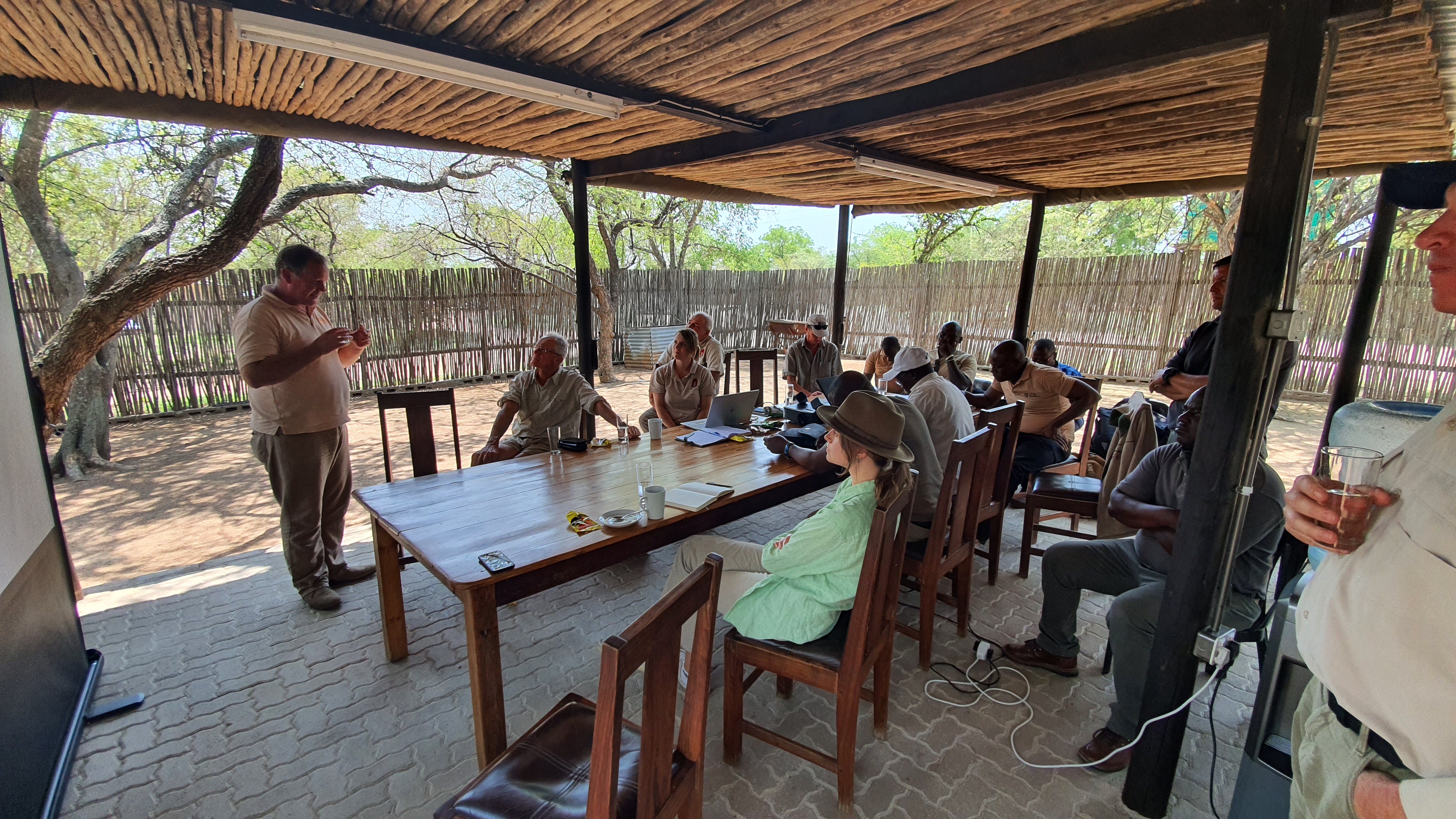
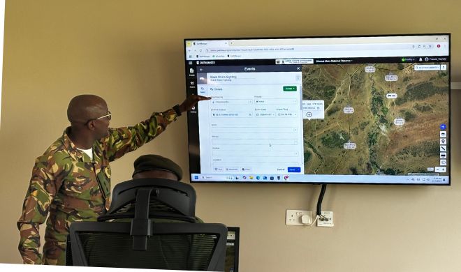
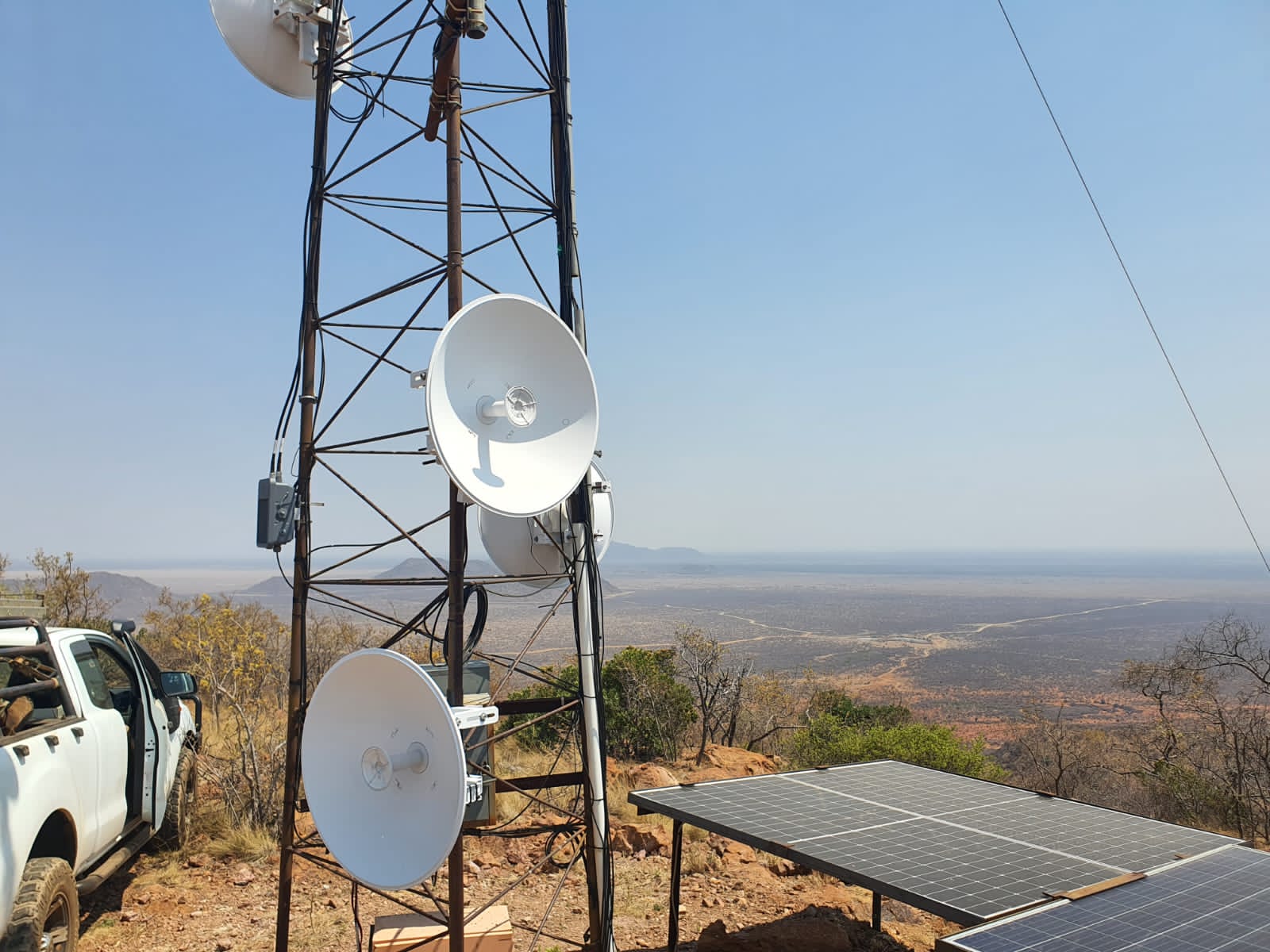
With our platform and tools, we not only provide opportunities to raise funds, simplify data collection for monitoring, and detect forest fires earlier to enable faster response, but also foster a sense of ownership for small grassroots projects tackling the globally critical issue of the climate crisis. Each project on our platform is encouraged to share its challenges and success stories with us and the broader community. This engagement happens through regular Community Talks or direct connections with other projects facing similar challenges, fostering meaningful discussions and facilitating valuable knowledge exchange at both local and regional levels.

Our project badges further enhance this sense of belonging, serving as both a symbol of community membership and an official seal of quality for potential supporters. Additionally, our free and confidential advisory service offers Restoration Organizations tailored guidance from our team of experts, empowering them to sustainably develop and improve their initiatives.

Active Community Engagement: Regular opportunities for interaction, such as Community Talks and peer connections, are essential for fostering collaboration, knowledge sharing, and mutual support among projects.

Training and Support: Providing training and ongoing technical support to project implementers ensures they can maximize the tools' capabilities and interpret the data effectively.

Recognition and Validation: Tools like project badges that serve as symbols of quality and credibility are important for both community morale and attracting potential supporters.

Tailored Advisory Support: Offering accessible, expert-driven, and confidential guidance ensures projects can address their unique challenges and make sustainable improvements.

Accessible Technology and Tools: User-friendly, reliable tools for fundraising, monitoring, and early detection of challenges like forest fires are vital for grassroots projects to operate effectively and achieve their goals.

Global yet Local Focus: Balancing global relevance with local impact ensures that both the broad climate crisis and specific regional needs are addressed comprehensively.

Key Lessons Learned

Community Engagement Builds Long-Term Value
Regular interactions through Community Talks and direct peer connections foster a strong sense of belonging and shared purpose. Projects benefit greatly from knowledge exchange, but these forums require consistent facilitation to ensure meaningful participation.

Recognition Drives Motivation and Credibility
Project badges act as an effective tool to recognize and validate project quality, boosting morale among implementers and instilling confidence in donors. However, the criteria for earning badges must be transparent and consistently applied to maintain trust.

Support Must Be Tailored and Accessible
Free advisory services have proven invaluable for projects facing diverse challenges, especially grassroots initiatives with limited resources. However, ensuring adequate capacity within the advisory team to meet growing demand remains critical.

Challenges and Aspects That Did Not Work

Inconsistent Participation in Community Engagement
Not all projects actively participate in discussions or share their experiences, limiting the potential for mutual learning. Encouraging broader involvement remains a challenge.

Balancing Standardization with Flexibility
While project badges and standards provide structure, some grassroots projects felt constrained by rigid criteria that didn’t fully account for local contexts. Introducing adaptability within guidelines has been key.

Advice for Replication

Foster Inclusive Communities
Actively encourage participation in knowledge-sharing initiatives by highlighting benefits and providing incentives for engagement, such as showcasing success stories.

Invest in Scalable Support Structures
Build a robust advisory team and implement scalable processes to accommodate the diverse needs of a growing project community.

Improved monitoring and reporting efforts for restoration

Environmental restoration initiatives must demonstrate the impact of their efforts to donors and other stakeholders. However, many projects struggle with collecting and presenting data effectively. This is where the digital tools TreeMapper and the DataExplorer dashboard provide invaluable support. TreeMapper enables restoration organizations to collect detailed on-site data about their restoration activities, beyond just tree planting. It can track interventions such as firebreaks, topsoil removal, or other ecosystem restoration measures. With an extensive database of over 60,000 species*, offline functionality, and the ability to re-measure monitoring plots, TreeMapper simplifies ecosystem monitoring and ensures comprehensive, reliable data collection.

Collected data is automatically uploaded to the platform, and publicly accessible within each project profile. For deeper analysis, restoration organizations can use the DataExplorer dashboard or export the data for further exploration in Python or Excel, gaining insights to improve their efforts.

Additionally, satellite data from NASA, European Space Agency, and other providers enhances monitoring by verifying project claims and tracking changes in biomass, tree cover, carbon sequestration, and risks like fire or flooding. This combination of on-the-ground and remote sensing data provides a detailed, comprehensive view of project quality and development over time, empowering stakeholders with transparency and actionable insights.

*BGCI 2024. GlobalTree Portal. Botanic Gardens Conservation International. Richmond, U.K. Available at https://www.bgci.org/resources/bgci-databases/globaltree-portal/. Accessed on 11/12/2024.

Robust and User-Friendly Tools: Digital tools like TreeMapper and DataExplorer must be intuitive, reliable, and functional in diverse environments, including offline scenarios, to ensure widespread adoption and effective data collection.

Comprehensive Data Integration: Seamless integration of ground-collected data with remote sensing datasets (e.g., from NASA and ESA) ensures a holistic view of project performance and ecosystem development.

Extensive Species Database: A well-maintained and expansive database, such as TreeMapper’s 60,000+ species catalog, is essential for accurate and detailed ecological monitoring.

Accessibility and Scalability: Tools should be accessible to projects of varying sizes and resources, with scalability to handle diverse restoration activities and large datasets as projects grow.

Transparent Data Presentation: Making project data publicly available in a clear and engaging format fosters trust among donors and stakeholders while promoting accountability.

Key Lessons Learned

Ease of Use is Crucial: Tools like TreeMapper and DataExplorer must prioritize user-friendliness to ensure adoption. Complex interfaces or workflows hinder usage, especially in regions with limited technical capacity.

Offline Capabilities Are Essential: Many restoration projects are conducted in remote areas with unreliable internet. Offline functionality in tools like TreeMapper has been pivotal for data collection in such environments.

Integration of Ground and Satellite Data Enhances Impact: Combining on-the-ground data with satellite insights significantly improves monitoring accuracy and provides a holistic view of project progress, which is critical for both implementers and donors.

Transparency Builds Trust: Publicly accessible and visually processed data strengthens donor confidence and promotes accountability, showcasing the impact of funded initiatives clearly.

Connectivity always a major consideration: Tools built are very light, so they work on old phones, and don't require cutting edge processors. All apps work offline, for instance, TRACER mapping is offline, TreeMapper data can be collected offline, and user only needs internet connectivity every month or so.

Financing and sustainability: ForestCloud's technical infrastructure is backed by a stable, long-term institutional partnership with Plant-for-the-Planet, Salesforce, and ESRI. A white-label version of the Restoration Platform—such as trees.salesforce.com—also serves as a fundraising tool to support broader ForestCloud operations. As the volume of users and applications grows over time, we may introduce a small percentage-based fee on donations to help sustainably cover maintenance and operational costs.


Aspects That Haven’t Worked

Inconsistent Data Collection Practices: Projects initially lacked standardized data collection protocols, which complicated integration and analysis.

Limited Early Training Support: Insufficient training materials and support initially hindered effective use of the tools. 


Advice for Replication

Focus on Core Needs First: Begin with essential functionalities that directly address user needs and gradually expand features based on user feedback and evolving requirements.

Standardize Data Collection: Implement clear, uniform guidelines for data collection and reporting standards to ensure consistency across projects. 

Offer Extensive Training and Support: Provide user-friendly training resources, tutorials, and ongoing technical support to help implementers fully utilize the tools.

Adapt Tools to Local Contexts: Consider regional variations in restoration practices and environments to ensure tools are versatile and relevant across diverse settings.

Prioritize Transparent Communication: Make project data accessible and understandable for all stakeholders, fostering trust and engagement.

test2

test

test

test