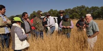
Strengthen cooperation in scientific research and continue to carry out scientific research monitoring

Strengthen cooperation in scientific research and continue to carry out scientific research monitoring. The application of infrared cameras and other modern monitoring technology for research, in-depth understanding of forest musk deer habits and survival methods, in-depth cooperation with the Three Gorges University, the Chinese Academy of Forestry and other scientific research institutions, with the help of professional forces to improve the level of protection, jointly carried out forest musk deer protection research. More than 160 cameras have been continuously deployed in Dalaoling Reserve for more than 7 years, and the population dynamics and habitat distribution of forest musk deer have been obtained in real time, so as to strengthen the protection of forest musk deer activity sites and reduce the corresponding human interference.

1.Continue to carry out field monitoring;
2.Strengthen cooperation with universities.

1.Monitoring equipment should be updated in time; 
2. The professional level of monitoring personnel should be continuously improved.

Improve infrastructure,strengthen patrol and management.

   To enhance economic investment in forest fire prevention, the Dalaoling Protected Area has implemented comprehensive infrastructure improvements. Specifically, the protected area is equipped with three management stations, seven business management offices, one forest fire command center, two sets of forest fire monitoring and early warning systems, 32 surveillance cameras, nine patrol vehicles, two fire engines, nine drones, and 60 patrol terminals. These measures have enabled the reserve to achieve 54 consecutive years without major fires, thereby ensuring the safety of the forest musk deer habitat.

Strengthen patrol and improve the management level of forest resources. The forest musk deer habitat is included in the scope of public service forest protection, and strict protection is implemented. The forest chief system is the general starting point of Dalaoling Reserve, the responsibilities of forest chief are strengthened, the co-construction and co-management mechanism is established with 11 villages and 5 townships around it, and a new model of co-construction and co-management of double forest chiefs of protected areas and townships is explored, and 30 forest chiefs are set up at three levels: bureau, station and plot. Every year, we regularly hold forest ministers' coordination meetings on resource protection, forest fire prevention, and special actions to solve the problems of resource protection and people's livelihood development. Employ more than 20 full-time conservators, and regularly carry out various activities such as fire prevention publicity and education vehicle dispatch, household distribution of various publicity materials, hanging fire prevention publicity banners and colored flags, to protect the living environment of forest musk deer and other wild animals.                                                                                                                                                                                                                                                                                                                                                                                                                                                                                                                                                                                                                   

  1. Funding support and technological investment; 
  2. equipment renewal and improvement;
  3. Establish a co-construction and co-management mechanism with the surrounding community;
  4. Strengthen joint law enforcement and severely crack down on illegal hunting and poaching.

1.1. Forest fire prevention is everyone's responsibility, and special groups should be properly managed; 

2. Increase the ways to increase villagers' income and reduce dependence on natural resources.

Presentation of results

Following from the six monitoring methods, six databases were also created to collect and analyse the data from these activities. The results have been written up into formal reports in English and Portuguese and shared with the national government. 

Each of the three fieldwork coordinators responsible for the data collection, processing and analysis of the data presented the results to other NGOs, the ministry of environment, Câmara Municipal Boa Vista (CMBV) (town council), Society of Tourism Development in Boa Vista and Maio (STDIBVM), Varandinha Association, Port Maritime Institute (IMP) and National Police including Maritime Police 

We are also hoping to submit the data collected during this project to be published in national scientific journals. 

Cooperation of the stakeholders.

Detailed and through databases produced by Dr Dario Cesarini with formulars for automatic calculation of indicators. 

Division of workload.

Sharing data allows for constructive feedback to be given to improve methods in the future. It also brings more meaning to the work and data colelction that was implemented over many months.

Surveys conducted on species, habitats, resources and illegal or damaging practices inside reserve.

To complete the surveys, each NGO had a team composed of a coordinator and technicians, the Fundacao Tartaruga’s team was composed of a coordinator and 2 field technicians and 2 drone pilots. Bios.CV and Cabo Verde Natura 2000 had teams composed of a coordinator and 2 technicians. The field teams always consisted of at least 3 members plus volunteers. During this project, they aimed to collect data on biodiversity, pressures, threats, species and climate impacts in the two protected areas, namely: Parque Natural do Norte and Reserva Natural de Tartaruga divided into 6 activities mentioned below:


  1. Behavior and abundance of ravens 
  2. Collection of fisheries and morphological data of Buzio Cabra
  3. Monitoring of introduced and potentially invasive plant species
  4. Study of the population of Phoenix Atlantica and Ficus Sycomorus 
  5. Recording of human pressures and impacts
  6. Collection of atmospheric climate data in communities

Each NGO participated and contributed equally to the field work element of the project. All participants took part in training and field visits to collect data. Each NGO was responsible for entering and processing the data, preparing reports and presenting the results of two of the monitoring methods. The final results were presented to various stakeholders during the IMET evaluation, which took place in November 2024.

A summary of each activity is provided below, and full reports for each activity are available.

A total of 139 trips were made to complete field work during the 5 months. 

  • 19 for the recording of human pressures and impacts
  • 25 for the study of the population of Phoenix Atlantica and Ficus Sycomorus 
  • 28 for the behavior and abundance of ravens
  • 19 for the collection of atmospheric climate data in communities
  • 38 for the collection of fisheries and morphological data of Buzio Cabra
  • 10 for the monitoring of introduced and potentially invasive plant species

Provision of high quality training.

Cooperation and clear communication by all members of the team including between different NGOs.

Weekly meetings of the fielwork coordinators allowed them to troubleshoot any issues before they became large problems.

The use of an online data storage facility - onedrive and qfieldcloud allowed for several groups to work simultaneously on the same project in similar areas. 

Communication and organisation was key to making this project a success.

Always save back ups of electronic data!

Purchase of biological monitoring equipment

All of the materials needed to implement the six defined monitoring methods were purchased. As Cabo Verde is an isolated achepelago, items needed to be brought from overseas. The three NGOs divided this equipment equally so that each organisation has its own set of equipment to be able to implement the six monitoring activities independently. In the planning phase we had defined 15 kits as the indicator value, however in reality, due to there being 6 monitoring activities implemented by 3 different NGOs, the total number of “kits” was 18 – 3 per monitoring activity.

  • Having a list of necessary equipment to purchase from the biodiversity consultant. 
  • Multiple people willing to help us to transport monitring equipment from serveral different european countries.
  • Sufficient budget to pay for the monitoring materials needed

Flexibility was important in ensuring the success and implementation of this activity. 

Diving the equipment by three to ensure each NGO received the equipment necessary to implement all 6 activities meant that the activity is now much more sustainable and have a good chance to be implemented over a long period of time.

Forests of the Blue and John Crow Mountains National Park
Community-Based Forest Management
Fire Management
Forests of the Blue and John Crow Mountains National Park
Community-Based Forest Management
Fire Management
Sustainable Livelihoods of Kuruwitu Beach Management Unit

The Sustainable Livelihoods component of K-BMU was a vital element in the project, aimed at supporting associated value chain actors to improve their livelihoods. This building block involved mapping actors in the fisheries value chain, identifying opportunities for improvement through business plan development, and testing pilot trials to demonstrate viable options. The project successfully met its primary objective under Sustainable Livelihoods, contributing to the enhancement of livelihoods for K-BMU members and associated value chain actors.

  1. Collaborative Mapping of Value Chain Actors: The joint effort by OA, KDoF, and K-BMU Executive to map all actors in the fisheries value chain facilitated a comprehensive understanding of the sector, enabling the identification of opportunities for improvement and ensuring equitable representation.
  2. Rapid Assessment and Business Plan Development: The rapid assessment of value chains and the development of business plan outlines for various options helped identify viable and feasible opportunities for up-scaling, supporting K-BMU in making informed decisions.
  3. Knowledge Sharing and Peer-to-Peer Training: The project's facilitation of knowledge sharing through peer-to-peer training enabled the exchange of best practices, supporting K-BMU members in exploring options for improving their livelihoods and establishing pilot demonstrations.
  4. Support for Pilot Demonstrations: The project's assistance in establishing pilot demonstrations for various Blue Economy value chain options (e.g., product hygiene, restaurants, deep water fish opportunities, eco-tourism, Tengefu options, and coral gardening) provided K-BMU members with hands-on experience and insights into potential livelihood improvements.
  5. Partnership and Technical Support: The partnership between OA, KDoF, and K-BMU Executive, along with the technical support provided, was crucial in facilitating the development of sustainable livelihoods for K-BMU members and associated value chain actors.
  1. Importance of Inclusive Value Chain Mapping: The project highlighted the value of comprehensive and inclusive mapping of value chain actors, ensuring that all stakeholders are considered and represented in decision-making processes.
  2. Viability of Diversified Livelihood Options: The experience with pilot demonstrations showed that diversifying livelihood options, such as exploring eco-tourism, Tengefu management, and coral gardening, can provide viable alternatives for improving the livelihoods of K-BMU members.
  3. Capacity Building through Peer-to-Peer Training: The peer-to-peer training approach demonstrated its effectiveness in building capacities and sharing knowledge among K-BMU members, facilitating the adoption of best practices and new livelihood opportunities.
  4. Need for Continuous Support and Monitoring: The project underscored the importance of ongoing support and monitoring to ensure the sustainability and scaling up of livelihood improvement initiatives, such as the pilot demonstrations established during the project.
  5. Partnerships and Collaborative Approaches: The project's success was largely due to the collaborative efforts among OA, KDoF, K-BMU Executive, and other stakeholders, emphasizing the value of partnerships in achieving sustainable livelihood outcomes.
Management effectiveness and enforcement of the Kuruwitu Beach Management Unit Co - Management Area

The Legal Framework of K-BMU was a foundational element in implementing the KCMA Plan, aimed at strengthening sustainable livelihoods and effective biodiversity conservation. This component involved upgrading the K-BMU Constitution and operational Bylaws, enhancing awareness among stakeholders, establishing a Monitoring Control and Surveillance (MCS) system, and initiating the gazetting process for the Fishery Limitation Sites (FLS). The project achieved its primary objective under the Legal Framework, laying a solid groundwork for the sustainable management of marine resources.

  1. Collaboration and Partnerships: The cooperation between K-BMU Executive, Kilifi Department of Fisheries ( KDoF), Oceans Alive, and other stakeholders like Kuruwitu Conservation Welfare-CBO (KCW-CBO) was instrumental in achieving the project's objectives, including the development of a joint MCS plan and a customized Marine Spatial Plan (MSP).
  2. Technical Support and Capacity Building: The provision of technical support by OA to K-BMU and KDoF, along with capacity-building initiatives for enforcement teams, played a crucial role in the effective implementation of the Legal Framework.
  3. Clear Division of Roles and Responsibilities: The project facilitated the clarification of roles between KDoF and K-BMU, particularly in enforcement and reporting, contributing to a more streamlined and effective conservation effort.
  4. Involvement of Community-Based Organizations (CBOs): The participation of KCW-CBO in the project, including the agreement on a Memorandum of Understanding (MoU) for cooperation, ensured that community interests and management practices (like those for Tengefu) were integrated into the overall conservation strategy.
  5. Support for the Gazettement Process: The assistance provided to K-BMU Executive in negotiating with KDoF for the gazettement of the KCMA, Fish Landing Sites  and other areas, contributed to securing tenure and legal standing for these protected areas.
  1. Importance of Customised Solutions: The development of a customised MSP, tailored to the specific needs and user groups within the KCMA, highlighted the value of adaptive management approaches in conservation.
  2. Community Engagement and Awareness: The project demonstrated that creating mass awareness and training members in sustainable resource use are essential components of successful conservation initiatives.
  3. Partnerships and Agreements: The experience with the MoU between K-BMU, KCW-CBO, and KDoF showed that formal agreements can facilitate cooperation, joint operations, and benefit-sharing, leading to more effective conservation outcomes.
  4. Legal Recognition and Security of Tenure: The process of gazettement for the KCMA and associated areas underscored the importance of legal recognition and secure tenure for the long-term protection and management of marine conservation areas.
  5. Capacity Building for Enforcement: The project's focus on building capacity and equipping enforcement teams emphasized the critical role of effective enforcement in the success of conservation initiatives.
Governance

The governance component of the KCMA project, led by K-BMU, was designed to enhance the management and sustainability of coastal fisheries resources in Kilifi County. This involved enhancing the capacity of K-BMU and its executive to effectively govern and manage the fisheries, ensuring that all actors whose livelihoods depend on these resources are registered, licensed, and aware of their rights and duties. The governance framework was pivotal in achieving the project's primary objective of ensuring sustainable livelihoods from coastal fisheries resources.

  1. Collaboration and Partnerships: The partnership between Oceans Alive, KDoF, and K-BMU Executive was crucial in providing technical assistance, awareness, and capacity building.
  2. Legal and Policy Framework: The Fisheries Act, which devolves authority of territorial fishing rights to local artisanal fishermen, provided a legal basis for the co-partnership in management and implementation of the CMA of K-BMU.
  3. Community Engagement: Wide awareness and inclusion of all members in the BMU Assembly meetings and the democratic election of K-BMU leaders ensured equitable representation and buy-in from the community.
  4. Capacity Building: Training and provision of technical knowledge, toolboxes, and templates for data collection and M&E empowered the K-BMU leadership to effectively implement the CMA plan.
  1. Importance of Legal Recognition: The process highlighted the importance of legal recognition and registration of all actors involved in the fishery to ensure security of tenure and empowerment of artisanal fishers.
  2. Community Participation: The success of the project underscored the need for widespread community participation and awareness in governance and management decisions affecting their livelihoods.
  3. Capacity Building: Continuous capacity building of local leadership and communities is essential for sustainable management and governance of fisheries resources.
  4. Partnerships and Collaborations: Effective partnerships between government agencies, NGOs, and local communities can significantly enhance the governance and sustainability of natural resources.
  5. Policy and Legal Frameworks: The existence of supportive policy and legal frameworks is critical for the successful implementation of governance and management plans for fisheries resources.