Integration of local knowledge in park management

Solución completa
Integration of local knowledge, Hin Nam No NPA

The complex surroundings of Hin Nam No National Protected Area require the PA management unit to co-manage the area with local villagers. This requires a common understanding of the area. The building blocks of village trail mapping, village ranger system, SMART data collection, participatory zoning and scientific biodiversity monitoring, help to gather information, process the data and create zoning and regulations to effectively manage the park by involving villagers and increase PA manpower with village rangers.

Last update: 02 Oct 2020
6340 Views
Contexto
Défis à relever
Poaching
Lack of alternative income opportunities
Lack of technical capacity
Poor monitoring and enforcement
Poor governance and participation
The challenge is to fill the gap in manpower and information needed for effective PA management which is created by the lack of Government personnel and funding through use of local manpower and knowledge from villagers. Villagers have extensive experience of the protected area and surroundings. Integrating them in the management of the protected area provides opportunities as well as threats.
Scale of implementation
Local
Ecosystems
Tropical deciduous forest
Tropical evergreen forest
Tema
Access and benefit sharing
Biodiversity mainstreaming
Protected and conserved areas governance
Local actors
Traditional knowledge
Protected and conserved areas management planning
Outreach & communications
Ubicación
Hin Nammo National Bio-Diversity Conservation Area, Khammouane Province
Southeast Asia
Procesar
Summary of the process
Identifying trails and local place names inside Hin Nam No NPA based on local knowledge is a useful starting point for involving local communities in co-management of the PA. It creates a good basis for dividing areas of management responsibility between villages. It creates a sound basis for setting up a village ranger patrolling system, which results in much better spatial monitoring data on occurrences of wildlife and threats. Maps produced in this process are a good basis for further sub-zoning and rules setting. Villager trail mapping, village ranger system and scientific monitoring data is gathered in SMART. Updated maps are created and used in participatory zonation and other management functions, like guiding the ranger activities. The system works because each village has an interest in keeping people from other villages out of their use area. It also provides a strong basis for co-management between Government and local communities.
Building Blocks
Villager Trail Mapping; capturing local knowledge
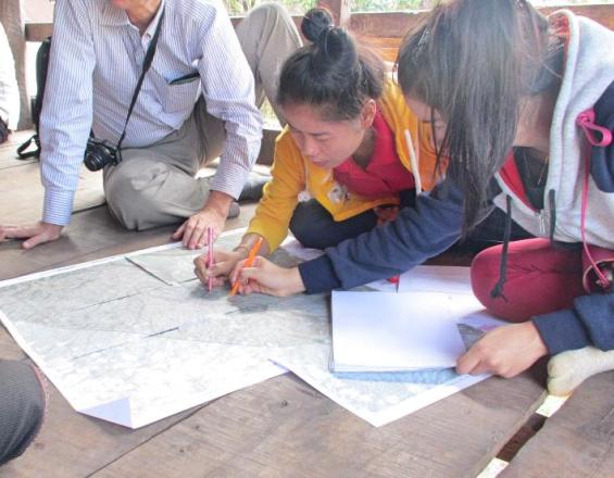
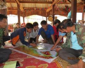
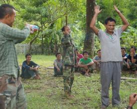
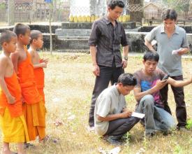
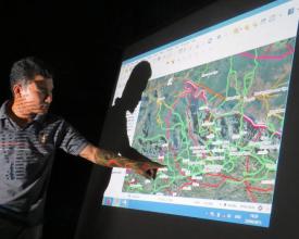
Government staff and surrounding villagers are able to communicate with each other when a common language on geographical features is established. Villagers surrounding the protected area have been brought up with the local knowledge of the area which includes local names and characteristics. Capturing this information is done in three repeated steps. The first step is to organize village meetings using general topographical maps in which the villagers indicate trails inside the NPA and names of areas, rivers/streams, hills etc. Where possible the villagers indicate areas they are controlling. The second step is to train teams of rangers (villagers & PA staff) to use GPS receivers and to have them walk all trails collecting location specific names and boundaries with GPS coordinates. The third step is the creation of updated maps with all trails and with location-specific names. The information on this map is then verified in a village meeting. These three steps may be repeated several times. The resulting maps are then used in discussions on zoning and village area delineation which determine the area for Village Rangers to patrol and which rules apply.
Enabling factors
As there is very little known about the Hin Nam No in general, there was no objection by the responsible ministry to start collection of data from the bottom up. The villagers are very willing to share their knowledge of the area and lively discussions amongst villagers erupt when different perceptions or names are known. Returning with updated maps creates a lot of understanding from both sides, and direct map updating in the village meeting with high resolution imagery shows the villagers the importance of their knowledge.
Lesson learned
The initial topographical maps used in village meetings should be accurate and show rivers and hills/cliffs with the names in the local language (and script). Maps printed on vinyl sheets allow villagers to write and erase with white board markers which supports discussions as labels can be changed. It is difficult for villagers to determine boundaries between locations. Especially for areas like forests, the boundaries are difficult to indicate as the boundaries are known only on the trails, not further afield. Some areas are limited by physical features (rivers, hills/cliffs) and thus with remote sensing estimations can be created but these need verification. Therefore several rounds of trail mapping, updating and meetings are required as villagers and government staff learn from each other which type of information is required for a common understanding. The resulting maps should be discussed with different groups in the village to ensure agreement and common understanding by all.
Village Ranger System
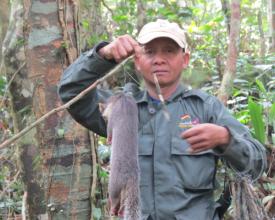
There are 18 villages that have traditional land rights inside the park boundaries. First 4-5 rangers per village were selected by the community based on their willingness to become rangers, knowledge of the area and having time available. The first teams were set up and trained to start villager trail mapping. Payment fee for biodiversity monitoring and patrolling was agreed through negotiations and based on a fair compensation for the hard and dangerous work of hiking in the mountains. The division of the park in village responsibility areas designates the village ranger working areas. Due to the different sizes, terrain and threats, some villages indicated the need for many more rangers and involvement of village militia or police. Now 110 villager rangers have been trained in use of GPS equipment and in the recording of sightings in coded booklets. They make regular trips into the park to record wildlife and threats (monitoring) and are involved in patrolling for law enforcement. The patrol frequency is adapted with the incoming information. As the village rangers know the area well, they are willing to go into very remote places and in very difficult circumstances where other rangers usually do not venture.
Enabling factors
Identification and acceptance of the limitations by government: agreement to fill the gap left by government of people for patrolling. A system that government could support in future: as cheap as possible but an effective patrolling system; no ranger stations and part time workers. Use limited government resources as effectively as possible as staff does not know the area well and do not want to work under remote and difficult circumstances; make use of local knowledge and hardened people for ranger activities.
Lesson learned
The system of village rangers depends on the willingness of all villagers to uphold the rules that they have established and agreed upon, as for the village rangers it is not possible to arrest their neighbors. Therefore it is important to have a separate ranger team focused on law enforcement from the government/outside. Village rangers only work in their own village managed area as trust between villages needs to be built. In the Hin Nam No the village ranger teams always include village militia or police who are authorized to carry arms which is a requirement to stop well equipped poachers. Training on monitoring, apprehension and other tasks needs to be done regularly. Clear processing of violators and support for poaching camp raids needs to be established. Feedback sessions are an important tool for exchange of information and improving effectiveness.
SMART data collection tool
SMART is a ranger based data collection tool specifically for managing patrolling activities. As it is a data collection tool for spatial data, the database was re-designed to not only serve the patrolling needs but also the wildlife monitoring and location data gathering needs. Training was given to government volunteer staff to work with the software and adapt the database, and to rangers on the use of the data booklet. Trials were done and the database and data booklet adapted to requirements from rangers and researchers, i.e. small size booklets, wildlife per category (indicator, key, hunted). To be able to collect data systematically and report important features to management, a tool like SMART is ideal. As the data gathering is done by staff with limited reading/writing capabilities, we simplified and coded the booklet, with the codes on the front and back of the booklet. The data entry (and reporting) can be done by few experienced staff. As rangers stay in the field for up to 6 days and electronic data gathering equipment does not have this kind of battery power, a more sophisticated system is not possible. For more sophisticated geographical analysis and mapping, the data is transferred to a GIS system.
Enabling factors
The tool is promoted by major players in the conservation world and as such is seen by the partner organizations as a tool that is acceptable. The tool is free and thus, besides training, no extra costs are necessary for software licenses. The very limited amount of data before the adoption of SMART and the lack of qualified staff to manage the previous software made the change easy. It is possible to transfer data from an old system into SMART.
Lesson learned
There needs to be an absolute minimum of one highly trained staff member who is responsible for entering the data, analyzing the results and creating the reports for management. More people is better as regular sharing of the database prevents data losses. Training of the staff responsible for SMART takes time as it is complex. Providing information to management creates awareness and results over time in further requests for information. This motivates those involved in data gathering (the rangers), analysis and reporting (PA staff). It is necessary to be flexible at the start of the usage of the tool as to be able to adapt to the data gathering needs. This requires several rounds of updates and trials; the database should be kept flexible. Training of rangers on the data booklet needs to happen several times and regular feedback of patrolling results increases effectiveness.
Participatory zoning
To be able to effectively manage the park, it should be clear in advance which areas are of importance for the villagers for their livelihoods, as they have customary rights to use non-timber forest products (NTFPs), wood for construction and hunting for food security. Meetings at the individual villages for trail mapping indicated approximate boundaries between villages. The updated maps from trail mapping are used in village grouping meetings to commonly agree on the boundaries between the villages. The participatory zoning meetings are held to delineate different use zones and rules for each zone. Discussions at village level cover: the maps and locations indicated, the use of NTFP’s and wood, the location of areas of usage and the rules and regulations for the collection of NTFP’s and wood. The outcome is a proposal by the village community to delineate a Total Protected Zone (TPZ) and Controlled Use Zone (CUZ) according to the Lao law, with specific rules and regulations for access and use. A final meeting is then held with surrounding villages to explain the areas concerned and the rules and regulations so that outsiders no longer misuse these areas. These rules are built on existing laws, just adding extra detail where needed.
Enabling factors
Lao protected area laws recognize 4 zones: Total Protected Zone (TPZ), Controlled Use Zone (CUZ), Buffer Zone and Corridor. The CUZ allows villagers to use part of the PA for self-sufficiency. The law leaves opportunities to create detailed village rules. As Participatory Land Use Planning is practiced nationwide for all village land, the villagers are used to zoning activities. Villagers have learned from other activities that creation of rules and dissemination of these rules may result in having more control over their resources.
Lesson learned
Although villages have commonly understood boundaries between them, many villagers will go into other village areas to collect NTFPs or hunt. For villagers to be able to control access it is thus of great importance to establish boundaries between village territories within the park and use areas within the village areas. After dissemination of the results these rules and regulations can be implemented and monitored and outsiders banned. Especially in the beginning the rules and regulations will be challenged and support of the village authorities by external support/mediation helps to settle issues between villages.
Resources
Scientific Biodiversity Monitoring
Scientific monitoring is part of the process of regular verification of some biodiversity indicators in the field. This is done in pre-selected transects and at specific times in the year. The selection of transects and timing are based on research on key species for the area. The team consists of village rangers and scientists. During the transect walks the sightings and calls are recorded. The activity has two results: (a) an independent set of data indicating the biodiversity status in a core zone of the PA providing a comparison with previous times and with the ranger monitoring data (b) a learning experience for the village rangers on the methodology of monitoring wildlife and a confirmation of the importance of their work.
Enabling factors
Project donors request biodiversity monitoring results as part of project monitoring. External experienced wildlife scientists are enthusiastic and this helps to positively influence villagers, village rangers and government staff.
Lesson learned
Having regular scientific monitoring done costs lots of money and is difficult to repeat regularly. Well trained locals (village rangers) may be able to do the same and cover larger areas.
Impacts

1) Sense of pride of villagers and village rangers because they have the right and obligation to protect the area from outsiders. This has resulted in ownership of the protection objectives. Now even village rangers ask for support from the management to help keep their own neighbors from breaking commonly agreed laws as they cannot uphold the law against village authorities or friends. 2) Diversified income outside agriculture or livestock rearing for the village rangers without their becoming dependent and hereby providing cost effective patrolling without the need for ranger stations and their maintenance. 3) Improved management as local names are known and data on wildlife observations and threats are gathered. The value of the gathered data has resulted in the Head of the Provincial Office of Natural Resources and Environment asking for regular threat updates and anti-poaching trips by combined departments.

Beneficiaries
• Protected Area Management Authority • Village Rangers
Sustainable Development Goals
SDG 15 – Life on land
Story
Rangers on the trail, Hin Nam No NPA
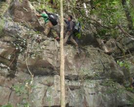
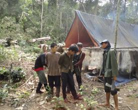
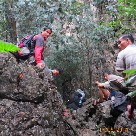
Immediately after the first trail mapping the diversity of the area, both in space and time, became clear. During the dry season certain areas can be reached by motorbike, while in rainy season a boat is necessary. The phenomenon of ‘Kuan’, a valley surrounded by (limestone) cliffs, gets a new meaning when one is actually trying to get into one. With the trail mapping and monitoring/patrolling trips afterwards, there is now a much better understanding of why certain areas are targeted by poachers and why certain areas can only be reached during rainy season, when water is plenty (often too much). Because of the difficult and steep terrain the rangers do not bring lots of materials and camp out in the bush for up to 6 days with minimal supplies, often staying overnight in caves or under overhangs and living off the land. Since the start of the work, the village rangers have regularly encountered campsites of poachers (both for wildlife and precious timber), sometimes with the people still around. Arresting and bringing poachers to the authorities outside of the park has had its challenges. Many have escaped as getting them out over the limestone cliffs and steep hills is dangerous and takes a long time. One effective way that the village rangers now deal with poachers is destroying all water canisters, plastic bags, or plastic lined ponds they can find in the camp. As the Hin Nam No is very dry for 6-7 months, all people need to carry water to survive and destroying the water supply forces poachers to leave.
Conectar con los colaboradores
Other contributors
Ronny Dobbelsteijn
IP Consult, part of NIRAS group
Other Organizations