Availability of Data

Three types of data were particularly important in the design and promotion of the “Program for Earthquake-Resistant School Buildings”: school data, data on damages, and data on hazard risks. School data was collected by surveys and investigations conducted by FDMA and MEXT. A list of the surveys is indicated below.

  • School Basic Survey (annually since 1948) to collect basic data.
  • Public School Facilities Survey (annually since 1954) to collect building area and conditions of school facilities.
  • Status of Seismic Resistance of Public School Facilities (annually since 2002) to collect data on the seismic resistance of school structures as well as suspended ceilings of gymnasiums and other nonstructural elements of school buildings.

Earthquake Damage Investigation (after each mega-disaster such as the Great Hanshin-Awaji Earthquake and the Great East Japan Earthquake) to collect damage to buildings, specifically the kind of damage suffered by various types of buildings, the location where the damage occurred and under what circumstances, and the kind of earthquake that caused the damage.

Building on experiences

One of the biggest instigators for developing and promoting school retrofitting is the past experiences of earthquakes. The 1995 Great Hanshin-Awaji Earthquake triggered the development of the program’s comprehensive guidelines, and the program gained momentum after the 2004 Chuetsu Earthquake and 2008 Sichuan Earthquake in China which caused the collapse of 6,898 school buildings and 19,065 deaths of schoolchildren. This prompted MEXT officials to pass the revised Act on Special Measures for Earthquake Disaster Countermeasures, which supported additional national subsidies toward the school retrofitting and reconstruction program. The 2011 Great East Japan Earthquake prompted the program to give higher priority to nonstructural elements and highlighted the need for tsunami countermeasures and functional improvements of schools as evacuation centers. Learning from each disaster event and applying the lessons learned to the improvement of the systems has contributed to ensuring the seismic safety of public schools.

  • Identification of the need to prioritize the subject through national policy.
  • The political will to make improvements to policies to achieve a goal.

Political will and interest to identify the retrofitting of schools as a priority initiative was essential for the national government to take measures to improve its systems and policies building on experiences. The constant effort to promote the retrofitting program was in part induced by politicians’ interest in both humanitarian and economic reasons. In a culture that prioritizes human life, a policy for making schools earthquake-resistant has the aim of saving the lives of schoolchildren. The policy also is considered an effective investment that contributes to local economies and produces tangible results that are well-received by the public.

Community Management of a Protected Area

PNG is one of the most diverse places on Earth — a country with over 850 languages and numerous mountain ranges that have historically limited contact between clans. These clans traditionally manage their own land their own way. Yet over the past two decades, communities scattered across the Huon Peninsula have defied tradition, joining hands to create a community-based group that collectively manages what in 2009 became known as the YUS Conservation Area (YUS CA), the first legally protected area of its kind in PNG.  Stretching over 75,000 hectares, YUS encompasses cloud forest peaks towering 4,000 meters high, coral reef on the coast below and tropical rainforest in between. The YUS CA protects not only the Matschie’s tree kangaroo, TKCP’s flagship species, but also a host of threatened species, as well as critical habitat that local communities depend upon for subsistence agriculture, clean water and hunting.

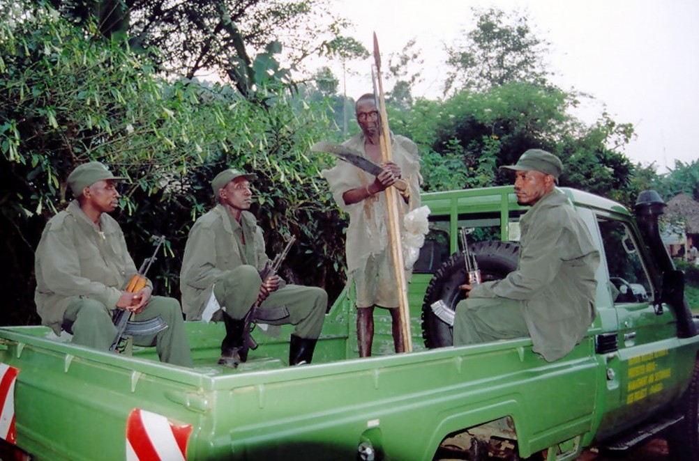
The YUS Conservation Area is managed in partnership among TKCP, the YUS community and the PNG government. TKCP manages the YUS conservation ranger team and the Ecological Monitoring Program conducts community awareness-raising, mapping and facilitates the YUS Conservation Area Management Committee.


  • A wide range of national and international partnerships (government, private sector, academia and the NGO sector).
  • Long-term time commitment to working with local landowners to understand community needs.
  • Working in partnership with local landowners and their families in conservation efforts;
  • On-going efforts to raise community awareness about the importance of YUS conservation;
  • Creation of the YUS Conservation Ranger Team;
  • Creation of YUS Ecological Monitoring Program; and
  • Establishment of a YUS Conservation Area Management Committee.

Fostering the design, establishment, and long-term management of a protected area in Papua New Guinea requires action appropriate to unique local conditions. Lessons learned for wildlife conservation include:


  • Significant planning and analysis should precede commitment to a site for conservation work. 
  • Long-term success requires a long-term investment of time  (it took more than a decade to establish the YUS Conservation Area). 
  • It is essential to build a trusting and respectful relationship with landowners. 
  • Community needs must be incorporated into conservation goals.
  • There is a need to build relationships with all levels of PNG government as project stakeholders.
Long-term Commitments and Partnerships

The long-term plan of OMY is embodied not merely by one private developer but jointly initiated by a group of public-private stakeholders across the local business districts. Indeed, the Council for Area Development and Management of OMY, being comprised of 68 landowners, 12 observers, and 8 special members in 2016, established the Advisory Committee on OMY Area Development in 1996 together with the Tokyo Metropolitan Government, Chiyoda Ward, and East Japan Railway Company. As the first area management initiative in the country, the Committee regularly updates the guidelines for redevelopment activities since 1998. These guidelines set out 8 development goals, key functions of zones, axes, and hubs, district design standards, and local operation rules for coordinating cityscape, networking public open spaces, and transferring FARs. Furthermore, the committee has introduced a variety of area management and place-making initiatives such as free loop bus service, car-free public spaces, establishment of a district-level association, and various city events.

  • Council for Area Development and Management of OMY (comprised of 68 landowners, 12 observers, and 8 special members)
  • Coordination across the local govenrment, the ward government, and the railway company
  • Legalization of the Area Management Initiative

Large-scale redevelopment projects generally require the complex and painstaking coordination of property rights among various stakeholders. The long-term commitment of major developers and the establishment of horizontal partnerships are essential for intergenerational redevelopments and sustainable area management. Many details of urban design, operation, and place-making efforts must be initiated and guided in local specific ways.

Cooperative networking

Association Las Huacas has developed a Cooperative networking with different allies from private and public sectors. Partnership agreement with GEOGES C.Ltda. (environmental consultancy agency), wich has been interested into cooperate with ancient populations in order to preserve the culture and traditions, as well as to recover the optimal conditions for mangrove development and conservation.
The agreement brings to the association the technical capabilities of the Agency, in order to get the assistance to design- implement- and follow up of the management plan. The agreement has also served as a framework for cooperation at different levels – community, asociation – in order to enforce the organizational aspects of both institutions, as well as to propose and to develop alternative initiatives of production or self-employment, and the critical analysis of thrird parties cooperation initiatives.

To find the right partner, relative objectives and vision (apply to bothsides).

Total commitment to cooperation, with full involvement of the members into the planned activities.

Long-term follow-up, in order to create and to register data that will allow future decission making.


Active participation in identifiying issues and planning process will allow better understanding of the issues and more realistic paths to deal with it.

Try and failure process is also necessary in order to understand different dynamics working at the time, and to develop successful next steps.

Importance of conservation

Scientists, who have been monitoring the area before it was closed, estimate a 500% increase in biomass within the area since the closure. The area, previously covered with sea urchins, is now a thriving biodiversity hotspot with the balance restored. The elders report new species in the MPA that have not been seen in living memory. The coral, previously destroyed by human feet, has recovered quickly and the lagoon area is now known as one of the best snorkelling destinations on the Kenyan coast. Local and international students come and learn in our living marine classroom. Turtles feed on the seagrass beds undisturbed, and the number of nests has increased significantly. The area has returned from being a marine desert to a marine paradise and a critical model globally that shows how a poor community can help conserve nature and benefit from it too. Bigger and better catches outside the MPA has ensured support for the permanent closure.


The MPA could not have gone a head without the belief and forsight of the fisherfolk in the area and the acceptance to beleive that positive change was possible even in difficult circumstances. Local knowledge from the elders ensured a suitable site for the closure was chosen. Scientific research also supported the choice as having the most potential for long term improvement. Regular updates on improvements within the MPA has helped sure up the belief that it is successful as a breeding area.

That nature is resilient and can recover amazingly quickly if left alone to do so. Identifying needs and fostering willingness to embrace change can improve livelihoods. The importance of undertaking an environmental impact assessment on the area, underpinned by research and local knowledge, before the project started has been a critical factor towards the success of the MPA. Constant awareness and updates of the improvement in the MPA need to be communicated back to the community. Analysing the information can be used to put into perspective in the socio-economic impact. The importance of communication of our progress back to the community has been something we have had to improve. When the community understands and sees the benefits from change they are, understandably, more willing to accept it.

Marine protected area (MPA)

Community recognition that action was needed to improve dwindling fish stocks was followed by the identification of various stakeholders to help us achieve our goals. Communication, outreach and awareness building programmes were set up and a visit to a similar project in Tanzania went ahead in 2004, and encouraged the community to use local marine resources sustainably.


A democratic decision to close an agreed lagoon area was agreed. Legal and policy frameworks were put in place, and the first LMMA in Kenya was approved in 2006 under the National Environmental Management Authority. Following this, a collaborative governance model has emerged under Beach Management Units (BMU's), where fishers and government work together towards sustainable fishing and improved livelihoods. In setting up the MPA, we went through various phases; conceptualisation; inception; implementation; monitoring; management and ongoing adaptive management.


The realisation by the community that there was a significant crisis looming and a determination to act for the sake of future generations was a crucial factor in the implementation process. Trust and belief in a positive outcome was paramount. Initial funding for alternative enterprises and support from key partners was necessary for technical and advisory capacities. An area was chosen that had good recovery potential with help from a scientist that had previously been monitoring that part of the coast coupled with local knowledge.

From the outset a clear strategy and management plan devised with maximum participation from community members is critical. Listening to the elders within the community creates an essential link between past and present. Targets and goals need to be achievable and clear timelines need to be set and adhered to keep the support of the community. The entire community needs to benefit from the project, and livelihoods need to improve tangibly in order to maintain support and create a sense of ownership that gives the project longevity. A community welfare aspect should be part of the strategy. Awareness, education and sharing of information need to be maintained, and a willingness to an adaptive management approach is vital. Learning from mistakes, sharing knowledge and creating close alliances with other similar organisations helps the project progress quickly. Creating collaborative partnerships and following clear procedures and legislative guidelines strengthen the structure of any entity. Good governance from the outset with a clear constitution that is followed at all times. 

Mainstreaming integrative forest management

For the successful application of the approach, sustainable and integrative forest management needs not only to be piloted and practiced on the ground but also integrated into national strategies, development plans, and long-term forest management planning and monitoring. Consequently, it is equally important to work with forest tenants on the local level as to mainstream the approach on the national level.

The Join Forest Management approach has been anchored in the Forest Code of Tajikistan in 2011. This builds the legal basis of the implementation and accelerates the further dissemination to other parts of the country. Since 2016, a more integrative forest management is practiced for which an inter-sectoral dialogue has been established. This inter-sectoral dialogue facilitates to address environmental, economic and social challenges beyond the mandate of the forest agency. Forest monitoring and management planning are being strengthened through support to the forest inspection unit. Only if a forest management planning system and a forest monitoring structure are in place, an approach such as the integrative forest approach can be out scaled throughout the country and mismanagement, corruption, and wide-scale violations of regulations (e.g. grazing on forest plots) prevented. 

The JFM approach follows a multilevel approach, targeting national, regional and local level which has proven to be necessary and consequently successful.

A theoretically sound solution can only be as good in practice as its underlying management planning and monitoring system as well as its political support.

Monitoring of Azores bullfinch population and restoration success

Every four years the "Atlas of Priolo" is conducted, with 50 volunteers counting all the priolos in the world in one or two days. This Atlas allows a more robust estimation of the priolo population size.

Annually a census of priolo is conducted by a project technician in May and June, and in September a juvenile census is conducted in order to assess the reproductive success of the species. Every four years a winter census is also conducted. This monitoring allows assessment of the population trends of the bird and quick action if any problem is identified.

Native vegetation evolution is assessed in all the intervention areas annually, comparing the composition of random 10 x10 metre squares of vegetation between restored areas and control areas. New plantations are also monitored to assess their success and identify problems. When an intervention area presents other sensitive issues, such as proximity of water lines, new monitoring schemes, for example water analysis, are put in place in order to ensure success and safety of all the interventions.

Finally, socioeconomic impacts of the project in terms of investment and ecosystem services provision are also monitored.

  • European Commission funding through LIFE Programme;
  • Scientific support by an advisory board.
  • Good planning and regular implementation of monitoring actions is essential in order to obtain good and robust results;
  • Scientific support of monitoring actions is very important, however, and since actual conservation actions are a priority, this monitoring needs to be adapted to reduced availability of economic resources and time to conduct these actions. Sometimes, it is necessary to find simpler ways of obtaining the answers we need in order to continue working despite not being totally scientifically rigorous. This is the case of ecosystem services provision assessment, which is conducted in qualitative terms, with some quantitative and monetary valuation, when the required information is available.
  • Monitoring actions allow identification of best practices, redefining new interventions and improving efficiency, but they are also a good communication tool, allowing us to show the importance and success of the project and to present this to the general public. The Atlas do Priolo has become a great communication and engagement event.
Value PAs and natural resources

To effectively conserve natural resources and facilitate sustainable development, a shift in perception must occur so communities and governments view PAs and natural resources as productive units of the economy, rather than resources under siege from development sectors and local communities. In the lower Mekong countries, attitudes are changing and governments are beginning to perceive PAs as economic assets carefully conserved for the development benefits they provide. While this shift is still occurring, governments are moving towards a situation where the natural capital held in PAs is subject to regular stock taking with the results reflected in GDP and budgets. Member states understand that investing in PAs and natural capital ensures resources are sustained, restored and expanded so they continue to produce ecosystem services vital to development and economic expansion.  

For this building block to be successful, citizens and industries must directly benefit from the conservation of natural resources and expansion of PA networks. Direct benefits may take the form of water filtration, flood control, fisheries production, etc. If citizens and industries do not directly benefit, they will fail to see the value in expanding PAs. Success also depends on the commitment of governments to financially invest in the upkeep and expansion of PAs and their resources.

All PAs need to have their values expressed in economic terms which can be communicated in annual and long term budget submissions. Valuations should be part of PA management plans and environmental assessments associated with development proposals affecting PAs.


Each sector needs to be made aware of the development benefits they do or might receive from PAs.
Those benefits and their maintenance should be recognised in sector plans and budgets.


A more systematic application of the beneficiary or user pays approach in all sectors is needed requiring supporting economic policies and instruments. Pilots already carried out, for example, the Lao hydropower levies, should be applied consistently and replicated in neighbouring countries.


Users of PAs need to become involved in their management and protection. New collaborative management approaches will be required relating to specific areas, resources and rights of access and to the services and products PAs provide.
 

Underlying all these new directions, is the need to build the capacity, skills and budgets of PA managers.