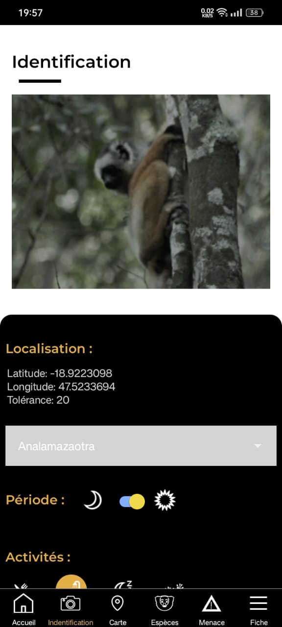
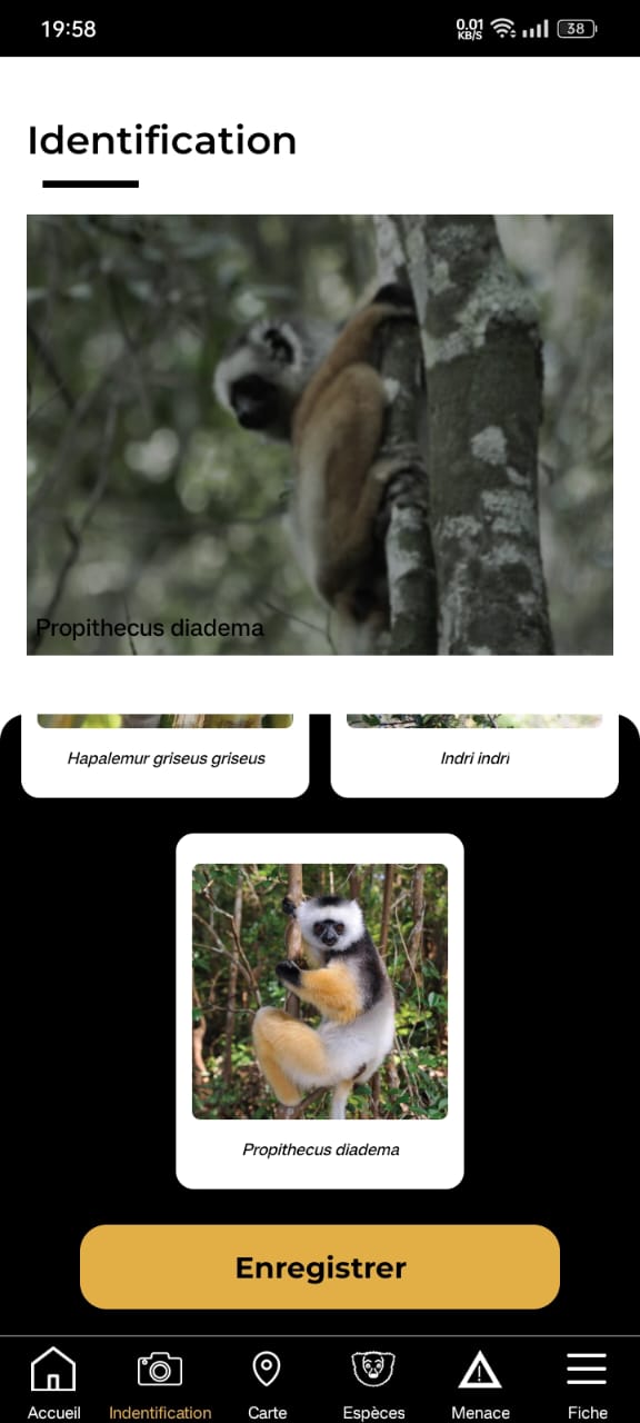
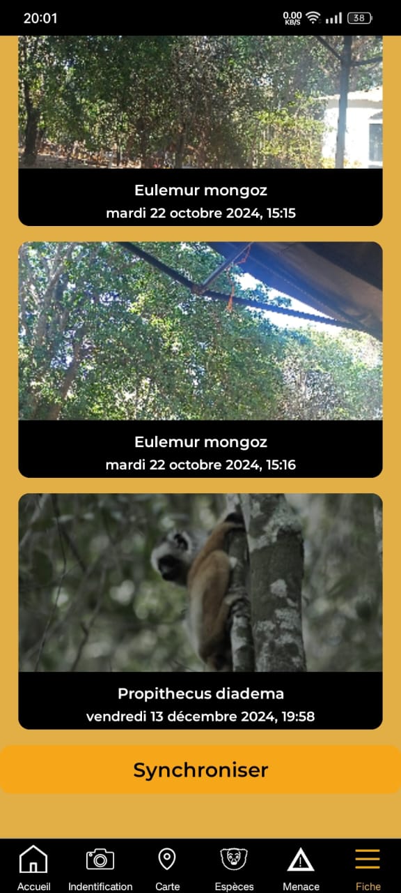
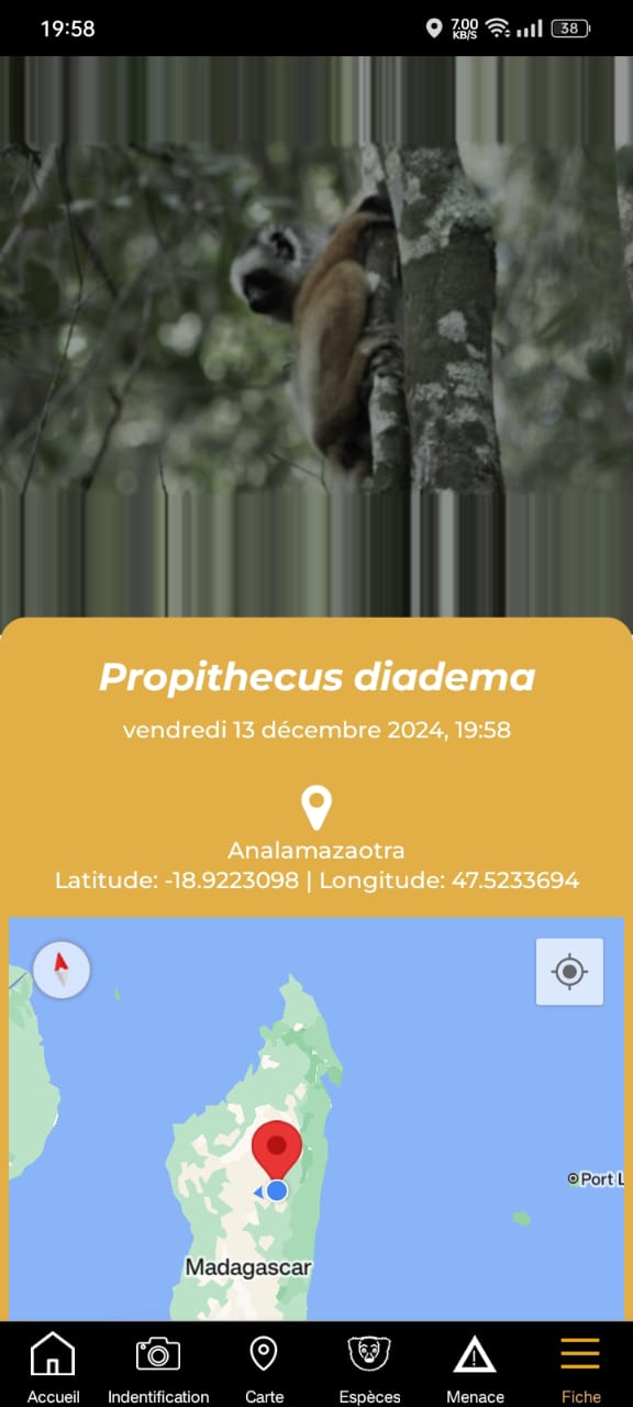
This dual-component system combines a mobile application for real-time data collection with an online platform for data visualization and analysis. The mobile app allows field agents, students, and community members to record species observations, even in remote areas, thanks to offline functionality. Data is automatically synchronized to a central database for visualization and analysis on the web platform.
By enabling spatial tracking of species, improving data flows from protected areas, and involving diverse users in conservation, this component contributes to GBF Target 1 (planning and managing biodiversity areas), Target 3 (strengthening protected areas), Target 4 (preventing species extinction), and Target 22 (ensuring inclusive participation in biodiversity action). These components also form the basis for long-term funding to maintain the project. By collaborating with travel agencies and protected areas, non-intrusive advertisements could be implemented on the website and mobile app to generate revenue and support the website's activities.
Intuitive, user-friendly interfaces tailored to a wide range of users with different digital literacy levels.
Use smartphone Integrated GPS tools to facilitate geotagging of species observations.
Compatibility with the database for automatic data uploads and access.
Continuous feedback loops between field users and conservation planners to improve functionality and relevance.
Active engagement of local communities, youth groups, and university partners through outreach and co-design.
While the app has significantly improved data flow and user engagement, many users, especially in rural areas, require hands-on training and ongoing support to build confidence in using digital tools. Additionally, long-term maintenance of the platform demands more resources than initial development, including technical infrastructure and human capacity. Sharing precise geolocation data can also pose risks, particularly for endangered species, highlighting the importance of strict data privacy and ethical protocols. Ensuring long-term success requires strong local ownership, responsive support systems, and sustainable funding strategies that go beyond pilot phases.
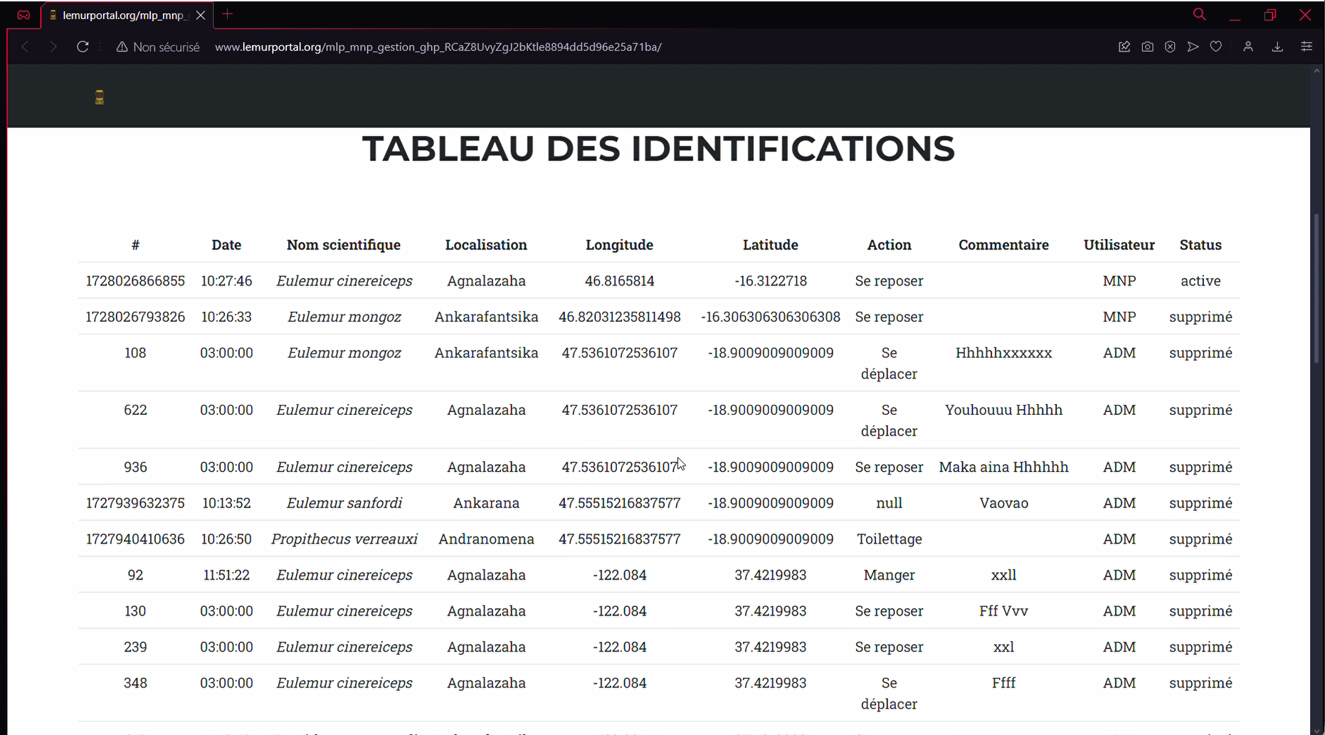
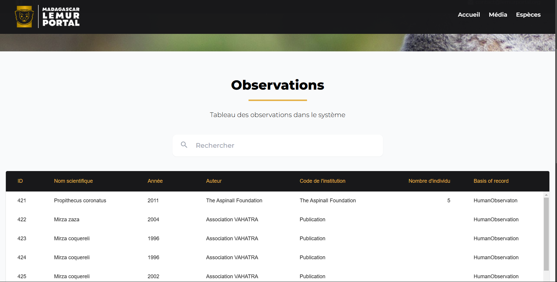
A centralized, open-access database compiles high-quality biodiversity data, including lemur species distributions, habitat conditions, and conservation threats. It provides a reliable foundation for research, policy development, and conservation planning across Madagascar. The database is regularly updated with field observations collected via the mobile app and validated by local experts.
By making biodiversity knowledge accessible, up-to-date, and decision-relevant, this component directly contributes to the GBF Target 4 (halt species extinction) and Target 21 (ensure public access to biodiversity knowledge and data). It enables trend monitoring, supports conservation action, and strengthens coordination between field and policy levels.
Integration of data from field studies, research institutions, and conservation NGOs.
Regular updates from mobile and online platforms to ensure current and relevant information.
Collaboration with local scientific communities to maintain data integrity and to validate and enrich the database
Inclusion of offline functionality to enable data collection in remote areas with limited connectivity.
A database alone has limited value unless it is actively used. Outreach, training, and sustained user engagement are essential to ensure the data is not only accessible, but also well understood and effectively applied by diverse stakeholders-including local communities and conservation practitioners. Additionally, in recent years, many funders have shifted away from supporting standalone data platforms. To secure long-term support, the database must clearly demonstrate its impact on conservation outcomes and its integration into real-world decision-making processes.
Empowering Communities Through Sustainable Livelihoods and Equitable Access to Economic and Environmental Justice
Corruption in the forestry sector continues to undermine the rights & livelihoods of local & Indigenous communities. By institutionalising the use of ForestLink, we empower local communities beyond enforcement - the system has proven critical in tackling this corruption, enabling communities to document land rights violations & illegal activities, defend their territories & secure access to justice, whilst securing sustainable economic opportunities linked to forest resources.
Crucially, ForestLink supports sustainable economic activities & lays the groundwork for payment for environmental services by reinforcing community autonomy & stewardship of natural resources. Through partnerships with local organisations skilled in legal advocacy & sustainable enterprise, communities are supported to develop livelihoods aligned with forest protection. Key enabling factors include understanding current economic practices, ensuring financial support for legal actions & engaging in parallel advocacy to secure land rights.
By actively managing and defending their lands, communities reinforce their autonomy & contribute to long-term, locally driven development. The data collected through the tool also plays a crucial role in supporting access to justice - providing evidence for legal & non-legal actions when communities face human rights abuses or environmental crimes.
Understanding the communities’ current economic activities is essential
Financial means are necessary to support legal and administrative processes
Partnering with local organisations specialised in legal advocacy & sustainable business enhances impact
Parallel advocacy work to secure individual & collective land rights is critical
Awareness-raising on sustainable economic activities must involve all community groups, with targeted efforts for women & girls.
Trained staff in justice, law & sustainable economy fields are vital for success
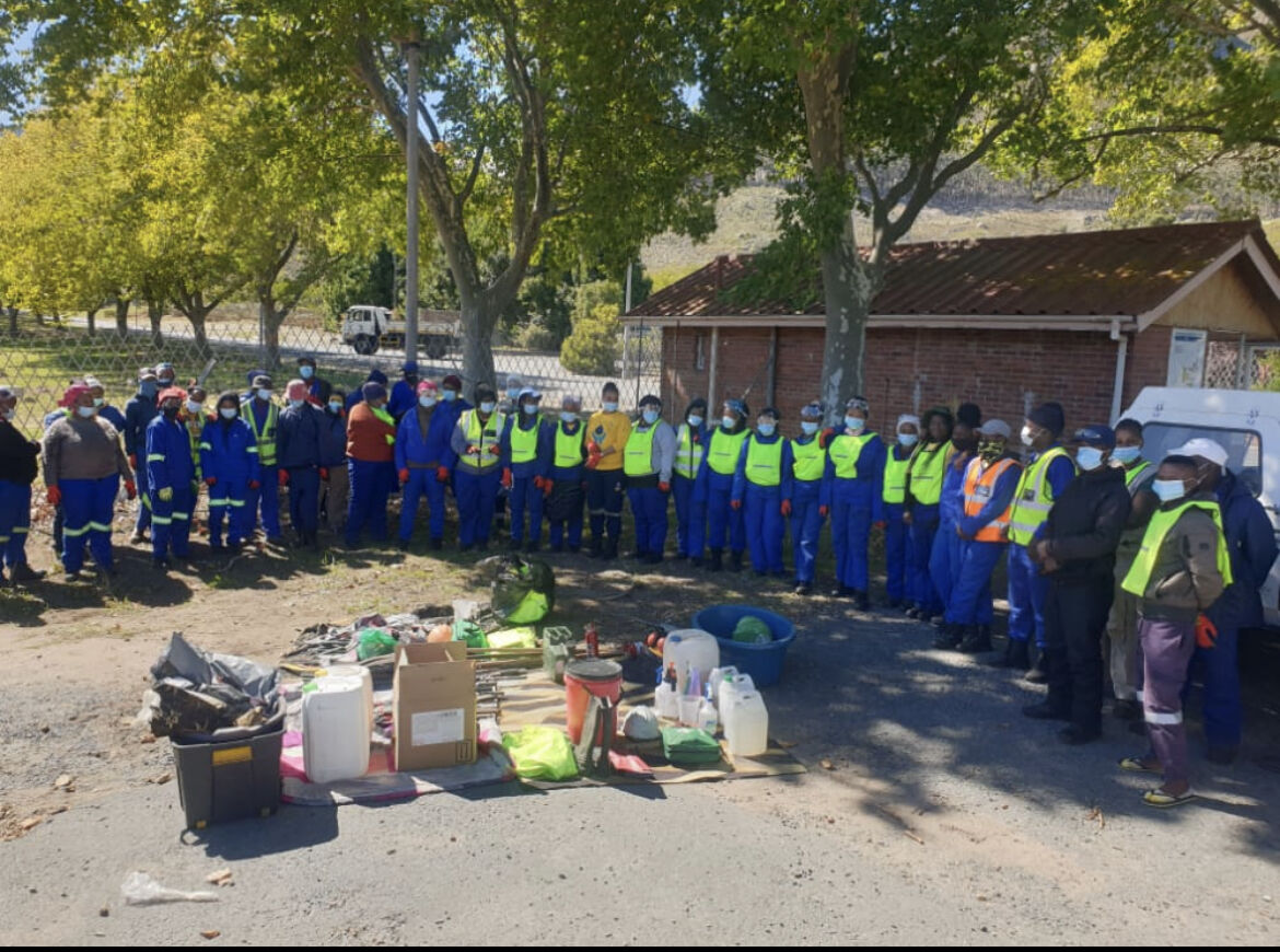
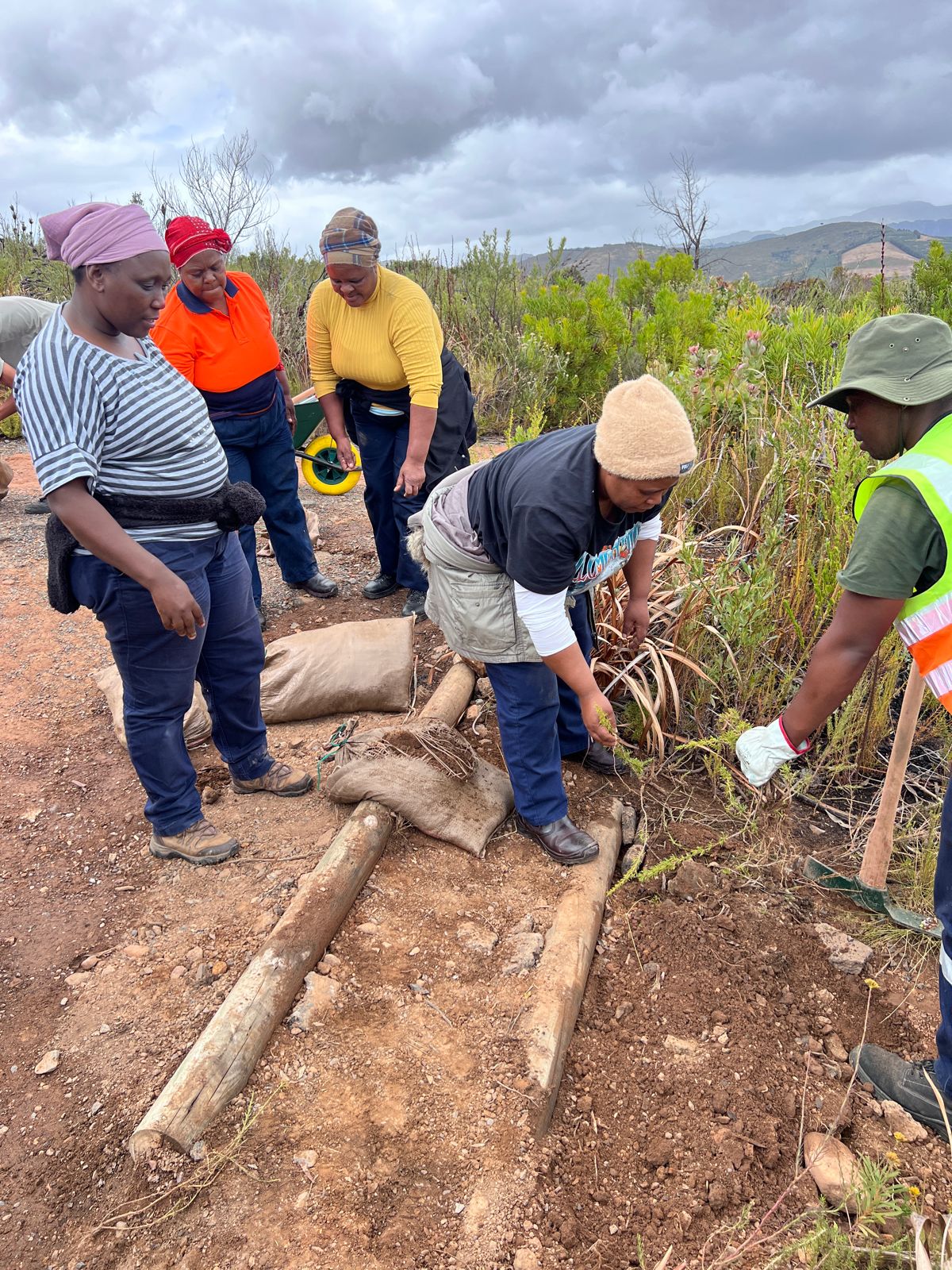
Contour Enviro Group further coordinate and create job opportunities for the MSMEs that have gone through the training programme so that they may practice their acquired skills. All of our MSMEs have acquired work since the inception of the programme and this has brought some sustainability on the model.
The MSMEs work opportunities to date through Contour Enviro Group who coordinates work opportunities in the sector.
The organisations that made this building block possible include but not limited to the following:
City of Cape Town
Cape Winelands Fire Protection Association
Kogelberg Biosphere Reserve
Conservancies
Once again, it was realised that their work is inundated with administrative work which they do mostly on books in field which often get lost. Thus the Grasshopper Project Management tool was developed in order to support them while they are working in field.
As mentioned in the previous sections, this programme is meant to achieve the following: “to develop, empower, support and professionalize Conservation MSMEs in the conservation sector in South Africa”.
The programme has trained over 20 MSMEs and created over 400 jobs annually since 2022 based on this programme. This programme is the main building block for the Grasshopper Project Management Tool as it was realised that the MSMEs need some support and a consolidation of their project management efforts, access to basic financial tools such as quoting and invoicing. Furthermore, to manage their assets etc.
The organisations that made the Programme successful have already been mentioned however they are listed below once again:
The Nature Conservancy- South Africa
The Table Mountain Fund
WWF-South Africa
Department of Fisheries, Forestry and Environment
Department of Small Business Development
Tourism and Conservation Sector Education and Training Authority
The focus of the programme is as follow:
Mentorship and coaching
Business support and development
Business, finance, and Human Resources training
MSMEs need to manage their projects efficiently.
The government partners already mentioned above need support to manage their alien vegetation teams and this solution will be a great tool to do so.
Digital Monitoring, Reporting, and Verification (MRV) System
Community-Inclusive Conservation Incentives
Ecosystem-Based Economic Trade-Offs
Community engagement
Communities must benefit from the data collected, and we ensure they do.
We support quarterly data-sharing meetings between Northern Rangelands Trust (NRT) community conservancies and Big Life Foundation, creating an open forum where data informs collaborative decision-making. This includes town planning, land-use strategies and community-led conservation initiatives.
By sharing insights on wildlife movements, environmental conditions and human activity, communities can plan together for peace, security and the prevention of human-wildlife conflict (HWC). These sessions empower conservancies to co-develop solutions across landscapes, strengthening cross-border cooperation and ensuring that data drives action where it’s needed most.
Control over data sharing or privacy.
Community stewards are empowered and trained to collect data through different sensors, using the IoT network to feed data into control rooms and Earth Ranger.
CCF is providing training for long-term sustainability, fostering ICT-driven green jobs
CCF
CCF provides a holistic digital ecosystem integrating landscape-scale technology, training and community engagement to drive meaningful change, contributing to GBF Target 20 – Strengthen Capacity-Building, Technology Transfer, and Scientific and Technical Cooperation for Biodiversity.
Launching in June 2025, the Protected Area Technician (PAT) Training Programme has been developed by CCF to empower local communities to protect nature.
This tailored programme is designed to build practical, in-demand skills that create real opportunities—from entry-level technician roles to long-term careers in leadership and consulting within protected areas. Co-developed with industry experts and rooted in local needs, the curriculum blends hands-on field training with applied conservation technology knowledge.
Participants will graduate with job-ready skills to support and maintain vital conservation tech infrastructure. They’ll also have the opportunity to earn a PAT Certification, with a pathway to a globally recognised Cisco Certification—unlocking even broader career potential in the conservation and tech sectors.
By investing in local talent, the PAT programme helps communities take a leading role in protecting the natural landscapes they call home.
Monitoring of impact will take place through the first cohort of learners, focusing on their career journeys and personal development outcomes