Data recovery and identification

    The Administration Bureau arranges the office workers to identify, classify and input data according to the staff, human activity information, and animal resource information. The office workers distinguish the photos of the human activities, and determine the specific information of the personnel (community personnel or not ).

1. Recycle and appraise camera data timely in accordance with the plan.

2. Maintain equipment regularly.

3. The identification of the camera data must be unified.

4. Carry out follow-up work  immediately for discovered human activities.

5. Corresponding reward and punishment mechanisms.

1. Number the camera´s data cards uniformly to avoid data confusion.

2. Replace the malfunction cameras timely.

3. Arrange fixed staff to identify the data.

Creating awareness and knowledge about EbA

Because Ecosystem-based Adaptation (EbA) was a completely new concept to the stakeholders and communities, it was essential to build awareness about EbA and its potential benefits. Prior to this, the communities’ model of development was deforestation and overexploitation of plant species, which negatively impacted biodiversity. Training on EbA was first given to local partner organisations and then to community members, with a focus on how the EbA approach addresses climate change and helps communities address other issues such as income generation. After the trainings, a series of awareness-raising activities were conducted, including the publication of brochures, signboards, posters, and other materials. The objective was to demonstrate the different activities to be implemented, such as conservation of community water ponds, and their positive impacts. After creating awareness about the EbA concept and its practice, the community took a leadership role in implementing activities and was empowered to integrate their local knowledge and skills in water source and pond conservation. Technical experts supported the communities’ local knowledge with technical and scientific expertise.

  • Active participation of governing bodies, implementing agencies, local communities and other stakeholders 
  • Communication tools such as interactive maps, posters, and videos
  • Integration of local knowledge and past experience in the construction of ponds (type of materials, suitable locations, etc.) 
  • Practical demonstration of activities 
  • Promotion of citizen scientists as bridges between the project and local communities 
  • Communities leading implementation
  • Community engagement is crucial. In Panchase, the project targeted engaged community leaders, who in turn motivated other community members to participate.
  • Participation of diverse groups increases the potential for success and the equitable distribution of benefits. The project sought the participation of community forest user groups and other community groups, including mothers’ group, homestay groups, and agricultural groups.
  • The project team should have a clear understanding of the environmental, socio-economic, and political context of the area. Tourism in Panchase helped determine the intervention. Increasing the viability of homestays provided an entry point for additional measures.
  • Maintaining a good rapport with communities and stakeholders fosters trust. Both IUCN and the local NGO regularly visited the site and communities and developed a strong rapport through frequent positive interactions.
  • Local knowledge: the project used the communities’ local knowledge about pond restoration, water conservation, and water management to develop the intervention.
Rehabilitation of the Northern Water Pipeline

We have identified clean water access as a key goal. Clean water access for humans, livestock, and wildlife will prevent wildlife-related injuries and deaths. In September 2012 IFAW conducted research and helped the county secure funding to rehabilitate the Northern Water Pipeline, which supplies water to communities living in the north of Amboseli. When the project is completed by the end of 2019, it is expected to reliably provide water to 300 homesteads, 3,000 people, and more than 6,000 herds of livestock. By rehabilitating the pipeline, the project ensures availability and sustainable management of clean water and sanitation for the Maasai community, and thus, reducing human-elephant conflict due to water access.

Participatory community engagement has led to trust within the community for IFAW and the project. Therefore, in-depth participation of community members in the project has allowed for social sustainability. In addition, after substantial investment in education and capacity, the project largely is run by community members who now have the skills to maintain and expand the infrastructure and initiatives. Because of the local capacity, benefits are clearly outweighed by costs. 

A challenge that the project ran into, in particular, was the lack of infrastructure, equipment, and training. Therefore, the project made it a priority to build capacity within the village to build (i.e. the community service center), repair (i.e. the Northern Water Pipeline), or otherwise manage any of the interventions. A lesson that we learned is that it is always better to build capactiy within the community. In our example, not only do local community members now have additional skills they can use on other projects, they have a sense of ownership and pride.


Education, training, and other capacity building for the community

IFAW is increasing wildlife security in the Amboseli landscape by equipping community wildlife rangers with expertise and skills through training in human wildlife conflict mitigation and providing operation resources such as rations, salaries, GPS-equipment, uniforms and a patrol vehicle for use by the rangers.

IFAW also initiated an education scholarship to offer financial support to 60 students to pursue studies in high school, tertiary colleges and universities, and 50 community wildlife scouts. By providing education scholarships and wildlife ranger capacity building, IFAW ensures inclusive and equitable education and promotes lifelong learning opportunities and alternative livelihoods for the local community. 

IFAW is also working with local women to develop markets for income-generating activities such as beadwork and livestock management. By creating a boarding secondary school for girls and facilitating income generation among women, the project promotes gender equality and empowerment for all women and girls in Amboseli, thus, leaving no-one behind.

One of the most enabling factors in this project was the fact that the main stakeholders and owners of the land recognized that that habitat loss, degradation and fragmentation was an issue for both widlife and people and that they needed to do something about it.. By partnering up with the OOGR and the KWS, the project ensured community engagement and promotes peaceful and inclusive societies for the sustainable development of the local community and even provides a model to follow for other communities.

Buy-in from the local communities and the government (KWS) is extremely important to the success of the project. As advice to other implementers, working within existing governmental frameworks can help with implementation. At the same time, working hand and hand with local communities is essential to ensure buy-in and that project activities and interventions are actually leading to desired outcomes.

Collaboration with the Olgulului Olalarashi Group Ranch and KWS

Amboseli National Park is home to some of Kenya’s largest elephant populations which depend on the surrounding community land for migration. In 2008, the land stakeholders recognized that the habitat loss threats, degradation, and fragmentation would lead to the loss of livelihoods and tourism revenue and opted to ensure the ecosystem’s sustainability. IFAW therefore partnered with relevant stakeholders to secure critical corridors and dispersal areas for elephants in community areas of the Amboseli landscape. To achieve this, IFAW implemented a multi-year commitment to secure 26,000 acres as wildlife migratory and dispersal land in the Amboseli landscape (the Kitenden Corridor, one of the last remaining elephant migratory corridors connecting Kenya and Tanzania).

The strategy for the leased land was to develop the Kitenden Community Wildlife Conservancy, which will continue to offer a three pronged benefit to wildlife and its habitat, the local community (through eco-friendly, compatible tourism, and enterprise projects), and investors through tourism development and investment. In 2017, IFAW worked with the local Maasai community to register the Kitenden Conservancy Trust - an important step toward securing this portion of land as a community-owned conservancy that supports sustainable livelihoods.

IFAW partnered with the community of the Olgulului Olalarashi Group Ranch (OOGR, which surrounds 90 percent of the park) in order to ensure that the wildlife protection benefits were connected to human wellbeing improvements. For example, the securing of the Kitenden Corridor would not have been possible without IFAW’s commitment to sign separate agreements with 2,600 indigenous landowners. This has led to remarkable benefits for both the people of the community and the wildlife of the Amboseli National Park. Combining the expertise of science-based wildlife conservation and development initiatives within the community turned out to be essential and should be applied to future projects. Incorporating community input in a structured and profound way has led to unique interventions tailored for this specific community and interventions that are sustainable and popular among the community. Both the local leadership and the community have been heavily involved since the beginning of the project.

Mobilizing and building capacity of community Institutions

KENVO mobilized the community institutions (CFAs and WRUAs) into an organized group and built their capacity to engage in PES. Further, awareness on policies was raised among the community upstream. To strengthen the CFAs and the WRUAs, they were trained in all aspects related to PES – policies, practices, rights, responsibilities, fund management, monitoring and compliance. 


Community consultation engagements were held with CFAs and WRUAs and produced actions plans. The main objectives of the action plans was support land use practices that improve water quantity and quality and capacity build the local community to secure catchment restoration through water payment services scheme. 


KENVO was ready to broker relationships between community and the businesses.

The community institutions were in existence and willing to participate and commit to businesses.

• The local community institutions, CFAs and WRUAs are an asset for forest restoration as they have enough labor to do the work.

• Local community represented by CFAs and WRUAs need support to negotiate with the business sector.

• Businesses are willing to work with local community institutions, CFAs and WRUAs that demonstrate financial management capability and delivery of planned targets.

Develop a tool to test if young people will pay to learn conservation skills

1)      Conservation has become an increasingly popular career choice for young people all over the world. But many conservation organizations complain that young graduates don’t have the right attitude or the real-word skills. Nature Seychelles created the Conservation Boot Camp (CBC) on Cousin Island Special Reserve to test if the island could be used as a laboratory to equip young people with conservation skills, while at the same time use the fees paid as a sustainable funding mechanism for the MPA. The program was financially supported by the GEF from April 2016 to December 2019. The GEF project pays for a full time CBC Coordinator, equipment, and materials and other.  The coordinator manages the application process, and receives and integrates participants into the program.  A conservation manager leads on conservation work, while the Chief Warden manages all the logistics. The CBC is exclusive and takes a maximum of 6 persons per session and takes place the whole year. Each session lasts for 4 weeks and costs Euro 1000.00 (not including airfares and food). A 2 week program was been introduced due to demand. Nature Seychelles is a Private Training and Educational Institution under Seychelles law and a Certificate of Completion is awarded at the end of the training. 

  1. Cousin Island Special Reserve - the 50 year old conservation success story - as a laboratory to test the program.
  2. Funding to support the initial implementation and testing of the program
  3. Nature Seychelles is a certified private training institution by law
  4. Leadership and mentorship from the CE who has over 35 years conservation experience
  5. Existing human resource to support the implementation
  1. Initial funding is important as program depends on participants to fill all slots for it to be viable and sustainable. Not all slots were filled throughout the year.
  2. Having well-known successes provides credibility and helps in attracting participants.
  3. Necessary information laid out in a CBC handbook provided prior knowledge before sign up. 
  4. One size doesn’t fit all - although targeted at people interested in conservation careers, some participants had no previous or post interest in conservation.
  5. Mentorship with well-known figure helps to boost confidence and catalyse conservation careers
  6. Program not able to attract participants throughout the year. Under review to improve numbers so that it remains viable after the GEF funding ends. 
  7. The program was valuable for people from the region, in particular from Madagascar (18 participants), especially where there are not
    exposed to conservation success stories. 
The NMS-COUNT Iterative Framework: Phase 4

In Phase 4, a field study tests the methodology and performance of measures. The results of the study and all phases will be used to validate and standardize methods, and to advance development of visitation indicators and models.  Depending on the customized suite of methods developed in Phase 3, Phase 4 could contain a multitude of techniques that involve both on-site data collection via surveys and observations as well as data mining from existing sources or other agency activities.

Phase 4 requires synthesis of data from multiple agencies and stakeholders. This integration is critical to the success of the NMS-COUNT process. A full understanding of data analysis methods and data synthesis is required.  This Phase is also enabled by collaborative planning at the site level to determine proper spatial and temporal characteristics of sampling.

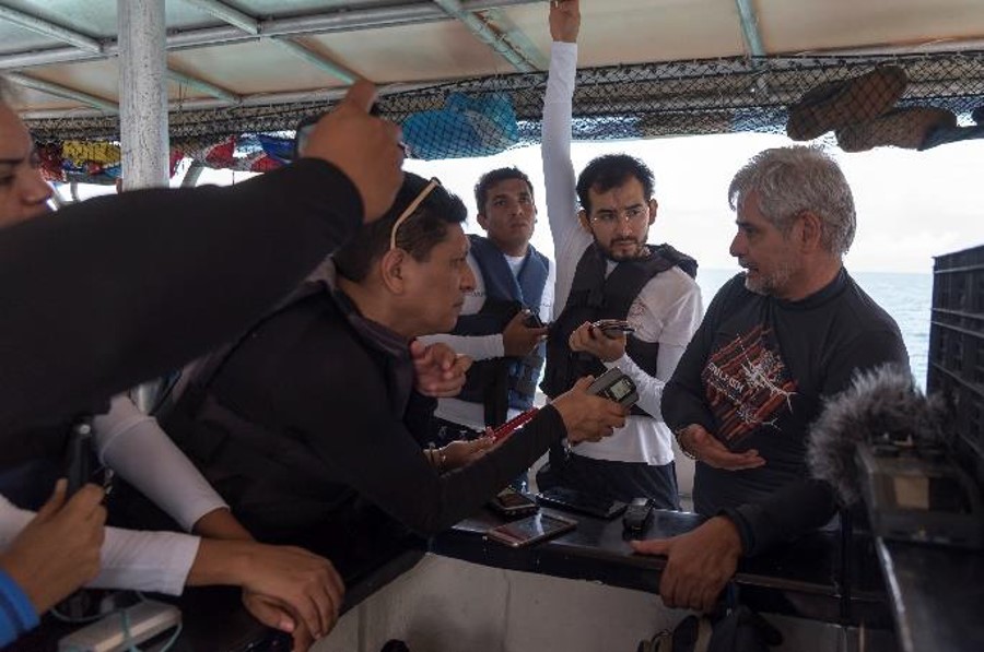
Phase 4 represents the ongoing data collection effort to fill in any gaps noted in the first three phases. One of the most critical gaps uncovered via NMS-COUNT in the existing visitor count data is the frequency of sampling or when and how often sampling occurs. Because of this gap, the research team will place interviewers on two dive boats to record observations of visitor counts in the sanctuary and to conduct interviews with the touring participants. There will also be several roving intercept surveyors which collect data from visitors as they leave the shoreline or return from offshore for visitor activities. Existing data streams will continue to inform the visitation estimates, with models that account for spatial and temporal changes detected by on-site sampling. Following the data collection effort, the results will be shared with academic and agency peers. Resource managers will continue to monitor and adjust use as needed to meet the requirements of the agency or other management plans.

The NMS-COUNT Iterative Framework: Phase 3

In Phase 3, data from expert panel input are analyzed and gaps are identified. A methodology is designed specific to the sanctuary based on this analysis. This methodology is customized to each specific MPA setting, based upon data gathered through Phases 1 and 2, as well as feedback from managers and stakeholders to assess the confidence associated with specific sampling techniques.

Similar to Phase 1, the greatest burden in Phase 3 is on the researcher. An appropriate methodology allows researchers to identify limits using existing data and illustrate gaps that hinder managers from fully understanding visitor use. A combination of expert judgment and feedback allows researchers to determine the utility of specific sampling techniques. Modeling of existing data sources within a framework that assigns confidence to each source helps create a starting point for visitation numbers that can be built upon in later iterations.

In Phase 3, researchers compiled the data shared by all the various stakeholders. For Gray’s Reef, data were synthesized and evaluated to understand the correlation in the confidence in the data by stakeholders. Using a 10-point confidence scale, stakeholder perceptions of their confidence in the data were tabulated. The panel study revealed that data on visitor counts were being collected by multiple agencies (i.e., NOAA, U.S. Coast Guard, GADNR) and sources including satellite, boat radar, smart-buoy, on-site patrols, and underwater hydrophones. This breadth of data was only realized by following the NMS-COUNT process, as the data emerged during the second and third phases of the process. The NMS-COUNT process helped all of those involved in managing visitation to collaborate and understand the types of data being collected across multiple agencies. The process also facilitated the integration of multiple data sources to provide a more comprehensive understanding of visitation to the Sanctuary.

Science and technical expertise

Dredging, recognized as a serious threat to the marine turtles, was identified by IUCN as a priority.  IUCN, with experts from the Species Survival Commission’s Marine Turtle Specialist Group designed and developed a dredging protocol to be followed during port operations. These included installing turtle deflectors on all dredger drag-heads to help ensure turtles were not pulled into the dredger. Trained observers were assigned to all dredgers to monitor this process. These observers would check screens on inflow and overflow pipes on a 24/7 basis. These measures (deflectors, screens, and human observers) were put in place to ensure that the dredging was “turtle friendly”. Such measures were the first to have been put in place in the history of dredging activities in India.


Lighting was the second major threat identified because excess glare is known to distract turtle hatchlings as they instinctively move towards brightly lit areas and away from the sea. For this, the IUCN Commission experts provided specific guidelines for the port’s lighting plan, which was adopted by the port authorities. IUCN further supported Tata Steel in identifying the right design for these lights. Today, Dhamra Port is the first and only port in India to have installed “turtle friendly” lighting.

IUCN supported DPCL in developing an Environment Management Plan (EMP). This plan was scientifically robust and practically implementable, going beyond the existing legal requirements. Most importantly EMP was designed in such a way that it becomes the integral part of the Standard Operating Procedures (SOPs) of DPCL. This makes it different from other EMPs.


Large-scale infrastructure can be designed to successfully incorporate biodiversity considerations.