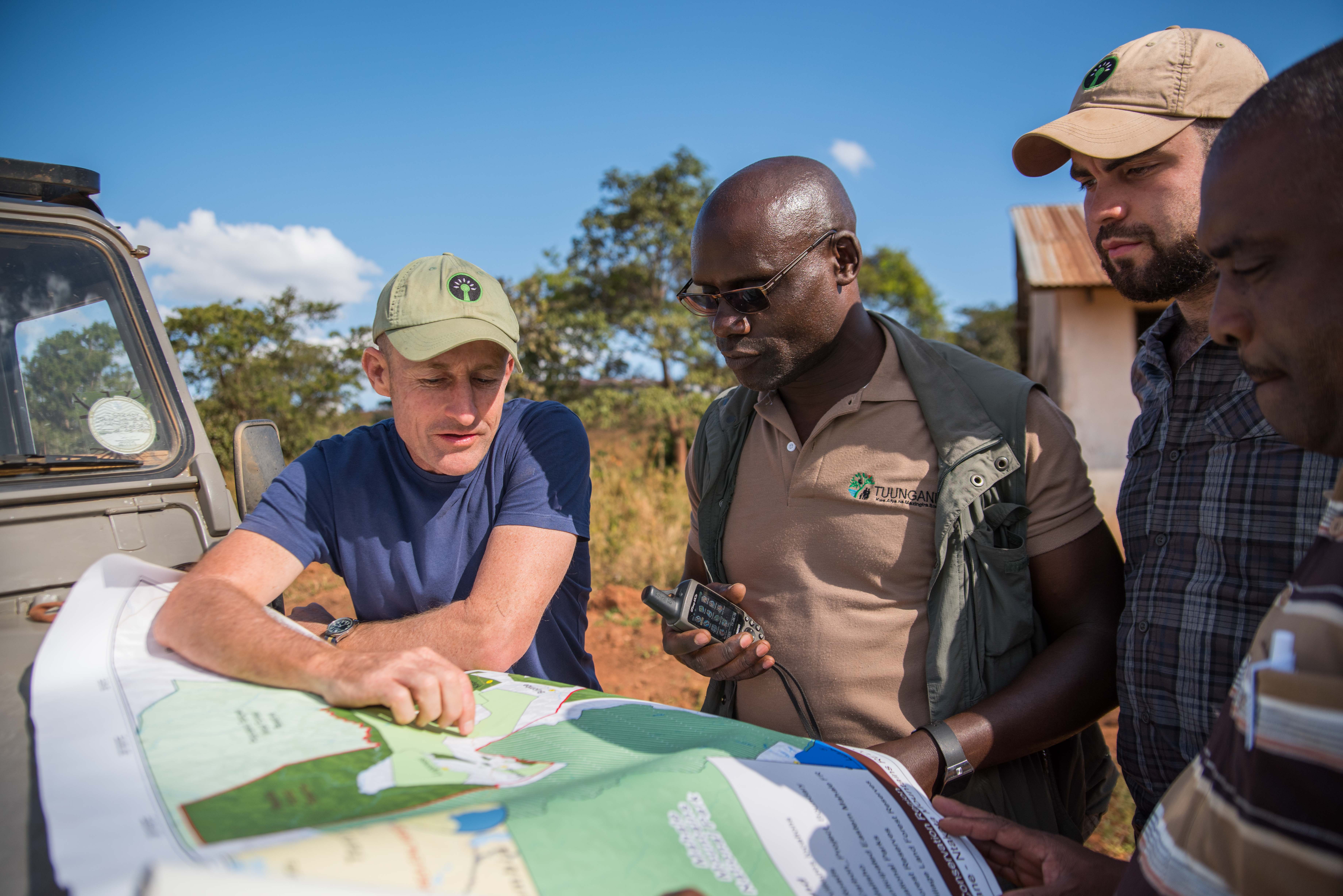
Collaboration with landscape partners including Village and District governments, TNC and Pathfinder International (Tuungane).

Collaborating and co-operating with local governments and organisations who share a common vision and common goals, yields enhanced results with greater efficiency, both in terms of resources used and funds deployed.

The first step is to identify partners with common goals but with varying strengths to achieve enhanced results. Time then needs to be taken to meet regularly, whereby relationships are developed and nurtured, to gain a deeper understanding of individual needs and to review and update procedures to ensure resources are shared and that strengths are being maximized.

A shared understanding of the importance of forest community land rights, the development and promotion of good governance, and respect for community development priorities is critical for successful collaboration.

The process of collaborating with landscape partners and local government institutions demands a long term approach in order to build genuine trust and mutual understanding. Our relationships with our local partners have generally been positive and mutually beneficial, but we have learned that continued efforts need to be made to ensure that alignment of goals and values is maintained across institutions as it can be challenging for new personnel in the respective organisations to immediately embrace the historical relationships between partners.

Algorithms for likelihood of carcass and need for alert

Specific algorithms process the GPS data on position, altitude, speed and temperature and consider all zonation as poisoning-prone areas (based on land use for grazing and previous events) to determine if alert is necessary.  

Algorithms need to rule out vulture descending onto a cliff or nest, and to include only descent onto areas where carcass likelihood is highest (based on ground inclination).

Algorithm calculates slope of the land at point of descent and adds this to the poisoning likelihood determination.

  • need excellent detailed GIS data of ground features and topography 
  • need lots of data of previous poisoning events
  • need data on land use (for rangeland or crops)


  • High resolution topgraphy layers are very important to rule out vultures landing on unlikely sites 
Advanced loggers receive GPS data
  • Integration of data on position, altitude, speed, and temperature from Orintela transmitters with the INPA information system 
  • IT professionals and developers
  • input from Ornitela

Input from transmitter manufacturer helps to integrate with home systems.

GPS-Tagged vultures send out data

In order to receive GPS data there have to be a requisite numner of birds with approriate tags that transmit real-time data.


  • experienced staff to capture and tag vultures
  • financial backing to purchase tags and the data

The more tagged birds there are, the wider the coverage and the better the success.

Establishement of Kayirabwa Chimpanzee Conservancy for conservation and protection of wildlife migratory routes in northern Albertine rift forests, western Uganda

Engagement of 500 private forest owners to set aside 6000 hectares for conservation of chimpanzee corridors

  • Local support for chimpanzee conservation
  • Great Potential for agro-ecotourism
  • Great potential for nature based enterprises eg. bee keeping
  • Conducive government policies

These corridor forests are disappearing quickly, however, and if these findings are not acted upon soon there will be little corridor forest left to conserve and most of these species will become extinct in this region. There is for Kayirabwa Chimpanzee Conservancy to provide economic incentives to land owners to enable these corridor forests to  offset the current incentives to destroy the forest for agriculture. 

Neighborhood committee and volunteer group

The purpose of this strategy is to build ties between neighbors and volunteers interested in participating in the construction, management and maintenance activities of the linear greenbelt trail and associated areas.

Meetings and fellowship opportunities were held to share ideas as well as information on:

  • Procedures for reporting environmental incidents in the area.
  • Techniques for reforestation and pruning of native plants.
  • Characteristics and importance of native plants in the region.

Neighbors were invited to form a group through whatsapp to keep them informed and invite them to activities.

  • Social recognition of the association.
  • Linkage with other sectors and relevant social actors.
  • Empathy towards the problems expressed by the neighbors.
  • Encouragement of participation and involvement in decision making.
  • For residents, involvement in the project implies time away from home and work complications (one of the main reasons for non-attendance at events that we detected both in the surveys and in maintaining attendance at activities).
  • More urgent needs were detected and closer to their homes than the Green Belt (vacant lots / clandestine dumps in front of homes).
  • For an effective follow-up, it is suggested to implement programs through focus groups in the already established groups and in other sectored populations with specific objectives: children, women, housewives, youth.
  • Improve communication, coordination and dialogue between local and regional actors and authorities for coordinated and efficient action.
Incentive and sustainability

Our project is based on the premise that farmers want sustainability and are incentivised to achieve this. No farming operation will be viable in the long run unless it is done in an ecologically and economically responsible manner. Climate change has led to an increased frequency of drought, as well as an increased severity of drought in the western regions of South Africa. Stocking rates are effectively falling as a result of climate change, and this necessitates the need for farmers to diversify income in order to survive. Failure to change will have a devastating impact on biodiversity.

We are incentivising farmers to protect biodiversity through the adoption of more sustainable farming practices, e.g. grazing rest, correct stocking rates and habitat restoration activities. While these lead to fewer, but better quality animals, the farmer still experiences a loss of income. We help the farmer compensate for this through the adoption of non-farming activities such as ecotourism.

Through continual engagement with the farmer, we are able to address concerns as they are raised and ensure that the farmer perceives active engagement in the partnership as an incentive to improve his farming operation.

The region has an existing tourism industry which can be leveraged upon. Known as the ‘bulb capital of the world’, the area is well known and relatively close (a 3.5 hr drive) to an international airport. However, this season lasts approximately 2-months, and this project seeks to extend tourism operations throughout the year.

The farmer needs to be open to tourism as a means of generating tourism income. 

The project has immediate potential to generate additional revenue and can be custom designed to suit the infrastructure and abilities of the farmer.

  • Choose projects which are quick to implement and quick to show results.  This will booster partnerships and improve the chances of other promises being fulfilled.
  • Farmers are not keen on paperwork and administration and often require support in this area, especially as it relates to the new venture.
  • It is very important to demonstrate that the incentive is working as this underpins continued collaboration. Celebrate the small successes.
Conservation framework

In South Arica we are fortunate to have a very progressive legislative programme for conservation on private land. The Biodiversity Stewardship framework allows for the voluntary declaration of private lands into the protected areas network following a clearly defined process.  As the process is well established, it is relatively easy to implement it and commitments are well understood. However, governmental conservation agencies have constraints on their capacity and rely on NGOs such as the EWT, to facilitate the process of identifying suitable properties, engaging with willing farmers and/or landowners, and developing the associated tools such as the farm management plan and annual plans of operation.

Landowners sign an agreement with the provincial conservation authorities formalising the declaration into the title deed of the property. This framework largely results in a win-win as biodiversity is conserved, the country is better able to meet its conservation goals in terms of multi-lateral agreements, and the farmer has a more sustainable farming operation to support his livelihood. Subsidiary benefits can be accrued to local communities through entrepreneurship opportunities. To pursue our conservation exchange, we merged this framework with other agreements between the farmer and the EWT.

  • The NGO has funds and resources on the ground to engage with farmers / landowners.
  • A good understanding by the landowner of exactly what they are committing to and the long-term expectations they need to meet. This should be based on clearly defined contractual terms.
  • Landowner willingness to participate in the Biodiversity Stewardship Programme.
  • Willingness to change farming practices.
  • Ability of NGOs such as the Endangered Wildlife Trust to support the farmer over the longer term.
  • Good relationships with local members of the provincial government.
  • A contractual framework is important as it clearly defines what is expected. Keep contracts short and to the point – the focus must be more on roles and responsibilities than about legal enforceability.
  • It can take time to have property declared under the Biodiversity Stewardship Programme due to departmental signoff processes. It is, therefore, important to ensure that the farmers understand the delays and where the process is at.
  • Rather than focus on the Biodiversity Stewardship process, focus on enabling the framework around improved management and the necessary support to get there.
Monitoring wildlife presence

To ensure that local benefits are tied to wildlife presence, the first step is enabling communities to monitor wildlife on their land. Each village selects two 'community camera-trapping officers' who are trained and employed to use camera-traps, which they place at what they think are the most wildlife-rich areas of their villages. Camera-traps are checked every month and images shown in the village to raise awareness.

The community needs to want to engage with the programme, and take ownership at all levels. There needs to be sufficient funding for the equipment and salaries.

There needs to be widespread discussion with the community to understand the programme, so that camera-traps are not damaged or stolen. The wider engagement, by showing the images in the villages, was also very important for raising interest and awareness about conservation.

Livestock farm management plans with anti-predation measures

In Panama, farms are culturally extensive and without good livestock practices. The management plans that Yaguará Panama seeks to support producers in having a better sustainable use of the land, under intensive management so that the paddocks are small (with more small keepers they walk less and feed better, without spending a lot of energy) and the animals are healthy and in better condition. In the case of cows with calves, a corral is prepared to reduce predation, since we know that the most vulnerable animals are the cows with calves.

Anti-predation measures include: electric fences powered by a solar panel, collars with bells for the cows as an auditory and luminous repellent because they have lights that are activated at night.

The plans have a map of current and future use so that the producer can appreciate the changes and is taught to keep track of what is happening on the farm, only in this way will he be able to see how the changes are occurring and at what point he begins to have a real gain in livestock production.

An important change is that now the paddocks have water for the animals to drink; usually they do not and when the cows go to the river they get stuck or are preyed upon by jaguars.

The application of small intensive paddocks with improved pasture makes the animals healthier and stronger.

  • healthier and stronger,
  • when selling the cattle, they receive better economic income,
  • they know when and which cows are pregnant, and this means that they do not lose animals to chicken,
  • less predation by jaguars,
  • less deaths of cows and calves due to clogging in the rivers because they have water in the paddocks. At this point there is confidence to continue working and the producers themselves show their neighbors how they have achieved this.

The lessons learned have been many. The owners of farms in Agua Buena de Chucunaque have been able to see that by managing or moving the animals with small paddocks and having water tubs in them, with improved pasture and keeping records of what happens on the farm, the results are very good.

Now they know that they must see the farm as a small business, only in this way they will be able to see the results of the work they carry out and that it is a dignified work, that well carried out, the family can live much better.

In addition, with the farm management plan they can also opt for loans in the banks of Panama, because now in Panama if someone wants a bank loan for these activities, they require a farm management plan and since they already have it, it is easier for them, they just have to continue advising them.

In addition, they have also learned that it is better to get advice from people who know and this is something that Yaguará Panama will continue to contribute, since the presence of Yaguará Panama in the area will be for a long term.