Research-monitoring

Guanentá has been characterized by its research work with different paramo and high mountain species, including three species endemic to the paramos of Colombia, Espeletia cachaluensis, E. chontalensis and E. laxiflora, as well as the Coloradito (Polylepis quadrijuga), these species are Conservation Object Values (VOC) of the protected area and of great value to local communities.

The research has been carried out hand in hand with educational institutions, which have had the opportunity to support the gathering of information on these and other species in the Sanctuary, generating information that has been complemented with the local knowledge of the inhabitants of the area of influence, which has been key in all phases of the project, from the collection of the seeds of each species, the propagation process, the maintenance of the seedlings in the nursery, and the subsequent planting of the individuals. In addition, Guanentá, being the PA with the greatest diversity of frailejones in the country, makes it an excellent scenario for research.

-Agreements with universities for the development of research on endemic species of the páramos.

-Local knowledge of farmers to complement the information generated.

Follow-up and monitoring of frailejon and high montane species that are propagated and planted.

- The information obtained with respect to effective propagation methods, timing and restoration strategy, product of the research, has been key for the generation of conservation actions and decision making.

- The frailejon baseline, monitoring and plots allow us to learn more about the biology and ecology of the species in order to implement actions that favor the conservation of the species.

-The effectiveness of planting is better when it is done with local personnel who have knowledge of the area than with external labor.

Developing the Regional Ocean Governance Strategy through a co-creation process

The ROGS Support Team supported a diverse WIO ROGS Task Force, involving state and non-state representatives from various sectors and organisations. This inclusive forum facilitated stakeholder dialogue and collaboration, with members providing inputs directly to the ROGS and expanding regional contributions by inviting stakeholders from their networks. The Task Force, along with key stakeholders, contributed strategic and technical insights to the ROGS through Technical Dialogues and regional events.


The Collective Leadership Institute (CLI) supported the Task Force through in-person workshops and online sessions  to enhance collective leadership and collaboration. An experienced ocean governance advisor, Mr. Kieran Kelleher, played a key role in formulating strategy questions and compiling ROGS content.


The inclusive and participatory approach aimed to foster ownership, improving the quality, feasibility and credibility of the ROGS. If adopted at the next Nairobi Convention Conference of Parties, this ownership is expected to boost the strategy's implementation.


  • Clear process and goal outlined in the process architecture for drafting the ROGS together

  • Participant interest and openness for individual and collective contribution

  • Capacity development and process stewardship prioritized by CLI, emphasizing authentic participation, trust-building, and co-creation

  • Technical dialogues led by the Task Force, engaging sector-specific stakeholders and experts for a shared understanding and optimal policy recommendations

  • Weekly online meetings of the ROGS Support Team, organized by CLI to ensure a high-quality process

  • Need to assign clear roles within the process including someone who drives the process forwards according to set timelines

  • Both process leadership and technical leadership

  • Consideration of financing and resourcing as an integral part of the ROGS

Developing the regional Information Management Strategy in a co-creation process

To develop a region-wide Information Management Strategy considering voices from across the region and different sectors, a participatory and representative Multi-Stakeholder Working Group (MSWG) of 24 persons composed of Nairobi Convention Contracting Parties and relevant stakeholders (incl. NGOs, universities, research institutions) in the region was established. The members of the MSWG have taken responsibility for designing and driving the IMS process within their organisations and with the broader stakeholder system, incl. organising and convening thematic stakeholder consultations.


The collective approach to developing the strategy values multi-stakeholder dialogue as key for co-developing a strategy informed by diverse voices and owned by a broad and representative set of stakeholders. Strategic partnerships to support the co-development of the Western Indian Ocean IMS are with the Collective Leadership Institute (CLI) and the Leibniz Centre for Tropical Marine Research (ZMT). With workshops and webinars, CLI helped build multi-stakeholder dialogue and collaboration capacity among members of the MSWG to enhance the quality, viability, and ownership of the IMS. ZMT supported the IMS development process with technical expertise and experience in drafting the IMS document.

  • A series of physical meetings were essential in developing the basic structure and content of the strategy.

  • Physical meetings also helped to keep the momentum alive for further online collaboration in the strategy development.

  • Need to assign clear roles within the process including someone who drives the process forwards according to set timelines.
Political will and a mandate for developing an Information Management Strategy

A mandate from the Parties to the Nairobi Convention, adopted at the 10th Conference of Parties in 2021, forms the basis for co-designing an Information Management Strategy for the Western Indian Ocean. It was emphasised that the development should happen in a co-development process, recognising the fundamental role of the Nairobi Convention national focal points, involving national data centres and amplifying the role of national experts to a sustainable regional Information Management Strategy development and implementation in the long term.

  • Having an official mandate is an essential success factor for such a participatory process. It helps create ownership for the process and the implementation of the resulting strategy.

  • Country participation in the creation of the strategy.

  • Long process leading to the adoption of the decision asking for the development of the strategy.

  • Coordination of such a regional and political process requires continuous capacities on all sides and strong will to actively participate.

  • Continuity and a long-term process for developing and implementing strategy needs to exist before the start of the process.

Elaborate a Zoning Proposal and Restoration Plan.

The objective of this building block is to provide the technical teams with the technical parameters to identify the sites where restoration should be carried out and the selection of effective actions for ecosystem recovery.

Zoning requires: 1) identification of areas for natural and assisted recovery, 2) areas for reforestation with native and endemic plants, and, 3) areas with potential for environmentally friendly productive activities.

The proposal for restoration actions includes: 1) the selection of activities to be implemented for each zoned area, 2) the estimation of resources needed to implement the restoration activities, 3) the distribution of responsibilities according to the competencies and resources available to the interested parties, and 4) the time required to implement actions taking into account the scope and resources available.

  • The quality of the previous diagnoses, the experience of the technical staff that accompanies these processes and the active participation of the stakeholders, facilitates decision making and the most cost-effective selection of restoration activities at the intervention sites.

The ecosystem functions to be restored, as well as the ecological and social context, determine the type of activities to be chosen and the geographic area to be intervened:

  1. Where opportunities exist to enhance biodiversity at the landscape level, activities should concentrate on sites located in or around protected areas or other forests of high conservation value.
  2. Where degradation has led to ecosystem functioning failures, activities should be concentrated along riparian strips, steep slopes, etc.
  3. Where opportunities exist to improve human well-being and, in particular, to support income-generating activities, priority areas should be appropriate sites for the production of high-value species.
Elaborate a Diagnosis on the State of Biodiversity and Socio-Economic Situation.

The objective of this building block is to provide technical teams with the biological parameters necessary to determine the current state of an ecosystem in order to determine the appropriate restoration measures to be implemented in that specific ecosystem.

The diagnosis of the state of the biodiversity is done by documentary review and field visits, where we perform: 1) identification of the site including the composition, structure, and different strata that make up the ecosystem, 2) description of the ecosystem services, 3) floristic composition, 4) diversity of vertebrate and invertebrate fauna groups, 5) presence of invasive species, and 6) identification of threats and degradation factors.

The socio-economic situation is carried out by documentary review and field visits, where the following is done: 1) identification of the current users of the site, 2) description of the productive activities carried out by the users, 3) clarification of the land tenure status of the site, 4) identification of local actors with presence in the territory, 5) identification of the potential local development with ecologically sustainable activities.
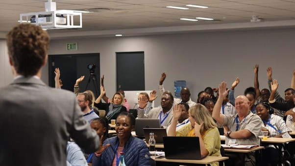
  • The sites should be referably of high national interest for the provision of ecosystem goods and services for the population and the conservation of existing Natural Protected Areas that are legally endorsed.

  • Have resources available for the incorporation of additional analysis such as GIS and other technological tools, which facilitate the delimitation and rapid characterization of the sites to have a first approximation of the general conditions.

  • The process can be demanding due to the level of detail and interdisciplinarity required. Therefore, it is necessary to plan the time, human and material resources that will be used for the documentary, geographic and field analyses.
  • Involve local stakeholders from the beginning to ensure the sustainability of the actions, take advantage of local knowledge and interest in the conservation of ecosystems for the benefits they obtain from them.
Harmonization of International Technical Concepts to National Legislation

The objective of this building block is to provide technical teams with tools that favor the restoration of ecosystems and landscapes according to international parameters and standards, while at the same time not entering into controversy or contradiction with institutional competencies and national legislation in force.

This process requires: 1) relating international processes in ecosystem and landscape restoration to the operational competencies of governmental institutions; 2) relating international technical terminology to the regulatory framework on which the operational competencies of governmental institutions are based; and 3) clarifying, adapting, modifying or adding new technical terminology to the technical instruments of governmental entities for their adoption and implementation.

  1. Conduct a broad communication, awareness-raising and consultation process with the different stakeholders, both within (different directorates and units) and outside (different ministries, civil society actors and the private sector) the governing body in charge of ecosystem and landscape restoration.
  1. These processes may require extensive technical discussions, therefore budgetary availability for the development of mediated learning materials to facilitate understanding among non-expert stakeholders and the execution of workshops at different local, sub-national and national scales should be taken into account.
Implementation of Good Silvopastoral Practices

The objective of this building block is to provide livestock producers with the technical parameters to implement an optimal silvopastoral system, according to the characteristics of their productive unit and at the same time contributing to restore the ecosystem services of the site.

Good agricultural practices were implemented in three areas: 1) the animal and its management, which includes feeding, health and animal welfare; 2) environment and production, which includes soil, water and forage, as well as waste, manure and effluent management; and, 3) infrastructure for production, with facilities, equipment and tools for cleanliness and product safety.

  1. To make producers aware of the benefits that the introduction of good silvopastoral practices can bring to their productive unit.
  2. Train livestock producers with relevant and current content, accompanied by high quality professionals, with experience and demonstrable results.
  3. Complement the training with technical tours, where the results of implemented measures can be observed, as well as testimonies of people who have benefited from the changes made.
  • It requires a high level of commitment from livestock producers, both in terms of technical preparation (participation in training and field tours), as well as in the improvement of the systems, compliance with plans and discipline in the continuity of actions while achieving the expected results.
  • To achieve a commitment of the participants, the training process must be relevant and pedagogically stimulating; this requires a good planning of the process, focused mainly on the duration, as well as on the quality of the training process.
  • All training material should be mediated and practice-oriented, so that the farmer can put it into practice without much difficulty.
Characterization of the Reference Ecosystem and Definition of Degradation Levels

The objective of this building block is to provide technical teams with the biological parameters necessary to determine the current state of an ecosystem (level of degradation) and the desired state (healthy), in order to determine the appropriate restoration measures to be implemented in that specific ecosystem; for example, we will use the case of the Guatemalan dry forest.

The characterization of the ecosystem is done by documentary review and geospatial analysis, identifying the general-initial conditions of the ecosystem and its associations. Distribution / Climate / Soil Quality / Topographic Elevation / Flora Diversity / Fauna Diversity / Dasometric Characteristics of the Reference Ecosystems. For the dry forest, 3 associations were identified: 1) thorny scrub, 2) high dry forest and 3) riparian forest.

The definition of the levels of degradation is done by plot survey, comparing the successional states of the reference ecosystem with the dasometric characteristics obtained from the plots. In the case of the dry forest, three levels of degradation were identified: 1) pioneer succession, 2) secondary forest and 3) degraded forest.

  1. The existence of a policy framework that defines work in strategic forest ecosystems as a priority.
  2. The existence of policy instruments (conservation strategies, general forest management guidelines, etc.) oriented to strategic forest ecosystems.
  3. Groups interested in promoting or updating public policy instruments in strategic forest ecosystems where they implement actions.
  1. The quality of the characterization of the reference ecosystems and their levels of degradation will depend on the quantity and quality of documentary and geospatial information available; the generation of this information and the survey of plots in the field may require a lot of resources and time.
Baseline

The baseline refers to the projection of greenhouse gas (GHG) emissions that would occur in a specific project area if no interventions or changes to current practices are implemented. This serves as a point of comparison to assess the effectiveness of the carbon project in reducing emissions.

The baseline is essential for calculating the actual carbon reductions attributable to the Capercaillie project and to measure the project’s impact on mitigating climate change.

The baseline sets the benchmark for assessing the carbon reduction achievements of the project and is therefore highly relevant for the issuance of CO2 certificates. Especially demanding is the forecast of the developement in a given area over long periods of time, which plays a crucial role on the amount of CO2 certificates issued. The long term protection goal in protected and conserved area is therefore a important advantage for the long term sequestration of CO2 equivalents.