Empowering Local Stakeholders through Drone Technology

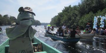
This building block on capacity building on local stakeholders including Indigenous including Peoples and Local Communities (IPLCs) to operate drones, enabling them to take active roles in conservation. 

Ease of Use of the method devellopted:

  1. Minimal Technical Skills Required:
    Users only need basic training in drone operation and measurement extraction from high-resolution images. The process is straightforward:
    • Fly the drone following the standardized flight protocol.
    • Marke crocodilians on overhead images.
    • Measure the visible head length using accessible image analysis tools (e.g., ImageJ, QGIS).
    • Apply the corresponding allometric equation or lookup from pre-prepared tables (abaques) for total length estimation.
  2. Readily Adaptable:
    The framework uses easy-to-read tables (abaques), making it accessible to both specilialists and non-specialists for operators can quickly apply the method without requiring advanced scientific expertise.
  3. Accessible Equipment:
    The approach relies on consumer-grade drones and widely available software, ensuring affordability and reducing barriers to adoption.

Why It’s Effective:

The framework’s simplicity, scalability, and reliability make it ideal for diverse contexts, from remote wetlands to urban-adjacent habitats. It empowers a broad range of users to generate scientifically robust data.

Allometric Framework for Crocodilian Size Estimation

The allometric framework is a non-invasive tool designed to estimate the total body length of crocodilians based on the measurement of their head length, captured through high-resolution drone imagery. By leveraging established species-specific head-to-body length ratios, this method eliminates the need for physical capture or handling, reducing risks for both researchers and wildlife. Validated for 17 of the 27 crocodilian species, the framework allow to provides reliable demographic data essential for population monitoring and conservation management.

The framework uses easy-to-read tables (abaques), making it accessible to non-specialists, operators can quickly apply the method without requiring advanced scientific expertise.

Estimating total length of crocodylians from drone-captured images by using a model

Understanding the demographic structure is vital for wildlife research and conservation. For crocodylians, accurately estimating total length and demographic class usually necessitates close observation or capture, often of partially immersed individuals, leading to potential imprecision and risk. Drone technology offers a bias-free, safer alternative for classification. This study evaluated the effectiveness of drone photos combined with head length allometric relationships to estimate total length, and propose a standardized method for drone-based crocodylian demographic classification. 

An allometric framework correlating head to total length for 17 crocodylian species was developed, incorporating confidence intervals to account for imprecision sources (e.g., allometric accuracy, head inclination, observer bias, terrain variability).This method was applied to wild crocodylians through drone photography. Terrain effects were less impactful than Ground Sample Distance (GSD) errors from photogrammetric software. The allometric framework predicted lengths within ≃11–18% accuracy across species, with natural allometric variation among individuals explaining much of this range. Compared to traditional methods that can be subjective and risky, our drone-based approach is objective, efficient, fast, cheap, non-invasive, and safe.

Standardized Drone Survey Protocols

This building block establishes standardized flight parameters for effective crocodilian monitoring

Crocodiles can be closely approached (.10 m altitude) and consumer-grade drones do not elicit flight responses in West African large mammals and birds at altitudes of 40–60 m. Altitude and other flight parameters did not affect detectability, because high-resolution photos allowed accurate counting. Observer experience, field conditions (e.g. wind, sun reflection), and site characteristics (e.g. vegetation, homogeneity) all significantly affected detectability. Drone-based crocodylian surveys should be implemented from 40 m altitude in the first third of the day. Drone surveys provide advantages over traditional methods, including precise size estimation, less disturbance, and the ability to cover greater and more remote areas. Drone survey photos allow for repeatable and quantifiable habitat assessments, detection of encroachment and other illegal activities, and leave a permanent record. 
Overall,dronesofferavaluableandcost-effectivealternative forsurveyingcrocodylianpopulationswith compelling secondary benefits, although they may not be suitable in all cases and for all species

Capacity Building through an Environmental Culture Approach

As the concept of environmental culture has spread throughout the island through research for national park designation and CEPA efforts, Kagoshima University has developed a human resource development program based on a reaffirmation of Amami's environmental culture in order to halt the decline of the local culture and community due to the decline in the local population and the spread of modern lifestyles. The program is designed to help local people to develop their own business skills. More than 100 people participated in the program, including local entrepreneurs and local government officials. Participants in the program, who learned to integrate environmental culture with modern knowledge and skills, have developed networks among themselves and are now independently developing product development and experiential tour businesses, school education, and welfare programs. Municipalities are incorporating environmental and cultural ideas in rebuilding aging meeting halls. In addition, the number of outside collaborators and immigrants is increasing, and local communities that had been on the decline are becoming more active. In addition, as an extension of the environmental culture that has been used in the past, efforts are underway to consider how to interact with the natural environment in the future. The environmental culture approach has improved livelihoods and enhanced the spirit of the local community by strengthening ties between them, resulting in increased attachment to the island and improved community well-being.

Sharing of issues with local residents and the direction of efforts to resolve them:
Through the preliminary survey, the local residents had a sense of crisis regarding the decline of the local environmental culture.

Partnership and cooperation: 
Cooperation among local institutions, organizations, and experts to enhance the quality of the training program.

Mutual learning :
Respect for each other's knowledge and experience and the creation of small outputs among participants.

Return of benefits:
There was an expectation that the benefits would be returned to the community in the future.


  1. Environmental Culture Approach:

    The integration of the spiritual satisfaction of maintaining the environmental culture and community and the self-sustaining economic development in the training program has improved the well-being of the region while meeting the contemporary needs of the participants.

  • In tourism, content that is based on environmental culture and that can strengthen local pride and identity for program implementers introduces the uniqueness of the local environmental culture to tourists.
     
  • In welfare, the environmental culture approach is more effective when it respects the sense of coherence based on the environmental culture and provides a sense of security.
     
  • In education, if the curriculum is based on environmental culture, participants will be able to strengthen their local pride and identity. It provides an opportunity to pass on traditions.
     
  1. Continuous learning:
    Continuous, step-by-step learning reinforces the effectiveness of the training.
     
Biodiversity Conservation Activities with the Participation of Islanders

Through the efforts of the government, local government, and local residents, the Amami Islands were designated as a NP in 2017. 
Subsequently, the extermination of non-native species such as mongoose and feral cat etc. became a challenge in maintaining the island's biodiversity in preparation for the registration as a World Natural Heritage site, and preserving the unique natural environment that forms the basis of the island's environmental culture.  The mongoose, the biggest challenge of all, has been exterminated under the government's initiative and will be completely eliminated by 2024. Meanwhile, measures against feral cats and monitoring of non-native plants were carried out with the cooperation of Kagoshima University, the Ministry of the Environment, local governments, and local residents. In the case of feral cat countermeasures, precedents from overseas were introduced and considerations for owners in their daily lives were shared. In terms of invasive plant monitoring, continuous training sessions for local residents have been held to improve their capabilities and share the results.
 

Shared awareness of the crisis:

 Islanders, NGOs and municipalities were able to share an awareness of the problem and their respective roles of familiar feral cats and invasive alien plants as a threat to the natural environment, which is the basis of World Natural Heritage and environmental culture.

Community ownership:
It is important to share the challenge that invasive species are a local problem.


Sharing of results:
For continued efforts, it is necessary to maintain motivation through the sharing of results.
 

Inclusive and Participatory Research on environmental culture and CEPA's efforts

When the Ministry of the Environment was seeking the designation of the Amami Archipelago as a national park for the purpose of registration as the World Heritage site, it proposed two management concepts, “Ecosystem Management Type” and “Environmental Culture Type,” with the support of Kagoshima University, which had launched the Kagoshima Environmental Studies Project, a public-private collaboration aimed at solving environmental problems in the region. The “Ecosystem Management Type” concept aims to preserve the area as a registered World Natural Heritage site, while the “Environmental Culture Type” concept supports cultural value by providing visitors with a chance to experience the history and culture of people who have lived in harmony with nature in the area, and have skillfully used and passed it on to future generations. The purpose of Japan's national parks is to protect natural scenic areas, promote their use, and contribute to conservation of biodiversity. “Amamigunto National Park” was the first national park to propose the concept of an Eenvironmental Culture Type” national park that focuses on the nature and culture of the region. The term “Amamigunto” means “the Amami Archipelago”.

The Ministry of the Environment and Kagoshima University conducted an interview survey, as an attempt, in collaboration with local residents in the satoyama area of Amami, a candidate area for a national park, to visualize the language and spirit that represent the culture of the islanders and how they live using nature, and to understand the local environmental culture that has coexisted with nature. Through many workshops and symposiums, including web-based workshops, the results of the survey were shared with local residents and people from Amami living in the city, and through understanding the uniqueness and value of the local environmental culture, the awareness that environmental culture has the potential to strengthen community identity and seed independent economic development in the region spread. This awareness has continued to spread.

What is Environmental Culture?
The concept of environmental culture is closely related to the nature-culture linkage.
In Kagoshima, this concept has been in use since around 1990, and more recently, it has been defined as: “The general consciousness, lifestyle, and production style that local people have formed and acquired while interacting with nature and influencing each other."


Example 1) The topography and geology of the “high island” and “low island” of the Amami archipelago determined the amount of water in rivers and groundwater, which in turn determined how the islanders obtained water for daily use and firewood. On the “high island,” waterwheel-powered sugar manufacturing flourished, taking advantage of the abundance of water in the rivers. The “low islands” had difficulty securing firewood due to the lack of well-developed forests, and trade developed to obtain firewood from neighboring islands, promoting cultural exchange. These “high” and “low” islands have strongly influenced the islanders' culture and awareness of the importance of resources. At the same time, this culture and awareness has influenced the islanders' approach to nature and has defined the natural environment of the islands.

Example 2)  The awareness of the forbidden by the yokai Kenmun in the island's folklore has become a means of appropriate control of natural resources and coexistence with nature. The “yokai” is closely English word for “ghost” or “supernatural creature”.
 

Use of Participatory community survey methods
The sense of efficacy and sense of ownership was increased by generating local knowledge together, rather than by giving knowledge in a one-way report..
 

Recognition of the importance of historical perspectives:
It is important to show respect for the local residents' awareness of nature and culture from a historical perspective.

Integrate existing research on multiple fields of study and use it to understand the holistic environmental culture of the region.
 

Use of Participatory community survey methods
The sense of efficacy and sense of ownership was increased by generating local knowledge together, rather than by giving knowledge in a one-way report.
 

Recognition of the importance of historical perspectives:
It is important to show respect for the awareness of local residents based on historical perspectives in addition to the relationship between nature and culture.

Use of existing research:
The use of existing research on a wide range of topics.
 

Cost-Effective Restoration Processes

One of the biggest barriers to large-scale restoration is cost. Our solution eliminates the need for costly nurseries and reduces labor-intensive efforts, enabling efficient large-scale planting. The drones can plant up to 2,000 seeds in under 10 minutes, drastically reducing time and labor costs. This affordability makes restoration feasible for low-income regions and opens up opportunities for scaling in areas previously deemed inaccessible. The process is adaptable to other restoration challenges, such as reforestation or agricultural regeneration, making it versatile across multiple applications.

AI-Powered Monitoring, Reporting, and Verification (MRV) System

Restoration is not just about planting—it’s about ensuring long-term impact. Our AI-powered MRV system provides real-time tracking of restoration progress and environmental health. It also addresses critical issues like illegal fishing, poaching, and deforestation, empowering communities to protect their restored ecosystems. This system integrates satellite data, drone imagery, and AI analytics to provide actionable insights, which can be adapted to other restoration or conservation efforts. It also supports transparency and accountability, ensuring stakeholders can measure progress and outcomes effectively.

Licensing and Training Platform

Our licensing and training platform equips communities to independently build, operate, and maintain drones. This approach is hands-on and collaborative, fostering local expertise and enabling communities to adapt the technology to their unique needs. The platform goes beyond technical skills, creating a foundation for communities to innovate and modify drones for additional applications such as surveillance, mapping, and precision agriculture. Importantly, the platform fosters a feedback loop where communities share their innovations, enriching the broader global network of users.