Competitive Funding Mechanism for Community Initiatives
Effective Infrastructure Management in Protected Areas
Volunteer Engagement and Corporate Social Responsibility in Protected Areas
Creating the necessary incentives to foster the success of green bonds
Following the development of the legislative and regulatory framework for issuing green bonds, it was also necessary to create incentives that enhance their attractiveness for both issuers and investors. With BIOFIN’s advocacy and in close collaboration with the Working Group, two key incentives were established.
First, investors benefit from a 15% exemption in withholding tax on green bonds listed on a Zambian exchange with a maturity of at least three years. This measure encourages investment in projects with positive environmental outcomes and accelerates resource mobilization. It also motivates potential issuers, who can expect stronger investor demand and, consequently, higher returns on their bonds.
Second, the SEC introduced a 50% reduction in green bond registration fees in Zambia. By lowering issuance costs, this measure further strengthens the attractiveness of the market for issuers.
A key enabling factor is the support of government and regulators for developing a green bond market and their willingness to design and approve such incentives.
Recently developed green bond markets might be perceived as too risky by investors who are more familiar with traditional bonds and other investments. Creating incentives for both issuers and local investors is crucial to navigate their risk tolerance and to stimulate the market in its early stages.
Capacity building and technical support for market developers and green bonds issuers
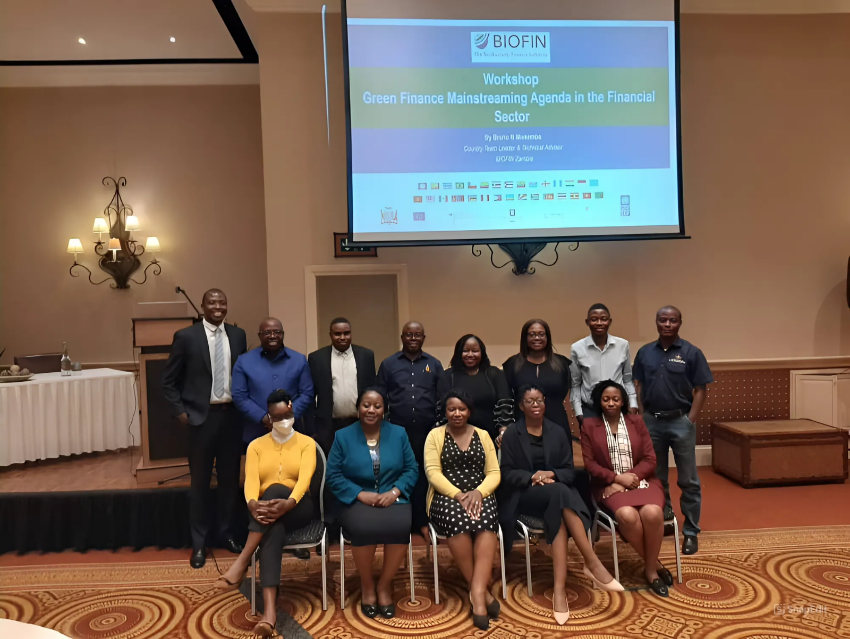
Green Finance Mainstreaming Agenda in the Financial Sector Workshop
UNDP Zambia
Since 2018, UNDP BIOFIN has organized various capacity building workshops and provided support towards the development of the green bonds market in Zambia, engaging with key financial sector regulators. These activities have been instrumental in the formulation of the Green Bonds Guidelines and Listing Rules, and have also included targeted trainings for the SEC on the review and approval of green bond applications.
As an example, a series of capacity-building sessions to scale up the market for green bond issuances in Zambia was delivered to members of the Working Group and other key stakeholders (e.g., investment brokers, transaction advisors, institutional investors, etc) in July 2025. The sessions covered topics such as the fundamentals of green bonds, the structuring process, and eligibility requirements.
BIOFIN has also provided technical assistance to high-potential green bonds issuers in Zambia. In 2024, a global call was launched to offer tailored guidance for five companies or other prospective issuers. This support includes drafting green bond frameworks, identifying eligible project pipelines, liaising with investment banks, and engaging second-party opinion providers for certification. It also provides advisory services on aligning bonds with international standards, impact reporting, and market positioning.
Enabling factors include the availability of experts to deliver workshops and provide ongoing assistance, adequate funding to cover activities and logistics, the willingness of government and regulators to develop a green bond market, and the active participation of financial regulators.
During the capacity building and technical support activities, it was observed that financial agents often misunderstood the principles of project finance, which differs from more typical corporate finance transactions in its composition of guarantees and risk scenarios. The benefits of green bonds, compared to conventional government bonds, were also not immediately clear to all participants. This highlights the importance of ensuring that capacity-building efforts (1) explain in detail the distinct characteristics of project finance, (2) are complemented by a broad awareness-raising campaign, and (3) also focus on transferring knowledge on environmental sustainability and associated standards to meet investors’ expectations.
Bringing key stakeholders together under the Green Finance Mainstreaming Working Group
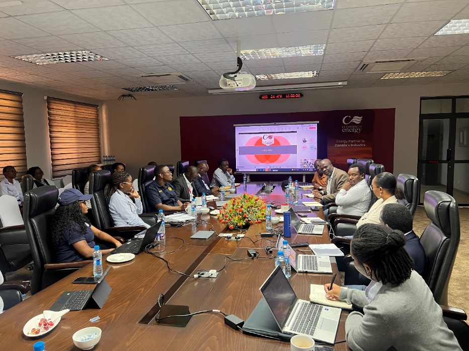
UNDP BIOFIN, the Green Finance Mainstreaming Working Group, and Fund Managers meet with CEC Renewables to advance Zambia's green bond market development following the inaugural issuance.
UNDP Zambia
The development of a green bonds market in Zambia is anchored in the activities of the Green Finance Mainstream Working Group, which brings together financial regulators, standard-setting bodies, development partners, and other key institutions with the objective of mainstreaming green finance into Zambia’s financial landscape. Members include the Bank of Zambia, the SEC, and the Pensions and Insurance Authority (PIA). In addition, the Working Group includes strategic participation from the Ministry of Green Economy and Environment, the Ministry of Finance and National Planning, the Zambian Institute of Chartered Accountants, and the Worldwide Fund for Nature (WWF) Zambia.
The establishment of the Working Group provided a regular platform for collaboration among regulatory bodies, government agencies, and experts, fostering an enabling environment for the development and effective implementation of green finance solutions. Many of these solutions are multidisciplinary in nature, from legal requirements to technical expertise, and potentially could not have been developed without this collaborative effort.
Enabling factors include stakeholders’ willingness to participate in and dedicate time to the Working Group, their recognition of the interconnectedness of green finance and the importance of the topic, and the availability of funding to support the Group’s ongoing activities.
A key lesson learned is that establishing governance and collaborative structures is crucial for the development of green bond markets and other financial solutions. Regardless of the level of implementation, national or subnational, these solutions are typically multidisciplinary, and their implementation runs more smoothly not only when there is collaboration, but also when a dedicated platform with clear procedures for ongoing engagement is in place.
In addition, it is crucial to consider broader advancements in the financial system that, while not mandatory for issuing green bonds, are likely to strengthen their creditworthiness. In Zambia, the Working Group is also pursuing complementary solutions that support the development of the green bond market, including measures to enhance economic stability, credit ratings, and market infrastructure. Examples include the development of Zambia’s National Green Finance Strategy and Implementation Plan, as well as a green finance taxonomy, tagging, and reporting system.


")