Skip to main content
Main navigation
Explore solutions
Network
Resources
News & Events
Contribute solution
Secondary navigation
About PANORAMA
Partners and Collaborators
Communities
Utilities navigation
Newsletter
Manual
FAQ
English
English
Français
Español
Deutsch
Italiano
中文
العربية
Bahasa Indonesia
한국어
Русский
Português
日本語
Nederlands
Türkçe
User account menu
Log in
Register
West Asia, Middle East
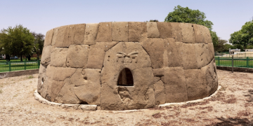
Preserving and improving a cultural landscape, using urban and architectural guidelines as a tool at Al Ain
Belhassen
Kinbi
Central America
South America
North America
Protecting hawksbill sea turtle eggs using community incentive programs
Ben
Scheelk
6 Building blocks
Nesting Beach Conservation
Fisheries Bycatch Research/Reduction
Policy Advocacy & Protected Area Management
In-Water Monitoring
Exploratory Habitat Investigations
Eco-Tourism, Outreach, and Education
West and South Europe
Waterevolution: an integrated approach to maritime cluster sustainability
Vienna
Eleuteri
3 Building blocks
Computational Sustainability
Cross-sectoral platform for marine conservation
Structured long-term financing for marine conservation
Caribbean
North America
Voluntary intergovernmental cooperation to conserve the High Seas
Kate
Morrison
4 Building blocks
Creating the scientific evidence base
Seeking international recognition for ecosystem
Development of international protection measures
Establishment of the Sargasso Sea Commission
Southeast Asia
Establishing Indigenous Community Conserved Areas in the Philippines
Floradema
Eleazar
3 Building blocks
Participatory mapping and inventorying
Community conservation agreement
Declaration of ICCA
North America
Tribal Parks in Canada: From Clayoquot to the Chilcotin and Beyond
Eli
Enns
North and Central Asia
The Conservation Standards-based method for planning and implementing Ecosystem-based Adaptation strategies
Paul
Schumacher
2 Building blocks
Participatory Vulnerability Assessments as a basis for EbA planning
Integrating climate information into local planning
West and South Europe
Safe Island for Seabirds
Azucena
de la Cruz
West Asia, Middle East
Dana Biosphere Reserve: creating socio-economic development opportunities for nature conservation
Natalia
Boulad
North America
Un instrumento dinámico y operativo para el uso integrado del suelo y la gestión del agua
CONANP
Mexico
4 Building blocks
Gobernanza y arreglos inter-instituciones a diferentes niveles
Creando una visión común del territorio a partir del agua
Los elementos clave para la conservación del ecosistema también son antrópicos
Apoyo de instituciones y organizaciones de base con presencia en el territorio
Pagination
Previous page
‹‹
Page 56
Next page
››
Subscribe to Subnational