Investment in sustainable management, prevention, eradication, and control of IAS and restoration of IAS-degraded habitat at key marine and coastal areas.

Testing and piloting a variety of IAS management and control strategies is crucial for developing experience and know-how. For this purpose, IAS management frameworks, i.e., IAS Management Plans, have been developed at four pilot sites of the project. The implementation of management plans has been initiated starting from Ayvalık Islands in 2023 and will be completed at all pilot sites by the end of 2024.


MarIAS project has also developed Harvest Incentive Programs for the Indo-Pacific origin lionfish (Pterois miles), Atlantic starfish (Asterias rubens), puffer fish (Lagocephalus sceleratus), and water hyacinth (Eichhornia crassipes) populations, offering solutions on how to control them and integrate them into the economy. As part of the implementation of these Harvest Incentive Programs, a fishing derby and gastronomy event for lionfish, a diving contest to collect starfish,  and a community activity for removal of water hyacinth from the Asi River and along the Mediterranean coast at Samandağ were carried out. The lionfish derby in Keldağ was followed by a tasting of different lionfish recipes, in an effort to popularize the hunting and consumption of lionfish among Hatay residents. Local divers participated in a small-scale tournament, competing to collect as many starfish as possible from the shores of the Marmara Islands, and the winners were rewarded with a scuba dive computer, a dive bag, and a dive torch. The community water hyacinth removal event targeted water hyacinths, which block waterways and channels and also prevent sunlight and oxygen from reaching the water column and submerged plants due to their very rapid reproduction and spread, thus negatively affecting transportation, tourism, and fishing activities, as well as causing much destruction to the ecosystem and a significant decrease in biodiversity. 

The main factor that has enabled investment in sustainable management of IAS is the availability of GEF funds for this cause, which further encouraged and increased the willingness and quick adoption of governmental institutions such as the General Directorate of Aquaculture and Fisheries in the struggle with the IAS, especially in the toxic pufferfish and lionfish. 


A committed and inclusive process for stakeholder involvement and active collaboration of an expert national NGO (Nature Research Society) in protected area management planning and species action plans for the development and expedited implementation of pilot site IAS Management Plans has also fostered a process that was accepted and formally recognized by all actors involved.

The participation of local coastal communities is important for creating awareness among the public, and collective and fun events can also be instrumental as short-term solutions for controlling the population of the marine invasive alien species. Additionally, these events help raise awareness among coastal communities about invasive species and the threats they may represent to local biodiversity and livelihoods.

To formulate and implement, based on science, the Master Plan of Changbaishan Reserve

 Changbaishan UNESCO Biosphere Reserve has established an effective management system. The Changbaishan Conservation and Sustainable Development Zone Administration Committee is the decision-making body, and under it is the Changbaishan Reserve Management Bureau, which consists of a management office and relevant operational departments responsible for the daily management of the park. It also includes a Expert Committee and a Community Committee, who also participate in decision-making and policy formulation.Changbaishan Reserve engaged representatives of the stakeholders, the public, and the rights-holders in the amendment of the Reserve’s management regulations and conservation-related work. Changbaishan Reserve values comments and suggestions from stakeholders. Extensive consultation was held with right-holders and stakeholders in major decision-making and planning, and adopted any sensible suggestions.                                                                                                                                                                                                                                                                                                                                                                                                                                                                                                                                                                                                              

Delopment of the SIREN App

This building block is to explain how I developped an App that allow fishers to contribute to marine science knowledge in Africa. 

Initially we gave fishers a pre-printed form to report opportunistic sightings they encountered. However, the form was getting lost most of the time. 

We decided to move to a digital solution. The existing App by then required internet to work and was just too complicated for fishers. So we thought we shoud develop an App that will be more userfriendly for fishers. 

We wrote the  algorithm (workflow) of the App and then contracted an Indian development company to write the code. 

Later we had to bring the development of SIREN back to Cameroon to reduce the cost of developement. 

We work with volunteer around the world that will continuously support with the development of the SIREN

  • passion and determination
  • availability of seed fund to develop an initial version of the SIREN App
  • Collaboration with local App developpers
  • Extending the collaboration to international volunteers 
  • understand
  • The first developper company I contracted for the development of SIREN was a foreign company based in India. The cost of develpment was very high and there was a lot of miscomunication due to language barriers. When we started working with local developpers, the cost of development decreased importantly and it was easier to communicate.
  • Before giving a smarphone to fisher for data collection you must develop a trust relationship with him before otherwise the phone will never be used by the fisher to report sightings.
Capacity Development through Technology Training

This building block emphasizes the importance of training students and local actors in advanced technologies for conservation purposes. In Bio-Scanner, students from the Universidad Politécnica de Yucatán  are trained in using AI algorithms, camera-trap data processing, and decision-support tools, fostering a new generation of professionals equipped to address biodiversity challenges.

The purpose of this building block is to build local capacity by providing hands-on training in cutting-edge technologies. This ensures that local actors can independently use, maintain, and replicate the solution in other contexts while fostering professional development among students.

Enabling factors:

  • Access to training resources and mentoring from experts in AI and conservation.
  • Collaboration with academic institutions to recruit and support students in applying their skills to real-world projects.
  • Ongoing support and capacity-building to ensure trainees can effectively use the tools and scale their applications.
  • Practical, hands-on training is more effective than theoretical approaches in building capacity for conservation technologies.
  • Partnerships with academic institutions provide a sustainable pipeline of trained professionals for long-term conservation efforts.
  • Regular follow-up and support after training help trainees apply their skills effectively and adapt to challenges.
  • Integral overview of the project, helps trainees to gain an overall vision of the entire initiative and notice the impact of their work in the project.
Collaborative Partnerships for Conservation

This building block focuses on the establishment of strong partnerships between academic institutions (Universidad Politécnica de Yucatán), local governments (Secretaría de Desarrollo de Sustentable del Estado de Yucatán), and conservation organizations (International Union for Conservation of Nature and Natural Resources), private sector (Huawei), and local communities (Dzilam de Bravo) to enhance the collection and analysis of biodiversity data, access to technological infrastructure, government program instrumentation and application, and local ownership and execution.

The purpose of this building block is to foster cooperation among diverse stakeholders to ensure the effective implementation of conservation technologies. These partnerships enable the sharing of resources and expertise, empowering local actors to participate in conservation projects and creating a framework for sustainability.

Enabling factors:

  • Strong engagement and alignment between stakeholders, including academic institutions, government agencies, conservation organizations, private sector and local communities.
  • Signed agreements that define clear roles, responsibilities, and benefits for all parties involved.
  • Access to local knowledge and expertise to ensure the relevance and effectiveness of conservation actions.
  • Transparent communication between stakeholders is crucial to build trust and ensure the long-term success of partnerships.
  • Including academic institutions fosters innovation and provides opportunities for student involvement in meaningful projects.
  • Government involvement helps to create conservation policies and facilitates execution in the community.
  • Partnerships with conservation organisations strengthen the scalability and visibility of conservation initiatives by pooling resources and knowledge.
  • Community of Dzilam de Bravo provides data on field and by taking ownership of the project, they contribute to efficient project execution 
  • Private sector provides infrastructure and expertise to facilitate the development of the technology
Advanced Image Recognition Algorithms for Jaguar Monitoring

This building block is centered on the use of Convolutional Neural Networks (CNNs), including Siamese and Autoencoder architectures, to detect and identify individual jaguars based on unique features such as rosette patterns and morphology. These algorithms process camera-trap data efficiently, reducing the time required for analysis and providing critical insights for decision-making in conservation.

The purpose of this building block is to enhance the monitoring and understanding of jaguar populations by automating the identification process. The algorithms detect jaguars in camera-trap images and classify individuals, contributing to understanding population size, distribution patterns, and behaviors. This facilitates conservation planning and policy-making by decision-makers. Additionally, the models are scalable and can be adapted to other species and ecosystems, expanding their applicability beyond the Yucatán Peninsula.

Enabling factors:

  • Availability of high-quality camera-trap data for training and validating the algorithms.
  • Technical expertise in AI and machine learning for developing and fine-tuning models.
  • Collaborative partnerships with local institutions for field data collection and algorithm design, development and testing.
  • Access to sufficient computational resources to train and deploy the algorithms effectively.
  • High-quality and diverse datasets are critical for achieving accurate and reliable results.
  • Community and academic involvement, such as the participation of the Dzilam de Bravo community and the Universidad Politécninca de Yucatán, enhances project outcomes by ensuring local capacity and ownership, and technological expertise to design the necessary algorithms.
  • Explainability in AI models (e.g., through Gradient Cam) is essential to build trust and ensure the results are accessible to decision-makers.
Spatial Intelligence for Wildfire Management

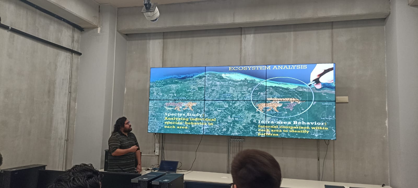
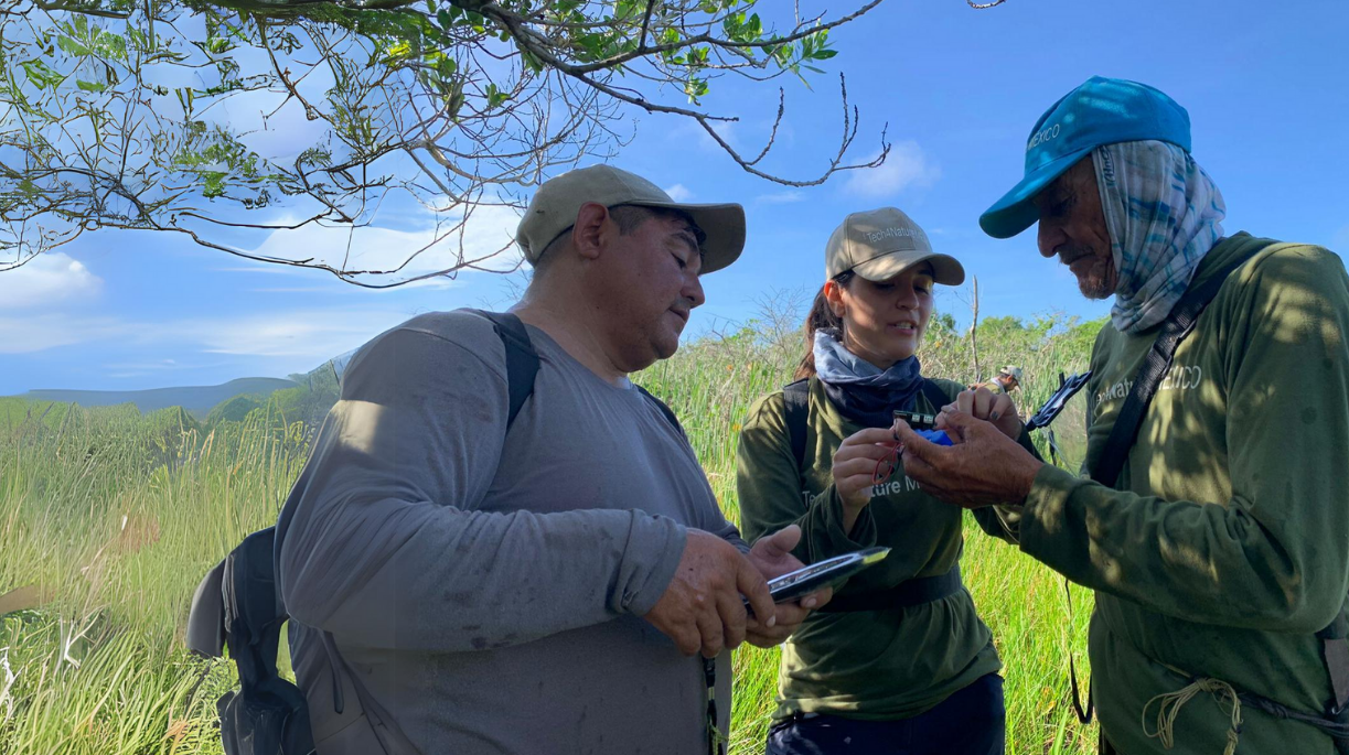
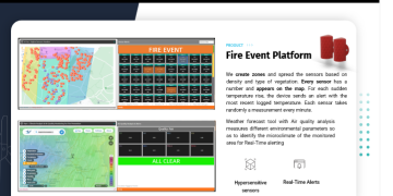
This building block provides the essential spatial intelligence for PyroSense, enabling a dynamic understanding of the geographical landscape. Its core purpose is to identify fire risk areas, pinpoint incident locations, and visualize resource deployment. This is crucial for strategic decision-making, allowing proactive resource allocation, and response planning. 

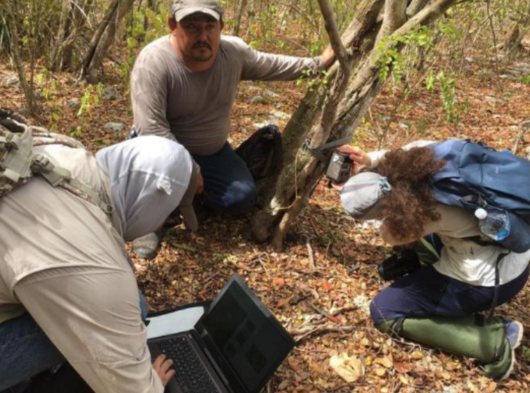
PyroSense utilizes a robust Geographic Information System (GIS) to power this function. The GIS integrates various spatial data layers, including topography, vegetation, infrastructure, etc. Initially, baseline risk maps are created by analyzing factors, guiding the placement of sensors and cameras.

Upon detection of a potential fire by environmental sensors or AI, the system immediately feeds the precise coordinates into the GIS. This real-time location data, combined with meteorological data (local and satellite), enables dynamic risk assessments. The GIS also serves as a central operational dashboard, visualizing the real-time positions of all deployed assets, including drones and first responder teams. This facilitates optimal resource allocation and coordination. This critical information is then communicated via a web application to stakeholders, providing clear visual situational awareness and supporting informed decision-making. 

  • Accurate and Up-to-Date GIS Data: Access to current geospatial data on topography, vegetation,  historical fire activity is essential for reliable risk assessments.
  • A powerful GIS platform is necessary for integrating diverse data layers, performing complex analyses, and running real-time AI.
  • Expertise is needed to interpret GIS data, validate models, and use the platform for strategic planning and incident management.
  • Connectivity with environmental sensors, drone feeds, and meteorological data is crucial for dynamic risk mapping and accurate fire tracking.

The accuracy and utility of geospatial planning are directly proportional to the quality and timeliness of the underlying GIS data. Investing in high-resolution, frequently updated maps and environmental data is paramount. Furthermore, the ability to integrate real-time sensor and drone data into the GIS for dynamic risk assessment proved to be a game-changer, moving beyond static planning to predictive capabilities. 

Initial challenges included the significant effort required to collect and digitize comprehensive baseline GIS data for large, remote areas. Data standardization across different sources (e.g., various government agencies, local surveys) was also a hurdle. Additionally, ensuring the GIS platform could handle the computational load of real-time data fusion and complex fire spread simulations without latency issues was a technical challenge.

  • Before deployment, dedicate substantial resources to acquiring and standardizing all relevant geospatial data. 
  • Choose a GIS platform that can scale with increasing data volumes and computational demands.
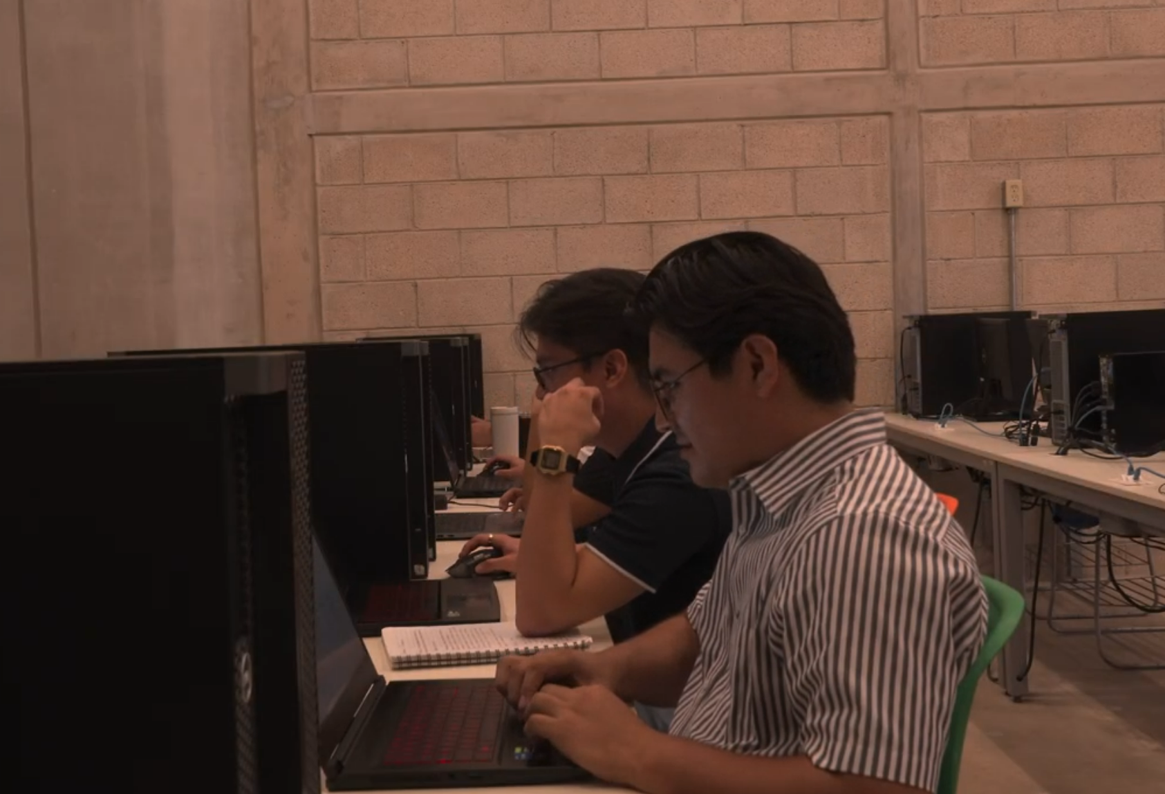
  • Ensure that local teams are proficient in using the GIS platform  
Comprehensive Data Ingestion for Fire Detection

This is the comprehensive intake mechanism for all information vital to PyroSense's platform. Its purpose is to gather real-time data, from multiple origins, ensuring the system has the input needed for accurate analysis and effective decision-making. 

PyroSense integrates an agnostic and highly compatible array of data:

  1. Environmental IoT Sensors are strategically deployed, and continuously collect real-time CO2, temp. and humidity data. They are agnostic in type and protocol, compatible with MQTT, LoRa, Sigfox, and NBIoT, ensuring broad integration. For efficiency, they feature long-lasting batteries (up to 10 years), minimising maintenance.  

  2. Fixed cameras and drones capture high-resolution images and live video. Integrated Vision AI processes this visual data in real-time to detect anomalies like smoke or fire. 

  3. PyroSense gathers data from local weather stations and satellites. Combining granular local data with broad satellite coverage provides a comprehensive understanding of current weather.

  4. GIS provides foundational spatial information, including maps of terrain, vegetation,  infrastructure, etc. 

  5. Firemen Wearables monitor real-time biometrics. AI enhances data for risk pattern recognition, of fatigue or heat stress. Real-time alerts are sent to nearby teams or control centers, enabling proactive intervention.

  • Reliable Sensor Deployment: Sensors should be strategically placed, well-installed, ensuring continuous data collection and security.
  • Data Stream Integration: Integrating data from various sensors, cameras, drones, and meteorological sources is crucial for situational awareness.
  • Data Quality and Calibration: Ensure all data sources are calibrated and high quality to avoid false alarms.  
  • Secure Data Transmission: A strong communication is vital for secure, low-latency data transfer from remote locations.

The diversity and agnosticism of data sources are critical for comprehensive and resilient fire detection. Relying on a single type of sensor or communication protocol creates vulnerabilities. The ability to integrate data from various IoT sensors, visual feeds (cameras, drones), meteorological data, and even human biometrics provides a robust, multi-layered detection system that significantly reduces false positives and increases detection accuracy.

  • The platform must be software and hardware agnostic.
  • Cybersecurity and intercommunication are crucial.

A significant challenge was ensuring seamless interoperability between different sensor types and communication protocols (e.g., MQTT, LoRa, Sigfox, NBIoT) from various manufacturers. As well as, maintaining connectivity in remote, terrains for all sensor types was also an ongoing effort, despite long battery life.

  • Design your system to be compatible with multiple IoT communication protocols from the outset. 
  • Develop algorithms for data validation and fusion to cross-reference information from disparate sources.
  • Consider hybrid communication solutions (e.g., satellite for remote areas)
Sensors and Weather Data
West and South Europe
Panagiotis
Apostolopoulos
Comprehensive Data Ingestion for Fire Detection
Spatial Intelligence for Wildfire Management
Stakeholder Communication & Wildfire Awareness
Core Technologies & Supporting Infrastructure
Protecting Ecosystems Through Fire Prevention Technology