3. Current Resilience Identification

In this stage Kassandra undertakes an analysis of resilience for all the entities within the Digital Twin based on twelve main Kassandra Parameters, hundreds of sub-parameters and thousands of relationships between these parameters. This highlights immediately areas where resilience might be lower and that might require urgent action.

For the successful implementation of Current Resilience Identification using Kassandra, key conditions include:

  • Comprehensive Data Collection: Gathering extensive data on the twelve main Kassandra Parameters and their sub-parameters is essential for accurate resilience analysis.
  • Robust Analytical Framework: Developing a strong analytical framework to process and interpret the complex relationships between parameters is critical for meaningful insights.
  • Integration of Diverse Data Sources: Ensuring the integration of varied data sources enhances the breadth and accuracy of the resilience assessment.

The key lessons learned during the implementation of Current Resilience Identification using Kassandra are:

  • Iterative Analysis: Initial analyses often uncovered unexpected relationships or gaps in understanding. Iterative approaches allowed for refinement and enhanced accuracy in identifying resilience factors.
  • Visualizations Aid Understanding: Effective visual representations of data relationships significantly improved stakeholder comprehension and engagement in the analysis process.
2. Digital Twin Creation

Kassandra creates or builds upon a Digital Twin of the asset to be studied that uses analysis and simulation tools to take a long-term and whole-system view of an environment.

For the successful implementation of Digital Twin Creation using Kassandra, key conditions include:

  • High-Quality Data: Accurate real-time data from various sources is essential for a reliable Digital Twin.
  • Robust Integration: Seamless integration with existing systems ensures comprehensive environmental views.
  • Interdisciplinary Collaboration: Engaging experts from diverse fields facilitates holistic modelling.
  • User Accessibility: A user-friendly platform encourages stakeholder engagement.
  • Scalability: The framework should be adaptable to future data sources and analytical needs.
  • Continuous Validation: Regularly updating the Digital Twin ensures its accuracy over time.

To avoid common pitfalls, we have found that there is a need to prioritize data quality, adopt flexible development practices, and encourage interdisciplinary collaboration.

  • Data Quality Matters: Ensuring high-quality, accurate data is critical. Inaccurate data inputs led to misleading simulations, undermining trust in the Digital Twin.
  • Iterative Development: Adopting an agile approach allowed for iterative improvements based on user feedback. Initial rigid processes led to missed opportunities for optimization.
  • Interdisciplinary Collaboration: Collaborating with experts from various fields enriched the modelling process. Attempts to work in silos often led to incomplete or unrealistic simulations.
  • Scalability Planning: Planning for scalability from the start ensured the Digital Twin could adapt to growing data and user demands without major redesigns.
  • Regular Validation: Establishing mechanisms for continuous validation helped maintain the Digital Twin’s relevance and accuracy.
1. Data Acquisition and Analysis

Kassandra is a platform designed to enhance climate change decision-making through the power of generative AI. It facilitates the acquisition and consolidation of data from various sources, such citizen engagement workshops, archive searches, surveys, or even IoT devices and urban applications, allowing for a comprehensive view of a city's environmental landscape.

  • Data Acquisition: Kassandra collects diverse data related to climate, resource usage, and urban dynamics, acting as a central hub for this information,
  • Data Transmission: The platform efficiently transmits this consolidated data to a virtual environment, making it accessible and easily understandable for decision-makers.
  • Data Analysis: By integrating with advanced analytics tools, Kassandra supports real-time insights, enabling city planners to visualize trends and make informed decisions regarding resource management.
  • Scalability: The platform’s seamless horizontal scaling allows for accommodating increasing data needs as cities grow and evolve.

The conditions crucial for enabling the success of Kassandra as a platform for climate change decision-making:

  • Data Quality: Ensuring the accuracy, consistency, and completeness of data collected from various sources.
  • Interoperability: Facilitating seamless integration between Kassandra and existing urban systems and technologies.
  • Stakeholder Engagement: Involving community members, policymakers, and experts in the decision-making process to ensure diverse perspectives are considered.

Key lessons learned during the implementation of Kassandra as a climate change decision-making platform include:

  • Importance of Data Governance: Establishing clear protocols for data collection, storage, and sharing is essential. Inadequate governance can lead to data inconsistencies and trust issues among stakeholders.
  • Iterative Development: Adopting an agile approach allowed for continuous improvement based on user feedback and changing requirements. Rigid planning often led to delays and misalignment with user needs.
  • Collaboration with Stakeholders: Engaging local communities, policymakers, and technical experts throughout the process fostered buy-in and created a more relevant tool. Initial efforts that overlooked this collaboration faced challenges in acceptance.
  • Scalability Considerations: Planning for future growth from the outset ensured that the platform could handle increasing data loads and user demands without significant overhauls.
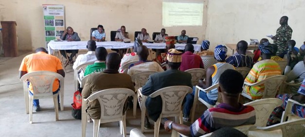
5. Mid-term review of the implementation of the OIPR DZNE - riparian villages agreements for access to the PNC in connection with the worship of sacred sites

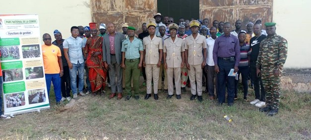
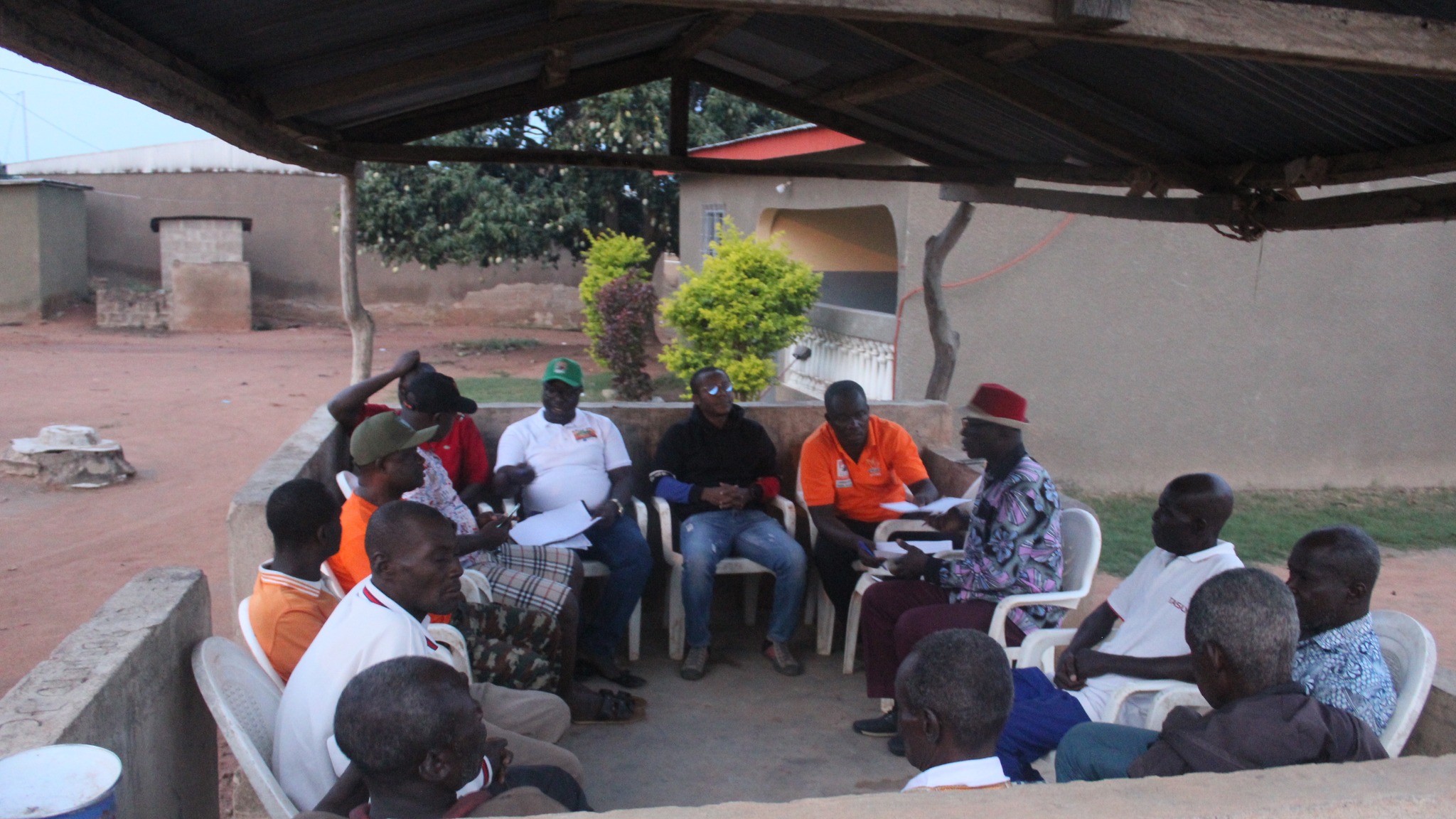
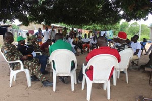
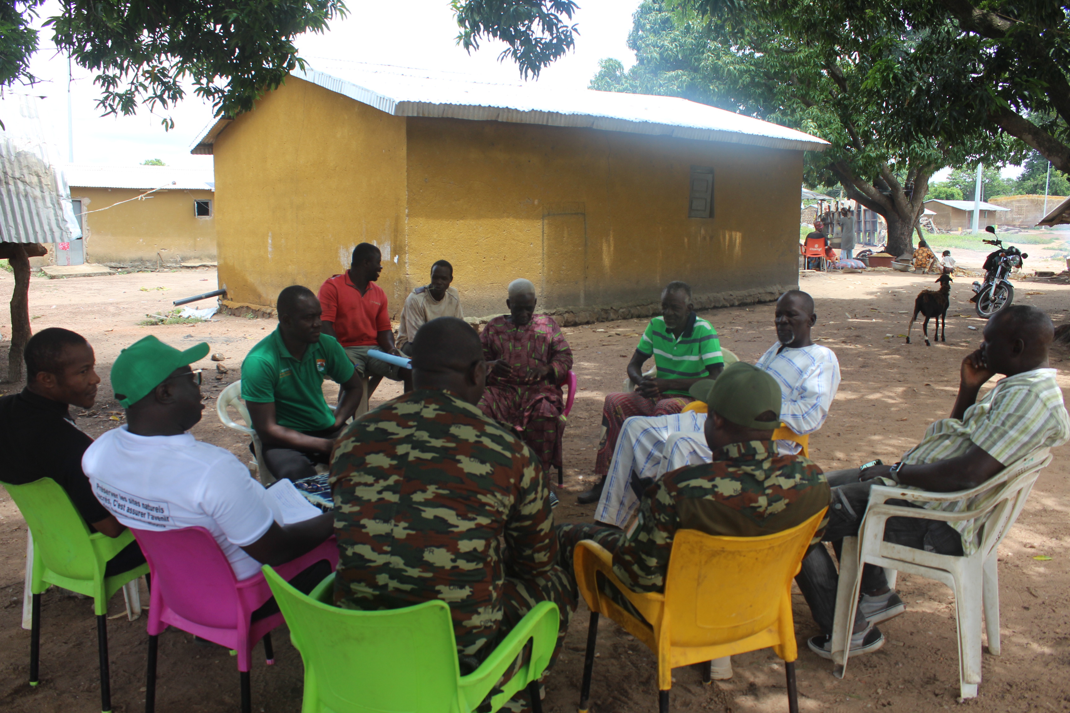
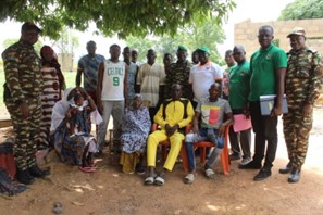
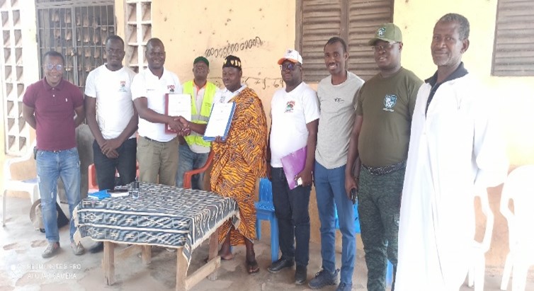
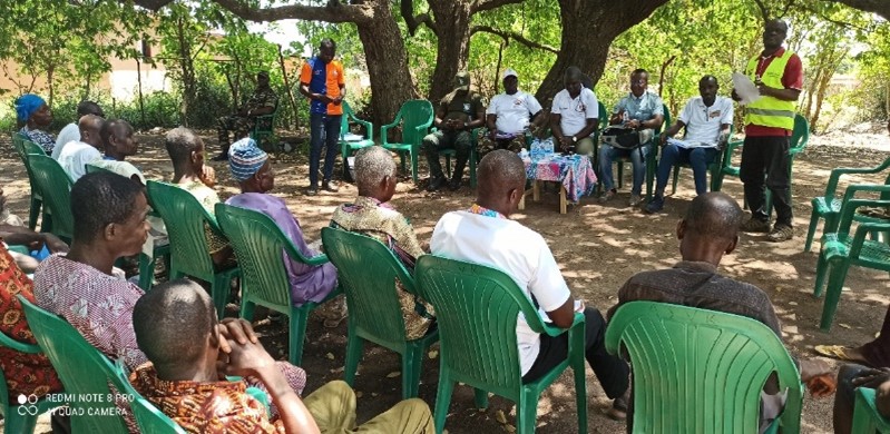
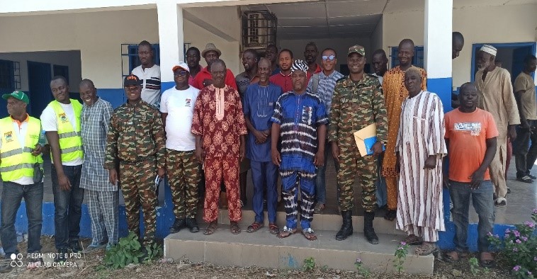
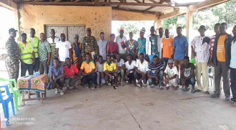
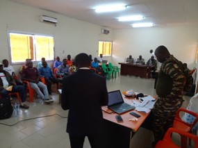
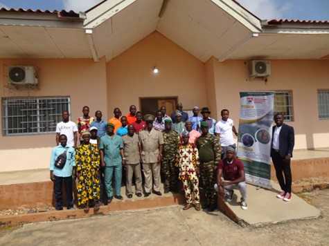
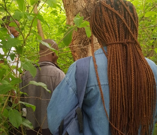
Follow-up missions to these agreements have enabled us to ascertain the level of their implementation and to initiate new partnerships. Several worship initiatives in the PNC have been carried out to seek cures, drive away evil spirits and solicit professional promotions. In all, 30 access agreements for the worship of sacred sites were signed in the localities of Nassian, Bouna and Tehini.A workshop was organized to take stock of worship activities carried out at sacred sites within the PNC by communities in each sector, to identify the advantages and difficulties associated with the implementation of the convention for access to sacred sites within the PNC, to provide the OIPR with an annual calendar of worship activities, and to formulate recommendations for improving collaboration between the signatories of this convention. The review workshop took place on December 20, 2023, in the meeting room of the Kotouba Sub-Prefecture. It brought together the Sub-Prefects of Tehini, Nassian, Kotouba and Bouna. The meeting was also attended by representatives of the villages that have signed the conventions, OIPR officials and a representative of the technical partner (GIZ/Pro2GRN).

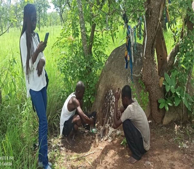
In all, thirty (30) agreements have been signed between the communities and OIPR for access to the PNC for worships in thirty (30) riverside villages. Fifty-eight (58) worships were performed in five (05) villages in 2023. Four hundred and seventy (470) people accessed the PNC during all the worship activities carried out in 2023. A few testimonials were collected from the local population during the workshop to present the benefits of the PNC access agreements.

Testimonial 1 (village of Kokpingué): fetish worship inside the PNC slowed down the succession of misfortunes that were befalling the village;

Testimonial 2 (Village of Kotouba): Several benefits of worship can be cited, the latest being the professional promotion of a state civil servant who had requested the services of the fetish and was rewarded with a high position.

Testimonial 3 (Village of Yalo): the village representative reported that drought was affecting the village, leading to crop failure. Following adoration of sacred sites, the rains were abundant and harvests were good.

A schedule of village worships was drawn up. Some of the difficulties encountered relate to access to the sites, insufficient financial resources for the worships, sites that cannot be found, and the disappearance of certain worshippers. Faced with these difficulties, OIPR DZNE and its partners intend to provide technical and financial support to find the people's sites and make the first sacrifices.

A regular review framework is important to assess progress and propose solutions to remove obstacles to convention implementation.

4. Mission to monitor the implementation of agreements for access to the PNC as part of the worship of sacred sites in the Bouna and Nassian sectors, and to scale up to all villages on the outskirts.

Following the signing of access agreements to the PNC for the worship of sacred sites, and after months of implementation, a monitoring mission was carried out in the field to identify the difficulties encountered in implementing the agreements and how to remedy them, the planning of visits to sacred sites in the PNC by all partner villages, and the status of villages that had not made any visits. In addition to the monitoring mission, discussions were held with the customary authorities of the villages bordering the Tehini sector, to gather information on the possibility of extending the sacred site access agreement to the Tehini sector. Twenty (20) sacred sites were inventoried in collaboration with communities in seven (07) villages in the Tehini sector, where certain communities have expressed the need to access sacred sites within the PNC for their worship.This mission was led by the OIPR/DZNE (the Chargé d'Etudes at the DZNE, the Chiefs of the Bouna, Nassian and Tehini sectors, rural animators and community relays from the sectors concerned) and the Biodiversity Expert from GIZ/Pro2GRN.

During the follow-up, it was noted that some villages had performed adoration in the PNC to implore the manna (35 adoration activities for 03 of the 17 villages that had signed the conventions). As for the other villages, they hailed the convention's initiative and added that, for the most part, no events requiring adoration had occurred since the conventions were signed. During the discussions, some villages pointed out that there had been a break between them and their manna for a very long time. As a result, there is no immediate need for worship. For them, sacrifices will have to be made before they can resume their ancient practices.

This stage enabled the identification of new partner villages, namely 08 (eight) villages in the Tehini sector (31 sites identified) and 04 (four) villages in the Nassian sector (08 sites identified), which have sacred sites in the PNC and would welcome collaboration in the worship of sacred sites.

In addition to the mission, data was collected from the local population in order to compile a list of useful plants that had disappeared, and the reasons for this in their territories.

The formalization of access to sacred sites has enabled local populations to renew contact with their spirits. However, for some villages that had abandoned these practices, the resumption of worship requires material and financial resources. New partnerships also need to be signed with new sites identified in other villages. These agreements build trust between managers and local populations, opening up new prospects for collaboration, such as the participatory preservation of utilitarian plants and their domestication for future generations.

3. Signing of agreements with the communities of the villages of Bouna and Nassian for access to the PNC as part of the worship of sacred sites.

At the end of the workshop, all the points of the model agreement were validated by the stakeholders present. The next stage of this important activity was therefore the organization of meetings with the communities of the various villages concerned in the Bouna and Nassian sectors to discuss any difficulties they might have in implementing the convention for access to the PNC for the purpose of worshipping sacred sites, followed by the signing of the convention in the villages visited.A meeting tour with the communities of each village whose representatives were present at the December 2022 consultation workshop was carried out to discuss the implementation of the convention for access to the PNC in the context of the adoration of sacred sites, and to proceed with its signature. The tour was attended by the OIPR/DZNE (the North-East Zone Director, the Project Manager, the Riparian Measures Manager, the Chiefs of the sectors and rural animators concerned) and the Biodiversity and Forests Expert from GIZ/Pro2GRN. There was a massive response from the local population, with village and land chiefs and their notabilities warmly welcoming the delegation.

The visit to each village lasted a maximum of 2h30mn, and the main activities included a welcome, installation and presentation of courtesies, a reminder of the context, objectives and rationale of the agreement, a reading and explanation of the agreement's content, the adoption and signing of the agreement by both parties, with a copy being given to each village, and discussions on other aspects of relations between the OIPR and local communities. Some twenty agreements were signed during the tour.

Pre-validation of the agreement model with the community representatives concerned during the consultation workshop and their presence during the tour facilitated exchanges and understanding of the content by all the communities, which in turn facilitated their support and the signing of the agreements by their representatives. Sites in other sectors (Tehini, Dabakala, Kong) need to be inventoried in order to sign new agreements with these villages.

2. Validation of a model agreement on access to sacred sites in the CNP with communities in the presence of local authorities.

The workshop to validate the agreement on access to the PNC as part of the worship of sacred sites was attended by a number of players, including the prefectoral authorities, GIZ, the villages bordering the Bouna and Nassian sectors, and local radio stations. This meeting required perfect coordination between the DZNE and its partner GIZ/Pro2GRN.

This phase required a preparatory phase, which involved drawing up and validating the terms of reference and the draft agreement for access to the sites. The OIPR-DZNE team presented the draft agreement to all participants. Two (2) working groups were set up to scrutinize the agreement already drawn up for comments (Suggestions and recommendations).

Each group presented the results of its discussions. The suggestions and recommendations made during the plenary sessions on the draft convention were presented and discussed.

The workshop thus enabled the model convention for access to the CNP in the context of the worship of sacred sites to be reviewed in its entirety, the opinions of the stakeholders were collected and taken into account in accordance with the management rules of the National Parks and Nature Reserves of Côte d'Ivoire, and the model convention for access to the CNP in the context of the worship of sacred sites was validated.

The study carried out to identify sacred sites in the CNP identified riverside villages with existing sites in the protected area and a need to revive these practices. This facilitated the mobilization of these villages for the validation of the model agreements.

1. Information and data collection through studies on the contribution of socio-cultural practices to the revival of ecotourism in Comoé National Park

The first stage focused on carrying out a study to identify cult sites in the PNC and surrounding villages.

OIPR's North-East Zone Management plans to boost ecotourism in the Comoé National Park (CNP). To this end, a strategy has been defined to promote the traditional practices of local residents for tourism purposes. Taking into account the history of the creation of the PNC, it is known that it inherited sacred sites in the interior, for which little information is available. With this in mind, a study by the Institut National Polytechnique Félix Houphouët Boigny entitled "Contribution des pratiques socio-culturelles à la relance de l'écotourisme au Parc national de la Comoé" (Contribution of socio-cultural practices to the revival of ecotourism in the Comoé National Park) was initiated, with the aim of gathering information on cultural sites and attractions that could contribute to the revival of ecotourism in the CNP.

One of the success factors was the willingness of land chiefs and traditional guarantors to provide information during the study surveys.

The results obtained show that the CNP contains a diversity of sites, and that the populations of its peripheral zone (ZP) have cultural attractions that can contribute to the revival of ecotourism in the CNP. In the Bouna sector, thirty-six (36) sacred sites have been identified, twenty-one (21) of which are in the park and fifteen (15) on its periphery, and thirty (30) sites in the Nassian sector, twenty-two (22) of which are in the park and the other eight (8) on its periphery.

However, problems linked to their devaluation have been identified. To meet this challenge, objectives have been defined, and to ensure that these practices contribute to the revival of ecotourism, two strategic axes have been identified. These are (i) the collaboration and motivation of local residents and (ii) the promotion of cultural tourism by the manager.

Local communities remain strongly linked to Comoé National Park through the cult sites that exist there, and are committed to preserving and enhancing them.

Project Impact Evaluation and Learning

The monitoring and evaluation (M&E) of the project is an ongoing process within Tsavo Trust (TT), with a dedicated M&E officer responsible for conducting these activities. The M&E officer collects data on various metrics such as crop harvest yields, reduction in human-elephant conflict (HEC), and other relevant ecological, social, and economic indicators to measure the project's impact. This systematic approach enables continuous assessment of the project’s effectiveness, identification of areas for improvement, and adaptation for long-term success. Data is regularly analyzed and incorporated into future planning and implementation to ensure the project's sustainability and alignment with its objectives.

  • Data Collection Systems:
    Robust systems for collecting quantitative and qualitative data were established, enabling effective tracking of ecological, social, and economic indicators. These systems ensured accurate and comprehensive monitoring of project outcomes, providing critical insights into both intended and unintended impacts.
  • Baseline and Follow-Up Surveys:
    Baseline surveys were conducted before project implementation, with follow-up surveys scheduled at regular intervals. These surveys measured changes and impacts over time, allowing the project to assess progress and effectiveness in achieving its objectives.
  • Community Feedback Mechanisms:
    Community members shared their experiences and provided feedback on the project through monthly meetings, ensuring their perspectives were heard and considered in future project adjustments. This strengthened local ownership and trust while promoting continued community engagement.
  • Continuous Learning Workshops:
    Regular workshops were organized to review evaluation findings, share lessons learned, and discuss strategies for improvement. Tsavo Trust updated stakeholders on the 10% Fence Plan (10%FP) during quarterly Human-Wildlife Conflict (HWC) workshops, fostering a culture of continuous learning and adaptation. This ensured that project teams and stakeholders could respond to new challenges and opportunities as they arose.
  • Continuous Evaluation Drives Improvement:
    Regular and systematic evaluation was essential in understanding the project's real impact. This enabled informed decision-making, allowing the project to remain responsive and relevant over time.
  • Community Feedback is Key to Success:
    Community members' insights and feedback provided practical, on-the-ground perspectives that led to meaningful improvements. Involving the community in the evaluation process built stronger relationships and increased local support for the project.
  • Partnerships Add Value:
    Collaborations with relevant stakeholders added significant value to the evaluation process by offering a more in-depth analysis and enhancing the credibility of results. These partnerships allowed for more rigorous assessments and a better understanding of long-term impacts.
  • A Culture of Learning Enhances Sustainability:
    The project’s emphasis on continuous learning through workshops and feedback mechanisms ensured its long-term success. This adaptive approach enabled the project to evolve, stay effective, and achieve sustainability by incorporating lessons from both successes and challenges.
Integrated Land Use Planning

Integrated land use planning strategically allocated land for agriculture, conservation, and human settlements, balancing the needs of both people and wildlife. After training on climate-smart agriculture (CSA) and continued sensitization on wildlife and habitat conservation during monthly community meetings facilitated by the BIOPAMA project, the integrated land use approach was on its way to being achieved. The beneficiaries of the 10% Fence Plan maximized the allocated 10% for agriculture by planting certified seeds best suited for the climatic conditions, resulting in high yields. At the same time, the remaining 90% of the land was effectively utilized by wildlife and livestock, creating the much-needed balance in Kamungi Conservancy. This approach benefited both the communities and wildlife by promoting sustainable land use that supported livelihoods and conservation efforts.

  • Collaborative Planning:
    A multi-stakeholder approach was essential for the success of integrated land use planning. Community members, conservationists, agricultural experts, and government officials were actively involved in the planning process, ensuring that the needs of all parties were considered. The inclusion of indigenous knowledge and the contributions made during monthly community meetings, facilitated by the BIOPAMA project, fostered a sense of ownership and commitment from local communities. This collaborative approach ensured that land was allocated for both agricultural and wildlife purposes, balancing the coexistence of people and nature.
  • Sustainable Land Management Practices:
    Training on climate-smart agriculture (CSA) empowered community members to adopt practices that enhanced agricultural productivity while conserving the environment. Certified seeds were used to optimize crop yields in the 10% of land allocated for agriculture under the Fence Plan. Simultaneously, sustainable grazing and habitat management ensured that the remaining 90% of the land was beneficially used by wildlife and livestock. This approach helped maintain biodiversity, supported ecosystem resilience, and contributed to soil health and water conservation.
  • Zoning and Mapping:
    Clear zoning and mapping strategies were implemented, designating areas for agriculture, wildlife, and livestock use. The 10% allocation for farming was carefully selected based on land suitability for crops and climatic conditions, ensuring maximum productivity. The remaining 90% was preserved for wildlife and grazing, providing a balanced and functional land use system. Community land mapping allowed for real-time monitoring of land use, helping to maintain the ecological integrity of Kamungi Conservancy.
  • Economic Incentives:
    Economic benefits played a critical role in ensuring community participation and adherence to the land use plan. The high agricultural yields from the 10% Fence Plan, achieved through the use of climate-smart practices and certified seeds, provided direct financial benefits to the local communities. Additionally, Tsavo Trust’s community support initiatives—such as the provision of solar home systems, energy-saving cook stoves, dam liners for water conservation, scholarship and education support, and health support—further incentivized communities to maintain the balance between conservation and development. These incentives significantly contributed to the overall success of the integrated land use approach by improving livelihoods while promoting sustainable land management practices.
  • Capacity Building and Training:
    The capacity-building initiatives led by the BIOPAMA project were instrumental in training community members on climate-smart agriculture and wildlife conservation. These trainings, along with continued sensitization efforts during the monthly community meetings, ensured that communities were well-equipped with the knowledge and skills to implement sustainable land management practices. The strong foundation of knowledge led to more effective land use, increased agricultural productivity, and improved wildlife conservation efforts.
  • Inclusivity Drives Success:
    Engaging all stakeholders—community members, conservationists, agricultural experts, and government officials—was essential to the success of the integrated land use planning. The participatory approach ensured that diverse needs were considered, fostering community ownership and long-term adherence to the plan. The inclusion of local knowledge, reinforced by continuous sensitization through the BIOPAMA project’s community meetings, contributed significantly to the plan’s success.
  • Climate-Smart Agriculture is Key to Productivity:
    The use of certified seeds and climate-smart agricultural practices under the 10% Fence Plan led to significantly higher yields, demonstrating that sustainable farming techniques can greatly benefit local communities. The successful integration of these practices allowed the community to benefit economically while simultaneously contributing to the conservation of surrounding ecosystems.
  • Economic Incentives Encourage Community Buy-in:
    Direct economic benefits, such as the provision of solar home systems, energy-saving cook stoves, dam liners, scholarship and education support, and health services, played a crucial role in encouraging community adherence to the land use plan. These livelihood projects, supported by Tsavo Trust, reinforced the balance between conservation and development, ensuring that communities saw tangible benefits from their participation in conservation efforts. This linkage between conservation and improved living standards fostered long-term support for the plan.
  • Balancing Land Use Enhances Coexistence:
    By designating 10% of the land for agriculture and reserving 90% for wildlife and livestock, the land use plan successfully created a balance that supported human livelihoods while maintaining wildlife habitats. This careful land allocation reduced human-wildlife conflicts and ensured the sustainable use of natural resources, promoting long-term coexistence.
  • Policy and Legal Frameworks Provide Stability:
    Strong policy backing and legal support were instrumental in enforcing the integrated land use plan. The collaboration with local governments ensured that land use boundaries were respected and violations addressed. This legal framework created a foundation for sustained conservation efforts and development.
  • Adaptability is Essential for Sustainability:
    The continuous monitoring and evaluation of land use through GIS mapping and community feedback mechanisms allowed for adaptive management. This flexibility ensured that the land use plan could respond to changing environmental conditions and socio-economic needs, making it more resilient and sustainable in the long term.