Tech4Nature Award - Digital Innovations for Conservation

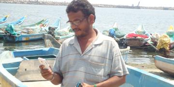
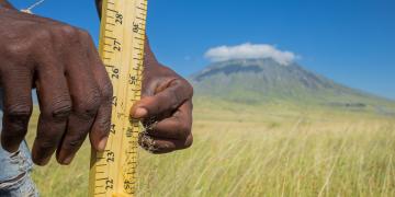
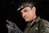
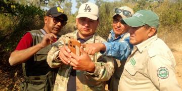
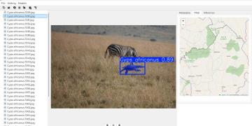
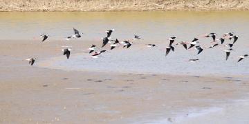
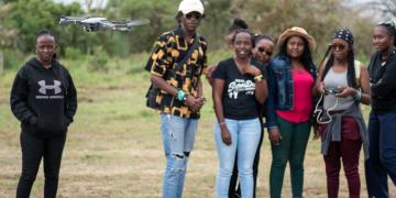
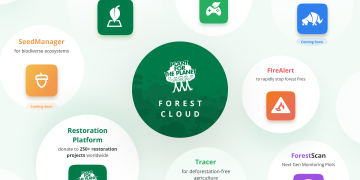
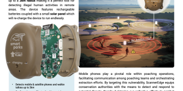
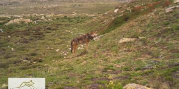
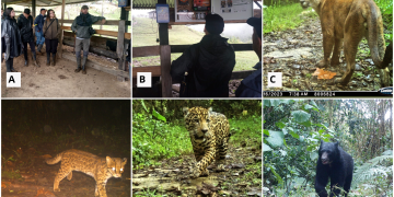
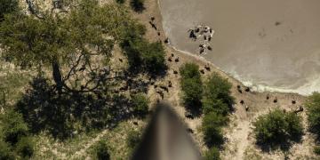
The Tech4Nature Award celebrates the power of digital technology to transform conservation. From tools that monitor wildlife and restore ecosystems, to innovations empowering Indigenous Peoples and local communities — these Solutions show how technology, guided by purpose, can help safeguard nature for future generations.

All entries were submitted through the PANORAMA platform, as part of the inaugural Tech4Nature Award, launched under the Tech4Nature partnership between the International Union for Conservation of Nature (IUCN) and Huawei’s TECH4ALL programme. 

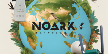
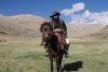
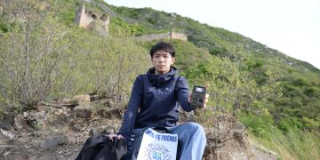
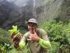
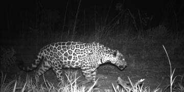
This compilation showcases a diverse range of PANORAMA Solutions — creative, practical, and inspiring stories from around the world. They remind us what’s possible when technology is guided by purpose, and when communities are at the heart of conservation. Explore the collection, discover the changemakers behind these ideas, and be inspired by how innovation can catalyse conservation action.

DIS drone
East and South Africa
Caribbean
Central America
South America
West Asia, Middle East
Southeast Asia
South Asia
East Asia
Oceania
Jane
Glavan
Modular Drone Technology
Licensing and Training Platform
AI-Powered Monitoring, Reporting, and Verification (MRV) System
Cost-Effective Restoration Processes
Fisherman from Kasimedu village see FFMA to access earlywarning for fishing
A multi-stakeholder partnership facilitate the successful journey of FFMA
Multi-pronged capacity building efforts is essential for sustain the interest of fishers to effectively utilize and take the Fisher Friend Mobile Application (FFMA) forward.
Hands hold a measuring tape with grass and a mountain in the background
East and South Africa
Neovitus
Sianga
Access & Connect with the Community
Team & Implement
Verify
Evolve
Drone crocodile surveys
West and Central Africa
North Africa
East and South Africa
Caribbean
Central America
South America
North America
Southeast Asia
South Asia
Oceania
Clément
Aubert
1) Standardized Drone Survey Protocols
2) Estimating total length of crocodylians from drone-captured images by using a model
3) Allometric Framework for Crocodilian Size Estimation
4) Empowering Local Stakeholders through Drone Technology
5) Evolution of on-board technologies and AI integration
Community guardians
Guarani roots and wisdom
SMART Technology for Monitoring and Surveillance
Territorial governance
White-backed Vulture
West and Central Africa
North Africa
East and South Africa
Stanislas Mahussi
Gandaho
AI-powered vulture species recognition model
Open-source software for vulture monitoring
Hybrid training & conservation advocacy
MLP logo
Robust scientific database
Mobile application and online platform
Data and knowledge sharing
Two men and one woman standing in a row looking down at ForestLink on a smartphone
West and Central Africa
South America
Louise
Cordery
Co-Designing Solutions with Grassroots & Indigenous Partners: Strengthening Community-Led Action for Inclusive & Sustainable Development
Flexible, Community-Centered Reporting & Monitoring System for Real-Time Accountability & Impact Tracking
Strengthening Multilevel Advocacy Networks Among NGOs to Amplify Collective Action
Empowering Communities Through Sustainable Livelihoods and Equitable Access to Economic and Environmental Justice
Grus japonensis in Jiangsu Yancheng Wetland & Rare Birds National Natural Reserve
Data collection
Wetland Vegetation Type Identification
Data Quantification and Database Establishment
Spatial and Temporal Characteristics Analysis of Wetland Vegetation
Key Drivers of Vegetation Evolution
Academic Communication
Training and Capacity Building
The comprehensive LoRaWAN network
East and South Africa
Sophie
Maxwell
Filtering data types and onward rooting
Transporting data from the field to the operations room
Centralising data for management and control
Technical support and training
Community engagement
Participants learn to fly drones
Forming partnerships with local institutions
Identifying impactful mentors, trainers, and allies
Developing core adaptable training materials
Focusing on hands-on engagement
Strengthening early career potential
Unlocking future impact: Funding and professional development
Forest Cloud suite
West and Central Africa
Caribbean
Central America
South America
East Europe
Maximilian
Schmid
Forest ecosystem restoration and conservation platform
Organization due diligence and project verification
Improved monitoring and reporting efforts for restoration
Strengthening community engagement and expert knowledge
Scanneredge-Onepager
West and Central Africa
North Africa
East and South Africa
North and Central Asia
West Asia, Middle East
Southeast Asia
South Asia
East Asia
Stan
Russell
Technical Installation and Training
Mobile/Satellite Phone Monitoring
Quick Response Unit acting on suspicious threats based on real-time data
Building Cross sectoral Partnerships
A dog with a GPS tag beig petted by the Club's students
West and Central Africa
East and South Africa
Francisco
Gouveia
Empowering Local Youth as Conservation Stewards
Hands-On Conservation Tech in STEM Learning
Co-Designing Education with Local NGOs and Schools
Building STEM Foundations for Digital Literacy
This is a drone monitoring shot of an Asian elephant. Through monitoring, we have recorded a great deal of Asian elephant behaviour in the wild.
Module 1: Monitoring Coordination and Technology Integration
Module 2: Drone and Infrared Camera Monitoring System
Module 3: Optimization of Big Data and Intelligent Recognition System
Module 4: Supporting Monitoring and Early Warning Platform
Module 5: Community Awareness and Early Warning Promotion
Mandatory Group Class Session: Outdoor Mindfulness
Empowering Youth through Conservation Education: The Ranger Goes to School (RGTS) Program
Connecting with Komodo: Building Place Attachment for Conservation Leadership
NoArk
WildGuard AI Sensor Ecosystem (Bio-Acoustic + Chemical + Climate Sensing)
Edge AI + LoRaWAN Infrastructure
PAMS Dashboard + Community Co-Design
The red point in (a) is a key staging site for migratory waterbirds, located in the east coast of Dongtai City, Jiangsu Province, China. The study site TZN720, the red square in (b), is a restored wetland and the monitoring site within the Tiaozini wetland; the red dots in (c) show the location of the 10 surveillance cameras; (d) shows the setup of a surveillance camera; and (e) is a panoramic view of TZN720 obtained from the cameras.
East Asia
Yifei
Jia
Create and manage a high quality roost site for shorebirds
Video surveillance monitoring of waterbird communities
This is just an image depicting the tool
Conservation MSME Development Programme
Inclusive Work Opportunity Facilitation
Strategic Partnerships for Scalable Impact
Grasshopper Digital Tool for Conservation MSMEs
Green Platform for Green Opportunities
Grasshopper adoption among MSMEs
Himalayan wolf captured by camera trap set by HWP
Technology deployment and field monitoring
Capacity Building through Community Conservation Groups (CCG)
Livestock protection infrastructure building
New Granada cross-banded tree frog sleeping on a leaf in the Colombian Chocó region
East and South Africa
Caribbean
Central America
South America
North America
North and Central Asia
West Asia, Middle East
Southeast Asia
South Asia
East Asia
West and South Europe
North Europe
East Europe
Oceania
Juliana
Gómez Consuegra
Democratization of data
Citizen science and community engagement
Mitigate biodiversity loss
Education tools
Adam shoots wild animals at the foot of the Great Wall situated in the suburbs of Beijing all year round and posts his photographic works on Wildlife Friends
East Asia
Adam
Gao
WeChat Mini Program Development
Processing of Numerous Infrared Images Driven by AI Species Recognition
Connection with Citizens
Interactive Interface for Citizen Scientists
Water level sensor
Foundation - Consultation with stakeholders, identify and prioritize suitable device, platform and network to be applied at MPNR for efficient wetland monitoring
Deployment - Partnership with local Government Department - Electrical and Mechanical Services Department (EMSD) for the utilization of Government-Wide IoT Network (GWIN)
Dissemination - To promote the application of IoT technology on wetland management
Rare cliff endemic and critically endangered Lysimachia iniki being collected by the Mamba sampling arm at its type locality on Kauai
East and South Africa
West and South Europe
Oceania
Ben
Nyberg
Drone Survey: location, mapping, and inventory of remote plant populations
Drone Collection: Using a drone-based robotic arm to collect inaccessible plants
Plant Propagation: increased efficiency with improved collecting techniques
A & B. Demonstrative solar-powered electric fences and motion-sensor lights to mitigate predation; C. Cougar; D. Oncilla; E. Antonio jaguar (rediscoverd for the andean area of the Cauca Valle department) F.  Spectacled bear recorded by Camera trap
Development of a transdisciplinary plan for managing human–jaguar interactions at the regional scale in the DRMI Serranía de los Paraguas
Implementation of community-based monitoring of jaguars and ,mammal diversity using camera traps
Applying a behavior change approach to address human dimensions related to jaguars in strategic areas where the species is present
Implementation of adaptive livestock management strategies on farms adjacent to water source protection forests and public and private reserves
In this image, one can see a monitored jaguar moving in one of our study areas.
South America
Letícia
Benavalli
Community-based conservation training
Technology-enhanced wildlife monitoring
Ecotourism development
Collaborative land management planning
Gender integration in conservation
A vulture's view into the ecosystem (composite image)
Understanding scavengers, predators, their communities, ecosystems and conservation challenges
Advancing animal-borne remote sensing, GPS tracking and monitoring
Artificial intelligence(s) for behaviour recognition, carcass detection and image recognition
Developing a new generation of animal tags and concepts for a digital swarm intelligence in networks of devices
Establishing a satellite-based IoT communication system
Integrating zoological gardens and animals under human care into a science- and technology-driven research and conservation project
Local capacity building for implementing and upscaling the solution
WECPD Website Landing Page
Open-Source Data Aggregation Tool
Interactive Visualization Platform
Federal Case Monitoring System
Policy Evaluation Framework
Stakeholder Collaboration Portal
Aerial view of Guayabillas community landscape, one of the pilot sites where NFTree’s DAO-based governance and conservation finance model is being implemented.
South America
Nicolas
Maldonado
Decentralized Local Governance via DAOs
Blockchain-based Conservation Tokens
Digital Monitoring, Reporting, and Verification (MRV) System
Community-Inclusive Conservation Incentives
Ecosystem-Based Economic Trade-Offs
DNA analysis of mammals' scats in order to determine their food web
Localized Reference Library Development
Advanced DNA Barcoding and Metabarcoding Techniques:
Strategic International and Academic Partnerships
Stakeholder Engagement and Knowledge Mobilization
Capacity Building and Regional Training Programs
Sensors and Weather Data
West and South Europe
Panagiotis
Apostolopoulos
Comprehensive Data Ingestion for Fire Detection
Spatial Intelligence for Wildfire Management
Stakeholder Communication & Wildfire Awareness
Core Technologies & Supporting Infrastructure
Protecting Ecosystems Through Fire Prevention Technology