Measuring the Impacts on Ecosystem Services

The objective of this building block is to provide developers and implementers of ecosystem and landscape restoration projects with a tool that uses remote sensing, augmentation factors, and the integration of the two as a way to evaluate the effectiveness of restoration interventions on the ground.

To evaluate the line of impact of ecosystem services based on remote sensing, baseline data (baseline, management units and recent images) are collected and the differential between the initial and final year is calculated through: the definition of the increment tables, the normalization and adjustment of images, and the modeling of ecosystem services.

The increment factor approach is used for cropland and/or livestock where spectral indices derived from satellite imagery fail to accurately detect vegetation changes; and is calculated through: definition of baseline data, categorization of restoration practices and estimation of increment factors per implemented measure.

By executing this process, the area directly and indirectly impacted is available.
  • Have a baseline with the same variables and geospatial models to make credible and reliable comparisons over time.
  • Have a database of management units that clearly reflects the restoration actions that were executed in the field.
  • Implement a training and capacity building process with an assigned advisor, where doubts and uncertainties about methodological aspects and technologies to be used are resolved, which facilitates their adoption.
  • The databases that include the restoration measures in the territories should be reliable and preferably have been verified through supervision and control of data in the field.
  • If the developers and executors of restoration projects implement these methods in different areas, it is important to homogenize the variables, their treatment and the scale at which they execute them.
Policy Dialogues or Workshops

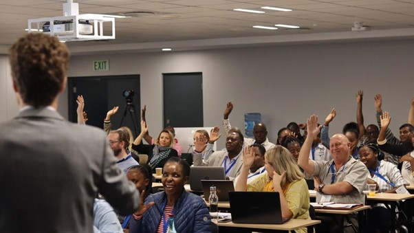
A dialogue or workshop with governmental stakeholders to present case studies or solutions that could be incorporated into national policies.

An ongoing collaboration with the national government and close communication about various project updates that are beneficial for policy.

Conducting panel discussions or FGD has been shown to facilitate dialogues between the public and private sectors. Such discussions are important for information accessibility to the private sector, while also influencing policies that are not resistant to project goals.


For instance, the carbon market workshop was significant in elaborating the Ministry of Environment and Forestry (MoEF) plan on the Indonesian Carbon Market. Elaborating projects such as the biogas initiative early on is necessary to ensure smooth implementation once the policies are ready.

Implementation in stages

The works were carried out progressively: 3 phases spread over 3 years to achieve the desired structure and respect the ecological dynamics of the site, given that the stations are different according to altitude.

  • A first phase in year 1 concerning the summit part of the site.
  • A second phase in year 2 concerning the middle part.
  • A third phase in year 3 concerning the lower part.

The cuttings are carried out in a "centrifugal" manner. We start at the edges and gradually move away from them. This ensures that only what is necessary is cut.

The landscape gardener monitors the cuttings "live" from another vantage point, facing the slope, to adjust if necessary.

It became clear that the presence of the landscape gardener was essential to the successful completion of the work and to the proper application of the original plan.

The results after 3 years are satisfactory, but require long-term monitoring. A posteriori, a photographic observatory of the evolution of the right-of-way should perhaps have been set up for more precise monitoring.

Monitoring and management recommendations

Based on the results of the various protocols implemented in the Chriopt'îles project, management recommendations were formulated by the GCOI and presented to the TAAF, managers of the Eparses Islands.

Based on acoustic analyses and the hostile environment on Tromelin, the island does not appear to be home to any chiropteran species. No recommendations for management or further study are envisaged.

Despite the absence of chiropteran sounds in Europa's acoustic analyses, its history and local context suggest that chiropterans could still be present. It is planned to re-deploy the passive listening protocol over periods based on the dates of historical observations. Management recommendations will be made following this research.

2 species of chiropteran have been recorded on Grande Glorieuse, including the Taphien de Maurice and an undetermined species. The renewal of the passive acoustic protocol is envisaged in order to improve knowledge of the occupation of the territory by these species. Monthly visual monitoring of the coconut grove at the life base is also envisaged. The management of invasive exotic species on Filaos or Coconut trees must take into account the presence of these two species.

  • Obtain representative results from the various protocols implemented

  • Organization of a meeting during the project with the TAAF to discuss feasibility, technical, logistical and human constraints relating to the recommendations.

  • Organization of a feedback meeting with the Prefect of the TAAF, Mrs. Florence JEANBLANC-RISLER, to present the established recommendations.

  • TAAF welcomed and approved the management recommendations.

  • Willingness of both parties (GCOI and TAAF) to continue the partnership by considering a follow-up to the project.

  • Establishment of a working partnership between GCOI and TAAF

  • Development of management recommendations for each of the islands studied, based on the overall results of the project.

  • Willingness to pursue the acquisition of knowledge concerning the chiropteran assemblages present in the Eparses islands.

Passive acoustic listening protocol

On each island concerned by the project, 2 SongMeter mini bat ultrasonic recorders were deployed during 2 listening sessions by 7 agents from the Terres australes et antarctiques françaises, previously trained by the GCOI in their use. The two listening sessions took place in winter (December-January) and austral summer (July-August), based on knowledge of the Taphien of Mauritius. Positioned for 5 nights, in 4 pre-selected habitat types, 20 listening nights per recorder and per session were recorded. In all, 240 listening nights were recorded on all the islands.

Sampling plans were based on data on the different types of environment present on the three islands, supplied by the Conservatoire Botanique National de Mascarin.

Once the recordings had been retrieved, the data were processed using a fixed-point protocol derived from the VigieChiro system managed by the Muséum National d'Histoire Naturelle in Paris, enabling the chiropteran species recorded in the sound files to be determined. Once the sounds had been processed automatically, a manual acoustic analysis was carried out by GCOI employees to identify any species not detected by the software.

  • Training of TAAF agents by the GCOI in the use of recorders

  • Involvement and autonomy of TAAF agents in setting up the protocol

  • Cooperation with CBNM to provide data on the types of environment on each island studied.

  • Cooperation with MNHN to adapt the fixed-point protocol to a study area other than metropolitan France

  • Involvement of GCOI employees in sound processing and analysis, and in drawing up management recommendations adapted to the results of the study.

  • Presence of two chiropteran species on Grande Glorieuse

  • No chiropterans on Tromelin

  • Doubt as to the presence or absence of chiropterans on Europa

  • Good partnerships with TAAF, CBNM and MNHN

3. Action planning based on the outcome of the SAGE assessment

Development of an action plan after the SAGE process was very crucial as it ensured that recommendations provided in the SAGE process were addressed in a systematic and targeted manner whereby key stakeholders who participated in the SAGE process were also engaged in the action planning process hence, they drew the roadmap for implementation of those recommendations.


In addition, recommendations which came out of the SAGE process informed Honeyguide on areas of priority in designing WMA governance capacity building programs.


The overall successful preparation of an action plan after the SAGE process required the following;

  • A clear understanding of the assessment findings and recommendations provided
  • Clear goals and objectives to be achieved
  • Strong leadership and coordination with key stakeholders
  • Adequate resources
  • Willingness and commitment from all key stakeholders.

Overall success of the action planning phase based on the outcome of SAGE process provided an opportunity to learn important lessons related to;

  • Keen selection and active engagement of key stakeholders in the planning process
  • Thorough understanding of the local context
  • Effective prioritization and goal setting by all key stakeholders
  • Inclusiveness of all key stakeholders in adequate resource mobilization

These lessons learned can be used as a good source of information to future development planning and programming organs of the WMA and can help to ensure that development interventions are effective, inclusive, and sustainable over the long term.

Monitoring and empowerment of IGAs

This corresponds to the individualization phase of the IGAs. Each member, having identified the activity that corresponds to him or her, breaks away from the group and sets up on his or her own. Close monitoring and evaluation of the IGAs developed by these communities is carried out with the aim of refining members' knowledge of their respective activities and minimizing production losses.

Overall, it enabled us to identify any shortcomings that had not been observed during the implementation phase:

- Communication on the progress of activities

- Proximity to markets and major towns, to enable crops to be sold off

- Optimization of cucumber yields

Among other things, the general objectives were to

- Allowing communities to choose with whom they would like to work in pairs.

- The transfer of experience from other members of neighboring villages on how to monitor an IGA.

Community collaboration and involvement

Collaboration with the local population has been a major factor in the success of anti-poaching operations, and must be maintained in order to strengthen confidence and build up the sources of intelligence essential for well-targeted actions in the Protected Areas (PA).

The objective of restoring public confidence in the security and defense forces (FDS) and creating a climate of serenity was 100% achieved under the project. The mixed units not only had access to eco-guards from the communities, but were also able to interact with the local population, exchanging ideas and restoring their confidence. This contact between the mixed units and the local populations was a unique opportunity that should be repeated.

Contact cells (intelligence cells) from the communities were also set up, with the overall mission of infiltrating the area covered by the PONASI complex in order to detect any suspicious poaching or criminal activity, and to quickly pass on information, process and analyze it, and initiate action or have it initiated.

  • Community participation in anti-poaching operations with village-based eco-guards,
  • Community participation in information-gathering operations through village-based community intelligence networks.

Ongoing inter-action between mixed anti-poaching units and local populations ensures better coverage of the landscape and faster results in protecting and securing Protected Areas.

Men's training

Training was a key factor in the success of anti-poaching operations.

The different elements did not have the same working procedures, the same work rhythm or the same rigor.

The men all received technical and tactical training, as well as knowledge of wildlife and the forest environment. This training was highly beneficial, enabling the men to reinforce their knowledge in various fields (forest combat, combat first aid, IST, ISTC, navigation, operational motorcycle driving, camp defense, logistical and operational mission preparation, RETEX, etc.). A total of 10 operational training modules are delivered each time a force projection is planned.

The capacity-building achieved through the operations supported by the project should be maintained for future operations, as it fosters close collaboration and a climate of trust between the various units deployed.

  • The same training for all planned units,
  • Better coordination,

When the components of mixed units receive the same training, everyone knows their role better, and command and action in the field are more effective.

Strong involvement and collaboration with government services in the implementation of a joint anti-poaching ap-proach.

Throughout the project, the involvement and collaboration of the administrative, military and paramilitary authorities representing the State has enabled the launch of large-scale joint anti-poaching operations capable of dissuading any desire to occupy the Protected Areas, given the level of insecurity.

This strong involvement of the State has enabled the various local security actors (FDS) to come together around the same table, bringing them to federate their efforts to achieve common goals.

The army's full collaboration in these kinds of activities is essential, and was a reality in the context of this project, enabling all members of the mixed units to be equipped with protective gear, weapons and ammunition.

- Bringing together the various players in local security (FDS) around the same table,

- Logistics and pooling of resources (financial, material and technical),

- Coordination of activities

The logic of a global approach combining the forces available is adapted to the specific terrain of Protected Areas, enabling the reconquest and complete control of these protected areas, which are still too often inaccessible, a necessary condition for securing the wider landscape.