Understanding the problem

We organized expert workshops to build a common base of the understanding, what ecological connectivity means and how we define it on a landscape level in different sectors (e.g. agriculture, forestry, urban planning).

Only in a second step methods, procedures and data were defined and implemented.

An important factor for success was the ability to moderate between the individual representatives so that common solutions could be found.


The process to bring all project partners from different countries to a common understanding and acting takes longer than the (technical) implementation itself.

Once, the first step is done and fully accepted, the technical solution can be developed on a solid basis.

Effective Customer Services

Effective customer service is achieved through the development of an online payment system and customer service enabled mobile app (currently under development). These measures enable clients to interact with the service, submit applications, requests, and payments and even look for any upcoming value chain services.

The existence of a mobile-based payment system and customer service app, enables the customers and other actors to interact with the service providers providing valuable feedback on the kinds of services they demand, hence increasing the effectiveness of service delivery.

The community we are serving is urban and trending towards high levels of smart phone ownership and internet access.

Service delivery through mobile-based applications enables information to be passed easily to users. This has helped increase community awareness of proper waste management practices.


The majority of the community we intend to serve are conversant with the mobile-based payment system in Kenya and thus, the mobile-based text (USSD) has helped facilitate the services where smartphones could not reach.


Some youths and women we target to subscribe to the franchise model of the waste collection are technologically shy and require encouragement.

Production of scientific knowledge

The Mamirauá Institute provides scientific knowledge inputs to local communities and this is relayed to communities and indigenous peoples, applying Conservation Area governance processes. 


This knowledge arises from 4 lines of action:

  1. Environmental education
  2. Environmental protection
  3. Strengthening the community
  4. Communication within the community 

The production of knowledge seeks to create medium and long-term solutions.


  1. Respect and dialogue: The knowledge generated is given to the communities but not imposed on them. They are the ones who decide whether the proposed strategies are implemented.


  1. Each community and group is different and one should never assume that what works for one community will work for the neighbouring community. (These are not replicable models.)
  2. Contexts, leadership and ways of working vary. If these differences are not taken into account, conservation processes become complicated and even impossible to develop. 
Working closely with the community

Working closely with the community respects the diversity of traditions, acknowledging elements of a backward nature.


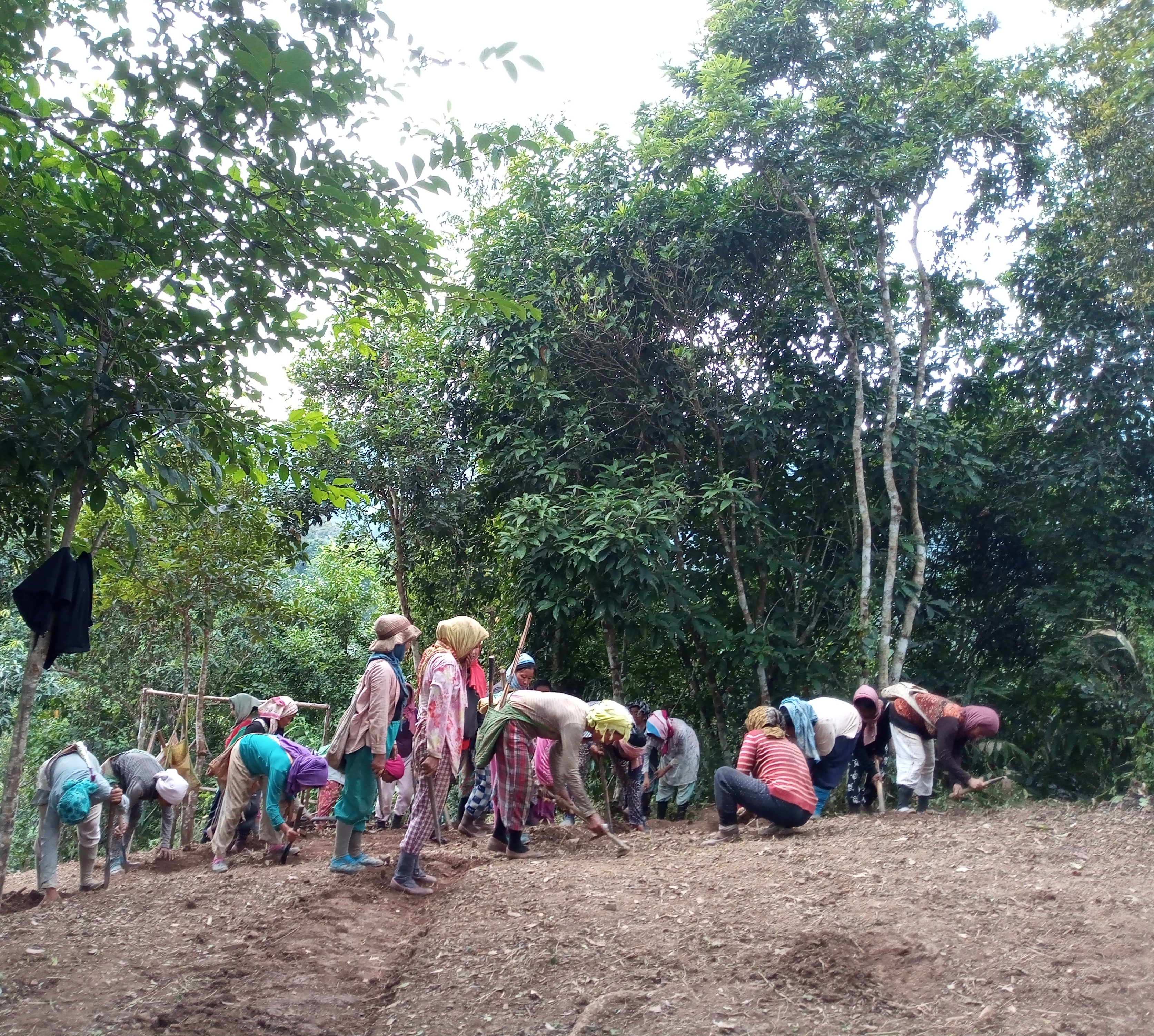
The community work must begin with the interests and needs of the community itself; the work should act as the protagonist in the solution to problems.


The purpose of the governance processes that the Institute applies is to facilitate communication processes between the organization and the communities, using methodology based on inclusive management workshops.


  1. In the Brazil region, it is known that nature conservation is 90% related to local communities. Bearing this in mind, the Institute is building relationships and creating a long-term work plan.
  2. The bonds of trust that are established with the communities are crucial to being able to work closely with them.
  3. Government governance processes
  4. Governance processes in indigenous and community-based conservation areas.
  1. Several organizations have participated in initiatives in an effort to ensure conservation in and development of communities. However they have not been able to do so because they have not been able to understand and respect the communities.
  2. Various organizations still do not understand that 90% of conservation projects involve communities and indigenous peoples
  3. It is important to work hand in hand with government governance processes; effective management of the territory will be achieved by involving stakeholders.
Formulated a specific Working Plan

In 2017, Guizhou Province formulated the Working Plan for the Full Implementation of the “River Chief System", according to the Recommendation on the Full Implementation of the “River Chief System” issued by the General Office of the State Council of the People's Republic of China in December 2016. The Working Plan clarifies the overall requirements and specific work objectives at each stage. The plan emphasizes the five working principles to be adhered to when implementing the “River Chief System”, including i) giving priority to ecology; ii) being led by government and participating in the public; iii) problem-oriented and implementing policies based on actual conditions; iv) overall planning and systematic governance; v) supervision and strict assessment according to law.


Huangguoshu Scenic Area have further refined the work plan, such as establishing Dabang River Basin Management and Protection Plan and Implementation Plan for Law Enforcement Inspections and Popular Science Education, holding several seminars on water supply safety, carrying out a series of work measures on the Dabang River Ecological Day, comprehensive investigating the river ecological status, promulgating the Notice on the Non-governmental River Chief, etc.

  1. Set a clear overall objective: to establish a management and protection mechanism with clear responsibilities, orderly coordination, strict supervision, and strong protection.
  2. Propose specific action plans: 11 specific plans were given, including planning management, water sources protection, sewage prevention, ecological restoration, improvement of laws and regulations, supervision and enforcement, information disclosure and social supervision, etc.
  3.  Set up special funds to ensure the effective development of the “River Chief System”.
  1.  Fully consider the public and stakeholders: Local residents are very important stakeholders. The tasks of the Working plan should not only emphasize the responsibilities of government departments, but also pay attention to the participation of the general public and stakeholders.
  2. Establish long-term and short-term goals: The Working Plan clarified the specific goals for 2017-2020, in addition to establishing the long-term goals.
  3. The Working Plan shall base on the regional background conditions: After considering its provincial situation (that is, there are many small rivers in the mountainous area), Guizhou Province proposed a five-level River Chief System (including province, city, county, township and village) based on the four-level River Chief System (including province, city, county, and township) promoted by the country.
SeaSketch Surveys to Assess Ocean Use

SeaSketch has features to develop and deploy spatial surveys that, for example, ask ocean users to identify valued or important areas (locations important for fishing, shipping, diving, aquaculture, traditional uses, etc.). Survey results may be used to create heatmaps that describe the distribution of valued areas. These results may be visualized (or not) and analysed when users draw prospective ocean zones to understand the potential value and impact of zoning scenarios. 

Currently, SeaSketch surveys only work on a desktop computer with Internet connection. It does not work offline or on mobile devices. (The next version of SeaSketch which will be launched in January 2022 will be compatible with mobile devices. Shortly thereafter it will also work in an offline mode). So, plan on conducting surveys in an Internet-connected environment and using a desktop computer. 


In many cases, surveys will require facilitation, particularly when the general population does not have personal computers. 

While it's easy to develop a survey in SeaSketch, it's not always easy to do it from a scientifically defensible perspective. Consider working with a social scientist who can help you create a survey that uses well-established survey techniques. 


Consider training a team of survey facilitators that can survey the local populations in person by meeting them at the docks, beach, cafes, institutions, etc. These facilitators should be trained in communicating the structure of the planning process and, in particular, how survey responses will be treated and used in planning. 


Keep surveys very simple. The simpler the survey, the higher response rate you can expect. Scientists and planners are often keen on gathering as much information as possible from stakeholders. Resist the temptation to ask more questions that you absolutely need to properly engage stakeholders and do marine spatial planning. 

Authoritative Geodata and Map Services

The foundation of any SeaSketch project is geospatial information (maps) displayed as map services. There are no minimum data requirements. You can begin working with whatever you've got. Maps may be published as Esri REST Services (e.g., with ArcGIS Server or ArcGIS online) and open source mapping services (e.g., WMS, WMTS) and then imported into SeaSketch. Example maps include administrative boundaries (e.g., EEZ, territorial sea, existing MPAs), seafloor habitats, bathymetry, human uses, etc.


The maps you choose to include as Data Layers in SeaSketch depend on the goals of your process. If you are planning for marine protected areas, shipping lanes and aquaculture sites, you may want navigational charts, habitat maps, the distribution of fishing activities and other layers that may be used to guide users in the design of their plans. Protected areas are only meaningful if they effectively protect certain habitats, shipping lanes minimize collision and maximize efficiency, aquaculture sites are located in certain depth zones, etc. On a case-by-case basis, you will need to evaluate what data need to be viewed as maps, and what subset of these data need to be analysed.


In some cases, relevant map data may already be published as map services and discoverable in coastal atlases and other map portals. As long as they are in the correct formats (Esri map services, WMS, WMTS, etc), they may be imported directly into SeaSketch and displayed as map layers. 
 

In many cases, it will be advantageous to publish your own map services for display in SeaSketch. This will give you control over the cartography and performance of the maps.

Successful projects usually have a single GIS technician who is responsible for locating existing map services, acquiring data from providers (government agencies, NGOs, academics) and generating new map services using standard desktop and web-mapping tools. 

Government Buy-In for Collaborative Planning

SeaSketch is designed to be used primarily for collaborative planning. We've focused on Marine Spatial Planning, but the software can be used for terrestrial planning as well. Furthermore, the software is intended to help generate ocean zoning solutions. If these zones are to have a meaningful impact, such as conservation or benefits to the blue economy, there needs to be buy-in to the planning process by the host government institutions. If zones developed in SeaSketch are not legally adopted, they are less likely to have the desired effect. 

A legal mandate for marine spatial planning is essential, without which plans are unlikely to be adopted. Furthermore, successful implementation of SeaSketch requires a genuine commitment to stakeholder engagement at various levels. It is one thing to set up a SeaSketch project with maps, sketch classes, forums and surveys, but it is another thing entirely to structure a planning process so that SeaSketch is used by stakeholders. One must create an accompanying stakeholder engagement plan to ensure stakeholders make good use of the tool.

A legal mandate for collaborative marine spatial planning and that maximizes stakeholder participation is essential. Without a mandate and a timeline for planning, one can plan for ages without generating a zoning solution. Simply having collaborative planning tools will not ensure that stakeholders will be engaged or that solutions reflect a variety of stakeholder interests. 

SeaSketch Software as a Service

In most cases, SeaSketch is used to support large-scale planning efforts where governments have mandated the establishment of a marine spatial plan and where broad stakeholder involvement is essential. In these cases, SeaSketch must be licensed by a lead agency or partner. SeaSketch may be used to visualize geospatial data as map services, collect to information via surveys, sketch and discuss plans. If plans are to be evaluated using analytics, geoprocessing services and reports must be developed in our lab. Note that a free license is available for educational institutions to use SeaSketch for strictly educational purposes.


In January 2022, we will release the next version of SeaSketch which will be entirely free and open source. Just as with the current version, many of the features within SeaSketch may be configured with minimal knowledge of or experience with GIS. The analytics and reports will be run on lambda and encoded using programming languages such as Javascript. Owners of projects may, therefore, set up their own SeaSketch project – from beginning to end – without intervention from our lab. It should be noted, however, that the geoprocessing and reporting framework, though free and open source, will require significant programming experience.

Currently the implementing agency (such as a government body, foundation or NGO) must purchase the license and contract for developing analytics. The current version requires an Internet connection, but the next version will include some offline capabilities. Successful implementation of SeaSketch will require some assistance from a GIS technician, for example publishing and importing map services. 

SeaSketch is extremely valuable in creating a transparent and collaborative atmosphere, maximizing stakeholder participation, and grounding decisions in science-based information. We see the best results when SeaSketch is used in combination with other tools such as desktop GIS applications, trade-off analyses, prioritization tools (e.g., Marxan, Prioritizr), and cumulative impact analyses. 

Sustainable heritage tourism

Soqotra is a “must see” tourism destination, all the more so as it is difficult to reach and is hard work when you arrive. Local tourism infrastructure is not well established, and local actors offer very similar and restrictive opportunities to visit a small number of localities.

The Soqotra Heritage Project sought to change this behaviour through documenting sites and practices and compiling a broader itinerary that could offer added value to tourists, local actors and global operators while at the same time increasing the conservation of sites and localities through diversification.

Sustainable heritage tourism is now being discussed again as a potential livelihood enhancement mechanism on Soqotra while at the same time addressing potential mechanisms to input directly into heritage conservation measures.

Involvement of expert sustainable tourism consultant (Carey Tourism) with knowledge and experience in this specific geographic context and with regional experience in less well known locations.

This required to gain and ensure access to tourism stakeholders at all levels.

It is extremely challenging to work on re-invigorating sustainable tourism ideas in a location with poor infrastructure and enforcement, with very limited travel options, and under a conflict scenario nationally with little access to regional and global stakeholders beyond the direct tourism industry makes it extremely challenging to achieve practical and measureable outcomes.

This is a work-in-progress.