Digital Monitoring, Reporting, and Verification (MRV) System
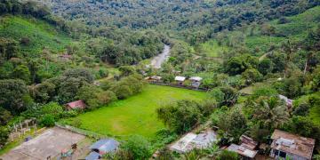
NFTree deploys a robust Digital MRV system that combines satellite imagery, drone-based observation, artificial intelligence (AI), and community-sourced data to measure carbon stocks, forest productivity, and biodiversity. The system processes spatial and biophysical data using tools like Google Earth Engine and machine learning models to detect forest changes at high resolution. Community-based monitoring complements technological inputs to validate and enrich ecological datasets. This multi-source approach ensures transparent reporting, boosts credibility with buyers and donors, and enhances local engagement in conservation efforts .
High-resolution satellite and drone imagery, accessible through platforms like Google Earth Engine.
AI models co-developed with academic and technical partners.
Consistent local ground-truthing efforts.
Digital infrastructure for data storage, visualization, and public access via platforms like nftree.com.ec.
Combining remote sensing with local monitoring increases accuracy and community trust.
AI models require region-specific calibration and ongoing validation.
Transparency and access to MRV data empower communities and improve funder confidence.
Training for local actors is key to sustaining long-term monitoring efforts.
NFTree tokenizes plots of 10x10 meters within conservation areas, using blockchain technology to create unique digital assets that represent ecological value, including carbon and biodiversity indicators. These NFTs are embedded with monitoring data generated by the dMRV system and are linked to geo-referenced locations. Each NFT is assigned a traceable identifier and linked to the DAO governance model, which regulates the reinvestment of funds. The proceeds from the purchase of NFTrees are allocated through a fiduciary fund to support the management and restoration of priority areas defined by the DAO statutes.
Availability of high-resolution geospatial data and MRV systems
Smart contract infrastructure on blockchain (Polygon, Cosmos)
Established governance structure (DAO statutes)
Legal and fiduciary framework for fund administration
Transparency in how tokens are defined and sold is key to user trust
Combining scientific modeling with blockchain improves integrity
Co-design with local actors ensures acceptance of tokenized units
A legal trust ensures transparent fund allocation aligned with conservation goals
NFTree promotes the formation of decentralized autonomous organizations (DAOs) that operate as governance bodies co-designed with landowners and local actors. These DAOs are formalized through statutes that outline voting rights, membership, responsibilities, and procedures for fund allocation and monitoring. In places like Guayabillas, the DAO is adapted to local contexts and integrates with existing instruments such as community meetings. These governance structures enable transparency, local prioritization of conservation areas, and collective oversight of restoration and MRV efforts. NFTree incorporates digital tools to manage the DAO on-chain, while also maintaining analog mechanisms when needed due to technological constraints.
Collective drafting and validation of DAO statutes with landowners and community stakeholders
Local capacity-building workshops and onboarding sessions
Integration of customary governance and ecological priorities
Use of open-source platforms like Aragon for DAO governance
Alignment with local conservation planning (e.g., management plans)
Participatory governance processes strengthen trust and long-term commitment
Co-design of statutes enhances local legitimacy and clarity on rights and roles
Hybrid digital-offline governance models improve accessibility and inclusion
Transparent, consensus-based fund allocation boosts engagement and accountability
Digital Monitoring, Reporting, and Verification (MRV) System
Community-Inclusive Conservation Incentives
Ecosystem-Based Economic Trade-Offs
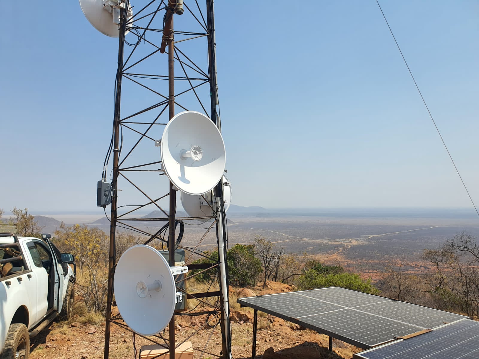
Transporting data from the field to the operations room
Cisco LoRa gateways enable low-power, long range sensors
Madikwe Futures Company
From soil moisture and water levels to animal migrations and habitat health, data from sensors travels via Cisco LoRaWAN gateways and Actility’s ThingPark™ Platform to central operations rooms, where platforms like EarthRanger provide a comprehensive 360-degree view of ecosystem health and threats. Previously, these have been donated by Cisco Inc. These LoRaWan gateways now support over 800 IoT sensors across protected areas.
When using LoRaWAN, data is transmitted wirelessly to a gateway. The gateway listens for the corresponding signals and transmits them to a LoRaWAN network server, which is connected to the Internet.
Deploying a LoRaWAN network is quicker and much more accessible than setting up a conventional cellular system.
Operation requires minimal infrastructure. Setting up cables and making connections to the power line is not required. Network design and optimisation are also simplified, as with one gateway, you can cover a larger area very effectively.
Reliable and long-term : The gateways are robust and come with a 7-year warranty, offering peace of mind and operational security for protected area managers working in harsh and remote conditions.
Unmatched coverage in rugged terrain: LoRaWAN technology continues to outperform alternatives in remote and rugged landscapes, providing extensive and reliable coverage across challenging terrain where cellular connectivity is limited or non-existent.
Seamless regional asset tracking: The system supports device roaming, allowing for uninterrupted tracking of assets across different regions without manual reconfiguration—an essential feature for mobile wildlife monitoring and conservation equipment.
Cost-effective: By leveraging low-cost, commodity-based hardware and integrating standard radio modules, LoRaWAN devices reduce overall deployment costs significantly. Compared to cellular or Wi-Fi-based solutions, this makes wide-area sensor networks more financially accessible for conservation teams.
A scalable and sustainable alternative: With its low power consumption, long range and minimal infrastructure needs, LoRaWAN provides a sustainable alternative to satellite communication. It enables real-time environmental monitoring in even the most isolated locations.
Widespread adoption for Conservation: Outside of this partnership, over 200 protected areas across the country are now using LoRaWAN to monitor vital resources like water, food, and habitat health. This growing adoption is helping secure a resilient future for wildlife, ecosystems, and the communities that depend on them.
Actility LoRaWAN Things Park Network ServerThe network server connects sensors, gateways and end-user applications and ensures reliable and secure data routing all along the LoRaWAN network. Along with the Operation Support System (or OSS), they are the brain that controls the complete LoRaWAN network
Collects data from the LoRaWan Gateways and transports this data from field-based sensors onto Node Red, which sends data to Earth Ranger (a data visualisation software).
It can be self-managed through training.
It is easy to replicable.
It can be deployed on-premise or on the cloud
Today, Actility’s IoT network server supports 131 LoRaWAN gateways with CCF and nearly a thousand sensors across 35 community-led and private conservancies. These networks span iconic landscapes like the Masai Mara, Tsavo and Northern Rangelands of Kenya, forming a digital safety net across nearly 10 million hectares.
Government agencies, including the Kenya Wildlife Service and Uganda Wildlife Authority, have endorsed the LoRaWan approach for expansion across national parks and community lands.
Transporting data from the field to the operations room
Centralising data for management and control
Technical support and training
Community engagement
Livestock protection infrastructure building
Predator Proof Livestock Corral in Halji village constructed by villagers in collaboration with the HWP team
Himalayan Wolves Project (HWP)
Predator Proof Livestock Corral in Zhang village constructed by villagers in collaboration with the HWP team
Himalayan Wolves Project (HWP)
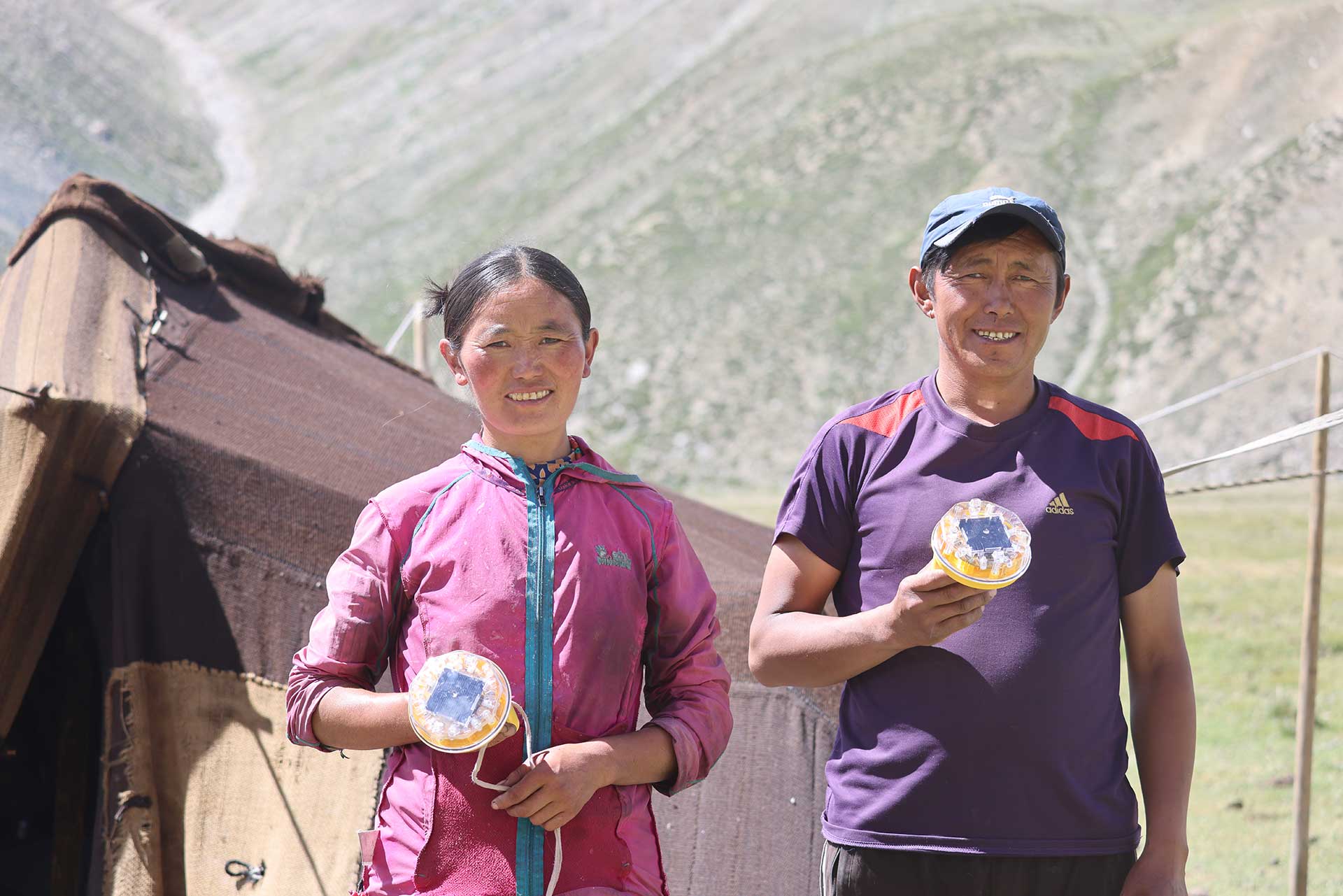
Herders with foxlights distributed and use instructed by HWP
Himalayan Wolves Project (HWP)
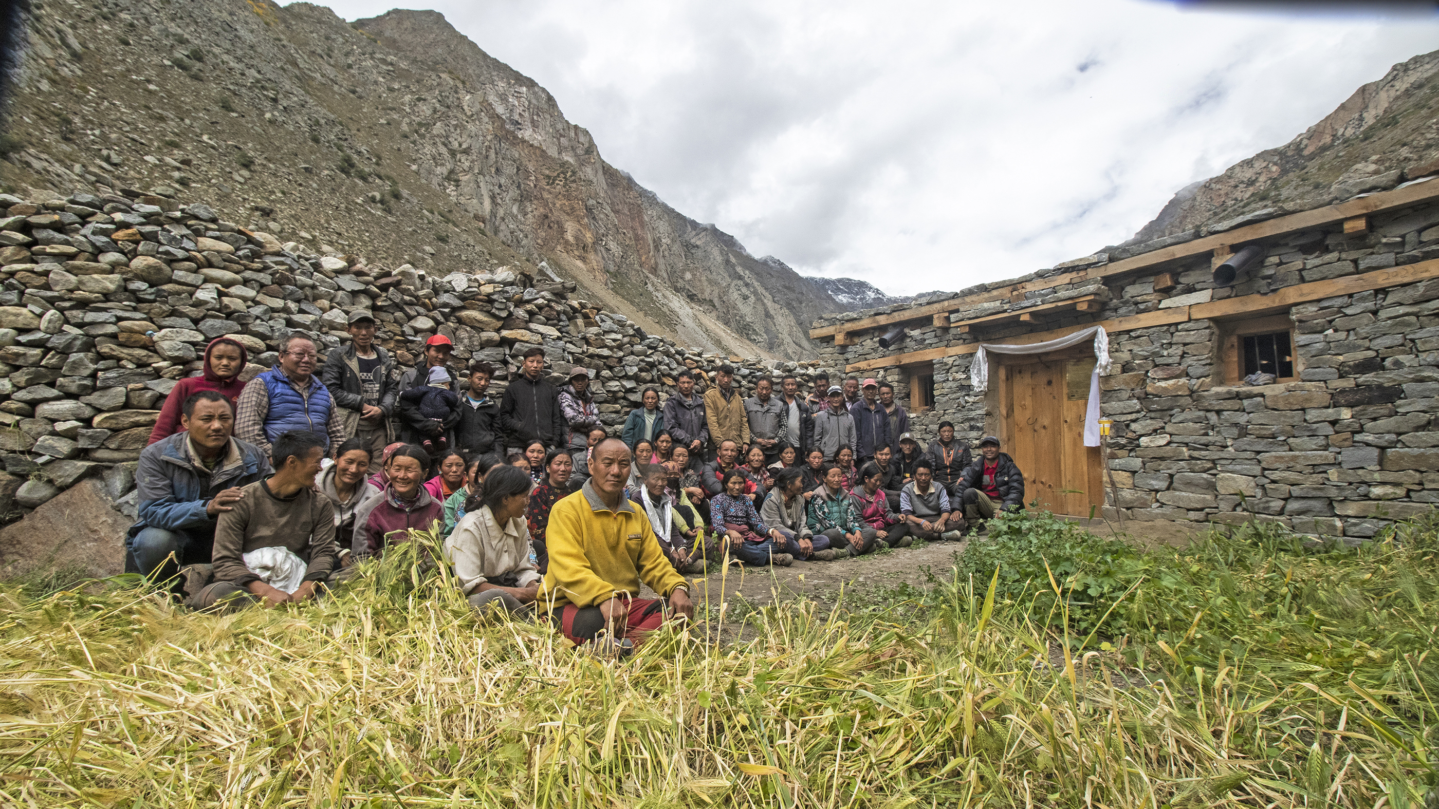
To address human-carnivore conflict, a range of protective measures were implemented in three villages of Limi Valley, Humla, Nepal, with the active involvement of local communities. These measures were designed to protect livestock from depredation by wolves and snow leopards, ensuring the safety of both local livelihoods and wildlife conservation efforts. Key actions include:
Commitment to Zero Poaching Policy: Local villagers were engaged to establish a strong commitment to a zero-poaching policy, fostering a collective responsibility for wildlife protection.
Construction of Communal Predator-Proof Night Corrals: Villagers collaborated to build sturdy, predator-proof corrals where livestock could be safely kept at night, reducing the risk of depredation.
Distribution of Predator-Deterring Foxlights: Foxlights, an effective visual deterrent for predators, were distributed to livestock herders, helping to prevent attacks on livestock by mimicking a human patrolling with lights at night.
Co-funding and Maintenance Responsibilities: Villagers took on responsibilities for co-funding the construction of the corrals and ensuring their proper maintenance over time, strengthening their investment in the success of the conservation efforts.
These actions were designed not only to protect livestock but also to build a sense of ownership and responsibility within the local communities, ensuring the sustainability of the efforts. GBF targets 8 and 9.
The success of this approach hinges on the commitment of local communities to the protection of both livestock and wildlife. By involving villagers in co-funding and maintaining the infrastructure, they become active partners in the conservation effort. This sense of ownership helps prevent neglect and fosters long-term support.
Local communities may initially resist conservation measures due to cultural habits or the allure of short-term solutions.
The key to success lies in continuous long-tem engagement and demonstrating the practical benefits of the infrastructure.
Building trust and providing incentives for long-term commitment are crucial. A follow-up program is necessary to monitor the effectiveness of the mitigation measures and adapt strategies based on community feedback.
Funding resources are capital to ensure continuity, maintenance and effectiveness evaluation.
We tried to conduct a post-intervention survey to account for an increase or decrease in people’s attitude towards carnivores. For this we provided a few selected locals with the survey forms. However they could not perform as expected. This presents a difficult reality. Stronger implication of Community Conservation Group and more solid information on human population structure will improve our knowledge of the population to be addressed and fill the gaps in our understanding of plan’s results.
To monitor the impact of predator deterring measures, we will analyze the evolution of livestock loss reports to administrative officers for compensation.
Capacity Building through Community Conservation Groups (CCG)
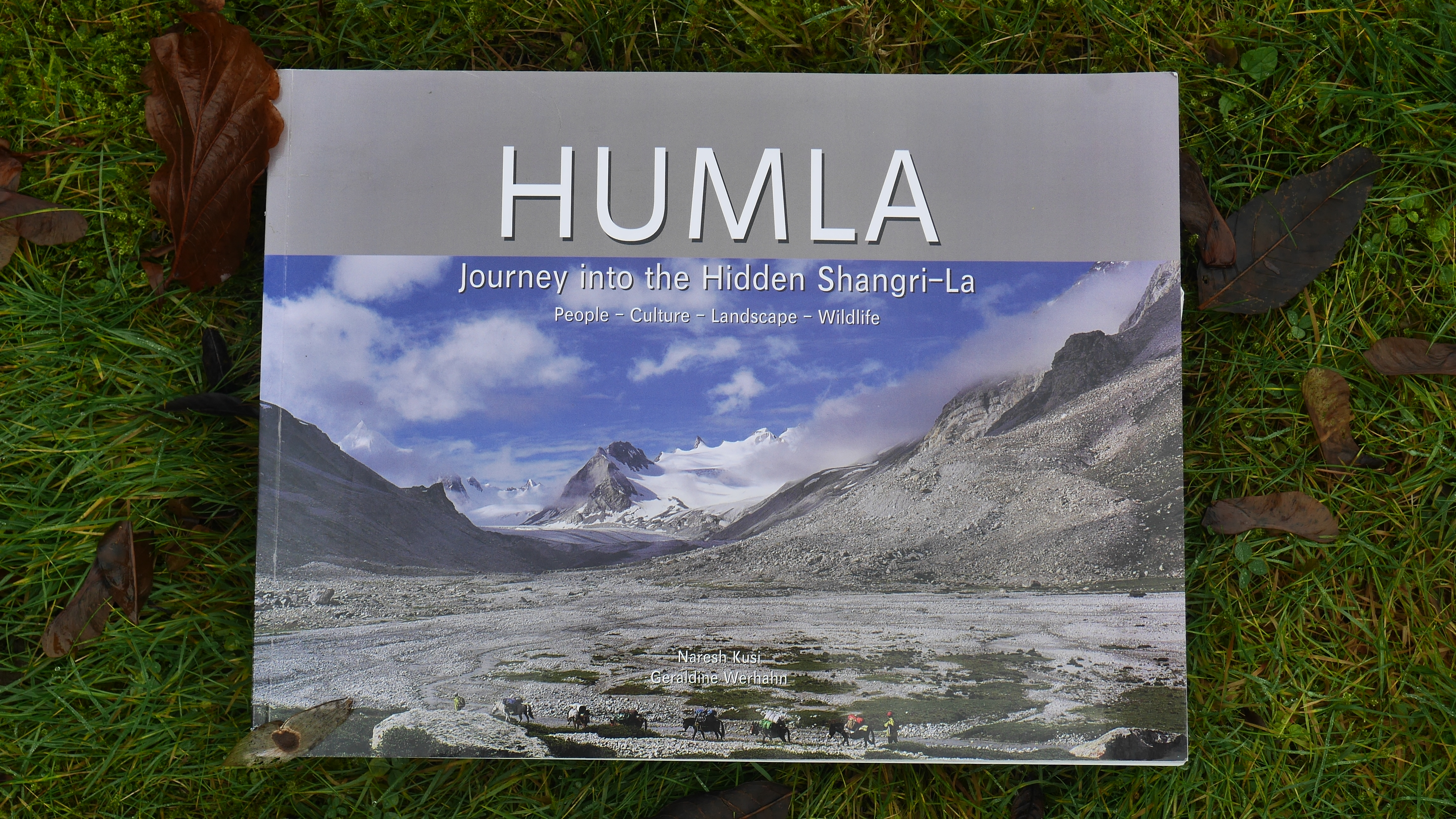
Book: Humla Journey into the hidden Shangri-La created by HWP team to celebrate the unique people, culture, landscapes and wildlife of the high altitudes of Humla
Himalayan Wolves Project (HWP)
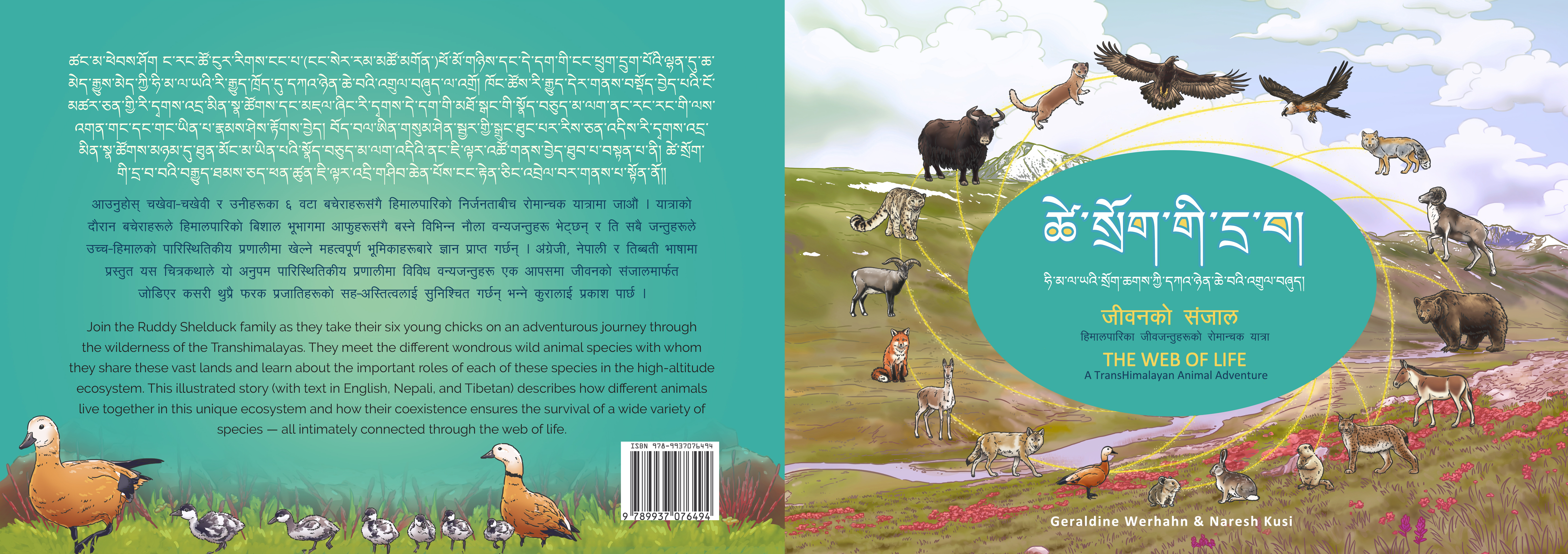
Book: The Web of Life: A Transhimalayan Animal adventure. Educative book by the HWP team to explain the ecological significance of the various animal species to the local mountain communities.
Himalayan Wolves Project (HWP)
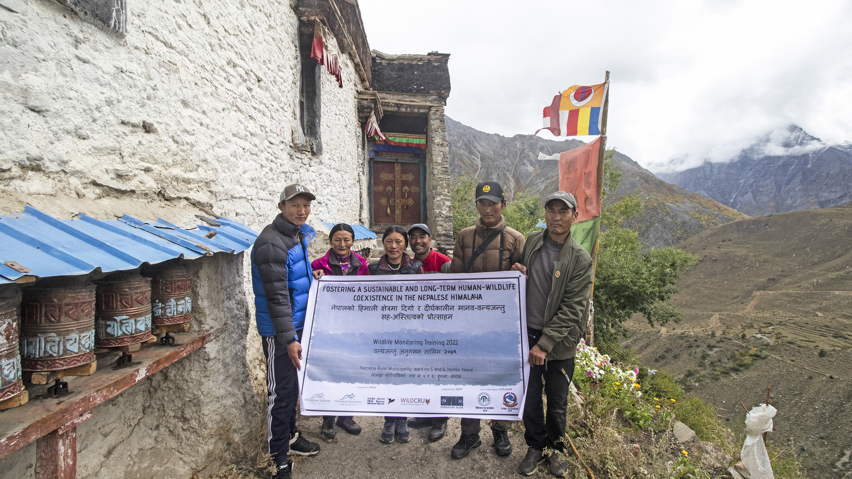
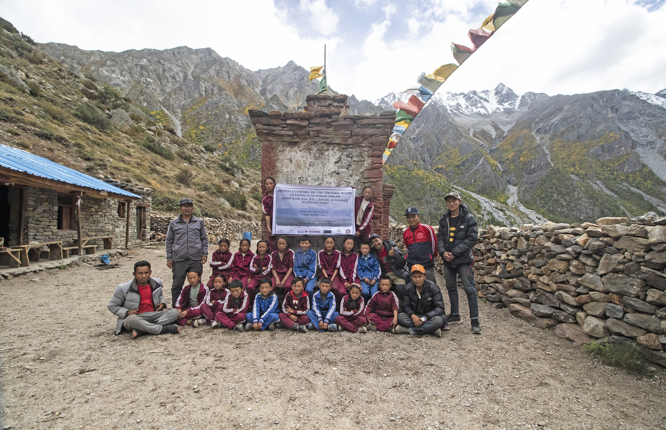
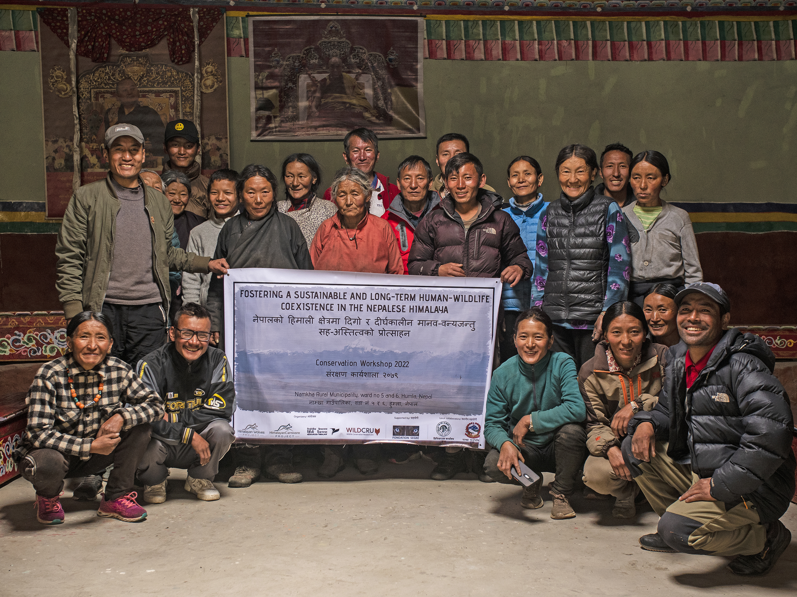
Community conservation and Wildlife Monitoring
Himalayan Wolves Project (HWP)
Conservation awareness workshop in school by HWP
Himalayan Wolves Project (HWP)
Conservation awareness workshop with community by HWP
Himalayan Wolves Project (HWP)
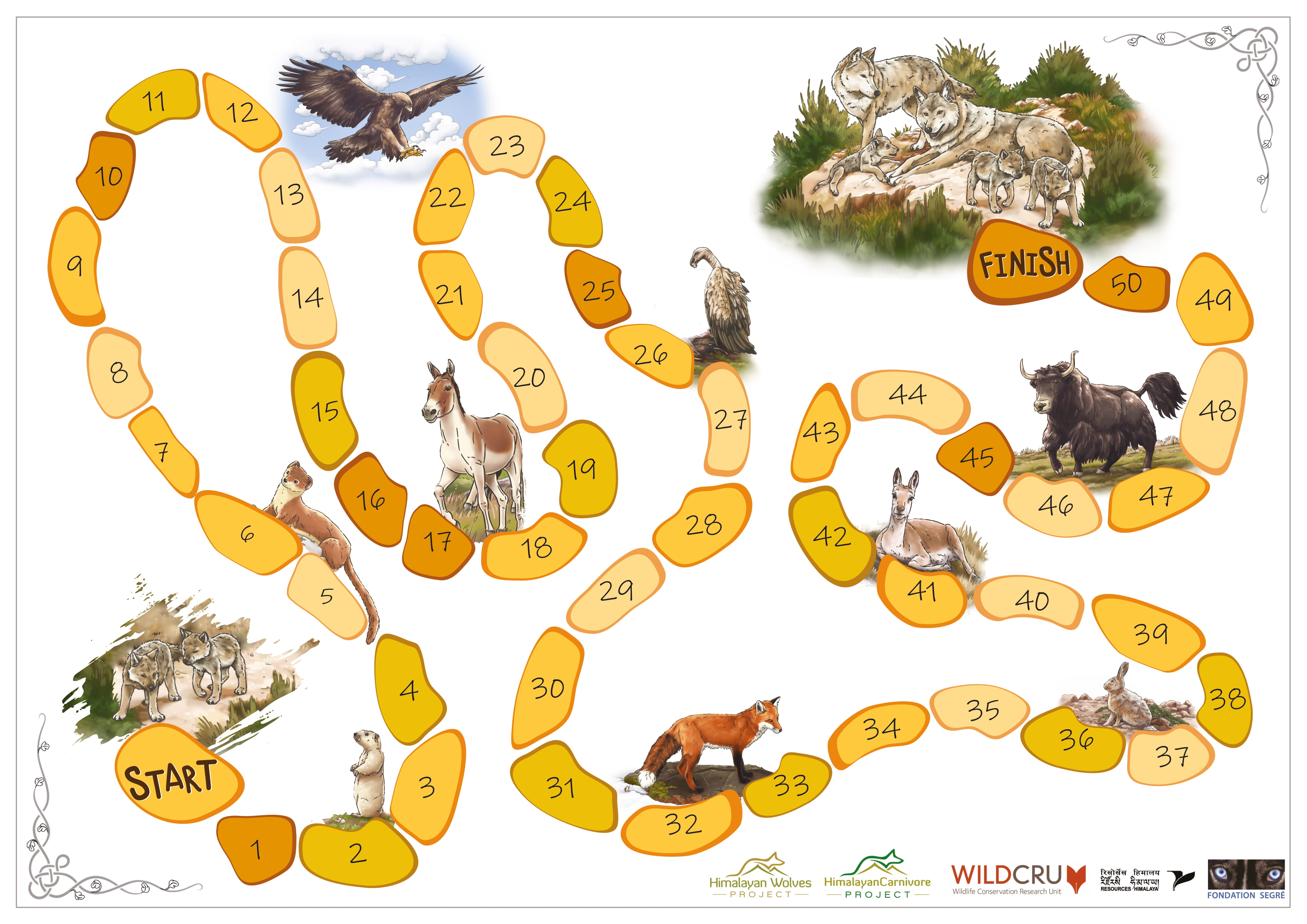
Board game created by HWP to use in conservation awareness workshops in schools and with adults in the remote regions of the Himalayas
Himalayan Wolves Project (HWP)
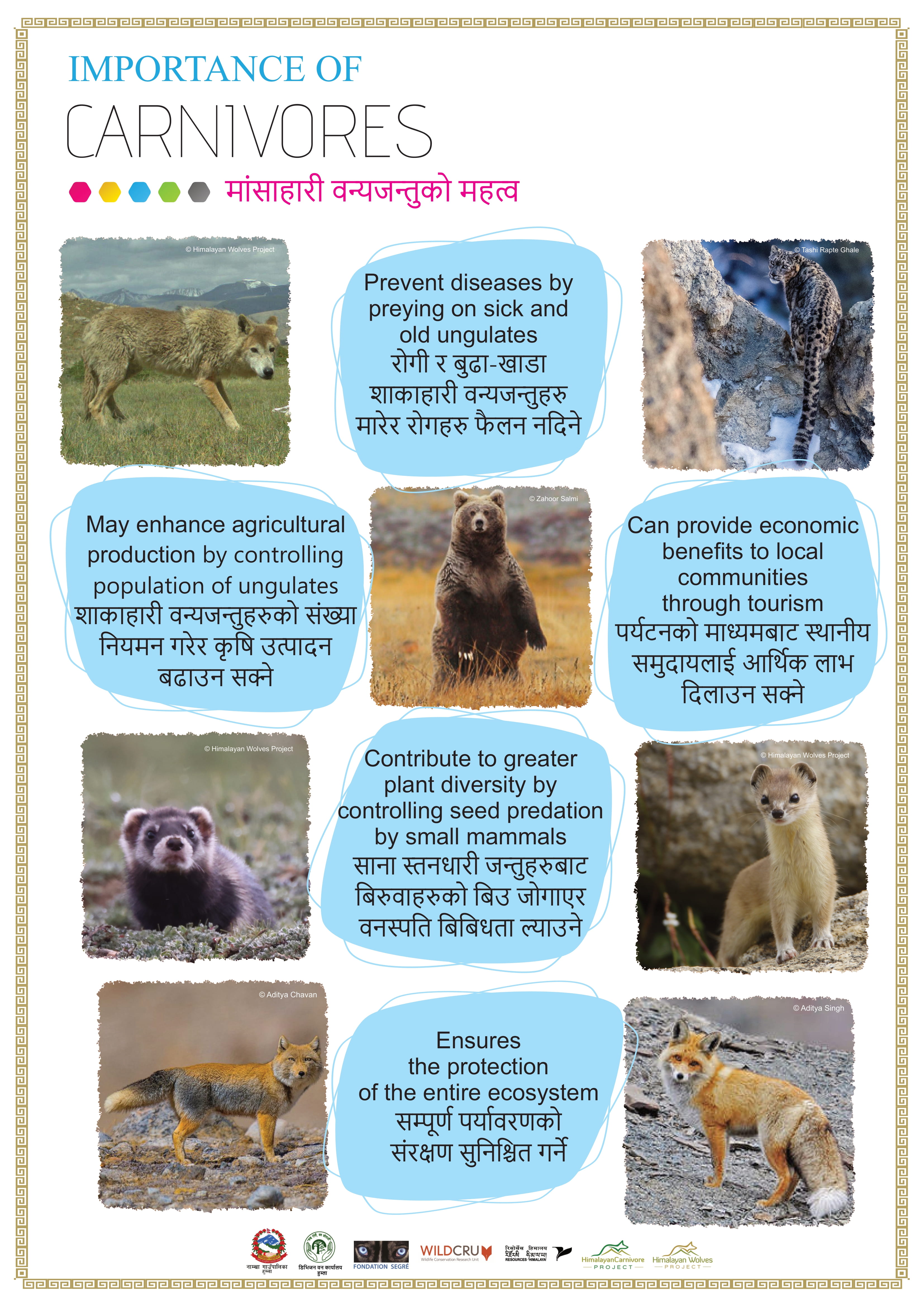
Educative poster Importance of Carnivores by HWP
Himalayan Wolves Project (HWP)
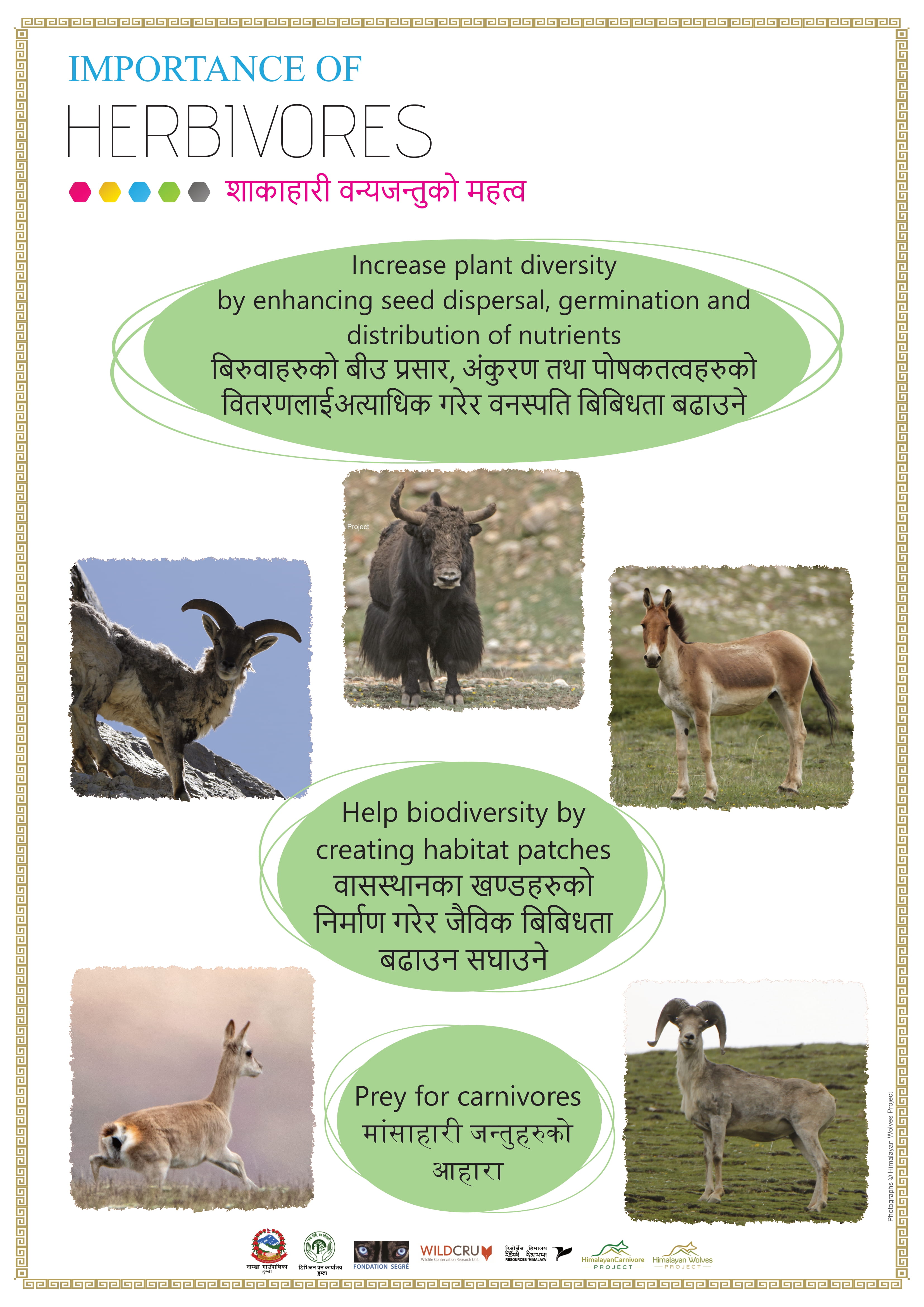
Educative poster Importance of Herbivores by HWP
Himalayan Wolves Project (HWP)
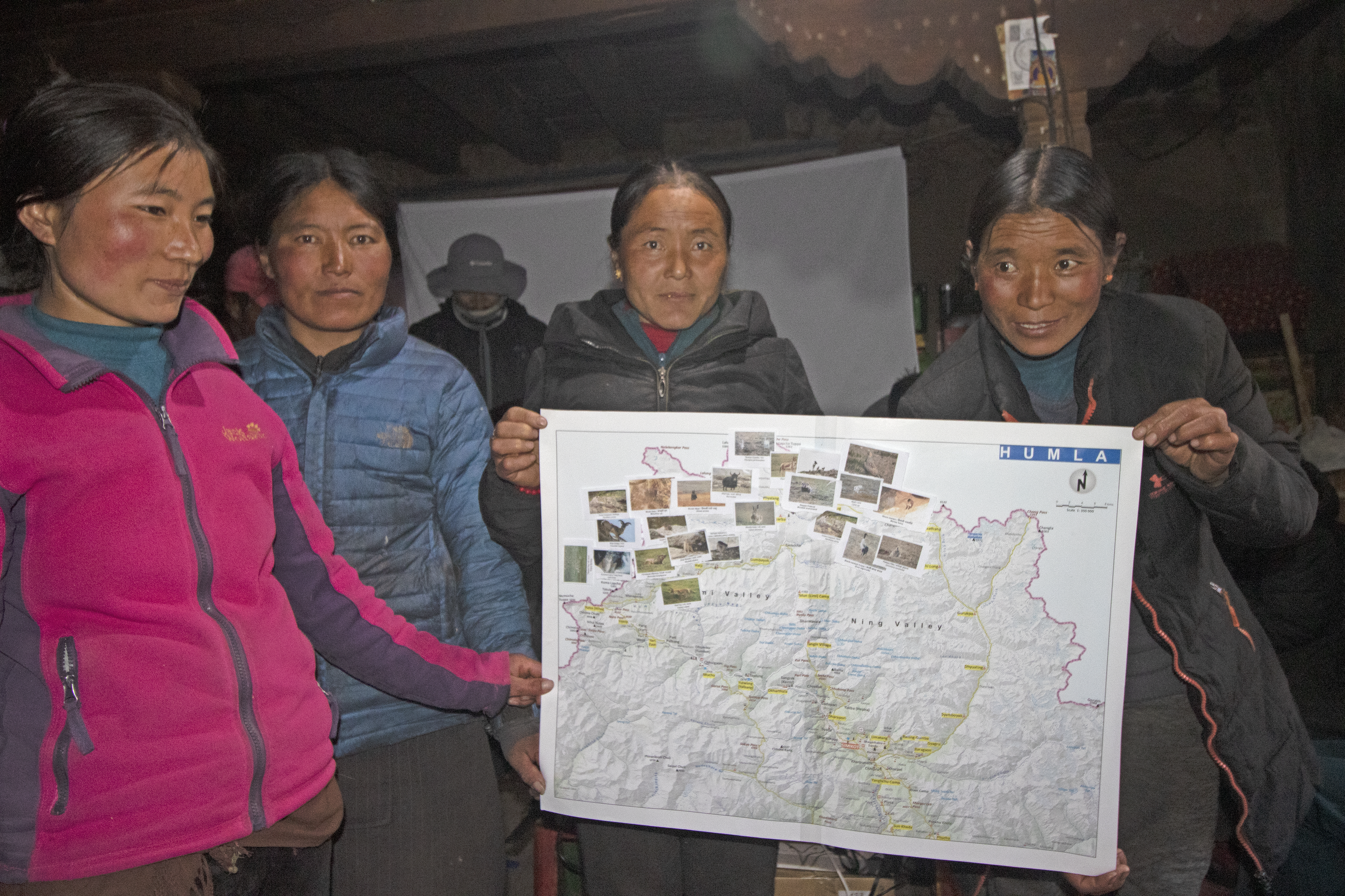
Participatory Mapping during community conservation workshop by HWP
Himalayan Wolves Project (HWP)
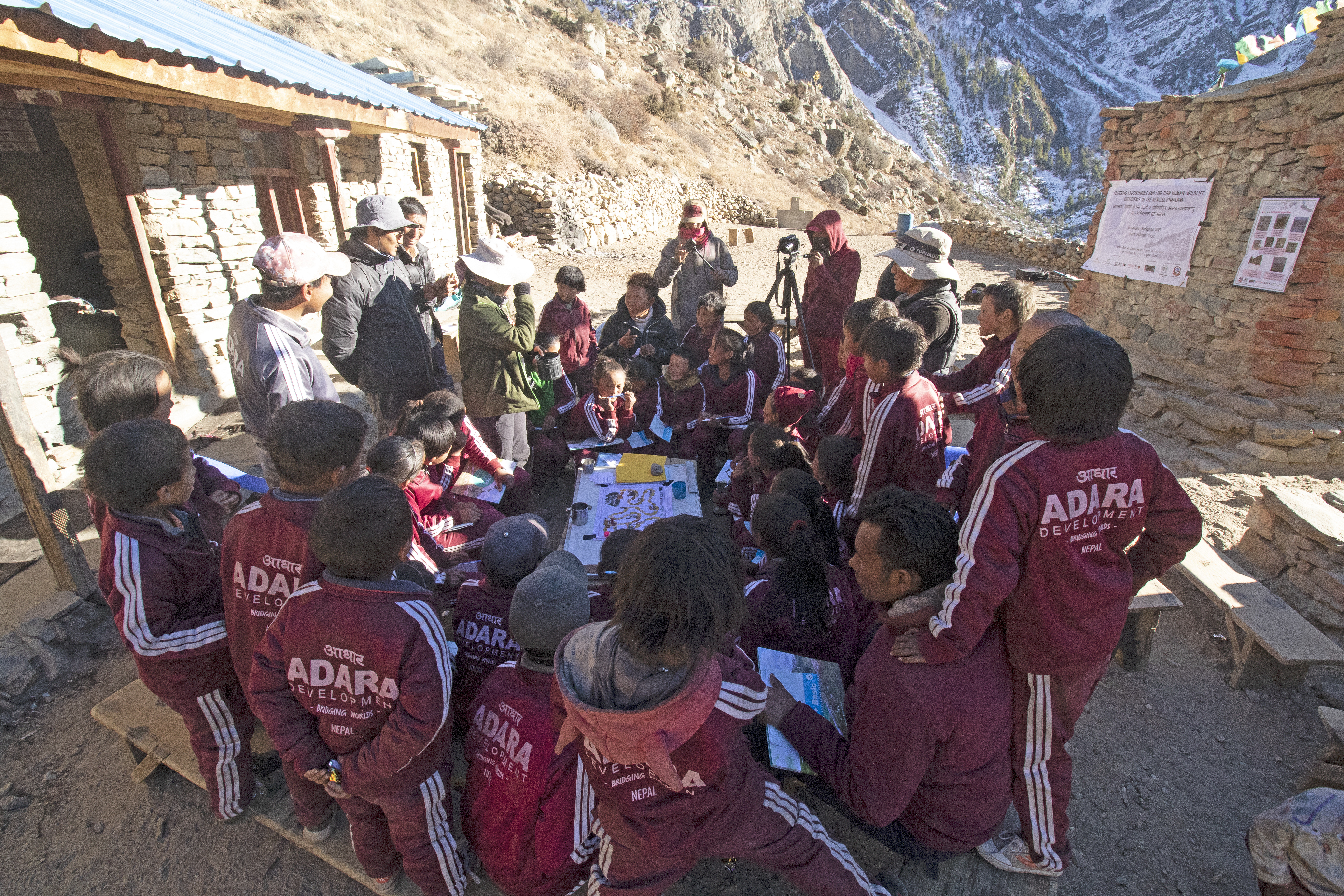
Educative Board Game playing during conservation awareness workshop in school by HWP
Himalayan Wolves Project (HWP)
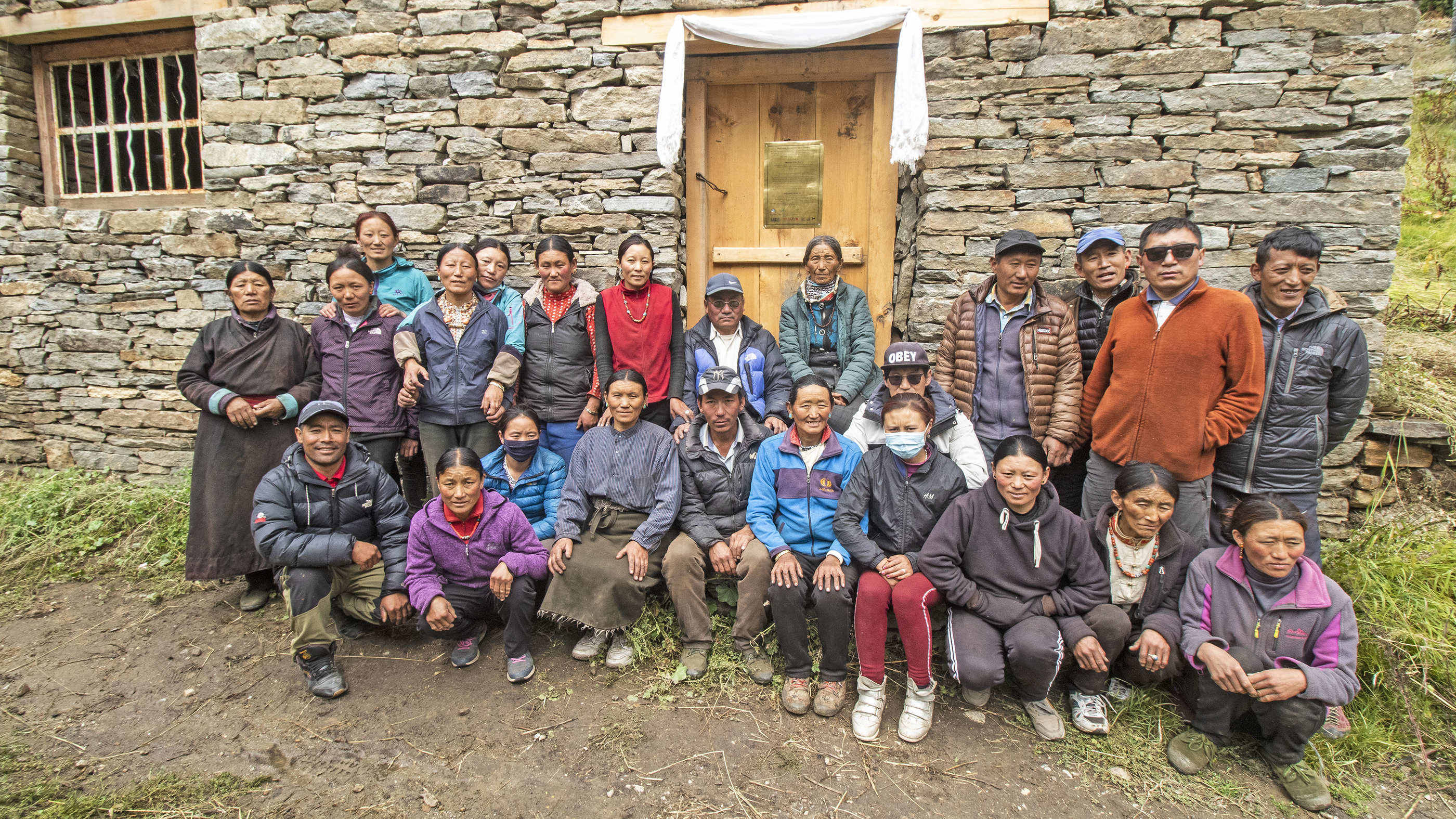
The creation of Community Conservation Groups (CCG) has been fundamental in building local capacity for effective conservation of the Himalayan wolf. These groups are composed entirely of local residents who are trained to participate actively in monitoring and conservation activities. Periodic workshops have been conducted to provide training in species monitoring, data collection, and camera trap management. Through these workshops, local participants gain valuable skills that enable them to contribute to the long-term success of the conservation project.
Community engagement and knowledge transfer are done by periodical workshops and follow-up on monitoring results using an audiovisual presentation. No remote digital platform can be used by local communities so far as there is no internet connection in the territory. The use of biodiversity credits as financial support for this block is currently under study. With this block we address the GBF targets 20, 21 and 22.
A key enabling factor is the active involvement of local residents in the creation and development of CCG. By providing training and ownership, these communities are empowered to become stewards of conservation efforts.
The workshops are tailored to meet local needs, and regular follow-ups ensure that knowledge is retained and applied effectively.
Additionally, the financial benefits generated through their participation in the project foster greater commitment.
Regular workshops and educational outreach, including the creation of the children’s book The Web of Life: A Transhimalayan Animal Adventure and self-designed conservation games, increased awareness about the role of top predators in the ecosystem.
Not all community members are initially receptive to participating in conservation efforts. Cultural habits and easier short-term solutions are the first call for many families. Workshops and community engagement are essential to building support.
The success of CCGs relies heavily on maintaining continuous engagement and adapting training programs to local realities. Establishing trust and ensuring that the community sees tangible benefits from their involvement are crucial for sustaining long-term participation. Regular communication and capacity-building efforts are essential to maintaining momentum and ensuring the success of the conservation plan.
Building a balanced relationship with local communities required an open, judgment-free approach that respected their cultural uniqueness and avoided imposing moral perspectives beforehand.