Teach the community the skills of Improved Cooking Stoves (ICS)

After understanding bad effects of cutting trees for heating energy, the people look for an alternative to reduce deforestation. The majority concluded to learn how to efficiently use less bulk of trees with same results in energy. Thus, the adoption of improved cooking stoves reduce the use of wood by 30% with the same result in heating.

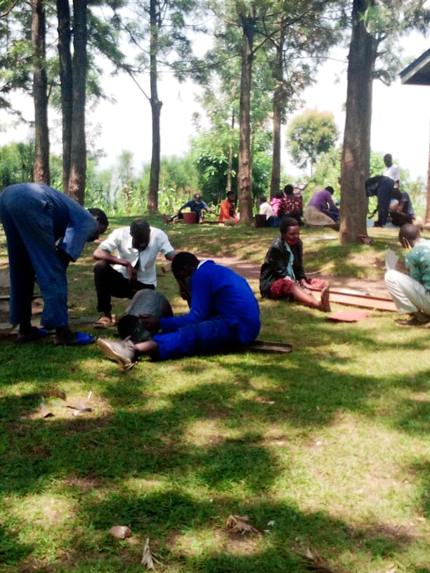
Within 4 months the cohort is taught how to mix availbale materials turning them in good ICS (clay, sand, used ironsheet, ). They are taught from scratch and become good ICS maker not only for household use but also for sale.


The availability of financial resources: To produce ICS requires a mix of different materials that need to be bought though not expensive(used ironsheet, nails, sand, clay).

Informed community: The knowledge of people enhance the right choice, ICS is one solution but there are other alternatives that might be used including those that are harmful to environment. It is required to educate the community to get good result as well as educating direct beneficiaries   before any activity to be conducted for getting the best of the solution

The participation of the local community is the key to all achievements and sustainability of solution in environmental matters. We learned that when the action respects the win-win rule, then there is an interest of all stakeholders. The skills in ICS making was a big benefit for the community, which was motivated and contributed to achievements of our goals.

To increase the awareness of the community on the role of environment in the wellbeing of the humanity

To get the awareness of the community and sustainability of our solution we teach the community through public meeting, in chuches, on radio talks and with any other means that delivers information. We prepared an education module that help community to have a full package: explanation of concept "environment", involved parties, the threat to environment, the role, rights & obligations of the community in environmental protection. In partnership with schools we make study tours in parks and other reserves help the community to understand the environment.

1. The appropriate collaboration of local leaders: Local leaders provide tremendous support in mobilization but they create also an enabling environment and in the reinforcement of laws related to environment.

2.  The availability of financial resources: In some parts, the implementation of above building block requires money to pay some necessities such as printings, airtalks, park visiting, etc.

The first lesson is that when the citizen is well guided, he undestands the importance of the environment protection and he is ready to act accordingly . Another lesson is that the environment can regenerate itself when taken care of. Forcing the community is not a good option for a sustainable solution in preserving the environment. Teaching them to get the personal commitment is the best alternative.

Mangrove reforestation by communities
  • Reforestation of mangroves in previously deforested or degraded areas helps to improve the health of mangroves and increases the services provided by mangrove ecosystems.

  • The area for reforestation is identified by the local community during the participatory mangrove zoning.

  • For the viviparous (producing seeds that germinate on the plant) mangrove species (e.g. Rhizophora spp), replanting is undertaken through propagules and for non-viviparous (e.g. Avicennia marina, Sonneratia alba) mangrove species through nursery establishment. The density should be one propagule/plant per square meter to ensure that they have enough space to grow properly.

  • The monitoring of the replanting takes place within three to four months after the replanting. The number of plants alive/dead within the sample plot is assessed. The number of sample plots (5mx5m) depends on the size of the area replanted but at least three replicas should be done. Community members are involved in the monitoring activities.

  • The reforestation area is identified by the community during the participatory zoning process and the plantation takes place when mangrove seeds/plants are available(depending on the fructification season).

  • The technical staff provides support to local community on mangrove reforestation (familiar with mangrove ecology and adaptation);

  • Propagules are harvested and selected a day before the replanting as sometimes they are not available nearby the site where the replanting takes place.

  • The best time for the mangrove replanting should be checked /decided with community members in advance and this must take place at the low tide during the spring tide.

  • Promoting voluntary mangrove reforestation is critical to ensure that it can be continued without external financial support. Motivation in kind (refreshment and biscuits) could be given to the participants when activities are completed to avoid them requesting money. The revenue from carbon payment can be a source of finance for long term reforestation.

  • If the propagules are not available near the place where replanting takes place, they can be collected elsewhere.

  • The monitoring of the reforestation is allowing evaluating the survival rate of the mangrove replanting. Community members are involved in the monitoring activities to allow them realize the impact they are having and thus keep their enthusiasm for replanting going.

Participatory monitoring
  • The participatory monitoring aims to develop a greater understanding of natural resource health and the impacts of anthropogenic activities within local communities through a socially integrated resource assessment.

  • The participatory ecological monitoring process begins with an initial village meeting to inform the purpose of the activities, select indicator species, monitoring sites and a local monitor team.

  • The local monitoring teams are either designated or elected by community members at the village level or can be volunteers. However, they should at least be able to read/write and count. A local monitoring team consists of five people per village and contains male and female.

  • The monitoring method is developed by the support organization and the monitoring has a simple design and method to be accessible to anyone, irrespective of educational level (using simple count of cut stump to assess the amount of carbon loss; measuring the tree height with graduated pole wood to measure tree biomass and carbon).

  • Local monitors were trained by the technical staff from the support organization on the method before conducting the fieldwork.

  • The support organization assists the community to identify the relevant indicators, these should be the key natural resources or target species providing useful information to allow local community to perceive the effectiveness of the management in place;

  • The support organization provides technical assistance in the long term monitoring and builds the capacity of the local monitors.

  • The monitoring method developed must be an effective means of illustrating to coastal communities the benefits of natural resource management. The number of cut stumps or number of mangrove mud crab holes could be a good indicator to demonstrate clearly to the community the effectiveness of the mangrove management.

  • The dissemination of the results of the monitoring helps the community to understand the state of their resources and the amount of carbon stocks in their mangrove forest. The support organization must define the key messages from the monitoring results (the carbon stocks at the mangrove reserve are much higher compared to the unmanaged mangrove forest).

  • Local monitor team is not paid but they are given a daily food allowance when they are conducting the forest inventory and carbon monitoring. The income from the sale of the carbon credits is planned to secure the long term monitoring activities.

Participatory Forest Management plan
  • A participatory management plan aims to support the local community to sustainably manage mangrove forest within the LMMA.

  • Using a printed high resolution Google Earth map, a first draft management plan is created by each concerned (proposed project area for the mangrove carbon project) village with the boundary of the mangrove zoning (core zone, reforestation area and sustainable logging area).

  • When all the relevant villages within the LMMA have completed the zoning, the data from the Google Earth map are digitized and projected on a big screen for validation. Delegates from each village are invited to attend a workshop for the validation of the mangrove zoning. For the validation, at least four people from each village must attend. Ideally both men and women are elected by villagers who they feel may best reflect their opinions (elders, chef Village).

  • Each community determines, agrees and implements the rules and regulations governing each mangrove zone.

  • This is conducted through a large village meeting. The support organization facilitates the process until the local law is ratified at the court.

  • A local convention or law enables communities to govern the natural resource management;

  • Aptitude of the support organization to incorporate the mangrove management plan into the existing LMMA management plan;

  • Ability of the law enforcement committee to enforce the Dina and deal with the fine payment in their respective zone without support/inputs from the government;

  • Demarcation of the management zone enables the community to observe on the ground the boundary of the mangrove zoning.

  • The support organization must be familiar with the government law, as the local laws/conventions (such as Dina) should not conflict with the national law. It has proven effective to involve appropriate government actors in processing the Dina (local law) at the village level to make the ratification easy.

  • Make sure villages sharing mangrove forest are consulted together through village meetings/workshops for a compromise on the mangrove zoning. For the demarcation at the forest, delegates from villages at the AOI must assist the technician staff from the support organization to make sure that the marks/signs are in the right place.

  • Colour of the marks/signs used for the demarcation should consistently be within the LMMA (e.g colour red for the core zone boundary for both marine area and mangrove forest).

Education on Cultural Practices Associated with Native Species

The Yerba Mansa Project offers educational programs that are free for the general public and school classrooms. These events include activities that connect people to the land and plants and are appropriate for a wide audience. Slow-paced plant identification walks through easy terrain afford opportunities for people of all ages and physical abilities to know the plants around them and begin to see their importance to the land, their families, and to themselves. Classes that feature hands-on botanical remedy making and wild food processing encourage the practical skills needed to work directly and safely with plants for increased wellbeing and foster a deeper appreciation and connection to the land. Teaching gardening and cultivation of popular native medicinal plants that are facing habitat pressures creates opportunities for improved urban habitat, easy access to healing and nutritive plants, and reduces pressure on wild populations. Also offering free programs for school classrooms, as described in the “Inspiring Story” section, brings the next generation into nature and provides hope for future solutions. All of these practices perpetuate the cultural traditions associated with our local lands and ensure that future generations will have access to this knowledge and the plants that underlie it.

Creating successful educational events requires broad community support. Most Yerba Mansa Project events are co-sponsored by other organizations including public libraries, city and county open space agencies, environmental- or conservation-oriented non-profits, public and private schools, or local businesses that share our values and mission. These collaborative partnerships provide financial support, increased ability to reach new sectors of our community, and opportunities to cross-pollinate similar efforts being made by all organizations.

As we continued to develop and improve our education programs, we learned about the erasure or minimizing of certain cultural groups, particularly indigenous communities. An important addition to all of our events has been starting with a land acknowledgment. A land acknowledgment is a way of honoring the people who have stewarded the land we are on since time immemorial and also recognizing the deep ecological and cultural knowledge held within these communities. It also provides an opening to discuss the role of colonial policies and modern economic land and water uses that negatively impact the land, water, air, plants, animals, and people. It is an invitation for all people of our community to come together to discuss how we can respect each other, learn from one another, and find common ground in our shared investment in land health and human health.
Native Edible and Medicinal Plant Restoration

This building block forms the foundation of the Yerba Mansa Project’s work. Healthy and diverse native plant communities are critical for ecosystem functioning and the cultural traditions built upon them. Our volunteers engage in live planting and reseeding of edible and medicinal species that have historically been present and are also considered to be adaptable for current and future climate conditions including higher temperatures and less water in the riparian system. Restoration work also includes habitat improvements such as removal of nonnative invasive ravenna grass (Saccharum ravennae) that impedes the growth and reproduction of native species. Our work has demonstrated that ravenna grass can be successfully removed with hand tools such as shovels and mattocks and if roots are adequately removed, the plants do not resprout. This serves as a model for land management agencies wishing to control nonnative understory plants along waterways of the American West while avoiding the use of chemical agents. The combination of invasive species removal and native plant restoration has proven successful when appropriate species are selected both for climate readiness and cultural relevance.

This building block requires consideration of two critical factors. First, a minimal standard of ecosystem functions must be present to restore native plant species. In this case, there must be enough water in stream flows and a water table that is high enough to be accessed by established plants. Second, species should be selected based on ability to adapt to climate change predictions for future decades. These include earlier spring run-off in rivers, less water in the system due to increased evaporation and economic usage, and higher temperatures.

We learned to anticipate and adapt to environmental conditions that change unexpectedly and negatively impact the ability of plants to survive. For example, beavers felled trees providing critical shade during new plant establishment. In another instance, our site experienced ‘historic’ flooding that inundated new plantings selected for hotter and drier conditions. Also our site is a protected natural area within an urban environment and thus receives high visitor use and degradation associated with off-trail hiking and unleashed dogs. All of these conditions must be accommodated as they represent the wildness of nature, the chaos of changing climate, and the pressures of population growth.


Similar concerns will likely affect other restoration projects in varying locations and can be met with flexibility. To accommodate felled shade trees and high visitor use, we devised a practice of gathering downed debris of thorny plants such as tumbleweed (Salsola tragus) and Russian olive (Elaeagnus angustifolia) and laid them on top of or around establishing plants to provide shade and deter hikers and dogs from walking through the area.

Ranger patrol report design

EarthRanger combines different data from different sources. A key aspect of this is reports from the field as rangers carry out their patrols. To ensure robust data is collected and in a format that can be analysed, a ranger patrol report schema was needed. Ol Pejeta designed a set of report types relating to different categories of incidents or issues, such as a wildlife sighting or a security incident. Within each report type, standardized data fields were developed, ensuring data is simple to input and can be compared. Rangers use handheld devices to capture these reports and photos quickly and effectively, building a rich picture of what is happening across the Conservancy. These reports, together with the other data sets integrated in EarthRanger can be used for rapid response to serious incidents, as well as trend analysis to inform longer term strategic conservation planning and management.

  • User focus – working closely with the rangers and ecological monitoring unit as users of the system to understand their needs and ensure the report design meets those needs.
  • ‘Minimum Viable Product’ approach – ensuring the report types cover most typical scenarios, achieving a balance of enough variety but not too many different categories so that reporting becomes complex and meaningless.
  • Focus on the challenge, not the technology – the focus should remain the challenge that is being solved, and not the piece of technology being delivered. This ensures that the solution is not cumbersome with unnecessary functions and ties in with the user focus condition which ensures proper uptake of the solution.
Integrated (EarthRanger) platform solution design

EarthRanger provides the platform for integration but the data sets and information to be integrated needed to be determined. Ol Pejeta therefore designed the platform solution, adapting it meet the conservancy’s needs – evaluating what information would be useful and how it could be integrated. This was partly based on what data was readily available as well as understanding the key factors in supporting critical operations. This included combining data from the field (animal, radio, vehicle tracking) to inform security and ecological monitoring efforts. Cameras that monitor wildlife corridors also provide alerts if vehicles, people, or animals pass by. The Conservancy also operates an integrated livestock and wildlife land management approach. Livestock bomas are mapped and if collared predators are close an alert is sent so teams can respond accordingly.

  • Problem solving – focus on what the needs are and exploring how technology can support rather than being solution led
  • Operational focus – grounded in conservation, understanding all areas of operations, important data, and user requirements to inform solution design.
  • Supporting infrastructure & systems – source platforms (digital radio, vehicle monitoring, animal tracking) to be in place to enable integration.
  • Skills and partnership – technical skills within the team deploying the solution and or partnership with an organisation that can help.
  • Partnership is critical – delivering such a solution requires partnerships to be formed across different parties. The institution providing the platform, the user and deploying organization and solution providers of the different source data platforms. All these parties have to collaborate effectively to deliver a proper working solution.
  • User training and buy in is key – the users of the solution have to be properly trained and involved in order to achieve buy in and proper utilization of the solution.
EP RESOLUTION 2

A method of combating plastic pollution and organic matter in the ocean.

The EP in collaboration with O.I.N.G PACO have set up a multi-community committee for the environment. Collective action to combat plastic pollution in the towns of the African community.

1. Effective coordination mechanisms, but less practical

2. B1000B waste management methods effective and implemented progressively