Landscape Assessment for Species Success

The purpose of this building block is to conduct thorough landscape assessments on the land owned by colleges and universities. By evaluating the environmental conditions, we can determine which species are best suited to thrive in these areas. This careful selection process ensures higher success rates for planting and contributes to more sustainable conservation efforts. The landscape assessment serves as the foundation for effective planting strategies, aligning species selection with the specific ecological characteristics of the land, ultimately leading to more resilient ecosystems.

Key factors for success include having strong environmental technical expertise within the team and leveraging our partnerships with universities to access the land for assessment. These partnerships provide the necessary support and resources to conduct comprehensive evaluations, ensuring that the species selected are well-suited to the specific conditions of each site, which is critical for the long-term success of the planting efforts.

One of the primary lessons learned is that not all tree species can thrive in the same region. Conducting land assessments is essential for understanding the unique environmental conditions of each area. This knowledge allows us to select species that are more likely to succeed, improving the overall effectiveness of our planting efforts. By aligning species with their ideal habitats, we enhance the sustainability and impact of our conservation initiatives.

Identifying with the communities strategic locations for solar panel implementation

Identifying strategic locations for solar panel implementation with communities involves assessing areas with high sunlight exposure and low shading. Engaging local members ensures that sites are selected based on practical needs, accessibility, and minimal disruption. This collaborative approach optimize's energy efficiency and aligns solar installations with community priorities.

  • Community Involvement: Engage local members in identifying potential locations to ensure sites meet practical and cultural needs.
  • Site Assessments: Conduct thorough assessments of sunlight exposure, land use, and shading to determine optimal locations.
  • Local Knowledge: Leverage the community’s knowledge of the area for selecting suitable and accessible sites.
  • Technical Expertise: Involve experts in solar technology to evaluate and validate chosen locations.
  • Access to Resources: Ensure availability of necessary tools and technology for site evaluation and installation.
  • Infrastructure: Verify that selected locations have or can be developed with the required infrastructure for solar panel deployment.
  • Regulatory Compliance: Adhere to local regulations and obtain necessary permits for site selection and installation.
  • Site Assessments: Conduct detailed assessments of sunlight exposure, land use, and shading to determine optimal sites.
  • Utilize Local Knowledge: Leverage community expertise to identify potential sites based on local conditions and needs.
  • Technical Evaluation: Involve solar technology experts to validate site suitability and ensure technical feasibility.
  • Community Feedback: Regularly gather and incorporate feedback from the community to address any concerns and adjust plans as needed.
Creating community led committees to ensure participatory approaches are implemented

Creating community-led committees ensures participatory approaches by involving local members in decision-making. These committees empower communities to actively engage in project planning, implementation, and monitoring, fostering ownership and accountability. This approach enhances relevance, cultural alignment, and sustainability, ensuring that solutions are effectively tailored to the community's specific needs and priorities. Community members would be chosen through election in their local language.

  • Inclusive Representation: Ensure that committees include diverse community members to reflect various perspectives and needs.
  • Effective Communication: Establish channels for open and transparent communication within the committee and with the broader community.
  • Supportive Leadership: Engage local leaders and influencers to endorse and support the committee’s efforts.
  • Regular Meetings and Feedback: Schedule regular meetings and feedback sessions to monitor progress and make adjustments as needed.
  • Clear Objectives: Define the committee's goals and roles clearly to guide effective participation and decision-making.

Community engagement is vital for a project to be successful . Involving the community throughout, using a participative approach is at the core of the success and sustainability of the project.

Development of Community Governance Structures for Sustainable Land Management

This building block focuses on developing and formalizing community governance structures to support sustainable land management. By leveraging networks, we connect various ecosystem management systems across Kenya to align resource management with livelihoods and conservation efforts.

We prioritize understanding the leadership within community groups and work directly with these leaders to engage the broader community. When requested by the community, we help formalize these existing structures to ensure our programs align with the established power dynamics and effectively address community needs.

  • Restoration agreements serve to formalize relationships with communities, acting as a memorandum of understanding (MoU) to align expectations and build trust among community members.
  • Government involvement is essential, requiring a direct line of communication with communities to ensure impactful ecosystem restoration.
  • Facilitating community elections to select leaders responsible for restoration networks empowers the community and ensures accountability.
  • Adhering to legal requirements in restoration policy that mandate community members to take on governance roles, thereby promoting the development of community institutions.
  • Building networks helps unite various community governance structures, fostering the sharing of knowledge and aligning efforts.
  • It is crucial to assess the community's need for governance structure facilitation while respecting existing power dynamics.
  • Community-driven network development creates a central power structure and formalized forum, ensuring that community concerns are taken seriously. This approach enhances visibility and influence with government stakeholders, strengthening CFAs as central institutions within the conservation framework.
Monitoring and research

Monitoring and evaluation allows us to effectively keep track of how the plants are doing by regulaurly studying the microsite conditions. The purpose is to gather information that helps us understand what works and what needs improvement. Continuous rese

Resource availability: Access to tools, trained personnel, and financial support for effective monitoring is crucial to gather reliable data. A regular data collection and analysis allow us to better appreciate species performances and factors that impact seedlings establishment. 

Monitoring and research are important for data sharing. Based on soil properties predominantly related to the African Black Walnut development, our findings shed light on how soil parameters contribute to species distribution at the fine scale. Thus, we found new information concerning the habitat requirements which are quite interesting and valuable for the ex-situ management and conservation of Mansonia altissima.  

Development of Community Governance Structures for Sustainable Land Management

This building block focuses on developing and formalizing community governance structures to support sustainable land management. By leveraging networks, we connect various ecosystem management systems across Kenya to align resource management with livelihoods and conservation efforts.

We prioritize understanding the leadership within community groups and work directly with these leaders to engage the broader community. When requested by the community, we help formalize these existing structures to ensure our programs align with the established power dynamics and effectively address community needs.

  • Restoration agreements serve to formalize relationships with communities, acting as a memorandum of understanding (MoU) to align expectations and build trust among community members.
  • Government involvement is essential, requiring a direct line of communication with communities to ensure impactful ecosystem restoration.
  • Facilitating community elections to select leaders responsible for restoration networks empowers the community and ensures accountability.
  • Adhering to legal requirements in restoration policy that mandate community members to take on governance roles, thereby promoting the development of community institutions.
  • Building networks helps unite various community governance structures, fostering the sharing of knowledge and aligning efforts.
  • It is crucial to assess the community's need for governance structure facilitation while respecting existing power dynamics.
  • Community-driven network development creates a central power structure and formalized forum, ensuring that community concerns are taken seriously. This approach enhances visibility and influence with government stakeholders, strengthening CFAs as central institutions within the conservation framework.
Monitoring and research

Monitoring and evaluation allows us to effectively keep track of how the plants are doing by regulaurly studying the microsite conditions. The purpose is to gather information that helps us understand what works and what needs improvement. Continuous research allows us to adjust our methods for better results.

Resource availability: Access to tools, trained personnel, and financial support for effective monitoring is crucial to gather reliable data. A regular data collection and analysis allow us to better appreciate species performances and factors that impact seedlings establishment. 

Monitoring and research are important for data sharing. Based on soil properties predominantly related to the African Black Walnut development our findings shed light on how soil parameters contribute to species distribution at the fine scale. Thus, we found new information concerning the habitat requirements which are quite interesting and valuable for the ex-situ management and conservation of Mansonia altissima.  

Capacity building to enhance TREEO App utilization

TREEO SaaS product enhances the skills, knowledge, and abilities of our users, enabling them to effectively utilize the app’s features for tree monitoring and carbon sequestration. We aim to ensure that users can maximize the app’s potential, leading to more accurate data collection, better project management, and ultimately, more successful reforestation projects. 

It also enables user empowerment, increases project transparency, and supports the scalability and sustainability of reforestation efforts. We do this through training, tutorials, and guides that provide hands-on experience and detailed documentation. Ongoing support via a dedicated customer service team,  and FAQs.

  • In house specialists: help to solve the daily challenges from a distance and also on-site immediately 
  • Offline technology that supports access in remote regions: most of the planting sites are remotely located and therefore the wifi signal can be weak in those areas. Our app ensures to collect all the data even offline
  • Ongoing support and customer service: we provide trainings on tool implementation; how to use the technology for all the use cases (land survey, project management, reporting, exporting data, etc.); we do a detailed training and onboarding process
  • User-friendly interface (TREEO App) - plus in-app training: Understanding that some of our app users might be illiterate, we have designed the app to be self-explanatory and supported by training manuals and visual aids.
  • Offering TREEO App as a SaaS product has helped us gather user feedback which has enabled us to identify areas of improvement. Therefore, with every update we consider the user feedback to make the app more user-friendly.
     
  • We maintain clear and transparent communication with our different customers about updates, new features, and best practices. This allows them to be fully equipped on how to use the TREEO app leading to better utilization of our product offering.
     
  • Our capacity building fosters environmental stewardship and motivate local people to actively participate in climate action - a “co-benefit” of such projects
     
  • Setting up the Customer Success team to conduct both remote and on-site training on-demand.
     
  • To ensure complete understanding, our training team uses the local languages of the area in their sessions with farmers.
Single Tree Monitoring

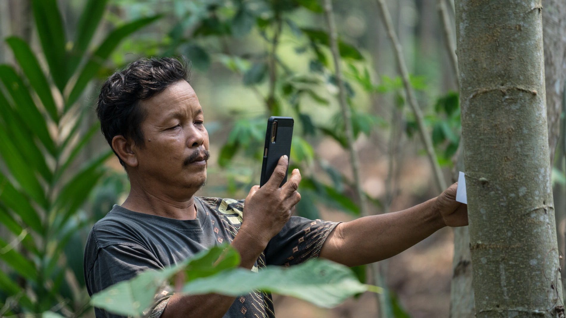
The TREEO technology allows project implementers to monitor their tree-planting efforts in a matter of seconds via the TREEO App and manage their data in the TREEO Cloud. Single-tree monitoring is actually very simple: walk around the forest and take a picture of their trees in the forest. TREEO technology will take care of the rest. Although it sounds too simple, it brings many advantages compared to standard methods available.  

Single tree monitoring entails the data capture (GPS coordinates, diameter, species name, sequestered CO2 and so much more) of your trees on the plot using the TREEO App and in only a matter of seconds.  Our technology provides the highest level of accuracy in CO2 calculation with a scientific basis that uses species- and climate-zone-specific allometric formulas, image processing, and machine learning. It is also the first Digital Monitoring, Reporting and Verification (dMRV) tool endorsed under the Global Tree C-Sink standard from Carbon Standards International, qualifying it for global use in tree-planting projects.

  • TREEO App: The TREEO App is at the heart of single-tree monitoring, through the app you will be supported to collect precise data of each and every single tree by scanning them at the DBH (diameter of breast height) with having a TREEO card as a subject of measurement for the scanning process. Additionally, its UX aspects makes it user friendly for farmers to utilize its different features.  The whole process is simplified down to the smallest detail so that anyone can implement it.
     
  • Project implementers / tree-planting project developers: There is a demand from project implementers all around the world, who want to enhance their transparency through single-tree monitoring in order to prove their planting activities for the public and their stakeholders. 
     
  • In-house specialists: We have an in-house technology specialists team that provides support to tree monitors to enhance their skills in doing single-tree monitoring.  Additionally, our in-house foresters can provide allometric formulas for different species per region.
     
  • Regulations: Upcoming regulations around the carbon markets, deforestation, and sustainability in the supply chain require certified processes and tools to guarantee the data and project quality. The TREEO App is already certified thanks to its science-based foundation through the Global Tree C-Sink Standards from Carbon Standards International. It is the first dMRV tool endorsed under this standard.

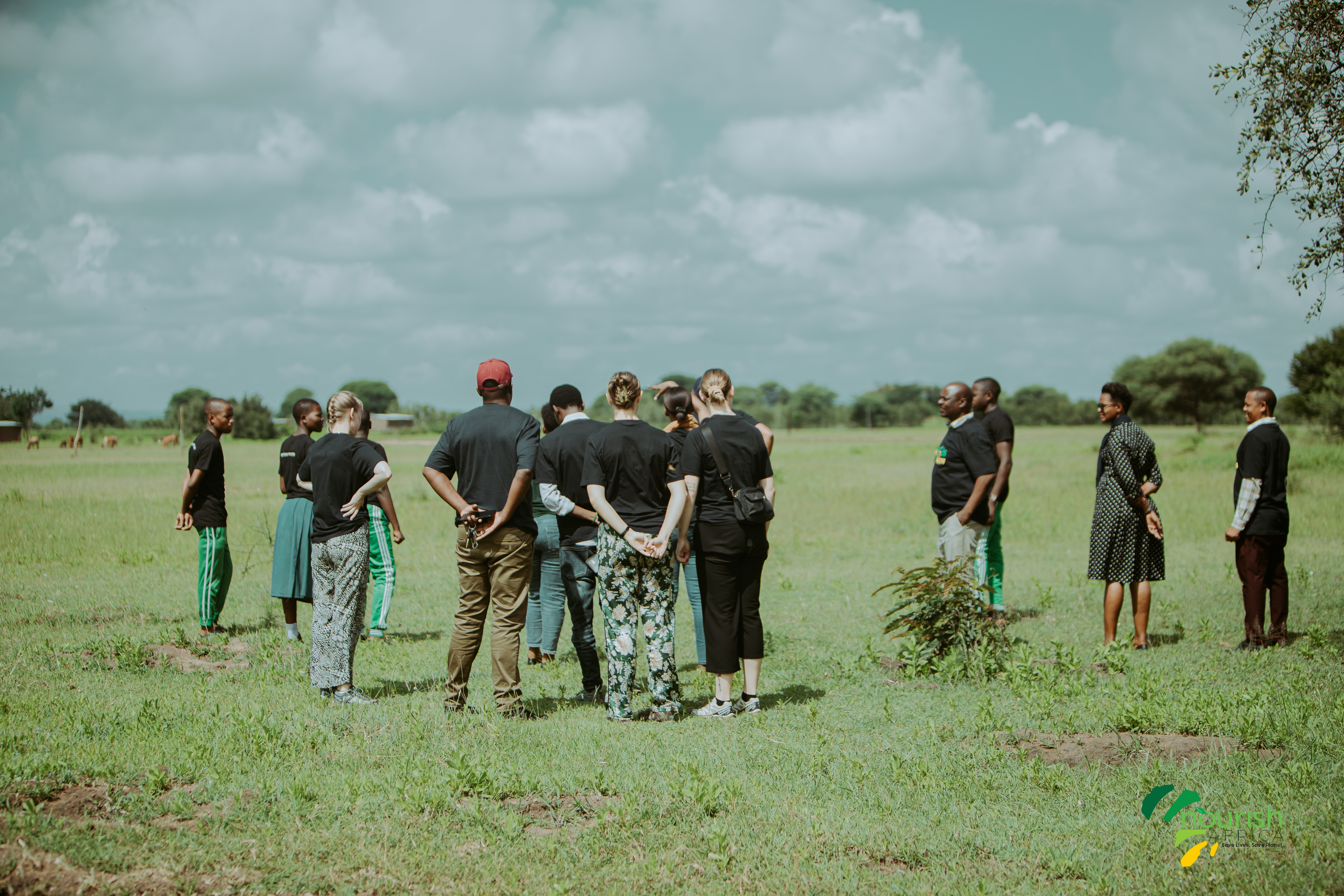
When originating the idea of offering our technology as a SaaS solution, we thought it would only help companies/NGOs that are operating in the Voluntary Carbon Market, because of the precise carbon calculation we offer. But within a short time, we realized that our product adds value for more target groups, even if they are not operating in the VCM and just want to track the number of trees they have planted, how many survive, and other monitoring needs. 

While enhancing our single-tree monitoring activities and technology, we had a few challenges to master, for example so the wifi connection can be off in the planting regions. That’s why our technology can be used as a 100% offline-first tool for monitoring the trees. 

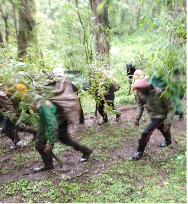
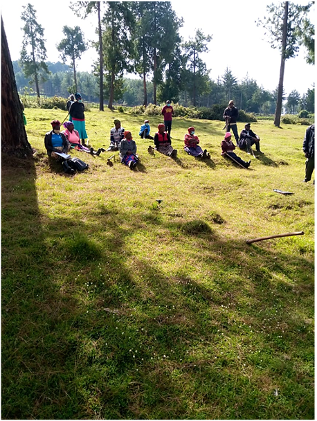
Weather patterns have a strong impact on tree monitoring, since most of the projects are affected by rainy seasons. This needs to be considered and can impact the speed of delivery and progress per day. 

We needed a data validation add-on, due to the misuse (e.g. photographing other objects) of the App. Therefore, we have implemented automatic tracking, which later our forestry team manually double-checks the anomalies detected by the automatic one.

Integrated Land Use Planning

Integrated Land Use Planning involved strategically allocating land for agricultural and conservation purposes to balance human and wildlife needs. This comprehensive approach ensured sustainable land use that supported both community livelihoods and wildlife conservation. The planning was necessitated by the 10% fence plan, where 10% of beneficiaries' land was secured with an electrified short fence. Farmers utilized the secured land to incorporate skills honed from climate-smart agriculture training, maximizing production, while 90% of the land was left fallow for wildlife and livestock. Currently, a total of 129 acres have been secured by the 10% fence plan, with over 1,000 acres (90%) left as room for wildlife to roam. Up to date, there has been zero elephant conflict registered within the fences, securing crops and property with zero crop raids or property damage.

  • Collaborative Planning: Community members, Tsavo Trust, other conservationists, and government officials were involved in the planning process. This inclusivity ensured that diverse needs and perspectives were considered, leading to more balanced and effective land use strategies.
  • Sustainable Practices: Land management practices that enhanced biodiversity, improved soil health, and strengthened ecosystem resilience were implemented. By focusing on sustainability, land use supported long-term ecological balance and productivity.
  • Monitoring and Evaluation: Systems for continuous monitoring and evaluation of land use plans were established. Regular assessments helped adapt strategies to changing environmental conditions and community needs, ensuring that plans remained relevant and effective.
  • Inclusive Planning: Engaging a broad range of stakeholders in the planning process helped meet the needs of both people and wildlife. This approach fostered a sense of ownership and commitment, which was crucial for successful implementation and long-term sustainability.
  • Adaptive Management: Continuous monitoring and adaptation were vital for addressing evolving environmental and community needs. Flexibility in land use planning allowed for timely adjustments in response to new information or changing conditions.
  • Policy and Legal Frameworks: Strong policy support and legal frameworks were critical for the successful execution and sustainability of integrated land use plans. Effective policies ensured that plans were backed by law and had the necessary resources for implementation.