Participatory process design and implementation

The starting-point was the agreement on the methodological steps (see BB 1) for the pilot project, including the involvement of key stakeholders and capacity development needs and measures. The upcoming revision of the management plan was an ideal entry-point for the integration of EbA and the work plan the key instrument. It defines that EbA should be treated in thematic meetings with different stakeholder groups and a workshop, in a specific chapter of the management plan and as part of an EbA Action Programme. Training of the core team was then followed by the collection of climate-related data and information which fed into the sessions with communities and a workshop.

  • Agreements with and support from staff responsible for approval of management plans.
  • Clearly defined and broadly accepted work plan.
  • The adaptation process should consider the ecosystem characteristics and the social and economic conditions within and beyond protected area boundaries. Therefore, a continuous and participatory process is needed, adressing the conservation priorities, climate and other risks as well as the needs and interest of stakeholders.  

  • The more participatory the process is being conducted, the more likely the EbA approach is to be integrated into the management plan of the protected area.
  • There is a need do identify and involve all departments and levels of hierarchy of the organizations responsible for the protected area in order to ensure the integration of EbA. In our case, the final review by the superiors resulted in delays and observation, as some of them had not been involved previously.
  • It is important to involve professionals with experience in EbA and protected area management planning. First of all, the project had to qualify  professionals and other stakeholders involved in the process in order to succeed with the integration of the EbA-approach into the management plan.
Institutional anchoring and broad-scaling

Through the elaboration of an EbA Action Program , the EbA approach was institutionally anchored in the protected area “Cananéia-Iguape-Peruíbe”. In addition, the methodological approach will be applied in eleven other protected areas in four federal states of the country through strategic partnerships with the Brazilian Environmental Ministry (MMA), the Brazilian Environmental Agenday (ICMBio) and others. The aspiration is that in the future, all protected area management plans consider EbA as a strategic response to climate change.

  • Agreements with and support from staff responsible for the elaboration and approval of management plans at central level of the protected area authority.
  • Partnerships with other projects and financiers are an important catalyst and trigger point for replication, up- and broad-scaling.
  • It requires time as well as financial and personal resources to develop ready-to-use methodological approaches and to advocate for their dissemination and integration.
  • There is a need to balance generalizable and context-specific issues.
Methodological approach for integrating climate change and EbA measures into protected area management planning

The methodological approach consists of the following steps (see also graphic in the gallery):

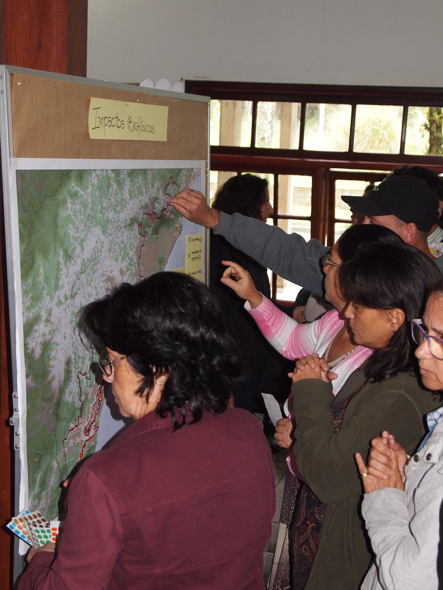
  1. Collection of perceptions of involved professionals and other stakeholders with regard to key climate risks and spatial mapping of these risks.
  2. Identification of key biophysical and socio-economic impacts of climate change in the region, in part by checking perceptions of stakeholders, in part by publicly available scientific data.
  3. Assessment of ecosystem services relevant for human well-being and/or climate change adaptation with stakeholders during a workshop.
  4. Definition of site-specific adaptation options and measures, including EbA.
  5. Integration of results into the management plan.
  6. Capacity development through courses and on-the-job training as a crucial accompanying measure.
  • Availability of both scientific and other types and sources of knowledge and information. 
  • Participation and contributions from technical staff and citizens.
  • The first milestone was levelling knowledge about climate change concepts and issues among the participants. In this regard, the dynamic and participative format of the meetings and workshops was crucial for strengthening the understanding of main concepts and the appreciation and integration of stakeholder perspectives and knowledge into the management plan.
  • The risk assessment should go beyond the conservation site and address its whole area of influence (e.g. water basins as an orientation for the scope).
  • Participatory approaches and the integration of perceptions of climate change impacts can result in differing views. The responsible team needs to be prepared to deal with it.
  • Likewise, the collection of local knowledge and perceptions can be resource-intensive and needs to be well-prepared.
  • The integration of climate change risks and implementation of adaptation actions in conservation management is a rather new and complex task which is influenced by factors differing from site to site. Therefore, the adaptation process should be area-specific.
Enhanced Service Delivery

Users of hydrological and meteorological data in Japan have grown significantly in number with the development of new technologies and sectors; from aviation and shipping to public services such as weather forecasting, there is increasing pressure on hydromet services to provide accurate, real-time information.


Today, up-to-date information on severe weather events is provided to the general public by the JMA, in collaboration with central and local disaster management authorities and other key stakeholders. Reaching first responders and the general public is a critical component of Japan’s effective early warning system, and early warnings at the municipality level have improved over the last decade largely in part to better communication and cooperation between stakeholders.


For example, MLIT’s Erosion and Sediment Control Department established a partnership with prefectural governments to promptly issue landslide alert information to at-risk citizens.

  • Financial resources and will to enhance service delivery.
  • Collaboration across government and private sectors to ensure optimal service delivery.
  • A comprehensive multi-hazard approach should be adopted, with collaboration between relevant actors such as disaster management agencies, local governments and private sector entities.
  • Early warning systems must be able to deliver essential information to first responders and the general public at the local level.
  • The end-user’s needs should inform and shape the development of hydrological and meteorological services, such as delivering clear information through the most appropriate medium.
Modernization of Systems

The effort to modernize hydrological and meteorological systems in Japan began in the 1950’s and continues to the present day. For example, the JMA Automated Meteorological Data Acquisition System (AMeDAS) is a network of over 1,300 automatic weather stations that was incrementally upgraded from the 1970’s. The system is now capable of collecting data sets from key stations every minute and can deliver information to end-users within 40 seconds. This data serves as a crucial input for early warning systems and enables accurate tracking of weather patterns. Another major milestone has been the series of Geostationary Meteorological Satellites (Himawari-1 to Himawari-8) which have further strengthened hydromet services in not only Japan, but across the Asia-Pacific region. Additionally, the Japan Meteorological Business Support Center (JMBSC) and the Foundation of River & Basin Integrated Communications (FRICS) work to ensure the broader use of hydromet data by municipalities, the general public, and private sector actors.

  • Sufficient financial resources and technical know-how to modernize systems.
  • Political will to mobilize resources towards modernization of systems.
  • Strong, quality-assured, user-centric observation systems are critical for delivery of effective hydrological and meteorological services and underpin climate change adaptation and DRM strategies such as river management practices and establishment of early warning systems.
  • A “second” operating center, such as a back-up facility that can resume all essential functions and services in the case of an emergency, should be established in order to ensure business continuity.
Institutional Strengthening

Key institutions in Japan’s hydromet landscape have evolved since the 1950’s. For example, hydrological institutions have undergone several changes, such as after the enactment of the 1964 River Law Act (revised version). This law required authorities tasked with managing rivers to adhere to integrated river basin management principles, as opposed to more area-focused disaster management practices that were prevalent prior to this (e.g., shifting from circle levees, which only protect the builder’s community, to continuous levees, which ensure more equitable protection for the wider population). As for meteorological services, the regulatory framework was established under the Meteorological Service Act of 1952, which designated the Japan Meteorological Agency (JMA) as the authoritative body responsible for issuing emergency warnings.

In terms of legal framework, Japan’s laws assign clear roles and responsibilities for the National Hydrological Service (WDMB/MLIT), the National Meteorological Service (JMA), and other key stakeholders to ensure effective coordination.
  • Will and capacity to communicate, coordinate and collaborate across institutions and sectors.
  • Political will and resources to establish relevant laws and regulations to assign clear roles and responsibilities and facilitate coordination between different agencies and stakeholders.
  • The period after a major disaster can serve as an opportunity to assess institutional strengths, weaknesses, and make strategic improvements. For example, after the Isewan Typhoon in 1959, which killed over 5,000 people, the Government of Japan conducted a comprehensive review of national strategies. Experiences from this disaster were a major driving force behind the introduction of the 1961 Disaster Countermeasure Basic Act, which brought about systematic improvements to Japan’s hydromet services.
  • Legal frameworks should clearly stipulate roles and responsibilities of different actors across government, private and civil sectors, to enable smooth and coordinated implementation of hydrological and meteorological services.
  • Hydrological regulatory frameworks should be aligned with and integrated within Integrated Water Resources Management (IWRM). Japan’s hydrological services are a key part of the country’s commitment to IWRM, which has enhanced sustainable water use and effective water cycle governance and promoted water efficiency and conservation of water resources.


Making additional non-structural risk reduction measures

Non-structural measures for road geohazards are those that do not involve physical construction and are often less expensive that structural measures. For example, Japanese highways often have roadside stations (michi-no-eki), which have been strategically planned to serve as evacuation centers and hubs for disaster-related information (e.g. road conditions and emergency information).  After the 2011 Great East Japan Earthquake, roadside stations and highway parking areas were used by numerous teams and organizations as operational bases for rescue and relief efforts. Many of them were equipped with electricity, food, and water supplies, and served as emergency shelters, where important information was shared with members of the public.

  • Financial resources to develop and implement non-structural risk reduction measures.
  • Technical know-how and capacity to develop and implement non-structural risk reduction measures.
  • Non-structural risk reduction methods, such as early detection and emergency information collection capabilities, development and implementation of emergency preparedness and response plans, and engaging stakeholders to reduce geohazard risks and raise public awareness, are critical to disaster risk management of roads.
  • Non-structural risk reduction measures can be a cost-effective way to reduce human and economic losses resulting from geohazard events.
Implementing structural measures to reduce the risk of road damage

After the 2011 Great East Japan Earthquake, the main highways and roads to the affected areas were back up and running within weeks, which greatly expedited relief and recovery operations. This was largely due to robust structural measures, in conjunction with efficient recovery work by public services. In contrast, it took over 1 and a half years for the highway to be reconstructed after the Great Hanshin-Awaji Earthquake in 1995.

  • Financial resources and will to invest in structural resources.
  • Technological and engineering capacity to implement large-scale structural measures.
  • Structural measures reduce the risk of road damage due to geohazards, reduce road maintenance costs, ensure connectivity during and after disasters, and contribute to the speedy recovery of a road after geohazard events.
  • Bio-engineering and other types of structural measures can be implemented during the road construction, operation and maintenance stages.
  • A thorough assessment of geographical, geological, geotechnical, hydrological, and hydraulic conditions are essential for the effective design of structural measures.
Conducting risk assessment of geohazards and planning for both new and existing roads

Roads, expressways, and other public facilities helped reduce damage and loss of life in the 2011 Great East Japan Earthquake by providing protection against flooding, owing largely to successful risk assessments carried out pre-construction. For example, the East Sendai Expressway (elevation of 7 to 10 meters) acted as a secondary barrier against the incoming tsunami, preventing the waves from penetrating further inland. Over 200 people escaped by running up to the expressway, and its embankment served as an evacuation shelter for local residents.

  • Having sufficient resources to conduct risk assessments.
  • Availability of relevant data to conduct accurate assessments and inform planning of new and existing roads.
  • Pre-concept risk identification is crucial. For new roads, geohazard risk evaluations enable management authorities to make informed decisions on how to avoid hazardous locations.
  • Hazard mapping, evaluation of exposure levels, and determining potential impacts on the social environment are essential for holistic road geohazard risk management.
  • Determining potential economic impacts incurred from loss of road access and conducting a cost-benefit analysis of potential investments to mitigate geohazards are critical. The results of these assessments help identify and prioritize endangered locations and inform risk reduction measures.
Establishing an adequate institutional framework

Relevant institutions in Japan work together to create and enact appropriate laws and regulations, as well as national and local government plans and strategies (e.g., Japan Rail, local government, and Ministry of Land, Infrastructure, Transport and Tourism collaborating on road geohazard risk management). Japan’s framework also includes institutional and technical coordination, and appropriate funding mechanisms. For example, the cost of adding height to an expressway can be shared by both public works organizations and disaster risk management organizations. These types of cost-sharing mechanisms ensure that financial burdens are shared equitably.

  • Political will to establish adequate institutional framework, laws, and regulations.
  • Financial resources to implement funding mechanisms.
  • Disaster risk management organizations and public works organizations can share costs of certain infrastructure investments.
  • National and local government and other key stakeholders should coordinate strategies related to disaster risk management, including the use of infrastructure and public facilities such as roads, highways, and railways. These facilities can be used to enhance disaster management procedures and operations in the event of geohazards such as floods, tsunamis, and landslides.