The Pump Sizing Tool

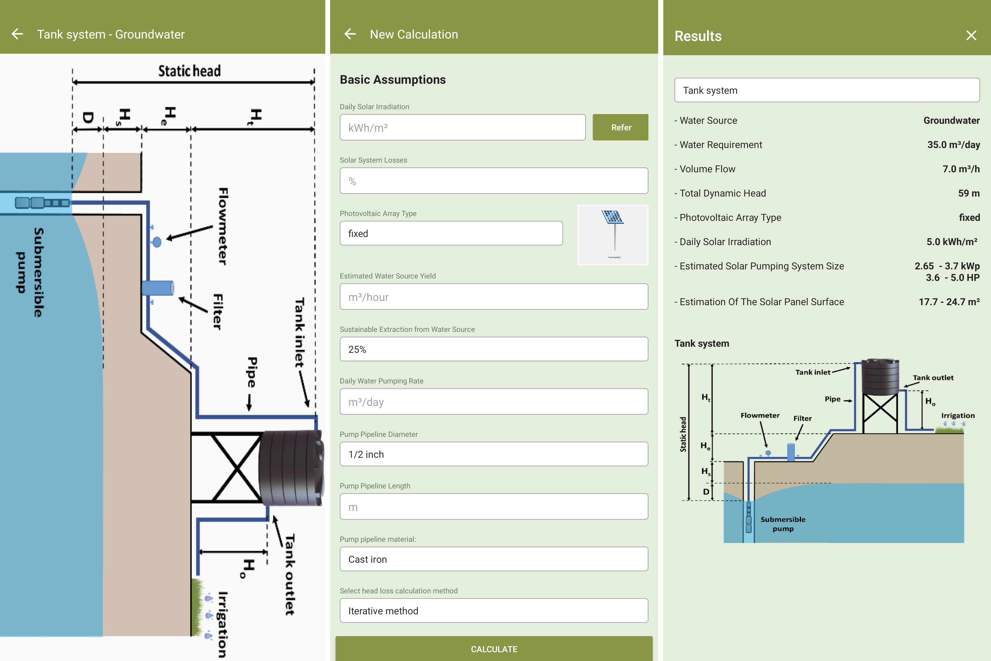
The Pump Sizing Tool allows for the calculation of the pumping head, the required solar PV module capacity, and selects suitable pump technologies. The DESIGN – Pump Sizing Tool  helps design the irrigation system so as to ensure that as little pressure as possible is lost in the system. In addition, it serves as a checklist to identify pressure losses, e.g. due to leaks in an existing system. 

Technical support of farmers during the planning phase; data on the daily crop water requirement, mean daily global solar radiation for the design month, country-specific costs of PV panel & pump; availability of financing options 

Proper sizing of the components of an SPIS is critical, since an SPIS with insufficient capacity will not satisfy the farmers’ needs and an over dimensioned system will induce unnecessary operation and capital costs. Negligence of the sustainable water yield of water sources may result in water shortage and a depletion of water resources, thus having negative impacts on the farm budget and the environment. It is therefore very important to be in close contact with the farmer during the planning phase and to inform him about the advantages and limits of SPIS. 


The final design of the PV pump and irrigation system should be left to experienced system integrators who use computer-based system sizing and simulation tools such as COMPASS, WinCAPS and PVSYST, HydroCALC, GESTAR.  

Participation of farmers and extension services

Farmers can access training and water user associations to develop irrigation and farming capacity. 

  • High participation rate from farmers 
  • Technical capacities are improved 
  • Training and water use association to develop irrigation and farming capacity

Scaling up the technology and achieving system-level outcomes requires an adequate understanding of the reasons why farmers adopt MRB, based on an insightful assessment of the technology’s efficiency, system performance and impacts.

Agronomic practices

Through improved agronomic practices, farmers can learn how to cultivate improved crop varieties and obtain higher yield using less irrigation water in a sustainable manor.

  • Improved crop varieties and agronomic practices
  • Enabling policy environment for long-term interest in this solution 
  • Reasonable and timely access to the raised-bed machines
  • High yielding varieties in addition to proper extension and advisory services

MRB combined with the increase of yields, results in the realization of more income with fewer expenses, thus a higher net income.  Thus, improving the existing farming system using the communities' indigenous knowledge and skills through innovative approaches is much better than introducing new systems.

Innovation Platform

The solution was also accompanied by an innovation platform (IP) that helped on guiding principles to adopting the solution. The platform includes clusters of wheat growing farmers, private and public seed producers, agri-input suppliers, extension services, NARS researchers, rural micro-finance institutions, agricultural banks, policymakers and other stakeholders come together to network, learn and discuss the process across the value chain from production to marketing.


  • High participation of institutions involved
  • Diversity of institutions
  • Groundbreaking approach as related to innovation
  • Private sector engagement

The Innovation Platform approach enabled to bring multiple stakeholders together. It enabled rapid technology development, promotion and diffusion and allowed the production of complementary innovation to accompany the solution in its development. 

Cactus network

Facilitates business development by sharing experiences from all over the world in all aspects of cactus use including livestock feeding, human consumption and for medicinal and cosmetic purposes.

  • Strong partnerships and collaboration around the network.
  • Knowledge sharing within and across the network
  • Facilitate the collection and utilization of germplasm.
  • Work with national partners to improve technical capability.
  • Exchanges through Dgroup as an active platform where people from different countries worldwide who are interested in cactus pear can post any question/ share any information related to cactus pear requirement.
  • Implementations of synergies for further research findings.
  • Merging individual efforts and collective efforts.

The creation of clear technical documents can foster knowledge sharing, collaboration and knowledge transfer to rural people. Not only on a collective level but also individual and national level to promote the importance of cactus pear. The regional coordinators should promote the establishment of joint projects between countries that share common problems related to cactus pear. Strong agreements and legal frameworks should be established between the implementing network institutions and other stakeholders interested in promoting, developing and implementing cactus. Through this cooperation it is important to develop appropriate cultural techniques that will result in both yield increase and environmental protection according to specific problems in a given area.

Integrated and participatory research and development

An integrated research and development program should then be designed and implemented involving local communities, institutions, and decision-makers, taking into consideration capacity building, preventing inequality, local specifics, dry area ecosystems and understanding specific needs of local communities. 

  • Motivation and promotion of awareness among the people with regard to the activity objectives and the ways to achieve them are essential. 
  • Understanding the specific needs of a local community or a group of beneficiaries is critical in designing and implementing an appropriate system. 
  • Institutional capacity building, water resource management policies, and management and maintenance programs are the keys to success. 
  • Dry area ecosystems are generally fragile and have a limited capacity to adjust to change.

SI provides benefits to farmers such as higher incomes, lower risks, increases water productivity, and has a positive spill-over effect in modern technology adoption (seed and fertilizer). However, its implementation must ensure that farmers understand the practice and how to operate/manage it properly. Most important is determining best time to irrigate and the right amounts to maximize water use efficiency and productivity. Integration of cultural practices and improved varieties is important to achieve best results. Incentives are provided to adopt the technology of drip irrigation, helping modern technologies adoption.

World Heritage capacity building initiatives

Norway is committed to working towards the full and effective implementation of the World Heritage Convention both nationally and internationally. Nationally, the Ministry of Climate and Environment, together with the Norwegian Directorate for Cultural Heritage and the Norwegian Environment Agency, organizes annual meetings with World Heritage coordinators, with the aim of creating dialogue and disseminating information necessary for a positive development of the World Heritage properties.

Internationally, Norway is a driver and donor behind the ICCROM/IUCN World Heritage Leadership Programme which is a global capacity building programme on the management of nature and culture at world heritage properties. Norwegian stakeholders are able to participate in the activities under the World Heritage Leadership Programme and several programme activities are held in Norway.

Capacity building in relation to World Heritage is included in the Report to the Storting (white paper) no.35 (2012-2013) Cultural Heritage Policy (Chapter 4.8 World Heritage) and the Report to the Storting (white paper) no.16 (2019-2020). Within the framework of the World Heritage Leadership Programme, the planning and implementation of capacity building activities is done by the Advisory Bodies (ICCROM, IUCN, ICOMOS) in cooperation with the Ministry of Climate and Environment. Other international partners are involved, such as the UNESCO World Heritage Centre.

  • Capacity building is a key element for the planning and implementation of the World Heritage Convention and it is also one of its five strategic objectives of the World Heritage Convention. Building capacities is at the heart of effective management and conservation of world heritage properties.
  • It is important that representatives from Norwegian World Heritage properties participate in international cooperation, thus contributing to raise the local World Heritage property's competence and capacity on its own type of World Heritage.
  • Capacity building is deeply rooted into experience sharing and learning from each other’s experiences.
Authoritative Geodata and Map Services

The foundation of any SeaSketch project is geospatial information (maps) displayed as map services. There are no minimum data requirements. You can begin working with whatever you've got. Maps may be published as Esri REST Services (e.g., with ArcGIS Server or ArcGIS online) and open source mapping services (e.g., WMS, WMTS) and then imported into SeaSketch. Example maps include administrative boundaries (e.g., EEZ, territorial sea, existing MPAs), seafloor habitats, bathymetry, human uses, etc.


The maps you choose to include as Data Layers in SeaSketch depend on the goals of your process. If you are planning for marine protected areas, shipping lanes and aquaculture sites, you may want navigational charts, habitat maps, the distribution of fishing activities and other layers that may be used to guide users in the design of their plans. Protected areas are only meaningful if they effectively protect certain habitats, shipping lanes minimize collision and maximize efficiency, aquaculture sites are located in certain depth zones, etc. On a case-by-case basis, you will need to evaluate what data need to be viewed as maps, and what subset of these data need to be analysed.


In some cases, relevant map data may already be published as map services and discoverable in coastal atlases and other map portals. As long as they are in the correct formats (Esri map services, WMS, WMTS, etc), they may be imported directly into SeaSketch and displayed as map layers. 
 

In many cases, it will be advantageous to publish your own map services for display in SeaSketch. This will give you control over the cartography and performance of the maps.

Successful projects usually have a single GIS technician who is responsible for locating existing map services, acquiring data from providers (government agencies, NGOs, academics) and generating new map services using standard desktop and web-mapping tools. 
SeaSketch Software as a Service

In most cases, SeaSketch is used to support large-scale planning efforts where governments have mandated the establishment of a marine spatial plan and where broad stakeholder involvement is essential. In these cases, SeaSketch must be licensed by a lead agency or partner. SeaSketch may be used to visualize geospatial data as map services, collect to information via surveys, sketch and discuss plans. If plans are to be evaluated using analytics, geoprocessing services and reports must be developed in our lab. Note that a free license is available for educational institutions to use SeaSketch for strictly educational purposes.


In January 2022, we will release the next version of SeaSketch which will be entirely free and open source. Just as with the current version, many of the features within SeaSketch may be configured with minimal knowledge of or experience with GIS. The analytics and reports will be run on lambda and encoded using programming languages such as Javascript. Owners of projects may, therefore, set up their own SeaSketch project – from beginning to end – without intervention from our lab. It should be noted, however, that the geoprocessing and reporting framework, though free and open source, will require significant programming experience.

Currently the implementing agency (such as a government body, foundation or NGO) must purchase the license and contract for developing analytics. The current version requires an Internet connection, but the next version will include some offline capabilities. Successful implementation of SeaSketch will require some assistance from a GIS technician, for example publishing and importing map services. 

SeaSketch is extremely valuable in creating a transparent and collaborative atmosphere, maximizing stakeholder participation, and grounding decisions in science-based information. We see the best results when SeaSketch is used in combination with other tools such as desktop GIS applications, trade-off analyses, prioritization tools (e.g., Marxan, Prioritizr), and cumulative impact analyses. 

Rescue and safeguarding of the biocultural heritage of the jaguar and its habitat.

Through ethnographic, sociological and, in general, social science studies, activities are carried out for the protection of biocultural elements at risk. These elements are then incorporated into societies with the support of education.

It is necessary to have a plural group specialized in social issues or with institutions that collaborate in the activities, in order to have a specialized work that supports the biocultural conservation of nature.

Field work is a priority for these activities, and collaboration with people in rural areas is indispensable and should always be included.